Museum · The Negev
Abraham's Well International Visitor Centre
The shaft is 13.5 metres deep, and the inscribed stone Claude Conder found fifteen courses down inside it is dated 505 AH, which is the twelfth century CE.
Abrahams Well / CC BY-SA 3.0 · Wikimedia Commons
Depth of the main shaft
13.5 metres
about 5 m of it cut in rock, diameter 3.75 m, on the Hebrew reference account
Dated stone inside the well
505 AH
the twelfth century CE, read by Claude Conder in the 1870s
Visitor centre opened
October 2013
designed by the architect Eli Armon on the foundations of the old well courtyard
Tour ticket
0 to ₪34
the range printed on the operator's booking page, read in August 2026
In short
- How long to give it
- about an hour, which is the slot the operator sells and the length it gives for the guided route
- Site opening hours
- 10:00 to 16:00, and only by arrangement made in advance
- Guided tour, price range as published
- 0 to ₪34
באר אברהם
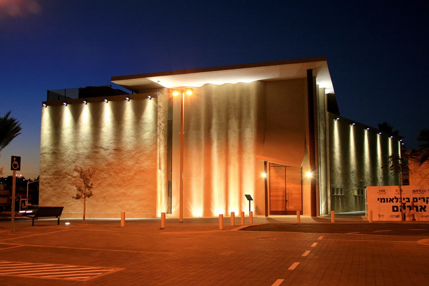
Abraham's Well International Visitor Centre is a guided audiovisual attraction built around a stone-lined water well on Derech Hevron, at the northern edge of Beersheba's Old City where the street runs down towards the bed of Nahal Be'er Sheva. The well is genuinely old and genuinely a well. The building over it is neither: it opened in October 2013, was designed by the architect Eli Armon, and was put up on the foundations of the courtyard that had surrounded the shaft since the city grew around it.
Two nineteenth-century surveyors measured the wells here before anyone thought of selling tickets to them. Edward Robinson reached them in 1838 and recorded the larger of two shafts at twelve and a half feet across and forty-four and a half feet deep to the water, sixteen feet of that cut in solid rock. Claude Reignier Conder camped beside them in the 1870s, counted a third shaft standing dry to the east, and then reported the thing nobody quotes: the masonry, he wrote, is not very ancient. Fifteen courses down the south side he found a stone with an Arabic inscription he read as 505 AH, which puts the lining in the twelfth century.
So the site sells a story that its own stonework does not confirm, and the more careful bodies describing it say so in the phrasing they choose. The Council for Conservation of Heritage Sites in Israel writes that the centre is built around ancient wells at the edge of the Old City, one of which an early tradition connects to Abraham. That is a fair description of what is here. Visits are by prior arrangement only, the guided tour runs an hour, and the operator's booking page prints the ticket as 0 to ₪34.
Abrahams Well / CC BY-SA 3.0 · Wikimedia Commons
Orientation
A tent on Derech Hevron with a courtyard behind it
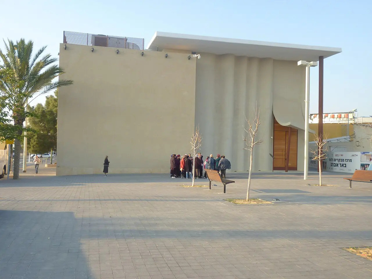
The address is Derech Hevron 2, on the edge of the Ottoman grid Beersheba now calls the Old City. From the street it is a low building whose roofline is meant to read as a tent, in desert colours with copper on it, and a long mosaic wall on the face turned towards the road. The operator, Kivunim, the Beer Sheva company that runs the city's culture and leisure venues, states the pattern of a visit plainly: a guide takes the group the whole way through, and there is no unaccompanied wandering.
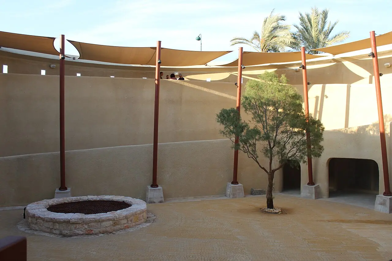
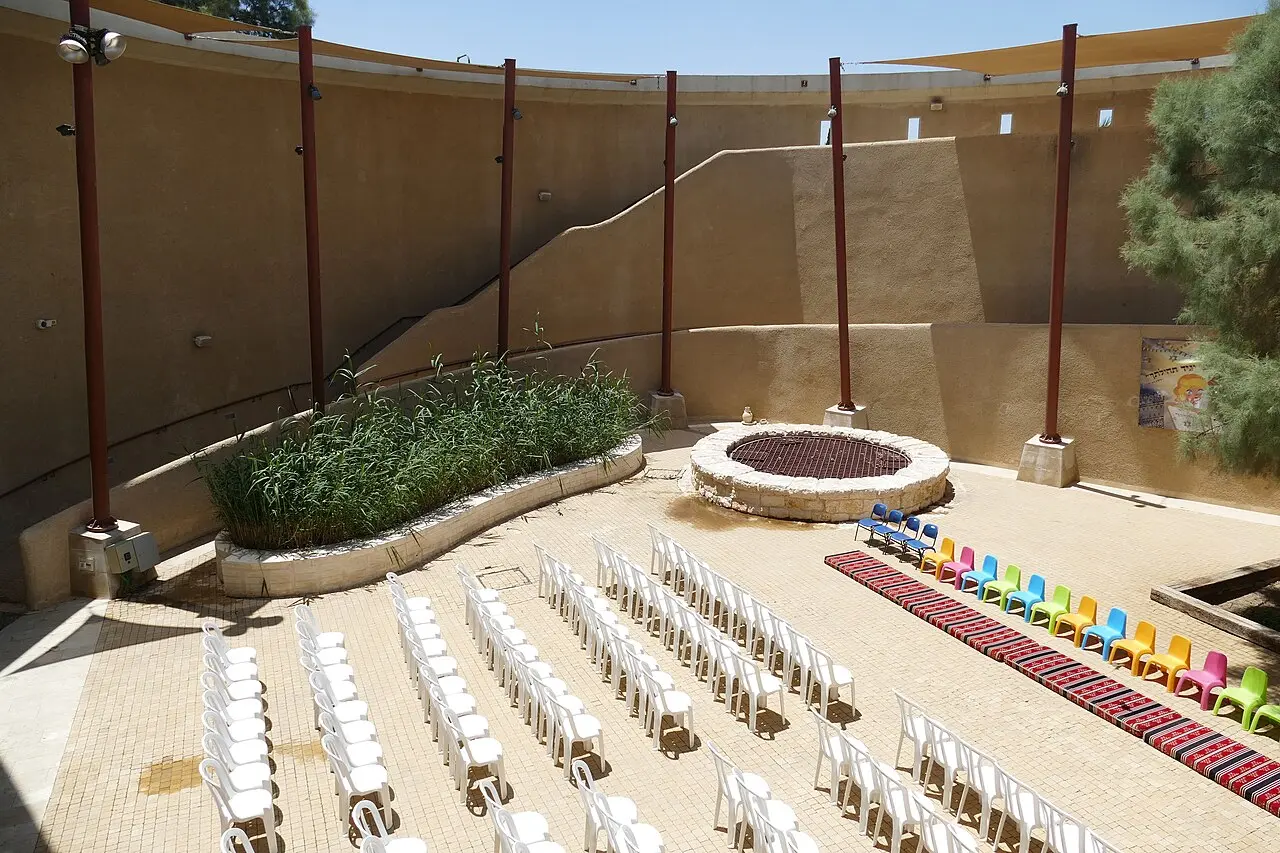
The sequence inside is short and fixed. Visitors walk a lit passage set with verses from the Hebrew Bible, then sit for an audiovisual presentation about Abraham built around the journeys attributed to him and the turning points in his life, and at the end of it the well itself is revealed in the courtyard beyond. A three-dimensional film about Abraham is part of the show. A photograph exhibition on the history of Beersheba runs alongside, and a hall seating about 150 is why the same address turns up hosting conferences, bar and bat mitzvah events and school ceremonies for the reception of a Torah scroll.
It is worth being clear about what the exhibition is and is not. This is interpretation, not a collection. No excavated material from the wells is displayed, the photographs are of the city rather than of finds, and a reader who arrives expecting Beersheba's archaeological museum will be in the wrong building: the city's antiquities displays are at the museum complex in the Old City, a few streets away. The heritage capsule maintained by the Avnei Moreshet project gives the centre a footprint of 750 square metres, which is about right for what it does.
One practical detail is easy to miss and changes what the visit is. The Council for Conservation of Heritage Sites notes that the audiovisual displays are not operated on Shabbat. The well and the courtyard do not go anywhere, but the part of the site that most of the ticket pays for is switched off.
- Guided throughout, in Hebrew or English, about an hour
- Lit passage of biblical verses, then an audiovisual presentation and a three-dimensional film
- The well and its courtyard at the end of the route
- A photograph exhibition on the history of Beersheba
- A hall seating about 150, used for events rather than for display
- Audiovisual displays not operated on Shabbat
The wells
What two surveyors measured, and what one of them found in the shaft
Edward Robinson came up out of the desert on his way from Aqaba to Jerusalem in 1838, crossed a wide watercourse he calls Wady es-Seba', and found two deep wells close on the northern bank. He recorded them as circular and stoned up very neatly with solid masonry, and gave the numbers: the larger twelve and a half feet in diameter and forty-four and a half feet deep to the surface of the water, sixteen feet of which at the bottom is excavated in the solid rock; the other fifty-five rods to the west-south-west, five feet in diameter and forty-two feet deep. The water in both, he wrote, was pure and sweet and in great abundance, the finest he had found since leaving Sinai. Stone troughs for camels and flocks stood around them, and the curb stones were deeply worn by the friction of the ropes.
Conder's account from the 1870s is the useful one because he looked harder. He put the principal well at twelve feet three inches in diameter and over forty-five feet deep, lined with masonry to a depth of twenty-eight feet, a second five feet across about 300 yards to the west, and a third to the east standing dry at twenty-three feet deep and nine feet two inches across. He counted nine stone troughs at the larger well and five at the lesser. And then, in his own word, came the disappointing discovery: the masonry is not very ancient. The dated stone fifteen courses down was, on his reading, 505 AH, and he judged it at least as old as the stones at the mouth, which carried more than a hundred rope channels cut by what he estimated as seven centuries of water-drawers.
The modern figures given for the well the centre is built around are 13.5 metres deep with about 5 metres cut in rock and a diameter of 3.75 metres, lined with dressed stone to the bottom. Converted, Robinson's forty-four and a half feet is 13.6 metres, his twelve and a half feet is 3.8 metres, and his sixteen feet in rock is 4.9 metres. Two accounts taken 175 years apart agree to within the width of a hand. The water was never deep-lying either: it comes from groundwater percolating through the loess and collecting at shallow depth beside the stream bed, which is why a watering place existed at this spot at all.
Guide2015 / CC BY-SA 4.0 · Wikimedia Commons
Dispute
Whether Abraham had anything to do with it
The biblical material behind the name is thin and it is doubled. Genesis 21:25 has Abraham complaining to Abimelech about a well of water that Abimelech's servants had seized; Genesis 26:25 has Isaac's servants digging a well at Beersheba a generation later. The name of the town itself is built from the Hebrew for a well and for either an oath or the number seven, and Britannica ties it to the covenant Abraham made with Abimelech of Gerar. There are two wells in the text and there are two or three shafts in the ground, and the tradition that picks one of them out is a tradition rather than a finding.
Where archaeologists put biblical Beer-sheba is somewhere else. The Iron Age town identified with it is Tel Sheva, the mound a few kilometres east of the modern city, excavated as an Israelite and Judahite settlement and inscribed by UNESCO in 2005 as part of the Biblical Tels alongside Megiddo and Hazor. Conder noticed the relationship in the 1870s without drawing the modern conclusion: he climbed the Tell of Seb'a, which he places two and a half miles east of the wells, and rode back down to camp beside the shafts.
Robinson is the honest witness against himself here. Standing at the wells in 1838, with no ruins visible and the desert behind him, he wrote that this was the place where the patriarchs Abraham, Isaac and Jacob often dwelt, and that Abraham dug perhaps this very well. Then, methodical man that he was, he walked up the low hills to the north, found the foundations of a scattered settlement, and matched what he saw against Eusebius and Jerome, who describe the place as a large village with a Roman garrison. Conder, looking at the same hills, said only the foundations of a flourishing fourth-century town remained. Neither of them found anything of the patriarchal age, and neither claimed to.
None of that makes the site fraudulent. What the visitor centre presents is Abraham as the shared ancestor of the three monotheistic religions, and the well as the place a long tradition attaches to him. Take the tour on those terms and it delivers what it says.
Around 1900
How a watering place ended up in the middle of a city
When Robinson reached the wells in 1838 there was nothing here. Arabs were pasturing camels across the open country, he noted, but no trace of dwellings was anywhere visible. Conder, camped by the principal well decades later, described a pasture land beautiful in spring and desolate in November, with not a tree anywhere near the wells.
The town arrived last. Britannica dates Ottoman efforts at town planning and development here to around 1900, and notes that even then the place stayed largely a watering station and a trading centre for the Bedouin tribes of the surrounding desert. That is the sequence worth holding on to: the wells did not appear in a city, the city was laid out around the wells, and the grid of streets a visitor now walks through to reach Derech Hevron is younger than the shaft at the end of it by at least seven hundred years. English-language reference accounts add that a local sheikh built a house over the well in 1897.
The British took Beersheba in 1917, and Britannica notes that the capture opened the way to their conquest of Palestine and Syria. Israeli forces took the town in October 1948, during Operation Yoav, and the well was thereafter left as public archaeological ground rather than built over. The municipality developed the surroundings, paving the plaza that leads to the shaft and walling the area, which is the arrangement the 2013 visitor centre replaced. The well is one of the few fixed points in Beersheba older than Beersheba, and the courtyard is the clearest place to see why a city was put in this patch of ground rather than five kilometres in any direction.
Daniel Ventura / CC BY-SA 3.0 · Wikimedia Commons
Fabric
What is ancient here, and what was built in 2013
The line between the two is unusually easy to draw here, because almost everything a visitor touches was finished in the last fifteen years. The old fabric is the shaft, its dressed stone lining, the second well that appears to have been sunk later, and whatever survives of the troughs and rope-worn curb stones the surveyors described. Even that has a date rather than an age: Conder's inscribed stone gives the lining a twelfth-century floor, and he was explicit that the masonry did not look older.
Everything above ground is Armon's. The architectural intent is stated rather than left to be guessed at: the form imitates the tent of Abraham, the palette combines desert colours with copper, and the copper is there to point at the Middle Bronze Age, the period the exhibition is about. The building sits on the foundations of the ancient well courtyard, which is a considered decision rather than an accident of the plot, and it holds the route, the presentation hall and the 150-seat auditorium.
The other made object worth naming is on the outside. The wall facing Derech Hevron carries the Peace Mosaic, a project led by the artist David Wakstein in which Jewish, Christian and Muslim pupils made roughly 105 square metres of mosaic carrying portraits and the names of the participants. It is a community art commission of the 2000s, not a historic surface, and it is one of the more interesting things at the address.
Armon is not an outsider to the city. He was Beersheba's city engineer between 1989 and 1992, through the largest wave of immigration from the former Soviet Union, and later designed the Beer Sheva Central railway station. Whether the tent form works is a matter of taste; that it was drawn by someone who had already spent years deciding what Beersheba should look like is not.
- Ancient, or at least medieval: the main shaft and its dressed stone lining, the second well to the west, the inscribed stone Conder dated 505 AH
- Nineteenth-century record, not necessarily still visible: nine stone troughs at the larger well and five at the lesser, and the rope channels cut into the curb stones
- Twentieth-century municipal work: the paved plaza leading to the well and the wall enclosing it, laid out after 1948
- Built in 2013: the tent-form building, the audiovisual route, the presentation hall and the auditorium seating about 150
- Community commission: the Peace Mosaic on the Derech Hevron frontage, about 105 square metres, led by David Wakstein
Bukvoed / CC BY 4.0 · Wikimedia Commons
What to look for
Things not to walk past at Abraham's Well International Visitor Centre
The details that repay knowing about before you are standing in front of them.
The shaft, seen from the courtyard
About 13.5 metres deep with roughly 5 metres of it cut in rock, lined with dressed stone all the way down. It is the reason there is a city here, and it is revealed at the end of the tour rather than at the start.
The masonry Conder distrusted
Fifteen courses down the south side of the large well, Conder found a stone inscribed in Arabic and dated, as far as he could read it, to 505 AH. He concluded that the lining was medieval rather than patriarchal, and said so in print.
The second well
Robinson recorded a smaller shaft five feet across to the west-south-west, and Conder a third, dry, to the east. The plural is the part most accounts of the site drop, and it matters, because Genesis has two wells at Beersheba as well.
The Peace Mosaic on Derech Hevron
About 105 square metres of mosaic on the street frontage, made by Jewish, Christian and Muslim pupils under the artist David Wakstein, carrying portraits and the names of everyone who worked on it. It costs nothing to look at.
The photograph exhibition
A run of images on the history of Beersheba, from the Ottoman town laid out around 1900 to the Negev capital it became. It is the part of the centre that deals in evidence rather than in atmosphere.
The long view
Abraham's Well International Visitor Centre, in order
505 AH, the twelfth century CE
The date on a stone set fifteen courses down the south side of the main well, read there by Claude Conder. It is the earliest firm date anyone has for the shaft's lining.
1838
Edward Robinson reaches the wells on his way from Aqaba to Jerusalem, measures two shafts, finds no dwellings anywhere in sight, and identifies the ruins on the hills to the north with the village Eusebius and Jerome describe.
1870s
Conder camps beside the principal well during the Survey of Western Palestine, records three shafts and fourteen stone troughs, and reports that the masonry is not very ancient.
1897
A local sheikh builds a house over the well, on the English-language reference account.
around 1900
Ottoman town planning creates Beersheba on the ground around the wells. Britannica records that it remained largely a watering station and a trading centre for the Bedouin tribes.
1917
British forces take Beersheba, which Britannica says opened the way to their conquest of Palestine and Syria.
October 1948
Israeli forces take the town during Operation Yoav. The well is left as public archaeological ground, and the municipality later paves the plaza leading to it and encloses it with a wall.
2005
UNESCO inscribes Tel Sheva, a few kilometres east, among the Biblical Tels with Megiddo and Hazor. The Iron Age town archaeologists identify as biblical Beer-sheba is not at this address.
October 2013
The visitor centre opens on the foundations of the old well courtyard, designed by Eli Armon in the form of a tent.
Practical
Visiting Abraham's Well International Visitor Centre
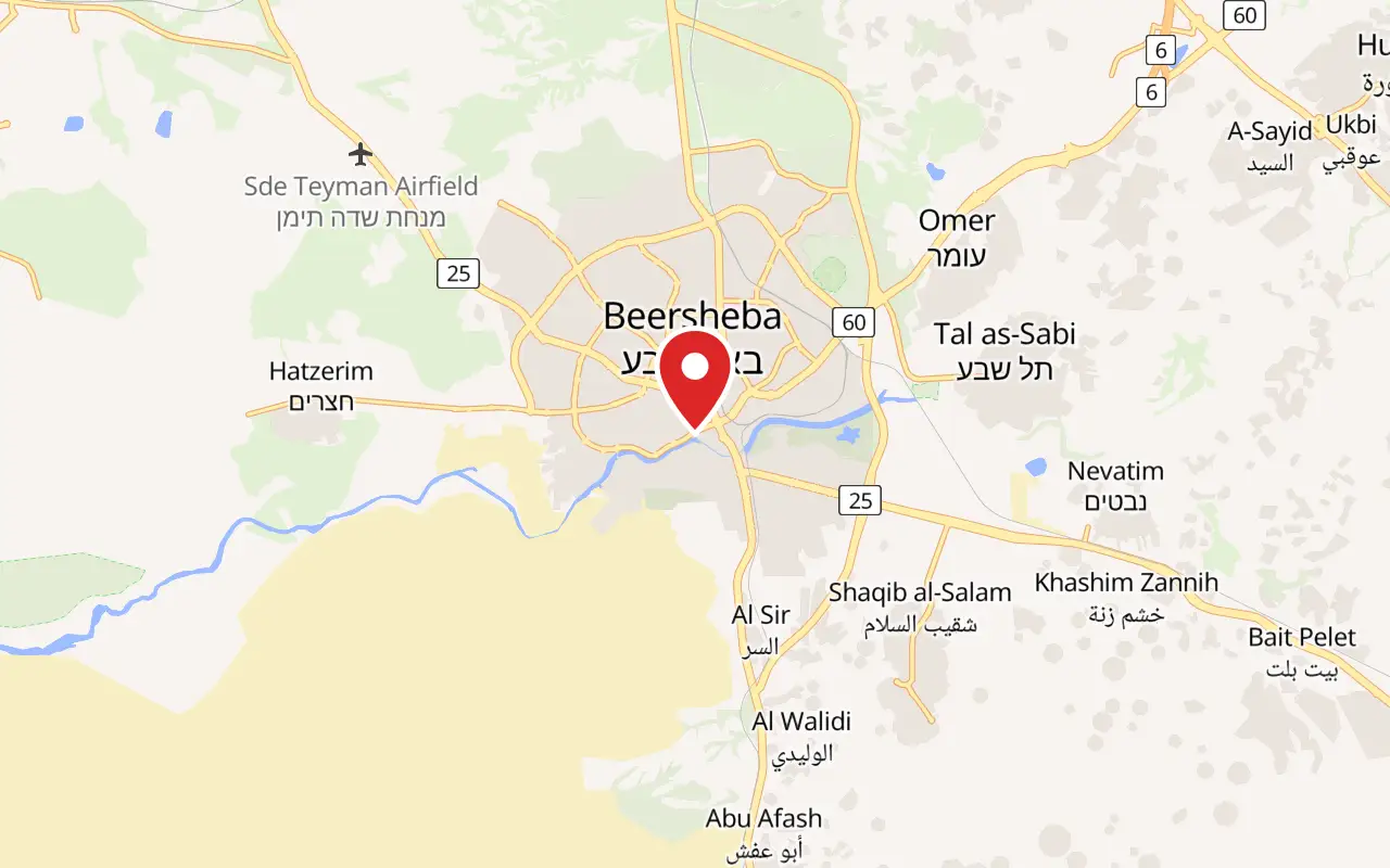
Where
Derech Hevron 2, Old City, Beersheba. Kivunim gives HeHalutz 90 as its postal address, which is a different place.
What ticket you need
This is a standalone municipal site with its own ticket. It is not inside a national park, and neither an Israel Nature and Parks Authority subscription nor a ticket to Tel Be'er Sheva National Park covers it. The two are separate places about four kilometres apart and are frequently confused.
Opening hours
- Site opening hours
- 10:00 to 16:00, and only by arrangement made in advancesource
- Scheduled Hebrew tour on the operator's booking calendar
- 15:00 to 16:00, listed daily across the ten dates shown when this page was writtensource
- English tours
- arranged by telephone on *8305; they are not published on the booking calendarsource
- Shabbat
- the audiovisual displays are not operatedsource
- Booking and enquiries
- *8305, or 08-623-4613 for the site itselfsource
Admission
Access
Good, and better than most sites in this destination. Kivunim states that the building is fully accessible to people with disabilities, and the Council for Conservation of Heritage Sites lists the site as accessible; the Avnei Moreshet heritage record answers yes to accessibility and lists shade, toilets and a car park. This is a level urban site with no climb, no gorge and no desert walk, which is the opposite of Ein Avdat or Makhtesh Ramon. What is not published anywhere is the surface and gradient of the well courtyard itself, so a visitor with specific needs should raise them when booking rather than on arrival.
On site
- Car park
- Toilets
- Kiosk
- Drinking water tap
- Shade
- Guided tours in Hebrew and English
- Photograph exhibition on the history of Beersheba
- Hall seating about 150
- Events, including bar and bat mitzvah ceremonies and Torah scroll receptions
Booking
Book before travelling. Both the operator and the Council for Conservation of Heritage Sites state that a visit has to be arranged in advance, and the site is not set up for people who simply arrive at the door. Hebrew tours can be booked online through Kivunim's ticketing system; an English tour has to be arranged by telephone on *8305, because English departures are not published on the calendar.
Hours and prices are given as the operator publishes them and change without much notice, particularly around Shabbat and the festivals. Check the operator's own page before you travel for this.
Official page at kivunim7.co.il →What people wish they had known
- Arrange the visit before going. The operator's own page gives the hours as 10:00 to 16:00 by prior arrangement only, and this is not a site where a walk-up visitor is shown round.
- If the tour needs to be in English, telephone *8305 rather than booking online. The public booking calendar lists Hebrew departures only, and an English guide has to be scheduled.
- Do not confuse this with Tel Be'er Sheva. The Iron Age town that archaeologists identify as biblical Beer-sheba, and that UNESCO inscribed in 2005, is a national park a few kilometres east with a separate ticket. Satellite navigation will happily take you to the wrong one.
- Come for the story and the shaft, not for a collection. There are no excavated finds on display here; the exhibition is an audiovisual route about Abraham plus photographs of the city.
- On Shabbat the audiovisual displays are not operated, which removes most of what the ticket buys. Choose another day if the presentation is the point.
- Navigate to Derech Hevron 2, not to HeHalutz 90. The second address is the operator's postal address and is somewhere else in the city.
The figures
Abraham's Well International Visitor Centre by the numbers
Each figure carries the year it belongs to and links the source it came from.
| Measure | Figure | As of | Source |
|---|---|---|---|
| Depth and diameter of the main well | 13.5 m deep, about 5 m of it cut in rock, 3.75 m across, lined with dressed stone to the bottom | 2026 | he.wikipedia.org |
| Robinson's 1838 measurements of the larger well | 12.5 feet in diameter, 44.5 feet deep to the water, 16 feet of it excavated in solid rock | 1838 | archive.org |
| Conder's measurements of the principal well | 12 feet 3 inches across, over 45 feet deep, lined with masonry to 28 feet | 1870s | archive.org |
| Date on the inscribed stone inside the shaft | 505 AH, read fifteen courses down the south side, which Conder placed in the twelfth century | 1870s | archive.org |
| Stone drinking troughs Conder counted | nine at the larger well and five at the lesser | 1870s | archive.org |
| Floor area of the visitor centre | 750 square metres | 2026 | makom.hamoreshet.org.il |
| The Peace Mosaic on the street frontage | about 105 square metres, made by Jewish, Christian and Muslim pupils under David Wakstein | 2026 | kivunim7.co.il |
| Published price of the guided tour | 0 to ₪34, for a slot of one hour | 2026 | kivunimb7.smarticket.co.il |
While you are here
The rest of The Negev
Everything else in this destination with a page of its own.
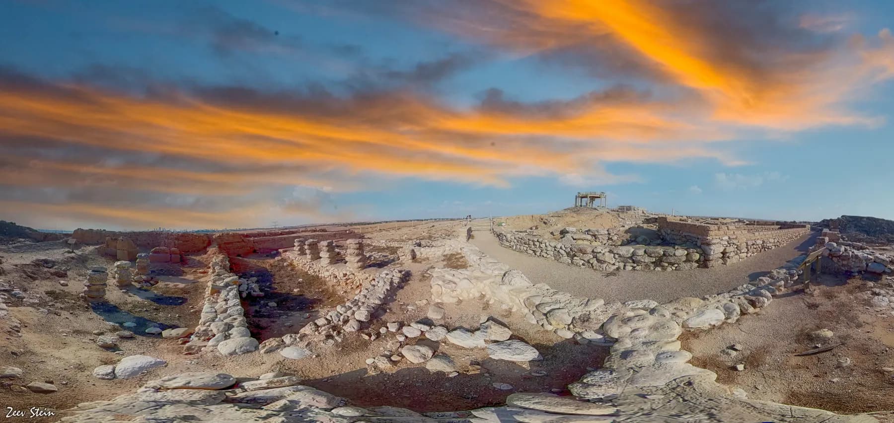
זאב שטיין / CC BY 2.5 · Wikimedia Commons
Archaeological site
Tel Be'er Sheva National Park
The stones of a four-horned altar were found here buried inside a storehouse wall, and the well beside the town gate goes down 69 metres to the water table.
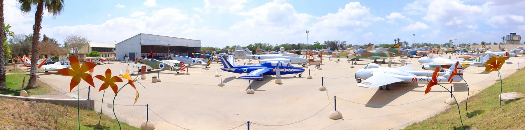
DYKT Mohigan / CC BY 2.0 · Wikimedia Commons
Museum
Israeli Air Force Museum, Hatzerim
The air force parks its retired and captured aircraft on an open concrete apron beside its own flight school west of Beersheba, from a Czech-built Messerschmitt copy of 1948 to the F-16 that struck the Osirak reactor in 1981.
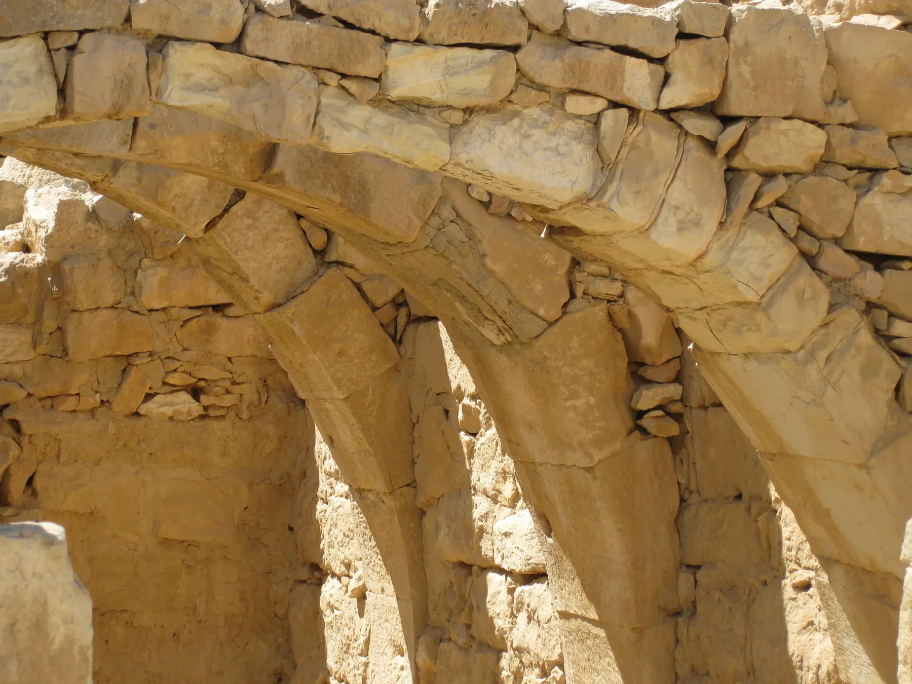
Deror avi / CC BY-SA 3.0 · Wikimedia Commons
Archaeological site
Mamshit National Park
Mamshit is the most compact of the four Negev desert cities in the UNESCO Incense Route inscription: about four hectares of Nabataean, Roman and Byzantine town inside a national park of 142.
Sources and further reading
Every link below was opened and checked when this page was written. Official statements are marked as such: they are the subject's own account, not an independent one.
- OfficialKivunim, the Beer Sheva Company for Culture and Leisurekivunim7.co.ilמרכז מבקרים באר אברהם (Abraham's Well Visitor Centre)
The operator's own page: opening hours of one-hour tours by prior arrangement only, telephone 08-6234613 and a WhatsApp line, tours in Hebrew and English, the statement that the building is fully accessible, the guided audiovisual route ending at the well, the Peace Mosaic of about 105 square metres led by David Wakstein, and the events programme
- OfficialKivunim Beer Sheva, Smarticket ticketing systemkivunimb7.smarticket.co.ilסיור בבאר אברהם בעברית (Abraham's Well tour), booking page
The published ticket range of 0 to ₪34, the one-hour slot length, the scheduled Hebrew departures at 15:00 to 16:00, the instruction to call *8305 to schedule an English tour, the tent-shaped building and its accessibility, and the description of the audiovisual passage of biblical verses ending with the well revealed
- OfficialVisit BR7, Beer Sheva municipal tourismvisitbr7.co.ilמרכז מבקרים בינלאומי באר אברהם
The municipal tourism listing: address at Derech Hevron 2 in the Old City, telephone 08-6234613, the three-dimensional presentation about Abraham, and the framing of the site as a heritage attraction rather than a museum collection
- ReferenceCouncil for Conservation of Heritage Sites in Israelshimur.orgמרכז מבקרים באר אברהם, heritage site record
The careful phrasing that the site is built around ancient wells at the edge of the Old City, one of which an early tradition connects to Abraham; hours of 10:00 to 16:00 by prior arrangement; tours in Hebrew and English; the site listed as accessible; and the statement that the audiovisual displays are not operated on Shabbat
- ReferenceEdward Robinson, via the Internet Archivearchive.orgBiblical Researches in Palestine, Mount Sinai and Arabia Petraea: a journal of travels in the year 1838
Robinson's own account of reaching the wells in 1838: two deep wells on the northern bank of Wady es-Seba', the larger 12.5 feet across and 44.5 feet deep with 16 feet cut in solid rock, the second 5 feet across and 42 feet deep, the stone troughs, the curb stones worn by ropes, no dwellings visible, and the ruins on the hills to the north matched against Eusebius and Jerome
- ReferenceClaude Reignier Conder, via the Internet Archivearchive.orgTent Work in Palestine: a record of discovery and adventure, vol. 2
Conder's survey account: the principal well 12 feet 3 inches across and over 45 feet deep lined to 28 feet, a second well 300 yards west, a dry third to the east, nine and five stone troughs, the judgement that the masonry is not very ancient, the stone inscribed 505 AH fifteen courses down, the hundred-odd rope channels, the Tell of Seb'a two and a half miles east, and the fourth-century town foundations near the wells
- ReferenceHebrew Wikipediahe.wikipedia.orgבאר אברהם
The well at 13.5 metres deep with about 5 metres cut in rock and a diameter of 3.75 metres, lined with dressed stone to the bottom and fed by groundwater percolating through the loess; a second well apparently sunk later; the visitor centre opened in October 2013 to a design by Eli Armon on the foundations of the ancient well courtyard, imitating a tent, in desert colours with copper for the Middle Bronze Age; the hall for about 150; and the 1948 handover and municipal paving and walling
- ReferenceEnglish Wikipediaen.wikipedia.orgAbraham's Well
The location at 2 Hebron Road, the Genesis 21:25 and 26:25 references, the statement that a local sheikh built a house above the well in 1897, and the transcribed passages from Robinson and Conder used to check the Internet Archive originals
- ReferenceEncyclopaedia Britannicabritannica.comBeersheba
The covenant between Abraham and Abimelech of Gerar, the derivation of the name from the Hebrew for a well and for an oath or seven, Ottoman town planning and development around 1900 with the town remaining a watering station and Bedouin trading centre, the British capture in 1917 and the Israeli capture in October 1948
- ReferenceEnglish Wikipediaen.wikipedia.orgTel Be'er Sheva
The identification of Tel Sheva with the biblical town of Beer-sheba, its inscription by UNESCO in 2005 as part of the Biblical Tels with Megiddo and Hazor, the two biblical wells at Beersheba in Genesis, and the note that Abraham's Well in the modern city dates to at least the twelfth century CE
- ReferenceHebrew Wikipediahe.wikipedia.orgאלי ארמון
Independent confirmation of the architect: Eli Armon, born 1955, Technion graduate in architecture and town planning in 1984, city engineer of Beersheba between 1989 and 1992, founder of his own practice in 1993, and designer of Abraham's Well alongside Beer Sheva Central and Wolfson railway stations
- ReferenceAvnei Moreshet, Hamoreshetmakom.hamoreshet.org.ilבאר אברהם / באר שבע, heritage capsule 5317
The visitor centre's floor area of 750 square metres, the three-dimensional film about Abraham, the 1112 inscription, the site facilities of car park, toilets, kiosk, drinking water tap and shade, the accessibility answer and the note that the site is ticketed
Abraham's Well International Visitor Centre: common questions
Is this really Abraham's well?+
There is no evidence that it is, and the earliest firm date anyone has for the structure is the twelfth century CE. Claude Conder found a stone inscribed 505 AH fifteen courses down the shaft and concluded that the masonry was not very ancient. What the site actually offers is a very old well that an early tradition attaches to Abraham, in the town whose name comes from that tradition, which the Council for Conservation of Heritage Sites is careful to phrase in exactly those terms.
How old is the well itself?+
At least about nine hundred years, and possibly much older, but nobody has published a date for the shaft as opposed to its lining. Conder's inscribed stone puts the masonry in the twelfth century, and he thought the stones at the mouth were no older, judging by the hundred-odd rope channels worn into them. A hole in the ground can be far older than the stones that line it, and this one may well be, but that is a reasonable inference rather than a finding.
How much does Abraham's Well cost, and how long does it take?+
The operator's booking page prints the guided tour as 0 to ₪34 for a one-hour slot, and shows the individual ticket categories only once you begin booking. Allow an hour for the tour itself and a little more if you want to look at the mosaic wall and the photograph exhibition without hurrying.
Can you turn up without booking?+
No. Both Kivunim, which runs the site, and the Council for Conservation of Heritage Sites state that a visit requires arrangement in advance, with the hours given as 10:00 to 16:00. Hebrew tours appear on the online calendar; anything else goes through *8305.
Is the tour available in English?+
Yes, but not on demand. The ticketing page states that tours are held in Hebrew and English and that an English tour has to be scheduled by calling *8305. The scheduled departures published online are the Hebrew ones.
What is the difference between this and Tel Be'er Sheva?+
They are different sites with different claims. This is a well and a visitor centre in the Old City of the modern town, about the figure of Abraham. Tel Be'er Sheva is the excavated Iron Age town a few kilometres east that archaeologists identify with biblical Beer-sheba, run as a national park and inscribed by UNESCO in 2005 among the Biblical Tels with Megiddo and Hazor. Visiting one does not cover the other.
Is it wheelchair accessible?+
The operator states that the building is fully accessible, the Council for Conservation of Heritage Sites lists the site as accessible, and the Avnei Moreshet heritage record answers yes on accessibility. It is a level urban site with no climb and no rough ground on the approach, which makes it one of the easier things to visit in the Negev. The published material does not describe the well courtyard surface in detail, so flag specific needs when booking.
Is it worth it if you are not religious?+
It depends what you want from an hour. The presentation is built around Abraham as the shared ancestor of the three monotheistic religions and it is unapologetically a story rather than an excavation report. The parts that hold up regardless are the shaft, the fact that a city was laid out around these wells rather than the other way round, and the photograph exhibition on how Beersheba grew from an Ottoman planning exercise of about 1900 into the capital of the Negev.
Can it be combined with other things in Beersheba in one day?+
Easily, and it should be, because an hour is not a day out. The Old City museums are a short walk away, Tel Be'er Sheva National Park is about four kilometres east, and the Israeli Air Force Museum at Hatzerim is a short drive west. Beersheba is also the natural first or last stop on a Route 40 run south through Sde Boker and Avdat.
Is there shade, and are there toilets?+
Yes to both. The heritage record for the site lists a car park, toilets, a kiosk, a drinking water tap and shade, and most of the visit happens indoors in any case. This is a city-centre site rather than a desert one, so the heat management that matters at Makhtesh Ramon or Ein Avdat is not really a factor here.