Nature reserve · The Negev
Makhtesh Ramon (Ramon Crater)
The floor of the makhtesh was quarried for clay and quartz before it was protected, and the parks authority's scenic road across the eastern half runs over ground it had to rehabilitate.
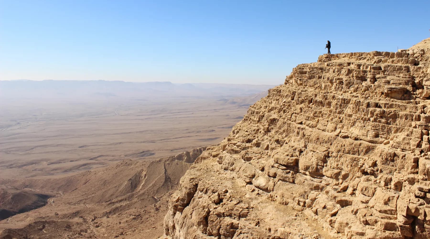
Orhat / CC BY-SA 4.0 · Wikimedia Commons
Length
about 40 km
2 to 10 km wide and about 500 m deep, on the US Geological Survey's figures
Floor altitude
557 m
above sea level, measured at the USGS satellite calibration site on the crater floor
Visitor centre ticket
₪31
child ₪16, as posted by the Israel Nature and Parks Authority in 2026; the makhtesh itself is not ticketed
Plant species
486
71 of them rare and 25 growing nowhere else on earth, per the parks authority
In short
- How long to give it
- About 90 minutes for the visitor centre and the promenade, or a full day if you drive down and take in the Ramon Colors route, the Carpentry and Ein Saharonim
- Summer, Sunday to Thursday and Saturday
- 08:00-17:00
- Adult
- ₪31
מכתש רמון
Makhtesh Ramon is a closed valley about 40 kilometres long, walled on every side and drained by a single stream that leaves through one gap in the east. It is not an impact crater and not a volcano. The Hebrew word makhtesh is used in English because the landform occurs, so far as the Israel Nature and Parks Authority describes it, only in the Negev and Sinai, and English never needed a word for it. The parks authority calls this one the largest makhtesh in the world; NASA's Earth Observatory calls it the world's largest erosion crater.
The site a visitor actually books is smaller than the landform. On the northern cliff, at the edge of the town of Mitzpe Ramon, the parks authority runs the Makhtesh Ramon visitor centre, which is ticketed, reservation-only and built around two subjects at once: how the makhtesh formed, and the life of Ilan Ramon, the Israeli air force colonel who flew on Columbia and died with the rest of the crew on 1 February 2003. The crater below it is open ground crossed by Route 40, with no gate and no admission.
Almost everything on the floor rewards the extra hour it takes to get down there: prisms of baked sandstone, a cliff of ammonite fossils, coloured sand, black volcanic dykes, a Nabataean caravanserai, a spring that runs in winter, and a herd of Asiatic wild asses released here in the 1980s that has been breeding ever since.
The landform
A valley with one way out, and no agreement on how many exist
The parks authority's own account of the geology runs in order. Soft continental sediments, sandstone among them, were laid down first. The sea came over them and hard marine rock, limestone, formed on top. A fault buckled the whole stack into an anticline while it was still submerged. The anticline rose, the water withdrew, and the hard cap began to wear off the top of the fold, exposing the soft rock underneath. Later the anticline rose again, tilted east towards the Arava as the Great Rift Valley moved, and a river running east along the crest emptied the soft heart of the fold far faster than it could cut through the walls. What is left is a valley ringed by cliffs and drained by one stream, which is the definition of a makhtesh.
NASA's Earth Observatory tells the same story in fewer steps and reaches further back: more than 200 million years ago this ground lay under the Tethys Sea, and once the water receded, wind and rain flattened the top of a hill of hard rock over a soft limestone core while rivers hollowed out its inside. The measurements are close but not identical. The US Geological Survey, which maintains a satellite calibration site on the floor, gives approximately 40 kilometres in length, 2 to 10 kilometres in width and about 500 metres in depth, at an altitude of 557 metres. NASA gives the same length and depth but a width of 2 to 19 kilometres, the difference being where the rim is drawn.
Nobody agrees on how many of these there are, either, which is worth knowing before reading a confident sentence about it. The International Dark-Sky Association's 2017 designation document describes the Ramon as the largest and most impressive of three erosion craters in the Negev. Hadassah Magazine, writing in 2006, called it the largest of five. The parks authority sidesteps the count and says only that craters formed by this process are found in the Negev and Sinai. The disagreement is about whether small examples on the surrounding ridges qualify, not about this one.
- About 40 km long, 2 to 10 km wide, about 500 m deep (USGS)
- Floor at 557 m above sea level (USGS)
- NASA gives the width as 2 to 19 km, on a different reading of the rim
- Drained east by a single stream, Nahal Ramon (parks authority)
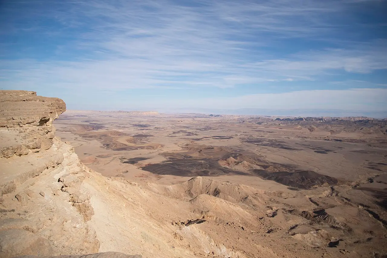
Meydan Mor Alon / CC BY-SA 4.0 · Wikimedia Commons
The rim
What the ticket on the northern cliff actually buys
The visitor centre stands in the middle of the northern cliff, at the edge of Mitzpe Ramon, and the parks authority is explicit that entrance is by reservation only, with the museum entrance closing an hour before the site does. Adult admission is ₪31 and a child ₪16, with ₪26 for a student or an adult in a group and ₪14 for a child in a group. Parking is charged; the authority points visitors who would rather not pay for it to the free lot at Hai Ramon. Groups of 30 or more can book outside the published hours for an extra fee.
Inside, one half of the building explains the makhtesh and the other half is a memorial. Ilan Ramon flew as payload specialist on STS-107, which launched on 16 January 2003 and broke up over Texas on re-entry on 1 February, about sixteen minutes short of its landing. He was the first Israeli in space. The naming is a coincidence people reliably get wrong: the makhtesh, the mountain and the town all carried the name Ramon before the astronaut did, and Mitzpe Ramon means, plainly, Ramon lookout.
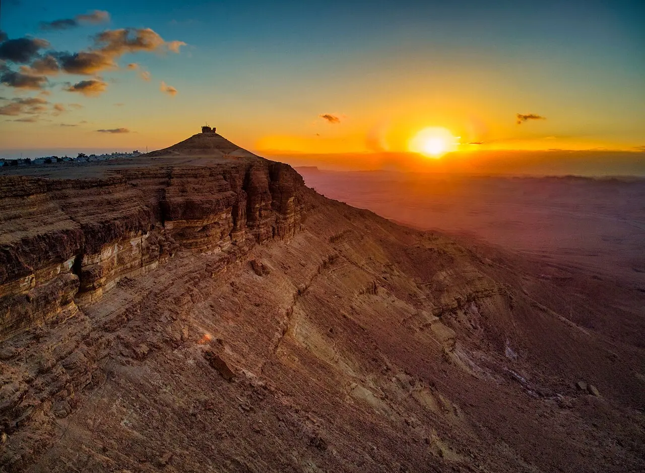
The view is the other half of the visit and it is free. From the centre the whole southern wall stands opposite, the eastern and western ends run out of sight, and Har Ardon rises in the east, the hill that gives the makhtesh its heart shape from the air. The Albert Promenade runs south from the centre along the cliff edge towards Har Gamal; northwards, a bridge over the Eilat road leads to a sculpture garden made during conventions of international artists, some of whose pieces are built to sound in the wind.
- Adult ₪31, child ₪16, student or adult in a group ₪26, child in a group ₪14, Israeli senior citizen ₪16
- Entry by reservation only; the museum stops admitting an hour before closing
- Parking is charged at the centre and free at the Hai Ramon lot
- Hai Ramon, the living desert park in the town, is a separate ticket: adult ₪22, child ₪9
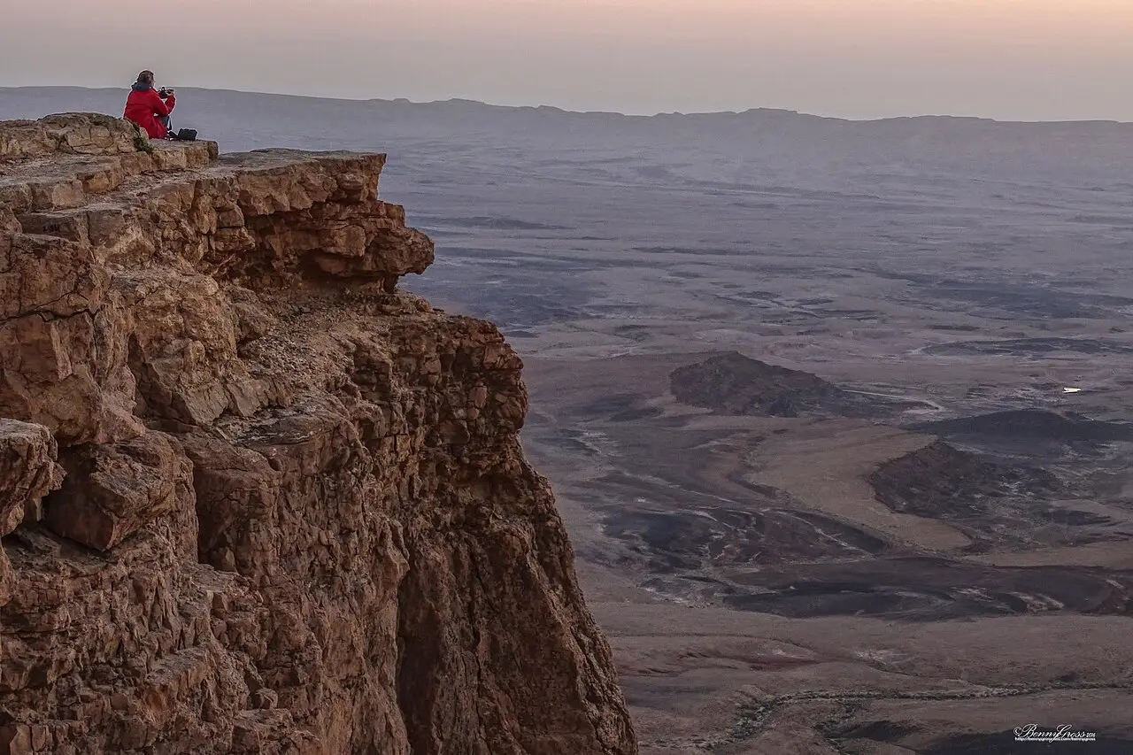
Bennygross / CC BY-SA 4.0 · Wikimedia Commons
Inside
The Carpentry, the Ammonite Wall and the spring at the far end
The Carpentry, HaNagariya, is the one everybody photographs: a low rise covered in stone prisms, formed when lava rising from below baked the sandstone it passed through, and the rock, cooling, cracked into thousands of polygonal columns that later broke into lengths. The Ammonite Wall, in the southern part of the makhtesh, is a rock face holding the fossilised shells of ammonites, which lived in the sea that covered the Negev. The parks authority states the position on both without hedging: the fossils are a protected natural phenomenon and collecting them is forbidden.
The eastern half holds the colour. Layers of sand in different shades are exposed in a few places, and the eastern part of the makhtesh is threaded with dykes, sheets of igneous rock forced up between the sedimentary layers, along with basalt hills such as Giv'at Ga'ash, built of lava. Karney HaRamon, seven basalt hills in the west, were dedicated to the memory of the seven crew members who died on Columbia, Ilan Ramon among them, and are visible from a walking trail off Har Ramon, which the parks authority calls the highest point in the Negev.
The far east end is where the water and the history are. Ein Saharonim is a spring that in winter makes a stream running for hundreds of metres and often dries out in summer; the vegetation around it is thick by desert standards and it is the surest place in the makhtesh to read animal tracks. On a hill nearby stands Khan Saharonim, a square building with rooms around an inner courtyard, a baking oven and a water reservoir, which served caravans on the Nabataean incense road. That road ran roughly 2,400 kilometres from Arabia to the port of Gaza and was in use from the third century BCE to at least the third century CE. Where it met the northern cliff the Nabataeans built an engineered ascent, Ma'ale Mahamal, watched over by the fort at Metsad Mahamal. UNESCO's 2005 inscription of the Incense Route covers Metsad Nekarot, Khan Saharonim, Metsad Mahamal and the stretch of road linking them.
There are older and stranger things down there too, and the parks authority is careful to say that their purpose is not settled. Nawamis tumuli, stone mounds in two parallel lines that seem to be burials. Sulam Ya'acov, stone arrangements beside old roads that may be camps or may be ceremonial. Shiniyot, cairns built on skylines. And afifonim, two long converging walls forming a funnel that ends in a pit, of which two are known here and which are thought to be animal traps.
Repair
What was taken out of the makhtesh, and what was put back into it
This is not a landscape that was left alone and then fenced. Mitzpe Ramon's early economy was planned around the quarries on the crater floor: Hadassah Magazine's account of the town describes its first residents working in clay and quartz workings inside Makhtesh Ramon, and the local council's own history says the settlement was intended to live off crater quarries, industrial plants and tourist sites. Protection came afterwards. The parks authority lists among its own conservation work the reduction of the areas being quarried in the makhtesh, the declaration of those areas as nature reserve, and the rehabilitation of vast tracts of ground that had been dug over.
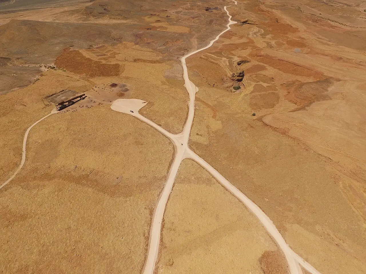
The Ramon Colors route, the graded dirt road that is the main way into the eastern makhtesh and is passable in an ordinary car, exists because of that repair job. The parks authority built it while rehabilitating the former mining area, signed it with explanations of the geology it passes, and did the work with the Quarry Rehabilitation Foundation. Its stated plan is to turn the abandoned quarry into an open geological museum, with trails for walkers and cyclists. A visitor driving that road is looking at exposed rock and coloured sand from a made surface laid across a repaired excavation, which is worth knowing rather than being disappointed by.
The animals were put back as deliberately as the ground. Asiatic wild asses had disappeared from this country early in the twentieth century. A breeding group was assembled at the Hai-Bar Yotvata reserve from 1968, and 28 animals were released into the Negev between 1982 and 1987, at Ein Saharonim, with ten more in 1992 and 1993 further south; Washington University in St Louis, whose Alan Templeton worked on the population with Ben-Gurion University and the parks authority, put the herd at around 250 by 2013. The parks authority now estimates 250 to 300 living in Makhtesh Ramon and Borot Lots. It also runs feeding stations for birds of prey in the area, to offset the collapse of their natural food supply.
Legal protection came in stages and is still being extended. Two nature reserves were declared inside the makhtesh in 1989, Matsok HaTsinim and Har HaNegev; Matsok HaTsinim was enlarged in 2009 and Har HaNegev in 2009 and again in 2011. What that protects, on the parks authority's count, includes 486 plant species, 71 of them rare, eight of those classed as endangered, and 25 that grow nowhere else.
- Two reserves declared inside the makhtesh in 1989, expanded in 2009 and 2011
- 486 plant species recorded, 71 rare, 8 endangered, 25 endemic
- 28 Asiatic wild asses released at Ein Saharonim between 1982 and 1987
- 250 to 300 wild asses now in Makhtesh Ramon and Borot Lots
- The Ramon Colors scenic road was built as part of rehabilitating the quarries
מיטב אסולין / CC BY-SA 4.0 · Wikimedia Commons
After dark
Why the makhtesh is worth staying for once the light goes
The conditions that make this a good place to look at the sky are the same ones that make it a good place to point a satellite at the ground. The US Geological Survey uses the crater floor as a calibration site precisely because it is hyper-arid, gets around 25 millimetres of rain a year, and has rare cloud cover, over a surface with an unusually wide range of mineral compositions in a small area. The German Aerospace Center's Earth Observation Center said much the same in 2022 when its EnMAP hyperspectral mission used the makhtesh for validation, listing sandstone, iron oxide rich rocks, gypsum, limestone, dolomite, clay minerals and crystalline plutonic units within a basin it measured at roughly 40 by 7 kilometres.
In September 2017 the International Dark-Sky Association designated the Ramon Crater Nature Reserve an International Dark Sky Park, the first such designation in the Middle East and, at the time, one of a small number worldwide. The management terms matter more than the label: the western crater is kept as an undisturbed dark core and lighting at the eastern campgrounds is controlled to limit spill.
Night use inside the makhtesh is also managed for the animals, not just the sky. The parks authority is direct about why campers are confined to marked areas: the campgrounds exist to serve visitors and, at the same time, to keep human activity off the crater floor at night, when most of the wildlife is moving. Be'erot, in the centre of the makhtesh, is the campsite with services, reachable by ordinary car, and it supplies water, toilets, light snacks and rubbish removal. The other camping areas in the makhtesh have none of that.
Hagai Agmon-Snir حچاي اچمون-سنير חגי אגמון-שניר / CC BY-SA 4.0 · Wikimedia Commons
What to look for
Things not to walk past at Makhtesh Ramon (Ramon Crater)
The details that repay knowing about before you are standing in front of them.
The Carpentry (HaNagariya)
A hill of polygonal stone prisms, made when lava baked the sandstone it rose through and the rock cracked as it cooled. It is the single most photographed thing on the crater floor and it is a short walk from the road.
The Ammonite Wall
A rock face in the southern makhtesh holding the fossilised shells of ammonites from the sea that once covered the Negev. Collecting them is forbidden and the parks authority treats the wall as a protected natural phenomenon.
Ein Saharonim and Khan Saharonim
The spring at the eastern end, which runs as a stream for hundreds of metres in winter and often dries in summer, and the Nabataean caravanserai on the hill above it, with its courtyard, oven and cistern. Both are on the UNESCO-inscribed Incense Route.
Karney HaRamon
Seven basalt hills at the western end, dedicated to the seven crew members lost with the shuttle Columbia. A walking trail from Har Ramon, the highest point in the Negev, reaches the viewpoint over them.
The Albert Promenade
The level cliff-edge walk running south from the visitor centre towards Har Gamal, with the makhtesh dropping away the whole length of it. It costs nothing and it is where the shape of the landform becomes legible.
Har Ardon
The hill in the east that gives the makhtesh its heart shape in satellite images, and the best view of the eastern floor and the southern wall. It is reached on foot only.
The long view
Makhtesh Ramon (Ramon Crater), in order
More than 200 million years ago
Under the Tethys Sea. NASA's Earth Observatory dates the marine phase that laid down the rock now exposed on the crater floor; the anticline that became the makhtesh was folded while still submerged.
3rd century BCE to 3rd century CE
The incense road crosses the makhtesh. Nabataean caravans used a route of roughly 2,400 km from Arabia to Gaza, entering the makhtesh at Ma'ale Dkalim and leaving it by the engineered ascent at Ma'ale Mahamal, with Khan Saharonim as a way station.
1953
A camp on the rim. Mitzpe Ramon's local council dates the Independence Camp, built for road builders, workers, soldiers and Bedouin working on the Eilat road, to 1953; other accounts put the first camp at 1951. It was declared a development town in 1956.
1968
Wild asses bred at Hai-Bar Yotvata. A breeding group of Asiatic wild asses was assembled at the Hai-Bar Yotvata reserve, the stock from which the Negev population was later founded.
1982-1987
Wild asses released at Ein Saharonim. Twenty-eight animals were let go inside the makhtesh over six years, with ten more released further south in 1992 and 1993.
1989
Two reserves declared inside the makhtesh. Matsok HaTsinim and Har HaNegev were both declared in 1989, the legal step that ended quarrying on the crater floor and began the rehabilitation of the workings.
2003
Columbia. STS-107 launched on 16 January with Ilan Ramon aboard as payload specialist, the first Israeli in space, and broke up over Texas on 1 February about sixteen minutes before landing. The visitor centre on the rim is built around his story as well as the geology.
2005
UNESCO inscribes the Incense Route. The inscription covers Metsad Nekarot, Khan Saharonim, Metsad Mahamal and the section of road connecting them, all inside or on the edge of the makhtesh.
2009-2011
The reserves are enlarged. Matsok HaTsinim was expanded in 2009; Har HaNegev was expanded in 2009 and again in 2011.
2017
International Dark Sky Park. The International Dark-Sky Association designated the Ramon Crater Nature Reserve in September 2017, the first such park in the Middle East, with the western crater kept as an undisturbed dark core.
2022
A calibration target from orbit. The German Aerospace Center's Earth Observation Center published EnMAP hyperspectral validation data from the makhtesh, using it for the density of distinct minerals packed into a small area.
Practical
Visiting Makhtesh Ramon (Ramon Crater)
Where
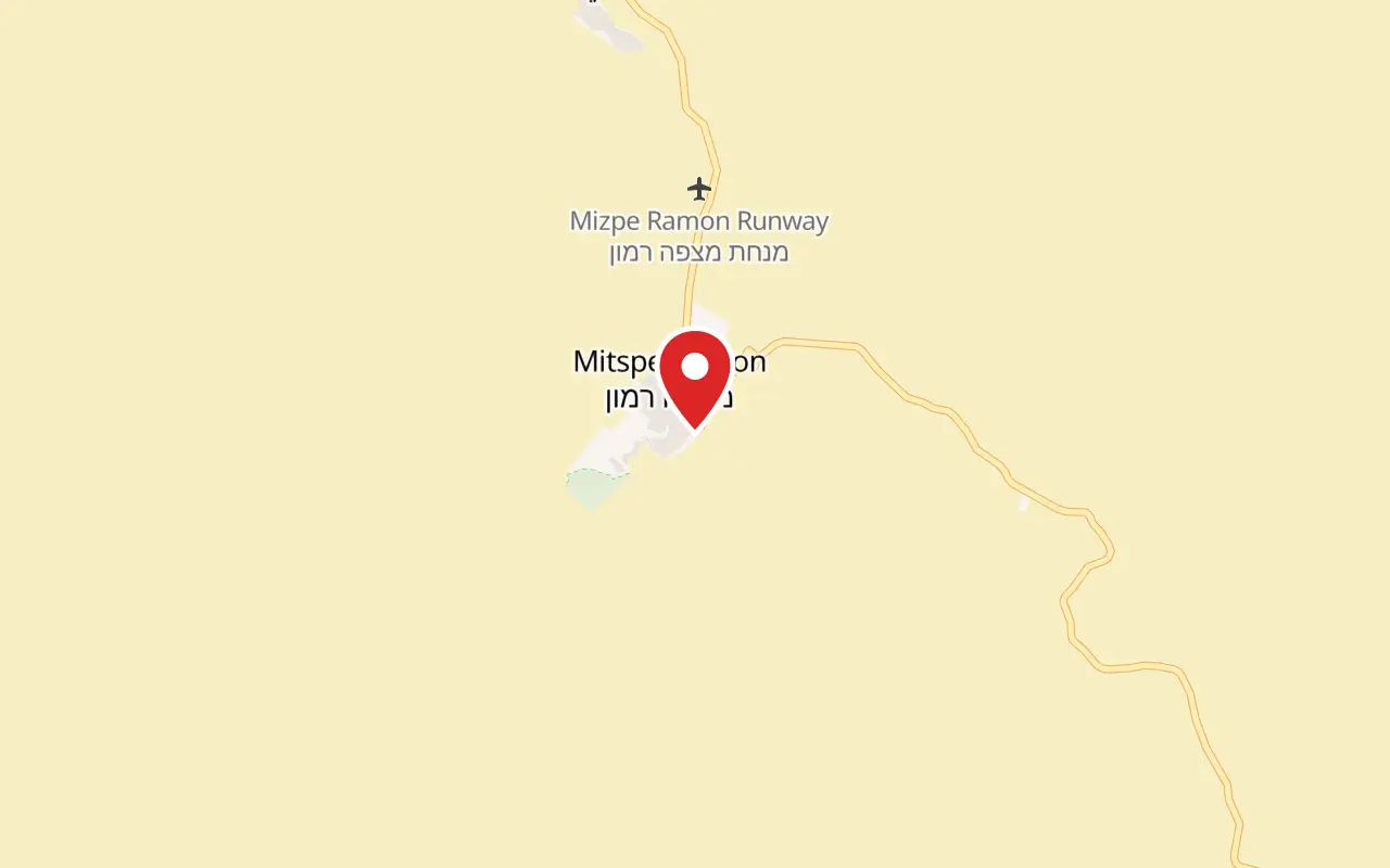
Makhtesh Ramon visitor centre, 1 Ma'ale Ben Tor, Mitzpe Ramon, off Route 40 between Beersheba and Eilat
What ticket you need
The makhtesh lies inside the Matsok HaTsinim and Har HaNegev nature reserves, which are not gated and carry no admission charge. The ₪31 ticket covers the visitor centre on the rim and nothing else; Hai Ramon and the Be'erot campsite are charged separately.
Opening hours
- Summer, Sunday to Thursday and Saturday
- 08:00-17:00source
- Summer, Friday and holiday eves
- 08:00-16:00source
- Winter, Sunday to Thursday and Saturday
- 08:00-16:00source
- Winter, Friday and holiday eves
- 08:00-15:00source
- Holiday eves and the eve of Yom Kippur
- 08:00-13:00source
- Last admission
- One hour before closing, and entrance is by reservation onlysource
- The makhtesh itself
- The parks authority publishes these hours for the visitor centre; it posts no gate hours for the crater, which Route 40 crossessource
Admission
- Adult
- ₪31source
- Child
- ₪16source
- Student, or adult in a group
- ₪26source
- Child in a group
- ₪14source
- Israeli senior citizen
- ₪16source
- Hai Ramon living desert park (separate site, separate ticket)
- Adult ₪22, child ₪9, student or adult in a group ₪19, child in a group ₪8, Israeli senior citizen ₪11source
- Be'erot campsite, per night
- Adult ₪75, child ₪65; group leaders' room ₪350 for up to six peoplesource
- Parking
- Charged at the visitor centre; free at the Hai Ramon lotsource
- The crater
- No admission charge; the ticket is for the visitor centre onlysource
Access
The visitor centre is listed by the parks authority among the sites on its accessibility page and publishes an accessible visit coordination form for people with disabilities; its own site notes mark it as suitable for pushchairs. Hai Ramon, in the town, publishes a fuller list: accessible parking, service centre, toilet, shaded picnic area, a concrete loop trail through the botanical garden, the animal display, classrooms and captions on the explanatory film. Inside the makhtesh the position is different. Getting to the floor means driving, the Ramon Colors route is a graded dirt road rather than a surfaced one, and the climbs to Har Ardon and Har Gvanim are on foot only and not suitable for wheelchairs.
On site
- Information station
- Observation platform
- Souvenir shop
- Restaurant nearby
- Paid parking at the centre
- Free parking at Hai Ramon
- Be'erot campsite on the crater floor, with water and toilets
- Marked scenic dirt road passable in an ordinary car
Booking
Entrance to the visitor centre is by reservation only, through the parks authority's booking system, and entry is permitted only on showing a reservation for the time booked. Groups of 30 or more can arrange a visit outside the published hours for an additional fee.
Hours and prices are given as the operator publishes them and change without much notice, particularly around Shabbat and the festivals. Check the operator's own page before you travel for this.
Official page at en.parks.org.il →What people wish they had known
- Book the visitor centre before setting out. The parks authority admits by reservation only and will let you in only at the time on the booking, which catches out people who plan to buy at the desk.
- Standing on the rim is not the same as visiting the makhtesh. The prisms, the fossils, the coloured sand and the spring are all on the floor, and the drive down and back adds most of a day to a stop that many people give an hour.
- The Ramon Colors route into the eastern crater is a graded dirt road, not a four-wheel-drive track, and the parks authority states it is suitable for all vehicles. People with hire cars often skip it for no reason.
- Fill water bottles in the town. The parks authority lists water at the Be'erot campsite, in the middle of the makhtesh, and the other camping areas have no services at all.
- Leave the rocks. Ammonites at the wall and the coloured sands are protected, collecting is forbidden, and the wall has been picked over for decades already.
- If you want the sky, plan on a moonless night and stay east or in the town. The western crater is kept as an undisturbed dark core and is not somewhere to go driving about after dark.
The figures
Makhtesh Ramon (Ramon Crater) by the numbers
Each figure carries the year it belongs to and links the source it came from.
| Measure | Figure | As of | Source |
|---|---|---|---|
| Length, width and depth | about 40 km long, 2 to 10 km wide, about 500 m deep | 2026 | calval.cr.usgs.gov |
| Altitude of the crater floor | 557 m above sea level | 2026 | calval.cr.usgs.gov |
| Adult admission, visitor centre | ₪31 adult, ₪16 child, ₪26 student | 2026 | en.parks.org.il |
| Adult admission, Hai Ramon living desert park | ₪22 adult, ₪9 child | 2026 | en.parks.org.il |
| Plant species recorded in the makhtesh | 486, of which 71 are rare, 8 endangered and 25 endemic | 2026 | en.parks.org.il |
| Asiatic wild asses released at Ein Saharonim | 28 animals between 1982 and 1987, with 10 more further south in 1992-93 | 2013 | source.washu.edu |
| Asiatic wild asses in Makhtesh Ramon and Borot Lots now | about 250 to 300 | 2026 | en.parks.org.il |
| Length of the Nabataean incense road that crossed the makhtesh | about 2,400 km, from Arabia to the port of Gaza | 2026 | en.parks.org.il |
While you are here
The rest of The Negev
Everything else in this destination with a page of its own.
Activity
Stargazing in the Ramon Crater
The Israel Nature and Parks Authority won the International Dark Sky Park title for the Ramon Crater in September 2017 after three years of assessment, and the research observatory five kilometres west of the town logs about 170 nights a year with no cloud at all.
רחל וייסלר / CC BY 2.5 · Wikimedia Commons
Nature reserve
Ein Avdat National Park
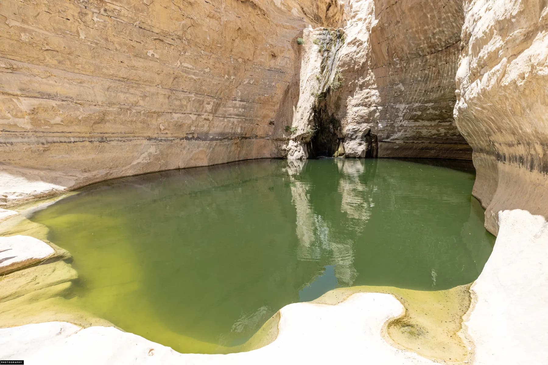
Three springs keep water running all year at the bottom of a white chalk canyon that was cleared, laid out and opened to the public in 1961 as a seventy-fifth birthday present for David Ben-Gurion.
ישראל פרקר / CC BY 2.5 · Wikimedia Commons
Archaeological site
Avdat National Park
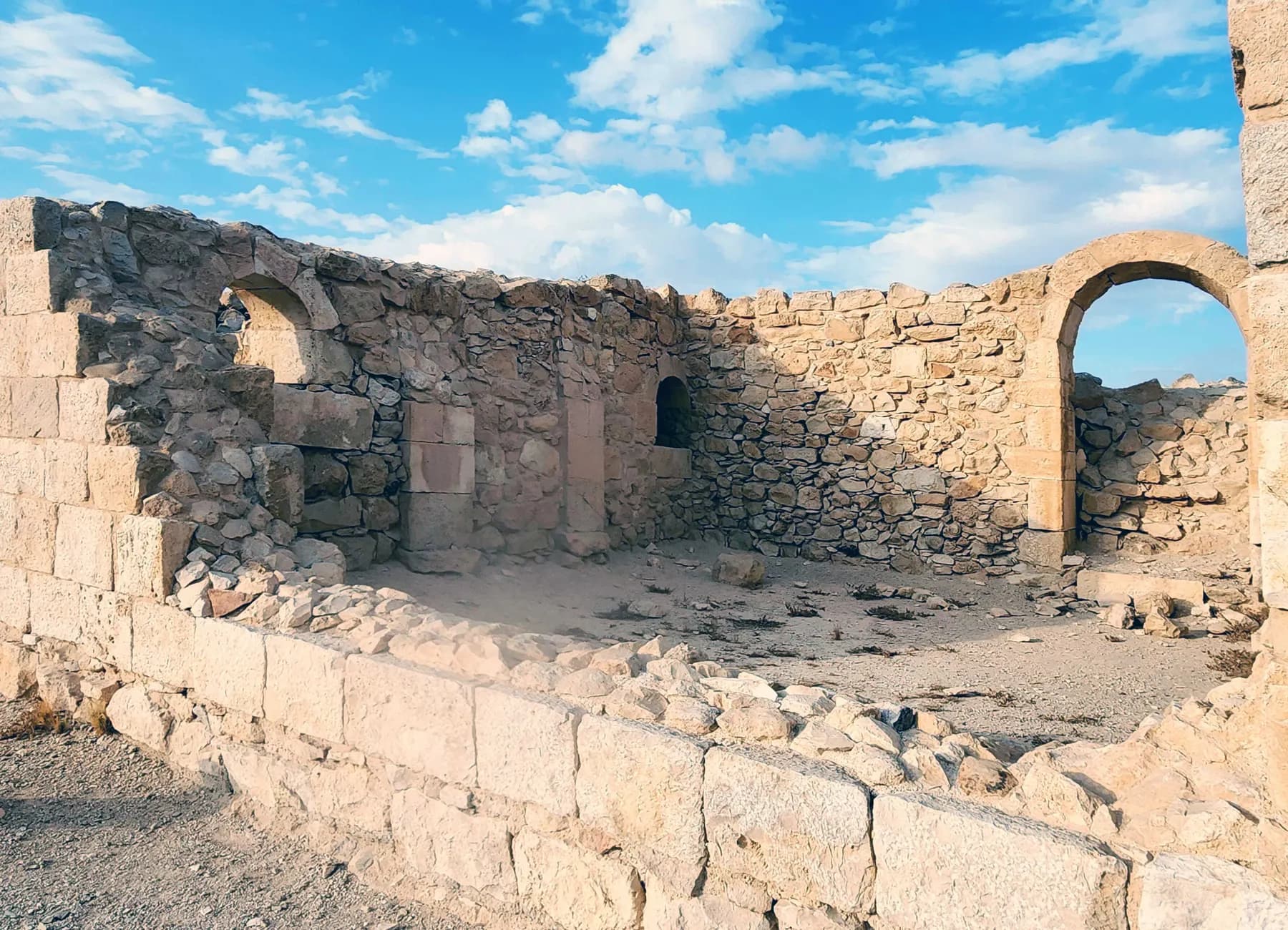
Avdat was station number 62 on the Incense Route, and the caravan road that brought frankincense from Arabia towards the port of Gaza can still be picked out climbing to it from the southeast.
Sources and further reading
Every link below was opened and checked when this page was written. Official statements are marked as such: they are the subject's own account, not an independent one.
- OfficialIsrael Nature and Parks Authorityen.parks.org.ilMakhtesh Ramon Visitors Center
The operator's own page, read in 2026. Opening hours summer and winter, reservation-only entry with last admission an hour before closing, entrance fees of ₪31 adult / ₪16 child / ₪26 student and group rates, Be'erot campsite fees, paid parking with the free Hai Ramon alternative, facilities, address at 1 Ma'ale Ben Tor. Also the site's own accounts of the geology, the centres of interest (HaNagariya, the Ammonites Wall, Ein and Khan Saharonim, Be'erot, the Ramon Colors route), the observation points, the fauna and flora (486 plant species, 71 rare, 8 endangered, 25 endemic; wild ass population of 250-300), the archaeology (incense road of about 2,400 km, third century BCE to third century CE, UNESCO 2005 covering Metsad Nekarot, Khan Saharonim and Metsad Mahamal), the reserve declarations of 1989 with expansions in 2009 and 2011, and the authority's own conservation and quarry rehabilitation work.
- OfficialIsrael Nature and Parks Authorityen.parks.org.ilHai Ramon, live desert park
Entrance fees of ₪22 adult, ₪9 child, ₪19 student or adult in a group, ₪8 child in a group, ₪11 Israeli senior citizen; about 40 species on display; the published list of accessible elements including a concrete loop trail through the botanical garden and captions on the explanatory film.
- OfficialNASA Earth Observatoryscience.nasa.govIsrael's Heart-Shaped Crater
Formation by erosion rather than impact, with the Tethys Sea covering the ground more than 200 million years ago; dimensions given as about 40 km long, 2 to 19 km wide and 500 m deep; described as the world's largest erosion crater.
- OfficialInternational Dark-Sky Associationdarksky.orgDesignation of the Ramon Crater, Israel as an International Dark Sky Park
September 2017 designation, the first in the Middle East; the Ramon described as the largest and most impressive of three erosion craters in the Negev; the western crater kept as an undisturbed core and eastern campgrounds lit to minimise spill; quotes from Shaul Goldstein of the Israel Nature and Parks Authority and Scott Feierabend of the IDA.
- OfficialNASAnasa.govSTS-107
Launch on 16 January 2003 at 10:39 a.m. EST; loss of Columbia and its seven crew on re-entry over east Texas on 1 February 2003, about sixteen minutes before the scheduled landing; Ilan Ramon flying as payload specialist for the Israel Space Agency, the first Israeli astronaut.
- OfficialMitzpe Ramon Local Councilmitzpe-ramon.muni.ilThe story of Mitzpe Ramon
The town's own history: the Independence Camp established on the rim in 1953 for road builders, workers, military personnel and Bedouin working on the Eilat road; a cooperative society formed in August 1953; the settlement planned to live off crater quarries, industrial plants and tourist sites; 85 km from Beersheba and 150 km from Eilat.
- ReportingHadassah Magazinehadassahmagazine.orgThe Jewish Traveler: Mitzpe Ramon
Published 11 January 2006. The first residents working clay and quartz quarries inside Makhtesh Ramon; the town declared a development town in 1956; the makhtesh described as the largest of five erosional craters, a count that differs from the parks authority's and the IDA's, which is why this page reports the disagreement rather than picking a number.
- ReportingWashington University in St. Louissource.washu.eduThe secret lives of the wild asses of the Negev
Published 27 March 2013. Breeding stock brought to Hai-Bar Yotvata in 1968; 28 Asiatic wild asses released into the Negev between 1982 and 1987 and 10 more in 1992-93; a population estimated at around 250 by 2013. Research by Shirli Bar-David and Amos Bouskila of Ben-Gurion University, Alan Templeton of Washington University and Roni King of the Israel Nature and Parks Authority.
- DataU.S. Geological Survey, EROS CalVal Center of Excellencecalval.cr.usgs.govMakhtesh Ramon calibration site
Approximately 40 km long, 2 to 10 km wide, about 500 m deep, at an altitude of 557 m; hyper-arid with around 25 mm of annual precipitation and rare cloud cover; a wide range of mineralogical compositions with distinct spectral signatures across 400-2500 nm, which is why satellites are calibrated against it.
- DataEarth Observation Center, German Aerospace Center (DLR)enmap.orgEnMAP validation site: Makhtesh Ramon, Israel
Published 22 September 2022. The basin measured at roughly 40 by 7 km, used for hyperspectral validation because of the density of rock and mineral types in a small area; sandstone, iron oxide rich rocks, gypsum, limestone, dolomite, clay minerals and plutonic crystalline units, with kaolinite, montmorillonite, gypsum, calcite and iron oxides identified in the data.
Makhtesh Ramon (Ramon Crater): common questions
How much does it cost to visit Makhtesh Ramon?+
Nothing to enter the makhtesh itself, which is open ground crossed by Route 40 with no gate. The parks authority charges ₪31 for an adult and ₪16 for a child at the visitor centre on the northern rim, with ₪26 for a student or an adult in a group. Hai Ramon, the living desert park in the town, is a separate ticket at ₪22 for an adult and ₪9 for a child, and parking at the visitor centre is charged while the Hai Ramon lot is free.
Do you need to book in advance?+
For the visitor centre, yes. The parks authority states that entrance is by reservation only, made through its booking system, and that entry is permitted only on showing confirmation for the time booked. The makhtesh itself needs no booking. Groups of 30 or more can arrange a visit outside the published hours for an extra fee.
Can you drive into the crater?+
Yes, in an ordinary car. Route 40 runs from Mitzpe Ramon down through the makhtesh on its way to Eilat, and the Ramon Colors route, the parks authority's signed scenic dirt road into the eastern half, is built to take all vehicles. It was laid as part of rehabilitating the old quarry ground and is signposted with explanations of the geology it passes.
Is it a meteor crater?+
No, and it is not a volcanic crater either. The parks authority describes a fold in the rock, an anticline, whose hard marine cap wore away to expose soft sandstone beneath, after which a river running east emptied the interior far faster than the walls could erode. What remains is a valley ringed by cliffs and drained by a single stream. English borrows the Hebrew word makhtesh because the landform occurs only in this region.
How long do you need there?+
About 90 minutes covers the visitor centre and a walk along the Albert Promenade on the rim. A full day is the honest answer if you want the floor: the drive down, the Carpentry, the Ramon Colors route and Ein Saharonim at the eastern end will fill it. Half a day gets you the rim and one or two stops on the floor and no more.
Is Makhtesh Ramon named after the astronaut Ilan Ramon?+
No, and it is the commonest mix-up here. The mountain, the makhtesh and the town all carried the name Ramon before Ilan Ramon flew; Mitzpe Ramon means Ramon lookout, and the settlement on the rim dates to the 1950s. The visitor centre was later built around his story alongside the geology, and the seven basalt hills of Karney HaRamon in the west were dedicated to the Columbia crew, which is where the association comes from.
Is there shade, water or anywhere to eat inside?+
Very little. The parks authority lists an information station, an observation platform, a souvenir shop and a nearby restaurant at the visitor centre on the rim. On the floor, the Be'erot campsite in the middle of the makhtesh has water, toilets, light snacks and rubbish removal; the other camping areas have no services. There is no shade to speak of anywhere on the crater floor, which is the single most underestimated fact about a summer visit.
Can you sleep in the crater?+
Yes, at designated campsites. Be'erot, in the centre of the makhtesh, is reachable by any vehicle and is the one with services; the parks authority publishes tent camp fees of ₪75 for an adult and ₪65 for a child. Other camping areas exist without services. The confinement to marked areas is deliberate: it keeps night-time human activity off the crater floor, when most of the wildlife is out.
Is it wheelchair accessible?+
The rim is partly so and the crater floor is not. The parks authority lists the visitor centre on its accessibility page and publishes an accessible visit coordination form; Hai Ramon in the town publishes a fuller list including accessible parking, toilets, a shaded picnic area and a concrete loop trail through the botanical garden. Inside the makhtesh, access means driving, the scenic route is graded dirt, and the walks up Har Ardon and Har Gvanim are on foot only.
What wildlife will you actually see?+
Nubian ibex around the town and the rim at dawn and dusk are close to a certainty, and Asiatic wild asses are a real possibility on the eastern floor, where the parks authority estimates 250 to 300 living between Makhtesh Ramon and Borot Lots. Dorcas gazelle, wolves, foxes, hyenas and a very small number of Arabian leopards also live in the region, but the last four are nocturnal or rare enough that tracks are the usual evidence. Do not feed the ibex; the parks authority asks visitors not to, because human food harms them.