Archaeological site · The Negev
Shivta National Park
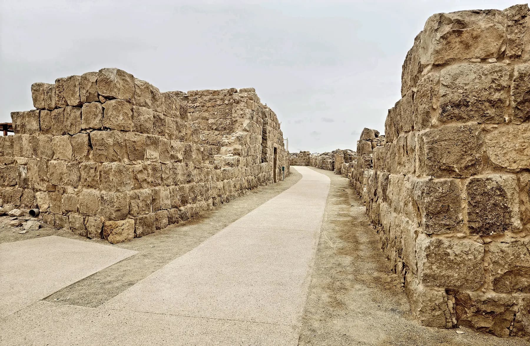
Nobody sacked Shivta: a University of Haifa survey recorded 21 doorways deliberately blocked with stone in 16 of its houses, which is why the streets and churches are still standing.
ישראל פרקר / CC BY 2.5 · Wikimedia Commons
Settled area
about 9 hectares
the Byzantine town, per the University of Haifa survey published in Antiquity
Houses recorded
about 170
Yizhar Hirschfeld's count, most of them between 200 and 600 m²
Tallest standing walls
about 10 m
the Northern Church, per the Israel Nature and Parks Authority
World Heritage
inscribed 2005
one of four Negev towns in the Incense Route property
In short
- How long to give it
- about 90 minutes for the town itself, or two and a half hours if the reconstructed orchard and a columbarium are added
- Summer, Sunday to Thursday and Saturday
- 08:00 to 17:00
- Entry
- No charge published by the operator
שבטה
Shivta is a ruined Byzantine town in the western Negev highlands, run as a national park by the Israel Nature and Parks Authority and inscribed by UNESCO in 2005 as one of four towns in the Incense Route property, alongside Haluza, Avdat and Mamshit. What makes it different from almost every other excavated site in the country is a negative fact. Nobody destroyed it. The town was left rather than levelled, and its streets, courtyard houses and three churches survive at heights that a sacked town does not reach.
The parks authority's own summary of the place gets to the point that matters: this was a town in the middle of a desert with no natural water sources whatsoever, no spring and not one well. Everything drunk here, and everything poured on a vine, was rain somebody had caught. The houses have private cisterns under their courtyards, the town centre a square with two public reservoirs, and an aqueduct brought water from 2.5 km away.
The other thing to know before arriving is that the site is unstaffed and unshaded. There is a car park, a toilet and a picnic area on a concrete apron, and after that a walk through open ruins with no roof over any of it. No visit needs to be booked.
Orientation
A town you walk into, not a monument you look at
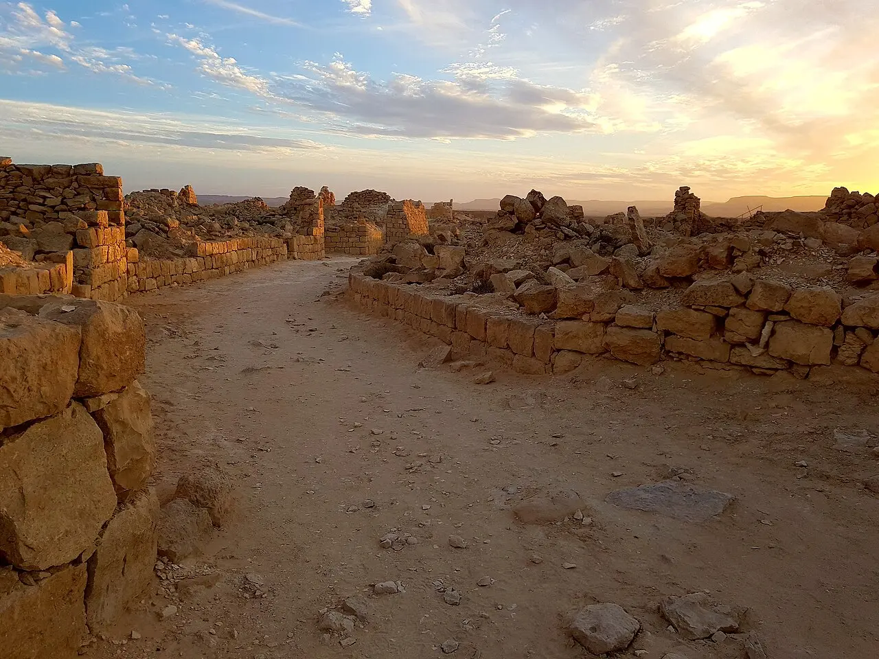
Shivta has no gate in the defensive sense, because it has no wall. The parks authority is explicit that the town was never surrounded by one and that no fortifications have been found; what looks like a perimeter is simply the outermost houses built in a continuous line. The opening where the street begins on the western side is called the Western Gate by convention, not by engineering.
The first building on the walk is not ancient. South of the car park stands the Colt expedition house, put up in the 1930s by the dig from New York University and the British School of Archaeology in Jerusalem, and used today for accommodation and desert hospitality. From there the main street runs the length of the settlement, from the Northern Church past the Central Church to the Southern Church, with the Pools Square, the Governor's House and the Northern Square strung along it.
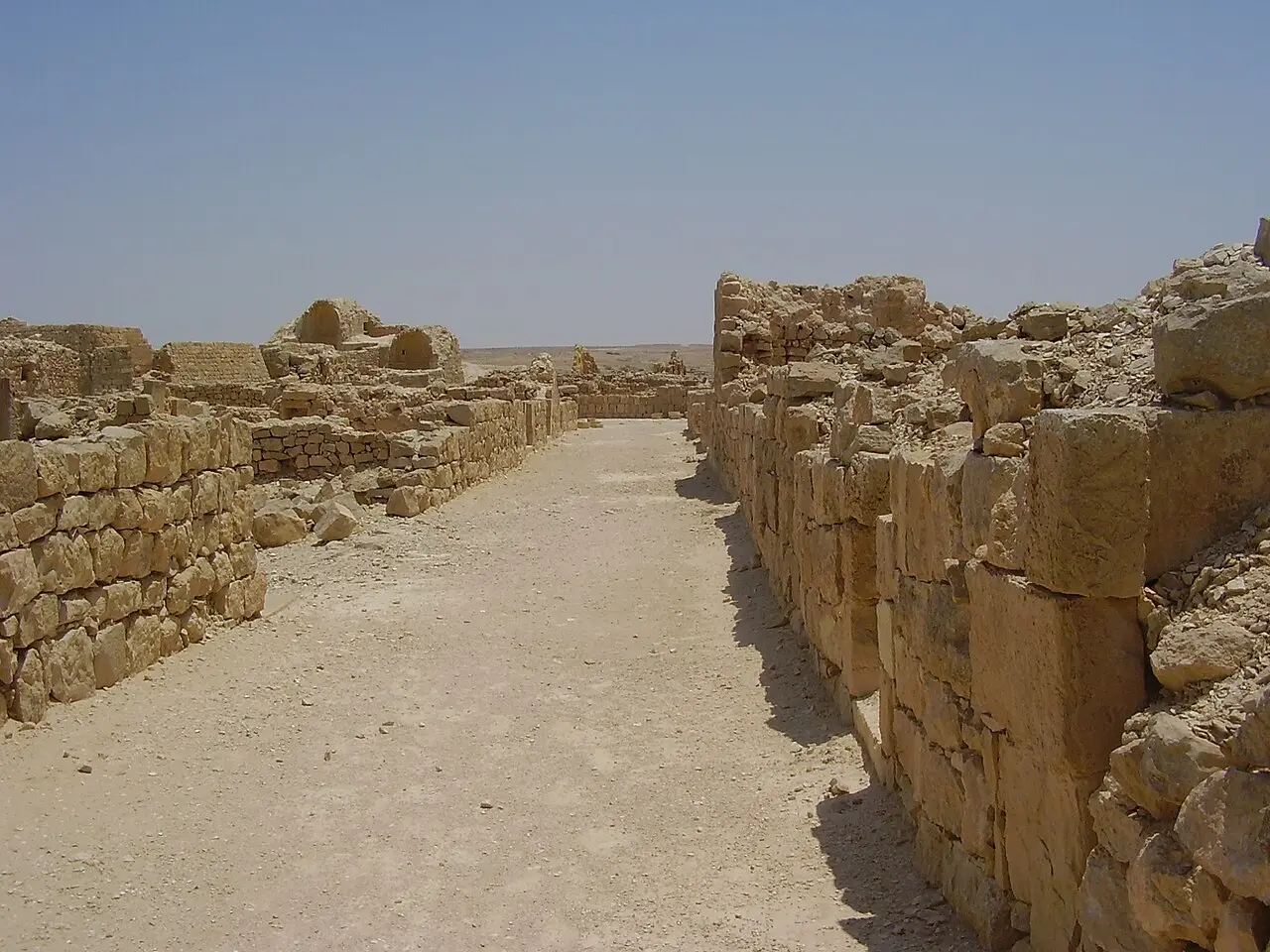
The streets are crooked and the plan looks improvised, which the parks authority's brochure concedes while pointing out that one axis does run the whole length of the town. Shivta reads better as a set of courtyard houses that grew into each other than as a piece of town planning. Churches were inserted into blocks of housing rather than given precincts of their own: the Central Church has residences attached on the east and south, and its three doors open straight onto the street.
- The Colt expedition house, 1930s, south of the car park
- The Western Gate, which is a street opening rather than a gate
- The Pools Square, with two public reservoirs, only one of them excavated
- The Governor's House, a private dwelling with a tower still standing to almost 6 m
- The Northern Square, with a winepress and a benched hall that may have been a council house
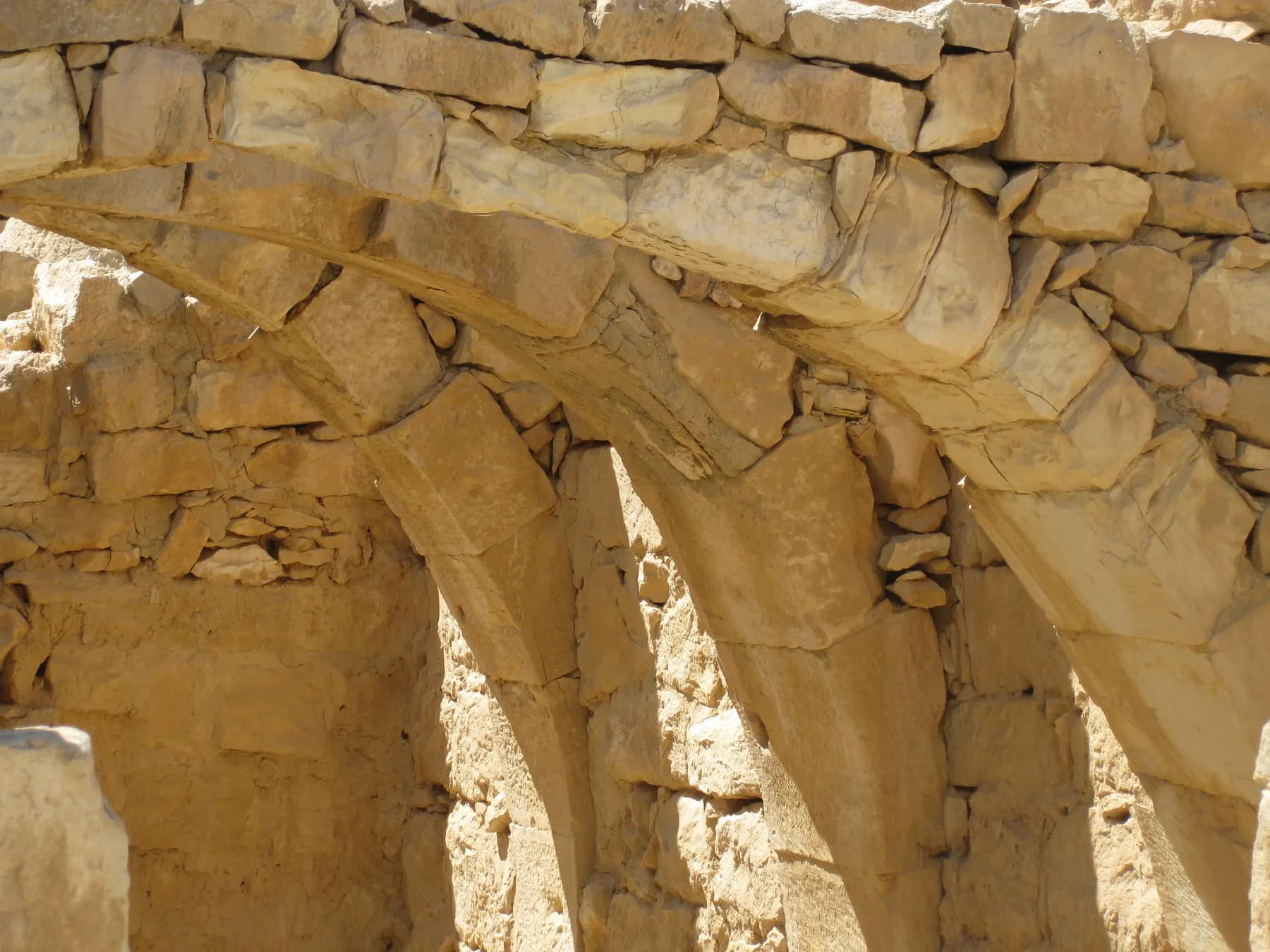
- The Vaulted House, where stone slabs still rest on complete stone arches
ד"ר אבישי טייכר / Public domain · Wikimedia Commons
History
A Nabataean village that turned into a Christian town
The University of Haifa team that has worked here since 2015 dates the foundation to the beginning of the first century AD, and the parks authority's brochure agrees that the first settlers were Nabataeans, the Arab tribe whose caravans carried frankincense and myrrh from southern Arabia towards Gaza. The trade that paid for the early settlement dried up: Roman shipping reached India through Egypt, the incense route lost its monopoly, and by the fourth century the traffic had stopped. What replaced it was farming, and Shivta grew rather than shrank.
The parks authority's brochure puts the Byzantine town at more than 2,000 people, living off agriculture and off the pilgrims who came to venerate saints buried in its churches. Two documents place it in a wider world. A fifth-century collection known as the Stories of Nilus the Saint has the author's son Theodoulos carried off in southern Sinai and offered for sale in a village called Sobata, the Greek name for this place. Papyri found at nearby Nessana list 30 donors from across the Negev who paid for the monastery of Saint Sergius there, nine of them men of Shivta, and a second papyrus copied to Shivta at the end of the seventh century concerns a delegation of Negev landowners organising a protest against the taxes of the new Muslim government.
What the name means is not settled. The parks authority's brochure says the sense of Shivta is unclear and suggests that the Greek Sobota preserves a Nabataean personal name, Shubaytu, in the way that Avdat and Haluza do. The modern Hebrew form was assigned by the Negev Naming Committee in the early 1950s; the Arabic name of the ruins was Subeita.
UNESCO inscribed Shivta in 2005 under cultural criteria (iii) and (v), in a property of some 6,655 hectares that also takes in Nabataean fortresses and caravanserais. The citation is about the desert cities as a group and the irrigation that made them possible, not about any single building here.
Water
No spring, no well, and vineyards anyway
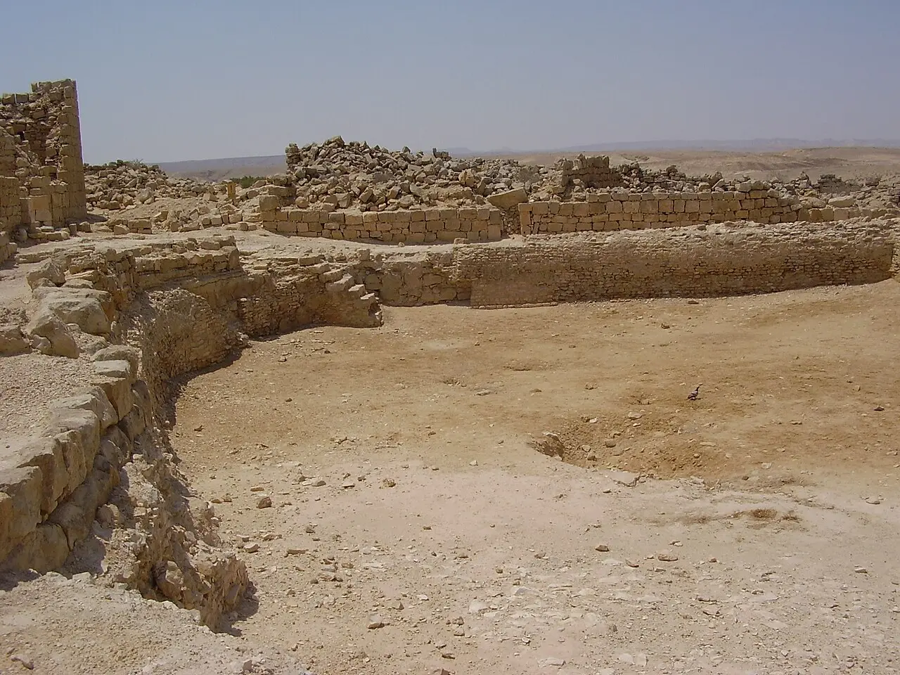
The public water system is the most legible piece of engineering on the site and it is right in the middle of the town. The Pools Square holds two large reservoirs, of which only one has been excavated. Water reached them along an aqueduct from a point 2.5 km away and then through channels that are still visible on the ground. The parks authority draws the distinction that matters socially: the cisterns under the house courtyards were private property, the pools in the square were for everybody.
The houses themselves were built to hold what fell on them. The parks authority describes walls about 70 cm thick, rough hard limestone below to a height of roughly 2 m and finely worked soft limestone above, which insulated well and shed water into the cistern in the courtyard corner. The average house here, courtyard included, is around 360 m².
Outside the town the same principle was applied at scale. Runoff from bare hillsides was steered onto terraced plots, and a 2025 study in PLoS One modelling Shivta's wine economy notes that ancient Negev runoff farms typically worked a catchment to cropland ratio of between 1:9 and 1:33, averaging about 1:20: a field of vines needed roughly twenty times its own area of hillside feeding it. Two winepresses have been excavated, the larger with a paved treading floor and separate bays where growers left their grapes and waited their turn.
The reconstructed orchard 700 m north of the Northern Church is a twentieth-century experiment rather than an antiquity. A team under the botanist Michael Evenari cleared and rebuilt an ancient terrace system in the 1950s, work that the parks authority reckons took about 2,000 man-days, and planted the first trees in the rainy season of 1958 to 1959. Carob, fig, almond, plum, olive, pomegranate, pistachio, peach, apricot and vines went in, none of them irrigated. The carob did best.
ד"ר אבישי טייכר / CC BY 2.5 · Wikimedia Commons
Fabric
What is original here, and what was put back
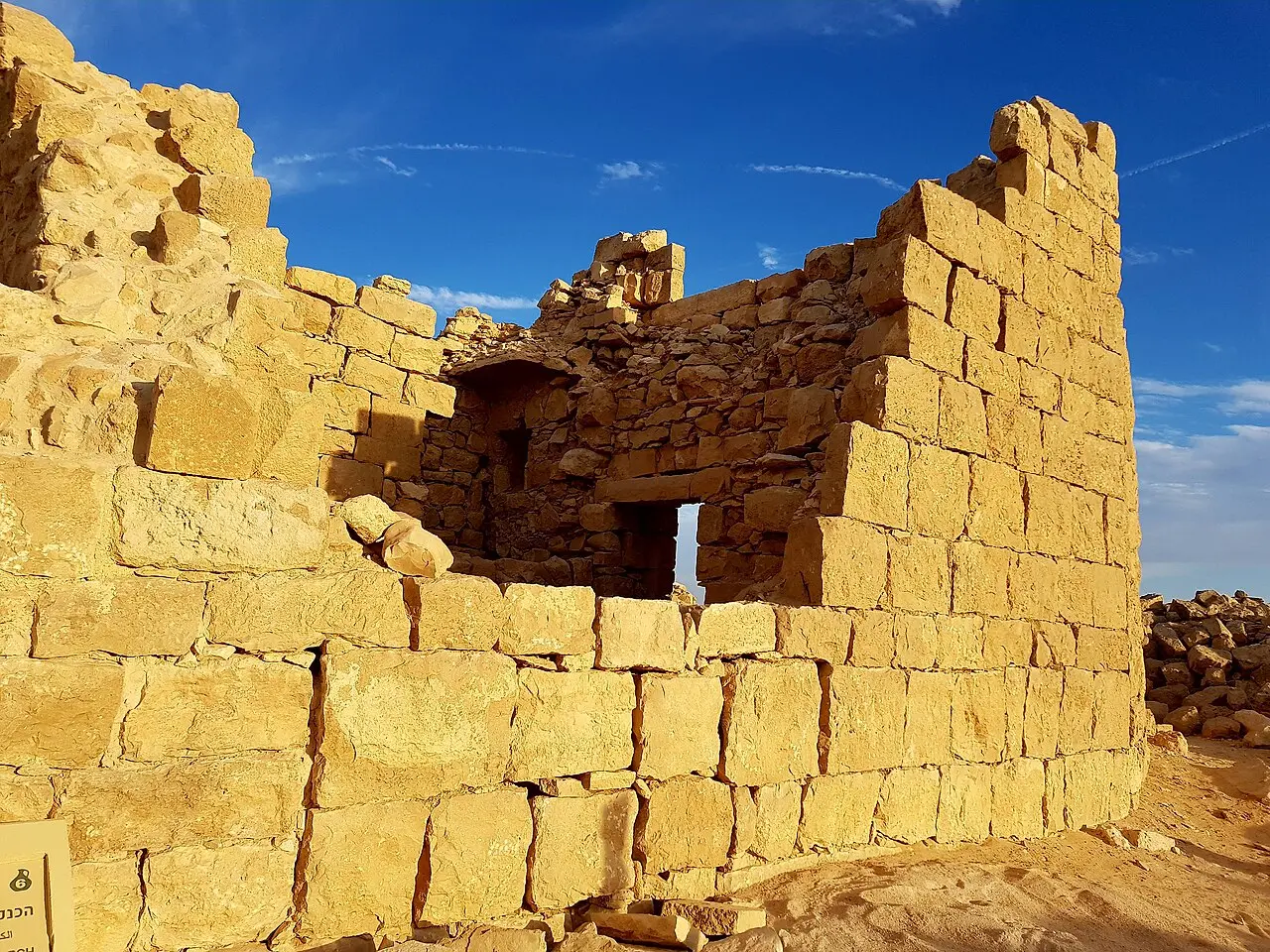
Shivta is unusual in how little of it needed rebuilding, which makes the exceptions worth knowing. The Northern Church is the largest of the three and its walls stand to about 10 m, held from outside by diagonal buttresses. Its prayer hall is entered through a square atrium ringed by two-storey rooms that were probably a monastery, and a side door in the southern aisle leads to a baptism chapel where the font, a large cross-shaped basin, is carved out of a single block of stone.
The Southern Church was built, apparently, over a Nabataean cult building. It began with two square rooms flanking the apse, in the manner of fourth-century Negev churches, and had them replaced at the start of the sixth century by apses with reliquary niches. A large baptistery was added on its north side.
The restorations are localised and the parks authority names them. The decorated entrance lintel of the Governor's House was found elsewhere in Shivta and set up here, while the stone-slab roof over its ground floor is original. Almost everything else a visitor walks past is what was left standing when the town emptied.
Two caveats. Excavation has never been complete: large parts of the town are still unexcavated and only one of the two public pools has been opened. And the parks authority currently has a notice on its Hebrew page saying that accessibility works have changed both the entrance arrangement and the walking paths, and asking visitors to follow the signs on site.
- Original: the standing house walls, the vaulted and slab-roofed ceilings, the church walls, the cross-shaped font, the cisterns and the channels from the aqueduct
- Restored or moved: the Governor's House entrance lintel, which was found elsewhere on the site
- Wholly modern: the reconstructed orchard north of the town, laid out in the 1950s
- Never dug: much of the residential town, and the second of the two public reservoirs
אריאל מנור / CC BY 2.5 · Wikimedia Commons
Paintings
Two faces of Christ, one of them noticed in the right light
In 2018 Emma Maayan-Fanar, Ravit Linn, Yotam Tepper and Guy Bar-Oz published in Antiquity a previously unknown painting of Christ's face at Shivta, in the baptistery beside the Northern Church, above the cross-shaped font. They read it as a baptism of Christ, with a youthful, short-haired Jesus and a larger haloed John the Baptist, and dated it to the sixth century. Their claim for it is precise and worth quoting accurately: it is the only in situ baptism-of-Christ scene that can be dated with confidence to the Holy Land before iconoclasm.
The Christ is short-haired and beardless, a convention the authors describe as widespread in Egypt and Syria-Palestine and then gone from later Byzantine art. It is also nearly invisible. Maayan-Fanar told the Times of Israel that she was under the apse at the right place at the right time, with the light just right. Visitors looking for a picture on a wall will not find one.
The second painting is in the Southern Church and has been known for over a century. Leonard Woolley and T. E. Lawrence, surveying the Negev for the Palestine Exploration Fund in 1914, recorded a scene there that they read as the Transfiguration, with Peter and John kneeling at Christ's feet and other figures identified as Moses and Elijah. The parks authority's brochure says that what remains of those paintings today is fragments of figures in red. Maayan-Fanar and Tepper published a reconstruction of the scene in Biblical Archaeology Review in 2024, in which Peter's beard is the best preserved passage of brushwork.
The end
Sealed doors, a mosque, and an argument about how this finished
The most quietly startling thing at Shivta is architectural rather than decorative. Yotam Tepper, Lior Weissbrod and Guy Bar-Oz, working for the University of Haifa's Byzantine Bio-Archaeology Research Program of the Negev, recorded 21 door openings that had been deliberately blocked, spread across 16 residential structures. The blockings vary from finely dressed masonry to unmodified stones piled in the opening, and they cluster in two distinct parts of the town, which the team reads as sections of the settlement being given up together rather than the whole place failing at once. People shut their houses on the way out.
When that happened, and why, is genuinely contested. Research led from the University of Haifa and reported by the Times of Israel puts the crisis in the mid-sixth century, ahead of the Islamic conquest altogether, and lines it up against the volcanic cooling of the 530s and 540s and the plague of 541 to 549. Daniel Fuks, who led that work, was frank about the limits of the evidence: he told the paper that the researchers do not know how to disentangle the plague, the social pressures and the climate change. The older story, that Muslim rule and a ban on wine killed a wine town, does not survive the dating.
Settlement did not stop at the conquest. A small mosque was built immediately north of the Southern Church's baptistery, two rows of three columns with a mihrab facing Mecca, and here the operator contradicts itself in print. The parks authority's English site page says a stone step at the mosque entrance carved with a cross appears to prove that no Christians were living at Shivta while the mosque was in use. Its own Hebrew brochure says the mosque's builders took care not to damage the baptismal font next door, and that church and mosque may be assumed to have functioned at the same time. Both statements are published by the same body about the same two rooms.
The endpoint is less disputed than the mechanism. The parks authority's brochure has residents leaving gradually and the town completely deserted by the end of the ninth century; the Haifa team describes a substantial decline through the Early Islamic period, in the eighth and ninth centuries. Nothing was built over it afterwards, which is the reason there is anything to see.
אריאל מנור / CC BY 2.5 · Wikimedia Commons
What to look for
Things not to walk past at Shivta National Park
The details that repay knowing about before you are standing in front of them.
The blocked doorways
Twenty-one door openings in sixteen houses were walled up with stone as the town was abandoned. Some were sealed with dressed masonry, some with whatever was to hand.
The Northern Church and its font
Walls to about 10 m, buttressed from outside, with alpha and omega cut into the entrance gate. The baptism chapel holds a cross-shaped font carved from one block of stone.
The baptistery painting
Above that font is the sixth-century face published in Antiquity in 2018 as the only securely dated pre-iconoclastic baptism of Christ in the Holy Land. It is very faint, and the light has to be right.
The Pools Square
Two public reservoirs in the middle of town, fed by an aqueduct from 2.5 km away, with the channels still readable on the ground. Only one pool has been excavated.
The Vaulted House
Stone roofing slabs still resting on their stone arches, complete. It is the clearest demonstration on the site of how these houses were covered.
The mosque beside the baptistery
A small prayer hall of two rows of three columns with a mihrab facing south, built hard against the Southern Church's baptistery. Whether the two were in use at once is disputed.
The long view
Shivta National Park, in order
Early 1st century AD
A Nabataean settlement is founded on the site, on the Negev branch of the incense and spice route towards Gaza.
4th century AD
Traffic on the incense route has ceased and farming replaces trade. The Southern Church is laid out with square rooms flanking its apse, in the Negev manner of the century.
5th century AD
Sobata appears in the Stories of Nilus the Saint as the village where the author's kidnapped son is offered for sale.
Early 6th century AD
The Southern Church is remodelled, its flanking rooms replaced by apses with reliquary niches. The Northern Church baptistery and Southern Church paintings belong to this century.
540s AD
Volcanic cooling and the plague of 541 to 549 coincide with the crisis that University of Haifa research places in the middle of this century, before the Islamic conquest.
Late 7th century AD
A papyrus copied to Shivta concerns Negev landowners organising a protest against the taxes of the new Muslim government.
8th-9th centuries AD
A mosque is built beside the Southern Church's baptistery. Houses are sealed and abandoned in blocks, and the town is deserted by the end of the ninth century.
1914
Leonard Woolley and T. E. Lawrence survey the town for the Palestine Exploration Fund and record the Transfiguration painting in the Southern Church.
1934-1936
The Colt expedition of New York University and the British School of Archaeology in Jerusalem digs at Shivta. Most of its finds and all its excavation diaries are later lost in a fire during the Arab Revolt.
1958-1959
Michael Evenari's team rebuilds an ancient terrace system north of the town and plants the reconstructed orchard, unirrigated, on diverted rainwater.
2005
Shivta is inscribed by UNESCO under criteria (iii) and (v) as part of the Incense Route property, with Haluza, Avdat and Mamshit.
2018
Maayan-Fanar, Linn, Tepper and Bar-Oz publish the Christ's face painting from the Northern Church baptistery in Antiquity.
Practical
Visiting Shivta National Park
Where
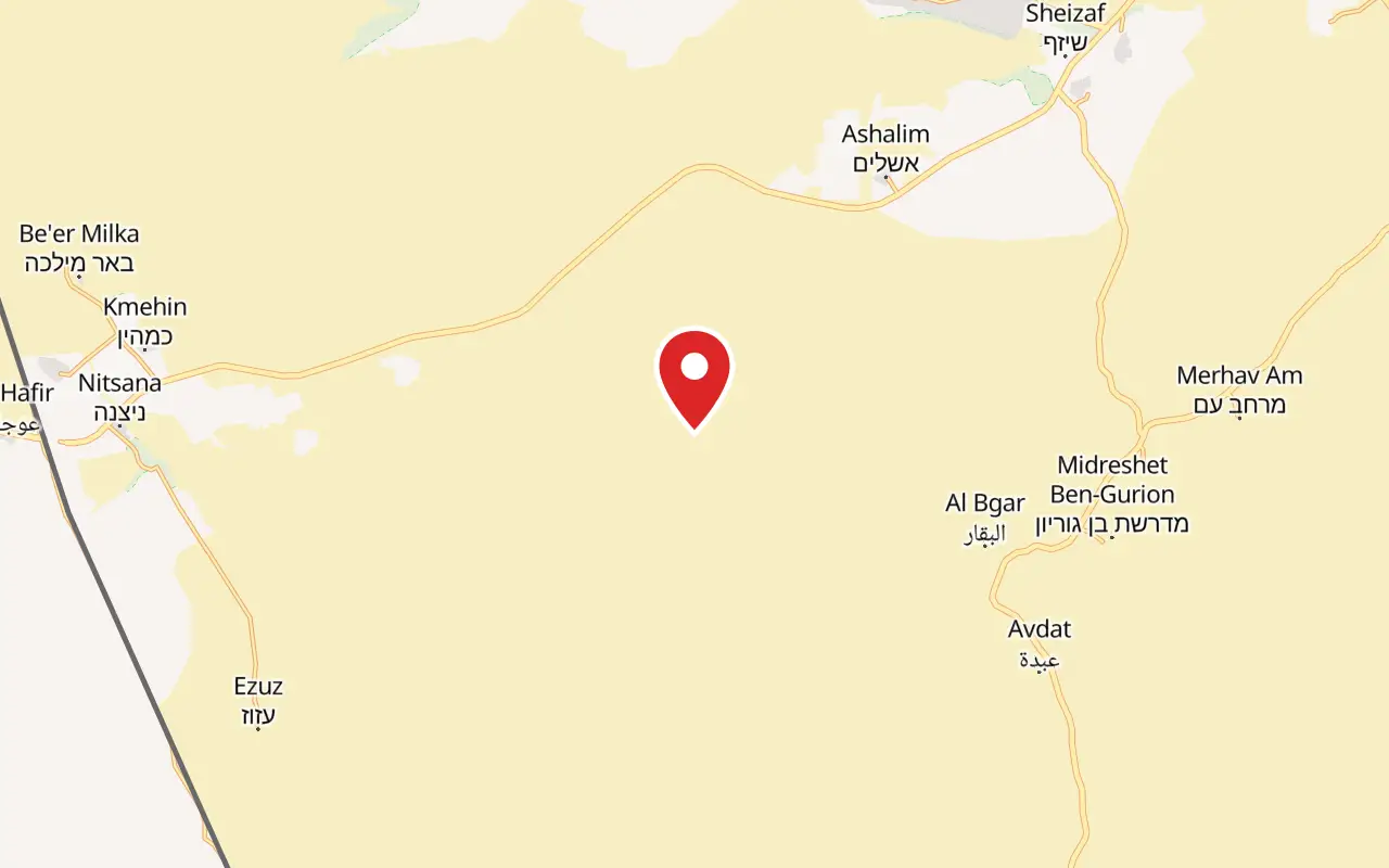
Shivta National Park, off Route 211, Ramat Negev
What ticket you need
Shivta is a national park in its own right and is not inside a larger ticketed site. It is one of four towns in the UNESCO Incense Route property, but that is a heritage listing rather than a ticket: Avdat and Mamshit are separate parks with their own gates and their own charges.
Opening hours
- Summer, Sunday to Thursday and Saturday
- 08:00 to 17:00source
- Summer, Friday and holiday eves
- 08:00 to 16:00source
- Winter, Sunday to Thursday and Saturday
- 08:00 to 16:00source
- Winter, Friday and holiday eves
- 08:00 to 15:00source
- Rosh Hashanah eve, Passover eve and Yom Kippur eve
- 08:00 to 13:00source
- Last entry
- one hour before the closing time listedsource
Admission
- Entry
- No charge published by the operatorsource
- Why that is the answer
- Shivta does not appear in the parks authority's own entrance fee table, which prices every charging site in the southsource
- For comparison, Avdat and Ein Avdat
- ₪31 adult, ₪16 child, ₪26 studentsource
- For comparison, Mamshit
- ₪24 adult, ₪10 childsource
Access
Partly, and the parks authority is unusually honest about the limit. It lists the car park, the toilet and a picnic area on a concrete apron as accessible, and states plainly that the antiquities cannot be given a stable, hard-surfaced path and that doorways cannot be widened without damaging them. Assistance with orientation and information can be requested, and service animals are admitted. Beyond the concrete, the route is uneven stone and rubble through the ruins, which a wheelchair will not cross. There is no shade anywhere on it. Accessibility works were under way at the time of writing and both the entrance arrangement and the walking paths have changed, so follow the signs on site.
On site
- Car park
- Toilets
- Picnic area on a concrete apron
- Accessible parking and toilet
- No visitor centre
- No shop, cafe or drinking water
- No shade on the route
- Dogs allowed, on a lead and muzzled
Booking
The parks authority states that no visit needs to be arranged in advance for this site. Because it publishes no price for Shivta while some third-party guides say a fee is charged, carry a means of payment rather than assume either way.
Hours and prices are given as the operator publishes them and change without much notice, particularly around Shabbat and the festivals. Check the operator's own page before you travel for this.
Official page at en.parks.org.il →What people wish they had known
- Go early or late. The parks authority's own advice is to avoid the hot hours, and it is worth taking seriously here: there is no shade on the route, no cafe and no drinking water on site, so bring more water than the walk seems to need.
- Do not expect a visitor centre or a guide. Shivta is unstaffed. The signage on site and the downloadable brochure are the whole interpretation, so read something before arriving rather than hoping to be told at the gate.
- The Christ painting in the Northern Church baptistery is not a picture on a wall. It is a faint stain that the researcher who identified it saw only because the light happened to be right. Look for a plaster surface above the cross-shaped font, and accept that most visitors see nothing.
- Allow for the orchard. It sits 700 m north of the Northern Church on a marked path and is the only place on site that shows what the runoff farming actually produced. Skipping it leaves the water story half told.
- Combine it with Avdat rather than treating it as a stop on the way to Mitzpe Ramon. The two are the same civilisation and Avdat has the acropolis and the fortress that Shivta lacks, but Avdat is a separate park with its own admission charge.
- Check what has changed at the entrance. Accessibility works have altered the entry arrangement and the walking paths, and the parks authority asks visitors to follow the signs on site rather than an older map.
The figures
Shivta National Park by the numbers
Each figure carries the year it belongs to and links the source it came from.
| Measure | Figure | As of | Source |
|---|---|---|---|
| Settled area of the Byzantine town | about 9 hectares | 2018 | antiquity.ac.uk |
| Residential structures recorded | about 170, most between 200 and 600 m² | 2018 | antiquity.ac.uk |
| Deliberately blocked doorways | 21, in 16 residential structures | 2018 | antiquity.ac.uk |
| Byzantine population estimate | more than 2,000 | 2025 | static-en.parks.org.il |
| Average house area, courtyard included | about 360 m² | 2026 | en.parks.org.il |
| Distance the aqueduct brought water | 2.5 km | 2026 | en.parks.org.il |
| Standing height of the Northern Church walls | about 10 m | 2026 | en.parks.org.il |
| Area of the UNESCO Incense Route property | 6,655 hectares | 2005 | en.wikipedia.org |
While you are here
The rest of The Negev
Everything else in this destination with a page of its own.
ישראל פרקר / CC BY 2.5 · Wikimedia Commons
Archaeological site
Avdat National Park
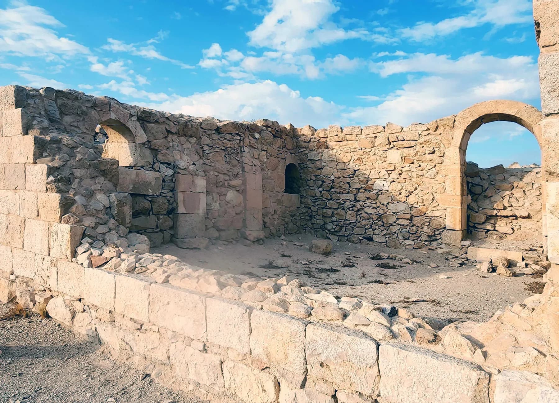
Avdat was station number 62 on the Incense Route, and the caravan road that brought frankincense from Arabia towards the port of Gaza can still be picked out climbing to it from the southeast.
רחל וייסלר / CC BY 2.5 · Wikimedia Commons
Nature reserve
Ein Avdat National Park
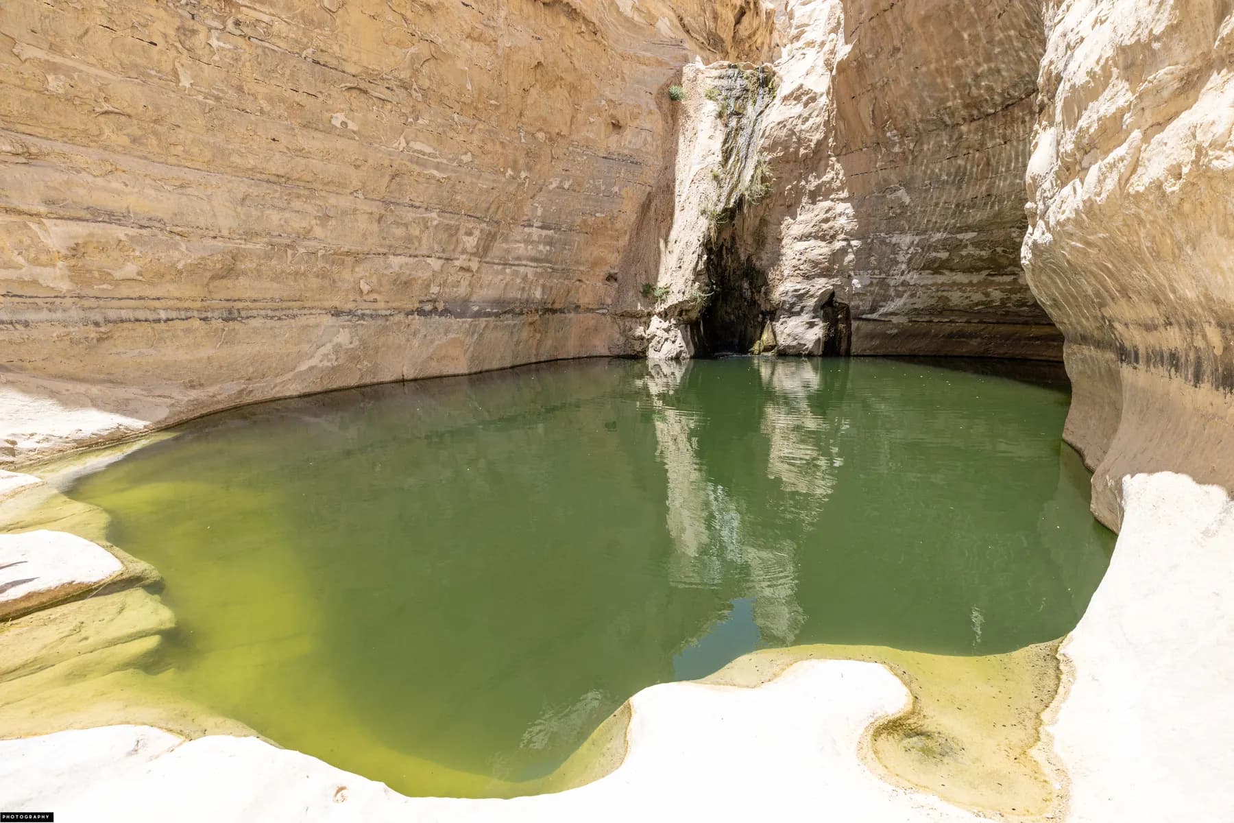
Three springs keep water running all year at the bottom of a white chalk canyon that was cleared, laid out and opened to the public in 1961 as a seventy-fifth birthday present for David Ben-Gurion.
Deror avi / CC BY-SA 3.0 · Wikimedia Commons
Archaeological site
Mamshit National Park
Mamshit is the most compact of the four Negev desert cities in the UNESCO Incense Route inscription: about four hectares of Nabataean, Roman and Byzantine town inside a national park of 142.
Sources and further reading
Every link below was opened and checked when this page was written. Official statements are marked as such: they are the subject's own account, not an independent one.
- OfficialIsrael Nature and Parks Authorityen.parks.org.ilShivta National Park
the operator's own description of the churches, houses, pools, mosque, columbaria and orchard, and the driving directions
- OfficialIsrael Nature and Parks Authorityparks.org.ilגן לאומי שבטה
the published opening hours, the accessibility statement, the dog rule, the notice about ongoing works and the statement that no booking is needed
- OfficialIsrael Nature and Parks Authorityparks.org.ilמחירון 2025: דמי כניסה לשמורות טבע וגנים לאומיים
the entrance fee table for the south, which prices Avdat, Ein Avdat, Mamshit and Makhtesh Ramon and does not list Shivta
- OfficialIsrael Nature and Parks Authoritystatic-en.parks.org.ilShivta National Park visitor brochure
the population estimate, the Nilus and Nessana papyri references, the Colt house fire, the Evenari orchard and the claim that church and mosque functioned together
- OfficialUNESCOunesco.orgIncense Route: Desert Cities in the Negev
the 2005 inscription of the four Nabataean towns, Shivta among them, and the terms in which the property is described
- ReportingThe Times of Israeltimesofisrael.comJesus image, hidden in plain sight at Negev church, is one of earliest in Israel
Emma Maayan-Fanar on how faint the painting is and on the conditions in which she saw it
- ReportingBiblical Archaeology Societybiblicalarchaeology.orgJesus in the Negev
the Southern Church Transfiguration recorded by Woolley and Lawrence in 1914 and its 2024 reconstruction
- ReportingThe Times of Israeltimesofisrael.comSeeds from 1,500-year-old Negev trash pits show a world on the brink of collapse
the mid-sixth century crisis at Elusa, Shivta and Nessana, and Daniel Fuks on the difficulty of separating plague, climate and market causes
- ReferenceAntiquity (Tepper, Weissbrod and Bar-Oz, University of Haifa)antiquity.ac.ukBehind sealed doors: unravelling abandonment dynamics at the Byzantine site of Shivta in the Negev Desert
the 21 blocked doorways in 16 structures, the 9 hectare area, Hirschfeld's count of about 170 houses and the abandonment chronology
- ReferenceAntiquity 92(364), Cambridge University Presscambridge.orgChrist's face revealed at Shivta: an Early Byzantine wall painting in the desert of the Holy Land
Maayan-Fanar, Linn, Tepper and Bar-Oz on the baptistery painting and the claim that it is the only securely dated pre-iconoclastic baptism of Christ in the Holy Land
- ReferencePLoS One (Garty, Gambash, Levy and Bar-Oz)pmc.ncbi.nlm.nih.govWine economy in Byzantine Shivta (Negev, Israel): exploring the role of runoff agriculture and droughts through agent-based modeling
the catchment to cropland ratios recorded for ancient Negev runoff farms
- ReferenceWikipediaen.wikipedia.orgIncense Route: Desert Cities in the Negev
the inscription criteria (iii) and (v), the reference number and the property area of 6,655 hectares
- ReferenceWikipediaen.wikipedia.orgShivta
the exploration history from Palmer and Musil to Colt, Evenari, Negev and Tsuk, and the Negev Naming Committee's assignment of the modern name
Shivta National Park: common questions
Is there an entrance fee at Shivta?+
The Israel Nature and Parks Authority publishes no charge for Shivta, and the park does not appear in its entrance fee table, which prices every charging site in the south including Avdat, Ein Avdat, Mamshit and Makhtesh Ramon. Some third-party guides state that a fee is collected. There is no ticket office on site. Carry a means of payment rather than rely on either account.
How long does Shivta take?+
About 90 minutes covers the town itself at a steady walk. Adding the reconstructed orchard 700 m north and one of the two columbaria takes it to roughly two and a half hours. The site is compact and flat, so the time goes on stopping rather than on distance.
Is Shivta worth the detour?+
It is worth it if standing buildings interest you more than famous ones. Shivta is the least visited of the four Negev towns on the UNESCO list and the best preserved, because it was abandoned rather than destroyed and nothing was built over it afterwards. If what you want is a dramatic setting, Avdat on its ridge and Makhtesh Ramon deliver that better.
Is there shade at Shivta?+
No. There is no shade on the walking route and no roof over any of the ruins. The picnic area beside the car park is the only place to sit out of the sun's path, and the parks authority itself advises visiting in the morning or the late afternoon and avoiding the hot hours.
Can you get to Shivta without a car?+
Not practically. The park sits about 9 km down a side road off Route 211, which is itself 19 km west of Tlalim Junction, and there is no scheduled service to the site. Visitors arrive by car or on an organised tour.
Do you need to book a visit?+
No. The parks authority states on the site's own page that no visit needs to be arranged in advance for Shivta, unlike some of its sites that require coordination. Turn up within opening hours; last entry is an hour before the posted closing time.
Can you actually see the painting of Jesus?+
Rarely, and not reliably. The sixth-century baptism scene sits in the baptistery beside the Northern Church, above the cross-shaped font, and it is extremely faint; Emma Maayan-Fanar, who identified it, described being under the apse at the right place at the right time with the light just right. The Transfiguration in the Southern Church, recorded by Woolley and Lawrence in 1914, survives only as fragments of figures in red.
Is Shivta accessible for wheelchairs?+
Only the fringe of it. The parks authority lists the car park, the toilet and a concrete picnic area as accessible, and says directly that the antiquities cannot be given a hard-surfaced path or wider doorways without being damaged. The route through the ruins is uneven stone, so a wheelchair cannot do it.
Was Shivta destroyed in a war or an earthquake?+
Neither, on the current evidence. The town was walked away from: a University of Haifa survey found 21 doorways deliberately blocked with stone in 16 houses, clustered in two parts of the settlement, which reads as sections being given up in turn. Researchers still differ on what drove it, with climate cooling in the 530s and 540s, the plague of 541 to 549 and the collapse of export markets all in play.
What is the difference between Shivta, Avdat and Mamshit?+
All three are Nabataean foundations that became Byzantine towns and all three are on the same UNESCO listing, but they show different things. Avdat has an acropolis, a Nabataean temple and a Byzantine fortress on a ridge; Mamshit is a small walled town with well-preserved houses and mosaics; Shivta has no wall, no fortress and no acropolis, and instead has the most complete surviving street plan and the tallest standing church walls of the three.