
Beach · Caesarea
Caesarea Aqueduct and Aqueduct Beach
The arcade behind the sand north of the harbour is two Roman aqueducts built hard against each other, and in February 2026 three bodies signed a ₪39 million agreement to stabilise all 85 of its arches.
Arches in the repair programme
85
every one to be structurally stabilised under the 2026 agreement
Agreed budget
₪39 million
₪15m conservation plus ₪24m surroundings, signed February 2026
Admission
Free
the one major Caesarea monument outside the ticketed national park
Legions named on the second channel
Four
X Fretensis, VI Ferrata, XXII Deiotariana and II Traiana Fortis
In short
- How long to give it
- about 60 to 90 minutes, or a half day if the plan is to swim
- Beach, as the operator publishes it
- April to October, 08:00 to 17:00
- Entry to the beach and the aqueduct
- Free
אמת המים וחוף האקוודוקט
Aqueduct Beach is a declared bathing beach on the sand about a kilometre north of Caesarea harbour, and the structure it is named for stands along the back of it: a Roman arcade carrying the channel that brought the city its drinking water. The Caesarea Development Corporation, which manages the town and publishes the beach's practical information, calls it Arches Beach, says entry costs nothing, and puts the springs that fed the aqueduct about ten kilometres from the city. There is no gate and no ticket desk here. A Caesarea National Park ticket is neither needed nor valid.
What crosses the sand is not one aqueduct but two, built hard against each other and altered for centuries afterwards. Channel A carried the water first. Channel B was added along its side, and so tightly that the decorative cornice running down that face of Channel A disappeared into the join, so its builders cut a fresh cornice on the outer face of the new work instead. Inscriptions on that outer face name four Roman legions, and most of them name Hadrian, which is why the second channel is normally tied to his visit to Judaea in 130 CE.
It is also the most fragile major structure at Caesarea. The western face of one arch came down in the early hours of 18 August 2023, onto a beach that was open to swimmers, and the Israel Antiquities Authority said it had been warning about the state of the aqueduct for years. In February 2026 the authority, the Carmel Beach Regional Council and the Caesarea Development Corporation signed a ₪39 million agreement covering all 85 arches. The works are expected to run about 40 months, so a visit made before the end of the decade is a visit to a monument in the middle of being repaired.
Structure
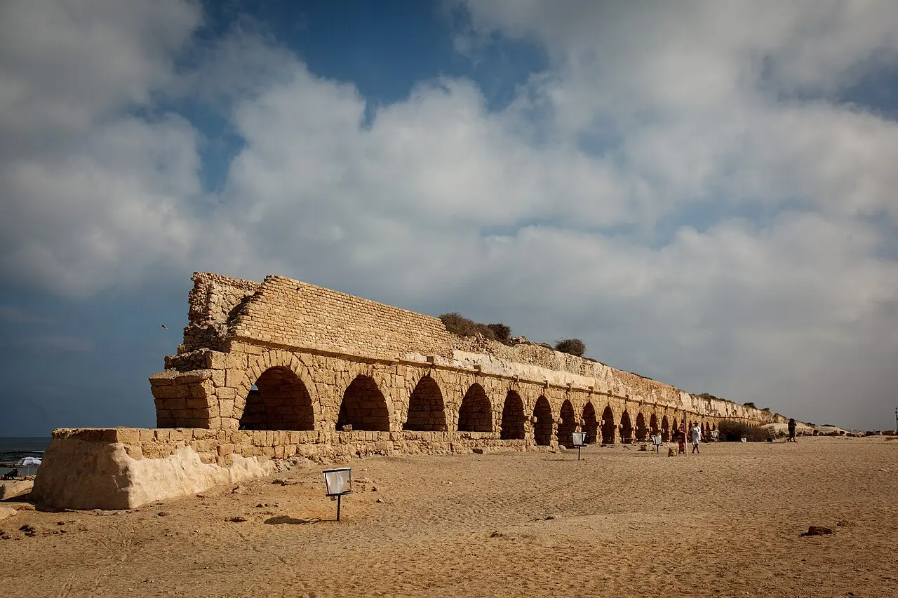
Two aqueducts, and the seam that runs between them
The line of arches reads as one structure only from a distance. Close up it is two channels of different dates set side by side on a shared line of piers, with the remains of later alterations on top of them. The sequence was established by five salvage excavations along the central sector of the aqueduct, published by Yosef Porath and Uzi 'Ad in 'Atiqot, the journal of the Israel Antiquities Authority, in 2015.
Their order is Channel A first, built at some point between Herod's inauguration of the city in 10/9 BCE and the reign of Hadrian, and on the architecture and the plaster more probably Flavian than Herodian. Channel B second, dated by an inscription to Hadrian. Channel C replaced B, and a gravity channel, C2, replaced the Channel C pipeline in the sixth century as the last stage of the system. The whole aqueduct ran for roughly six centuries, until the city fell to the Muslim armies in 640/1.
The two channels were not built to the same size, and the published dimensions make the reason for the second one obvious: it was not a spare, it was extra capacity. The figures below follow the summary of the excavation reports in the Hebrew Wikipedia article on the Caesarea aqueducts.
The join is the detail worth finding on the ground. Channel A was finished with a moulded cornice down both faces. When Channel B was set against its right side, that cornice was swallowed by the join and became invisible, so the builders of B cut a matching cornice along the outer face of the new channel, where the sea wind now hits it. What looks like decoration is in fact a record of a decision to preserve the look of the older work after doubling it.
- Channel A: about 115 cm high, 70 cm wide, a fall of roughly 16 cm per kilometre, up to about 930 m³ of water an hour
- Channel B: about 140 cm high, 90 cm wide, up to about 1,600 m³ an hour
- Channel B drew additional water through a tunnel some 6 km long, cut with vertical shafts about every 40 metres
- Channel C: a later, smaller channel raised on top of the blocked Channel B
- The system in total: about six centuries of continuous use, ending in 640/1
Ruby1619 / CC BY-SA 3.0 · Wikimedia Commons
Inscriptions
The soldiers who signed the second channel
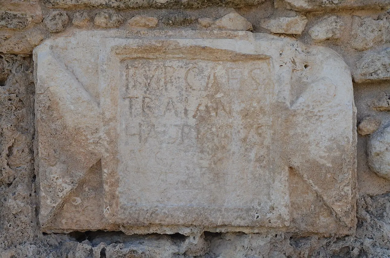
The outer face of Channel B carries dedicatory inscriptions cut by the units that built or repaired it, and they are the reason the second channel can be dated at all. Four legions are named across them: Legio X Fretensis, Legio VI Ferrata, Legio XXII Deiotariana and Legio II Traiana Fortis. Most of the texts name Hadrian, whose eastern tour brought him to Caesarea in 130 CE, and the growth of the city is the usual explanation for why a second channel was wanted at that moment.
Published counts of the inscriptions do not agree, and it is worth saying so rather than picking one. The World History Encyclopedia's account of the Hadrianic aqueduct itemises five texts naming the Tenth, two naming the Sixth, one the Twenty-Second and one the Second. The Hebrew Wikipedia account puts eleven inscriptions on Channel B, of which ten are Latin legionary texts and one is a Greek inscription of 385 recording repair work in the Byzantine period. Several of the Latin texts record repairs rather than first construction, and one erased text is generally presumed to have belonged to the Twenty-Second, a legion that disappears from the record around the Bar Kokhba revolt.
Two of them are on the beach itself. Set into the western face of the aqueduct are a pair of marble plaques, the southern one carrying a legible Latin text and the northern one rubbed out. Others are elsewhere on the line or have been lifted into museums: one of the best known is built into the aqueduct near Beit Hanania, a few kilometres north, and pairs the legionary emblem with a tabula ansata reading IMP CAES TRIAN HADR. Specimens are held by the Ralli Museum in Caesarea, the Israel Museum and the Rockefeller Museum in Jerusalem.
The plaques are easy to walk past. Most visitors approach from the car park and photograph the arcade from the landward side, and the inscribed face is the seaward one.
Carole Raddato from FRANKFURT, Germany / CC BY-SA 2.0 · Wikimedia Commons
Conservation
The arch that fell in 2023, and the money that followed it
On the night of 17 August 2023 the western face of one arch collapsed onto the sand. The section that failed belonged to the Hadrianic work, and the beach beneath it was in use. Eli Eskosido, director-general of the Israel Antiquities Authority, told reporters: "It's pure luck that bathers weren't killed. We have been sounding the alarm, we presented documents and plans, we said the situation was catastrophic and there was a real danger of collapse, we met again and again with the owners of the land, we even offered to cover some of the cost of the works."
The authority's conservation department used the moment to widen the warning. Its head, Ami Shahar, said the aqueduct at Acre, some 15 kilometres of it, was in a worse engineering state again and needed immediate attention. Nothing about the Caesarea arcade is unusual in that respect: it is masonry standing in salt spray and shifting dune.
The response took two and a half years. In February 2026 the Israel Antiquities Authority, the Carmel Beach Regional Council and the Caesarea Development Corporation signed a joint agreement worth ₪39 million. Of that, ₪15 million from the antiquities authority, the regional council and the Edmond de Rothschild Foundation pays for planning, conservation, the structural stabilisation of each of the 85 arches, engineering treatment of the water channel on top and a safe crossing for pedestrians. The remaining ₪24 million from the Caesarea Development Corporation pays for infrastructure, landscape maintenance around the aqueduct, walking trails, parking arrangements and visitor toilets. The work is expected to take about 40 months.
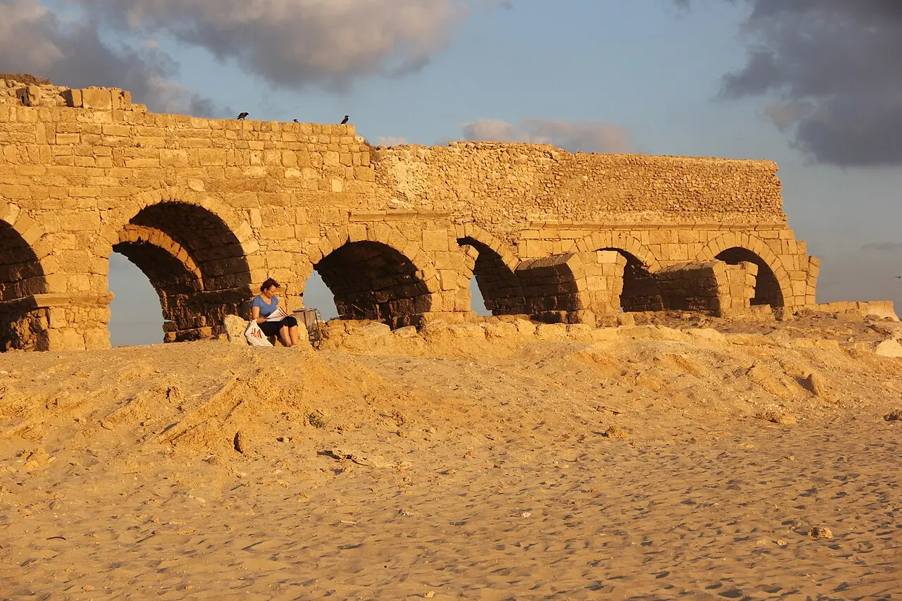
The practical effect for a visitor now is that parts of the arcade are fenced, and that the structure is not one to lean on, climb or shelter under. The sand runs right up to the piers, which makes it easy to forget that this is a building that has already dropped a face onto a public beach once.
On the ground
Free beach, two car parks, and a lifeguard 300 metres north
The single most useful fact about this beach is that the arches and the lifeguard are not in the same place. There are two car parks. The small free one sits at the southern end, directly beside the aqueduct, and has no lifeguard station. The larger paid one is about 300 metres north, and the lifeguard station stands opposite it. People park at the free southern lot because it is under the arches, swim where they parked, and are then swimming on an unsupervised stretch of an otherwise supervised beach.
What the operator publishes is straightforward. Entry to the beach is free. The beach is open April to October, from 08:00 to 17:00. Lifeguard cover, the kiosk, the showers and the toilets all run through the bathing season, April to October, and not outside it. There are shaded areas and drinking-water points along the beach, no benches and no tables, and no overnight parking or sleeping. The Caesarea Development Corporation says the beach is accessible to wheelchairs and pushchairs during the bathing season.
Those published hours and the council's own do not quite line up, which matters if the plan is a late swim. When the Carmel Beach Regional Council reopened its beaches on 30 April 2026 it stated lifeguard hours of 09:00 to 17:00, extended to 08:00 to 18:00 in July and August. The operator's page says the beach is open 08:00 to 17:00. Either way the sand is physically open outside those hours and nobody is watching the water then.
Two other things are worth knowing about the strip. The Israel National Trail, the footpath that runs from Dan to Eilat, passes along this beach, so the walkers coming through in spring are not lost. And on the eastern side of the car park is a second, quite different aqueduct: the low-level channel, which is not carried on arches at all and brought water from the dam in what is now the Taninim Stream reserve.
Moran Pirani / CC BY-SA 4.0 · Wikimedia Commons
2026
The bathing season that nearly did not open
Aqueduct Beach is one of five declared bathing beaches run by the Carmel Beach Regional Council, and in the spring of 2026 none of them opened on time. Nearly three weeks after the national bathing season began, the council was still providing no lifeguards, no cleaning and no beach facilities, on the grounds that the Interior Ministry had not transferred the money to run them.
The council's case, set out in a letter from its head, Asif Isaac, was that the budgets for 2025 and 2026 had not arrived despite repeated requests, and that the interior minister had not signed the amended by-laws the council needs in order to enforce, charge and operate the beaches properly. Its coastline is the longest of any authority in Israel, about 42 kilometres, of which some 26 kilometres are open undeclared shore; its five declared beaches, Neve Yam, Nahsholim, Dor Merkaz, Dor Darom and Aqueduct, take more than three million bathers a year. "The Carmel coast beaches are an asset of every citizen of Israel, not only of the council's residents," Isaac said. "It cannot be that one council carries the burden of a national service on this scale alone." The council announced it was preparing a petition to the High Court of Justice.
On 30 April 2026 it reversed itself and opened the beaches anyway, saying it did so out of responsibility to a public for whom the sea is a refuge in a difficult period. Six beaches opened, the five above plus a new one at Neve Yam South, with lifeguard cover from 09:00 to 17:00 and from 08:00 to 18:00 in July and August.
The underlying argument was not settled by that decision, which is the reason to check before travelling in spring. A beach that depends on an annual transfer from a ministry can be declared on paper and unsupervised in practice, and this one has been both inside a single season.
What to look for
Things not to walk past at Caesarea Aqueduct and Aqueduct Beach
The details that repay knowing about before you are standing in front of them.
The seam between the channels
Look along the arcade for the doubled channel on top of the piers. Channel A's right-hand cornice vanished into the join when Channel B was built against it, so a matching cornice was cut on the outer face of the new work.
The two marble plaques
Set into the western, seaward face of the aqueduct: the southern one carries a Latin text, the northern one has been rubbed out. They belong to the series recording the legions that built and repaired the second channel.
The gap where the arch fell
The western face of one arch collapsed in August 2023 and sections of the arcade have been fenced since. Stabilisation of all 85 arches was only agreed in February 2026 and is expected to take about 40 months.
The low-level aqueduct by the car park
On the eastern side of the car park runs a second channel that is not carried on arches at all. It brought water from the dam in what is now the Taninim Stream reserve, and almost nobody photographs it.
Sea daffodils on the masonry
Pancratium maritimum flowers on this shore in August and September, and some of the plants grow on the aqueduct itself. Later in the year the dunes behind the beach carry a dense stand of the invasive camphorweed.
The Israel National Trail
The national footpath from Dan to Eilat runs along this beach, which makes the arcade one of the few Roman monuments in the country you can arrive at on foot from either end of Israel.
The long view
Caesarea Aqueduct and Aqueduct Beach, in order
10/9 BCE
Herod inaugurates Caesarea. Channel A, the first of the high-level channels, is built at some point between this date and Hadrian's reign.
c. 69-96 CE
On the architecture and the plaster, Porath and 'Ad judge Channel A more probably Flavian than Herodian.
130 CE
Hadrian's eastern tour reaches Caesarea. Channel B is added along the side of Channel A; its inscriptions name four legions.
385 CE
A Greek inscription on the second channel records repair work, the only non-Latin text in the series.
6th century CE
Gravity Channel C2 replaces the Channel C pipeline: the last building stage of the aqueduct.
640/1 CE
Caesarea falls to the Muslim armies and the high-level system, after about six centuries of use, goes out of service.
17-18 August 2023
The western face of one arch collapses overnight onto the beach. The Israel Antiquities Authority says it had warned repeatedly about the aqueduct's condition.
February 2026
The antiquities authority, the Carmel Beach Regional Council and the Caesarea Development Corporation sign a ₪39 million agreement covering all 85 arches.
April 2026
The regional council keeps its five bathing beaches closed in a budget dispute with the Interior Ministry, then reopens them on 30 April.
Practical
Visiting Caesarea Aqueduct and Aqueduct Beach
Where
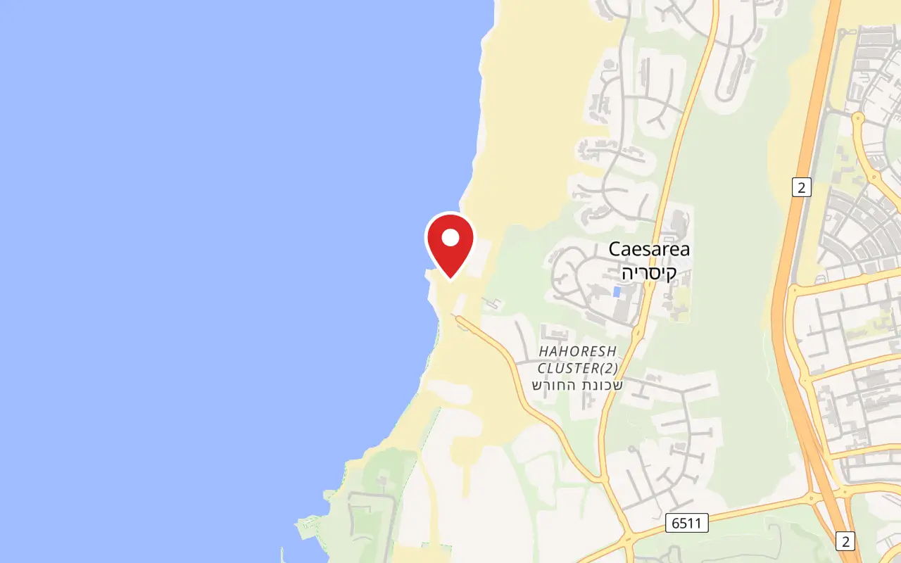
Aqueduct Beach (Hof HaKshatot), on the shore about 1 km north of Caesarea harbour, west of the town of Caesarea
What ticket you need
This is the one major monument at Caesarea that does not sit inside Caesarea National Park. A park ticket is neither needed nor valid, and the park's opening hours do not apply. The beach is run by the Carmel Beach Regional Council and the Caesarea Development Corporation, not by the Israel Nature and Parks Authority, and the aqueduct itself is the responsibility of the Israel Antiquities Authority.
Opening hours
- Beach, as the operator publishes it
- April to October, 08:00 to 17:00source
- Lifeguard cover, as announced by the council
- 09:00 to 17:00, and 08:00 to 18:00 in July and Augustsource
- November to March
- No lifeguard, no kiosk, no showers and no toiletssource
- Overnight
- No night parking, and sleeping on the beach is prohibitedsource
Admission
Access
The Caesarea Development Corporation says the beach is accessible to wheelchairs and pushchairs during the bathing season, April to October, when the seasonal matting and facilities are in place. Outside those months the approach is soft dune sand and a wheelchair will not manage it unaided. There is no made path along the arcade itself: it stands on open sand, with fenced sections where the masonry is judged unsafe, and there is no climb and no steps anywhere on the site.
On site
- Lifeguard station (April to October)
- Showers and toilets (in season)
- Kiosk (in season)
- Shade shelters
- Drinking-water points
- Free car park (south)
- Paid car park (north)
- Disabled parking
- No benches or tables
- No overnight parking
Booking
Nothing here is booked or ticketed. In July and August the paid northern car park fills by the middle of the morning at weekends, and the free southern one is much smaller.
Hours and prices are given as the operator publishes them and change without much notice, particularly around Shabbat and the festivals. Check the operator's own page before you travel for this.
Official page at caesarea.com →What people wish they had known
- Park at the northern car park if anyone in the group intends to swim. The free car park at the southern end is the one directly under the arches, and the lifeguard station is about 300 metres north of it, opposite the paid car park.
- Do not treat the arcade as shade. One arch face came down onto this beach in August 2023, parts of the structure are fenced, and the stabilisation of all 85 arches only began to be funded in 2026.
- Come between April and October if the point is a swim. Outside those months the operator runs no lifeguard, no kiosk, no showers and no toilets, and the beach is simply open sand.
- Do not buy a national park ticket expecting it to cover this. The aqueduct is outside the park boundary, entry is free, and the two sites are about a kilometre apart with separate car parks.
- Walk round to the seaward face before leaving. The two marble plaques are set into the western side, and almost every visitor photographs the arcade from the landward side and never sees them.
- Leave the last hour of daylight for the arches rather than arriving at midday. The shore faces west, and low light down the line of the arcade is why this is the most photographed thing at Caesarea.
The figures
Caesarea Aqueduct and Aqueduct Beach by the numbers
Each figure carries the year it belongs to and links the source it came from.
| Measure | Figure | As of | Source |
|---|---|---|---|
| Arches in the stabilisation programme | 85 | 2026 | timesofisrael.com |
| Total value of the joint agreement | ₪39 million | 2026 | jpost.com |
| Conservation share of that budget | ₪15 million | 2026 | timesofisrael.com |
| Surroundings and access share | ₪24 million | 2026 | jpost.com |
| Expected duration of the works | about 40 months | 2026 | jpost.com |
| Distance of the springs, as the operator gives it | about 10 km | 2026 | caesarea.com |
| Distance of the springs, as reported in 2026 | about 16 km north-east | 2026 | timesofisrael.com |
| Bathers a year on the council's beaches | more than three million | 2026 | 1075.fm |
While you are here
The rest of Caesarea
Everything else in this destination with a page of its own.
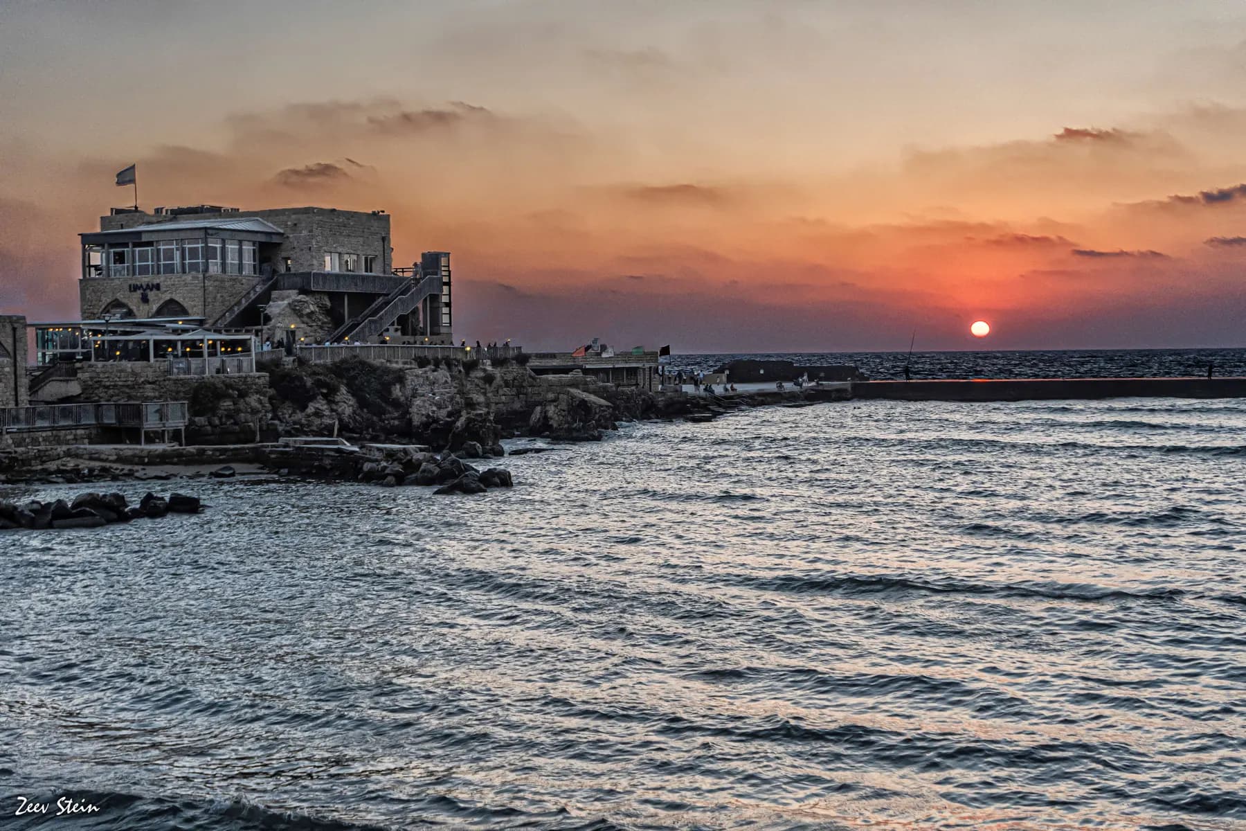
זאב שטיין / CC BY 2.5 · Wikimedia Commons
Archaeological site
Herod's Harbour (Sebastos)
The breakwaters that made Caesarea possible are still there, five to seven metres down, and the harbour began settling into the seabed almost as soon as it was finished.
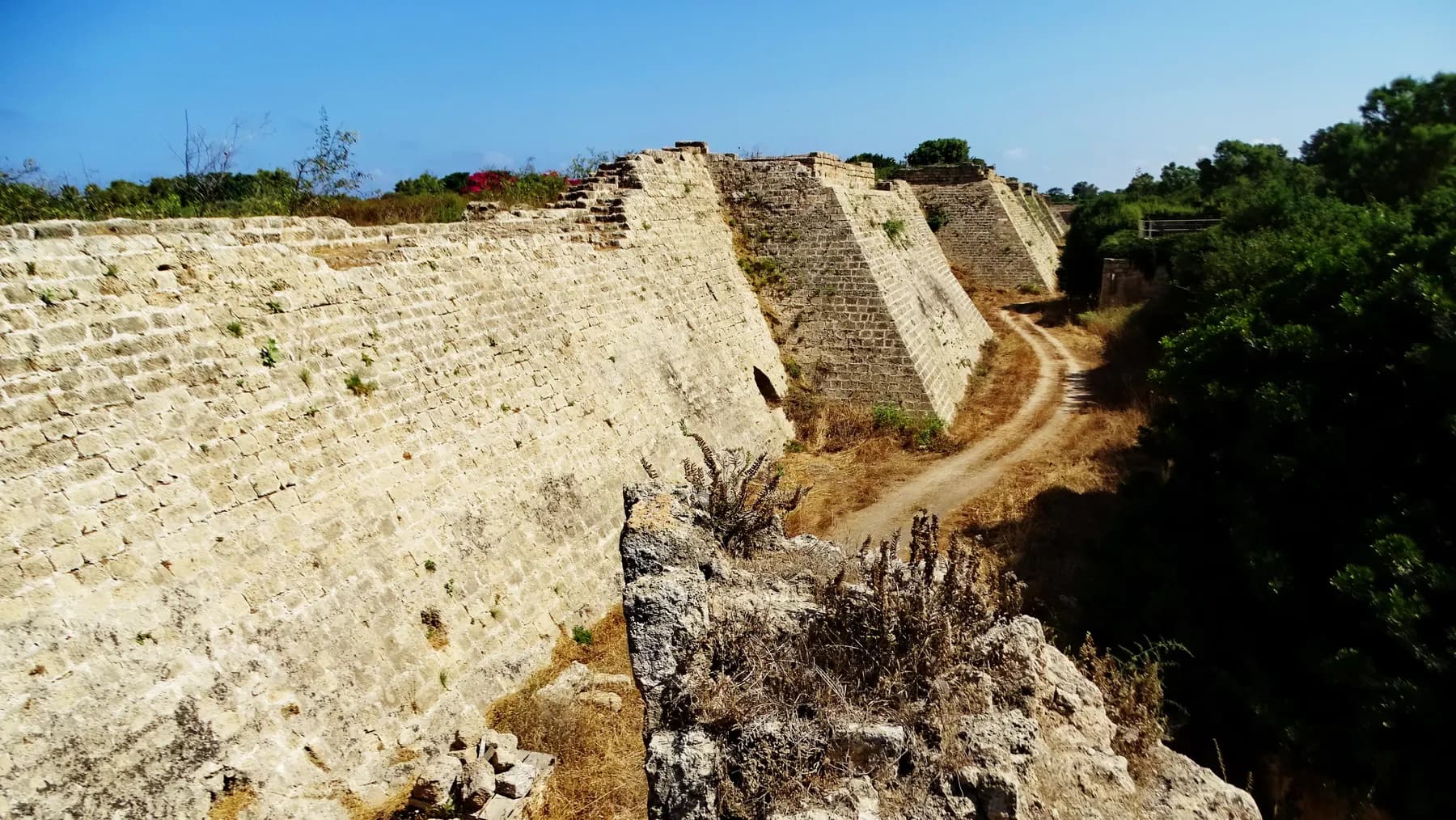
israel zeller ישראל זלר / CC BY 2.5 · Wikimedia Commons
Archaeological site
Crusader City and Ramparts
Louis IX of France walled a town of about 120 dunams here in 1251, a fraction of the Roman city, and cut a dry moat round it that the park's operator still measures at 8 to 10 metres deep.
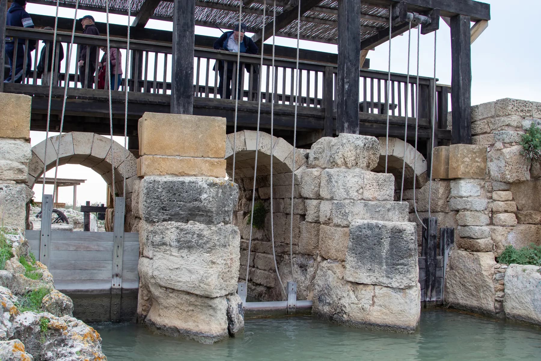
מיכל פריימן / CC BY 2.5 · Wikimedia Commons
Nature reserve
Taninim Stream Nature Reserve
A stone wall 194 metres long, thrown across the gap the stream cut through the kurkar ridge, raised the water by three metres and turned the Kebara valley into a lake of about 6,000 dunams, which is the only reason Caesarea's low aqueduct could run downhill.
Sources and further reading
Every link below was opened and checked when this page was written. Official statements are marked as such: they are the subject's own account, not an independent one.
- OfficialCaesarea Development Corporationcaesarea.comThe Aqueduct
the operator's English page: the springs about ten kilometres out, the castellum, the sequence of aqueducts, and the statement that the site now stands on an official beach
- OfficialCaesarea Development Corporationcaesarea.comCaesarea aqueduct and Arches Beach: information and opening hours
the operator's Hebrew page and FAQ: free entry, April to October, 08:00 to 17:00, lifeguard, kiosk, showers, shade, drinking water, accessibility and the ban on sleeping over
- OfficialCaesarea Development Corporationcaesarea.comBeaches and Water Activities
the operator lists the aqueduct among its beach and water sites
- OfficialIsrael Nature and Parks Authorityparks.org.ilCaesarea National Park
park hours and the ₪46 and ₪27 admission quoted for comparison; the aqueduct does not appear on the park's own page
- ReportingThe Times of Israeltimesofisrael.com2,000-year-old arch in Caesarea aqueduct collapses; official: 'We sounded the alarm'
18 August 2023: the collapse, Eli Eskosido's statement and Ami Shahar on the aqueduct at Acre
- ReportingYnetnewsynetnews.comRoman-era aqueduct collapses in central Israel
independent account of the same collapse, attributing the fallen section to the Hadrianic phase
- ReportingThe Times of Israeltimesofisrael.comTwo years after collapse, Caesarea aqueduct to be restored in joint project
February 2026: the ₪39 million agreement, the ₪15 million and ₪24 million split, 85 arches, about 40 months, springs some 16 km north-east
- ReportingThe Jerusalem Postjpost.comCaesarea's Roman-era aqueduct to undergo multi-million shekel preservation, restoration project
second, independent account of the same agreement and of what each body has undertaken to do
- ReportingRadio Haifa 107.5FM1075.fmA national resource or a financial burden? Hof HaCarmel Regional Council to petition the High Court
27 April 2026: the five declared beaches, the 42 km coastline, more than three million bathers a year, and Asif Isaac's letter to the Interior Ministry
- ReportingRadio Haifa 107.5FM1075.fm'Out of responsibility to the public': Hof HaCarmel Regional Council reverses course and opens the beaches
30 April 2026: the reopening, the six beaches named, and the lifeguard hours of 09:00 to 17:00 and 08:00 to 18:00 in July and August
- ReferenceYosef Porath and Uzi 'Ad, 'Atiqot 81, Israel Antiquities Authoritypublications.iaa.org.ilExcavations along the High Level Aqueduct to Caesarea Maritima
the excavation sequence for Channels A, B and C, the Flavian dating of Channel A, and the six centuries of use ending in 640/1
- ReferenceHebrew Wikipediahe.wikipedia.orgThe aqueducts of Caesarea
channel dimensions, gradients and capacities, the cornice absorbed into the join, the count of eleven inscriptions and the Greek text of 385
- ReferenceWorld History Encyclopediaetc.worldhistory.orgThe Hadrianic aqueduct of Caesarea Maritima, Israel
Hadrian's visit in 130 CE, the four legions named in the inscriptions and where surviving specimens are held
- ReferenceiNatureinature.infoAqueduct Beach
the two car parks and the lifeguard station 300 metres north, the marble plaques on the western face, the low-level channel by the car park, the Israel National Trail and the sea daffodils
Caesarea Aqueduct and Aqueduct Beach: common questions
Is the Caesarea aqueduct free to visit?+
Yes. The Caesarea Development Corporation, which publishes the beach's information, states that entry to the beach is free of charge. There is no gate, no ticket desk and no booking. Parking is the only thing you may pay for: the southern car park beside the arches is free, the larger northern one is charged.
Do you need a Caesarea National Park ticket to see the aqueduct?+
No. The aqueduct and its beach lie outside the national park boundary, roughly a kilometre north of the harbour, and are not run by the Israel Nature and Parks Authority. A park ticket is neither required nor accepted here. The park charges ₪46 for an adult and ₪27 for a child for its own ruins.
Can you swim at Aqueduct Beach?+
Yes. It is a declared bathing beach with lifeguard cover through the bathing season, April to October. The Carmel Beach Regional Council announced lifeguard hours of 09:00 to 17:00 for 2026, extended to 08:00 to 18:00 in July and August. Outside the season and outside those hours nobody is watching the water.
Where is the lifeguard at Aqueduct Beach?+
About 300 metres north of the arches, opposite the large paid car park, not opposite the free car park at the southern end where most people stop. This catches out a lot of visitors, because the free car park is the one directly beneath the aqueduct and it is the natural place to get into the sea.
Is it safe to walk under the arches?+
Not everywhere, and it is not a good idea to linger under any of them. The western face of one arch collapsed onto this beach in the early hours of 18 August 2023, and the Israel Antiquities Authority had been warning about the structure's condition for years beforehand. Sections are now fenced, and every one of the 85 arches is scheduled for structural stabilisation under the agreement signed in February 2026.
How long does a visit take?+
About an hour is enough to walk the arcade, find the inscribed plaques on the seaward face and look at the low-level channel by the car park. Add a swim, a picnic and the walk between the two car parks and it becomes a half day. It combines naturally with the national park a kilometre south, which needs two to three hours of its own.
Was the aqueduct built by Herod or by Hadrian?+
Both answers are partly right, which is why they are both in circulation. Two channels stand side by side: Channel A, built at some point between Herod's inauguration of the city in 10/9 BCE and Hadrian's reign, and judged by the excavators more probably Flavian than Herodian; and Channel B, added alongside it and dated by its own inscriptions to Hadrian. Popular accounts collapse the two into one Herodian aqueduct, and the reporting of the 2026 repair agreement did the same.
Is there shade, food and drinking water?+
During the bathing season, yes: the operator lists shaded areas along the beach, drinking-water points, a kiosk, showers and toilets, all of them running April to October only. There are no benches and no tables at any time of year. Out of season, bring everything, including water.
Is the beach accessible for a wheelchair or a pushchair?+
The Caesarea Development Corporation states that the beach is accessible to wheelchairs and pushchairs during the bathing season, when the seasonal access arrangements are in place. Outside those months the approach is loose dune sand. The aqueduct itself stands on open sand with no made path and no steps, so it is flat but not firm underfoot.
Could the beach be closed when I get there?+
It has happened recently. In the spring of 2026 the Carmel Beach Regional Council kept all five of its declared bathing beaches, this one included, shut for about a month after the season opened, in a dispute with the Interior Ministry over unpaid operating budgets, and it opened them on 30 April while preparing a petition to the High Court of Justice. The sand itself was never fenced off, but there were no lifeguards and no facilities. Check the council's announcements before travelling in April or May.