Archaeological site · Caesarea
Herod's Harbour (Sebastos)
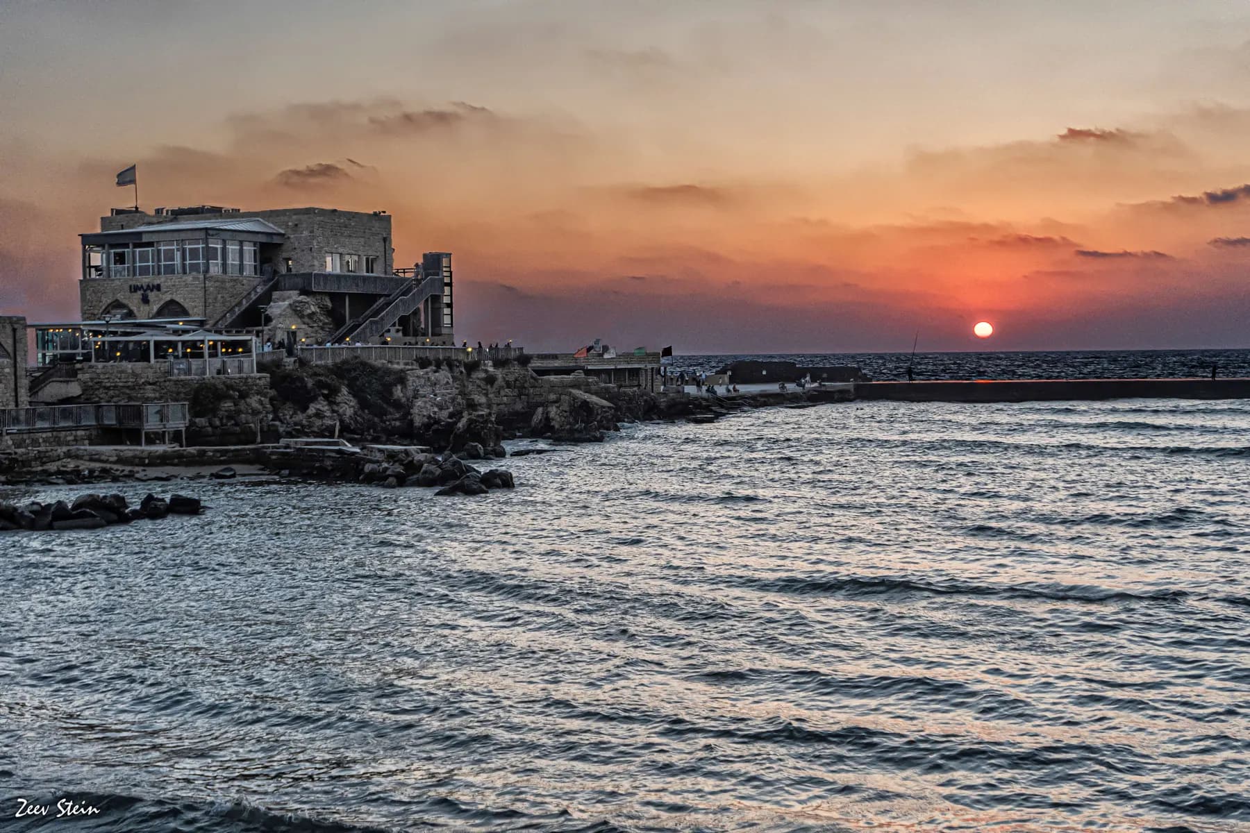
The breakwaters that made Caesarea possible are still there, five to seven metres down, and the harbour began settling into the seabed almost as soon as it was finished.
זאב שטיין / CC BY 2.5 · Wikimedia Commons
Protected anchorage
about 200 dunams
three linked basins, on the Old Caesarea Diving Club's account
How far it has sunk
5 to 7 m
measured at quays, jetties and a mooring stone that once stood at or above the water line
Built in
c. 22–10 BCE
twelve years for harbour and city on Josephus's count, and researchers still date the finish differently
Port-only ticket
₪18
the harbour without the visitor centre, theatre or hippodrome, as the Caesarea Development Corporation prices it
In short
- How long to give it
- about 60 minutes for the harbour front and the vaults, or about 25 minutes if the visitor centre is the only stop
- Park, April to October, Sunday to Thursday and Saturday
- 08:00 to 17:00
- Port only, no visitor centre, theatre or hippodrome
- ₪18
נמל קיסריה (סבסטוס)
Sebastos was the artificial harbour Herod the Great laid into open water at Caesarea, and it is the reason the city exists. The Roman Maritime Concrete Study, which cored its blocks in 2005, calls it the largest artificial harbour ever built in the open sea up to that point. Nothing of it now breaks the surface: what a visitor walks along at the north end of Caesarea National Park is a modern quay, and the Herodian work lies offshore, five to seven metres down.
That is the fact to carry to the site, because the harbour is the one major structure at Caesarea that cannot simply be looked at. Sebastos has to be read off other evidence: paving under the modern concrete quay, a mooring stone with a water line eroded beneath it, a round tower at the mouth of the inner basin, and fourteen storage vaults behind the waterfront.
The engineering is why people keep coming back to it. Herod's builders used hydraulic concrete, a mortar of lime and volcanic ash that sets under water, and shipped the ash from the Bay of Naples to do it. They used three different systems of underwater formwork in this one harbour, and nobody has explained why. They also built the basins to flush themselves clean of sand. Then it began to sink.
Orientation
The harbour is there. It is under the water.
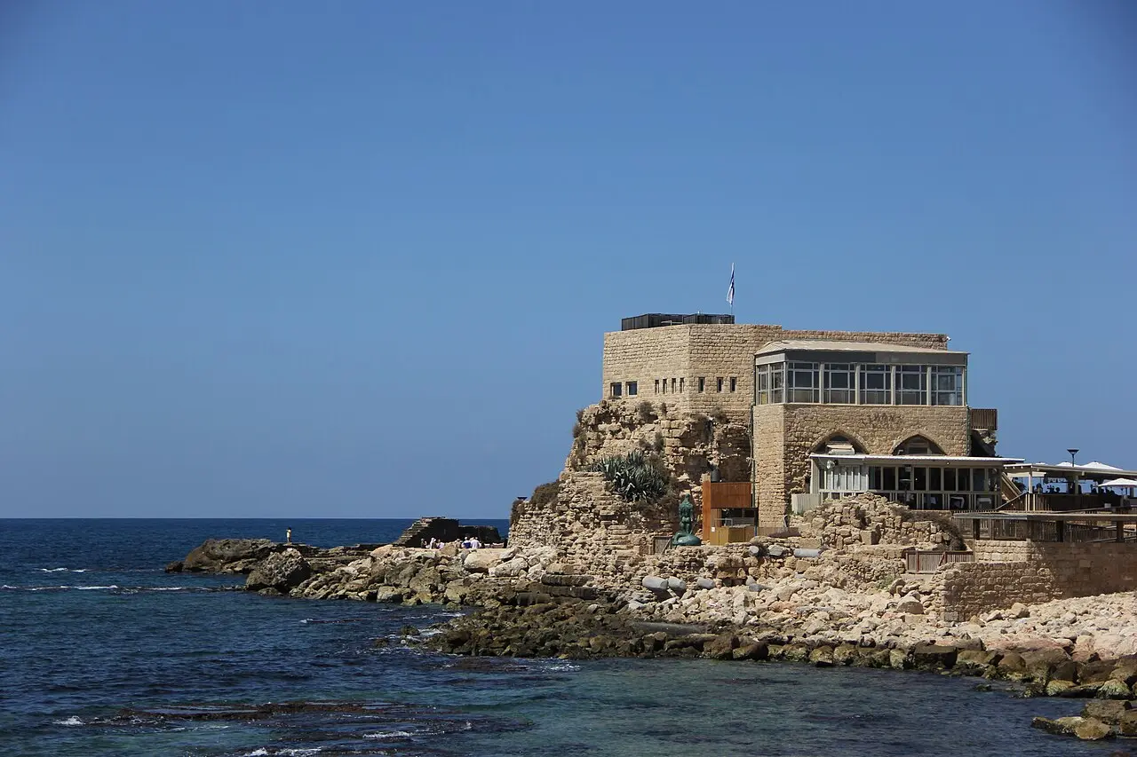
The harbour front reached from the park's northern gate is a working quay with restaurants, galleries and an artists' court along it, run by the Caesarea Development Corporation rather than by the parks authority. Herod's outer basin lay west of it, and the breakwaters that enclosed it are shoals now rather than structures.
The middle of Herod's three basins was based on a natural bay and sits under the modern anchorage. The Old Caesarea Diving Club, which runs the underwater trail here, notes that the original Herodian paving of the great breakwater can still be seen beneath the modern concrete quay, and that a round tower about 13 metres across still stands at the mouth of the inner anchorage, probably on an earlier fortification of Straton's Tower.
The innermost basin was never enclosed at all: it was dug, and it is now almost entirely dry land, under the seafront buildings and the lawn. At its landward edge, at the foot of the temple platform, a mooring quay survives with a tie stone in it, and under the tie stone a horizontal notch worn by standing water. That notch is a measurement. It records where the sea sat when ships were tied here, which is why what to look for on land is a water line rather than a building.
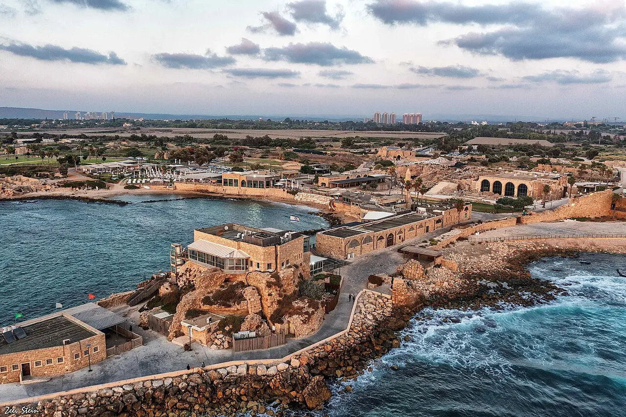
זאב שטיין / CC BY 2.5 · Wikimedia Commons
Decision
A port put where the coast offered nothing
The ROMACONS team describes the setting bluntly: a shifting sand beach with no mitigating physical features, exposed to the longest fetch in the Mediterranean and scoured by a strong current carrying sand from south to north. Their reading is that the site was chosen for political reasons and not because nature favoured a port there. Josephus puts the same problem from the sailor's end: between Joppa and Dora there was no haven fit for ships, and merchants were generally forced to ride at their anchors in open sea.
There was a commercial case as well. The diving club puts the motive in trade: a principal port inside Herod's kingdom for luxury goods moving from the Indian Ocean to the Mediterranean, the spices, costly textiles and gemstones whose demand had risen across the empire since Augustus.
When it was finished is genuinely unsettled. Josephus gives twelve years for the whole programme, and the diving club dates harbour and city to 22 to 10 BCE on that basis. ROMACONS puts the harbour at roughly 23 to 15 BCE, Roman Ports has it begun in 22 and completed in 15, and the Caesarea Development Corporation says ten years of engineering. None of the accounts hides the disagreement.
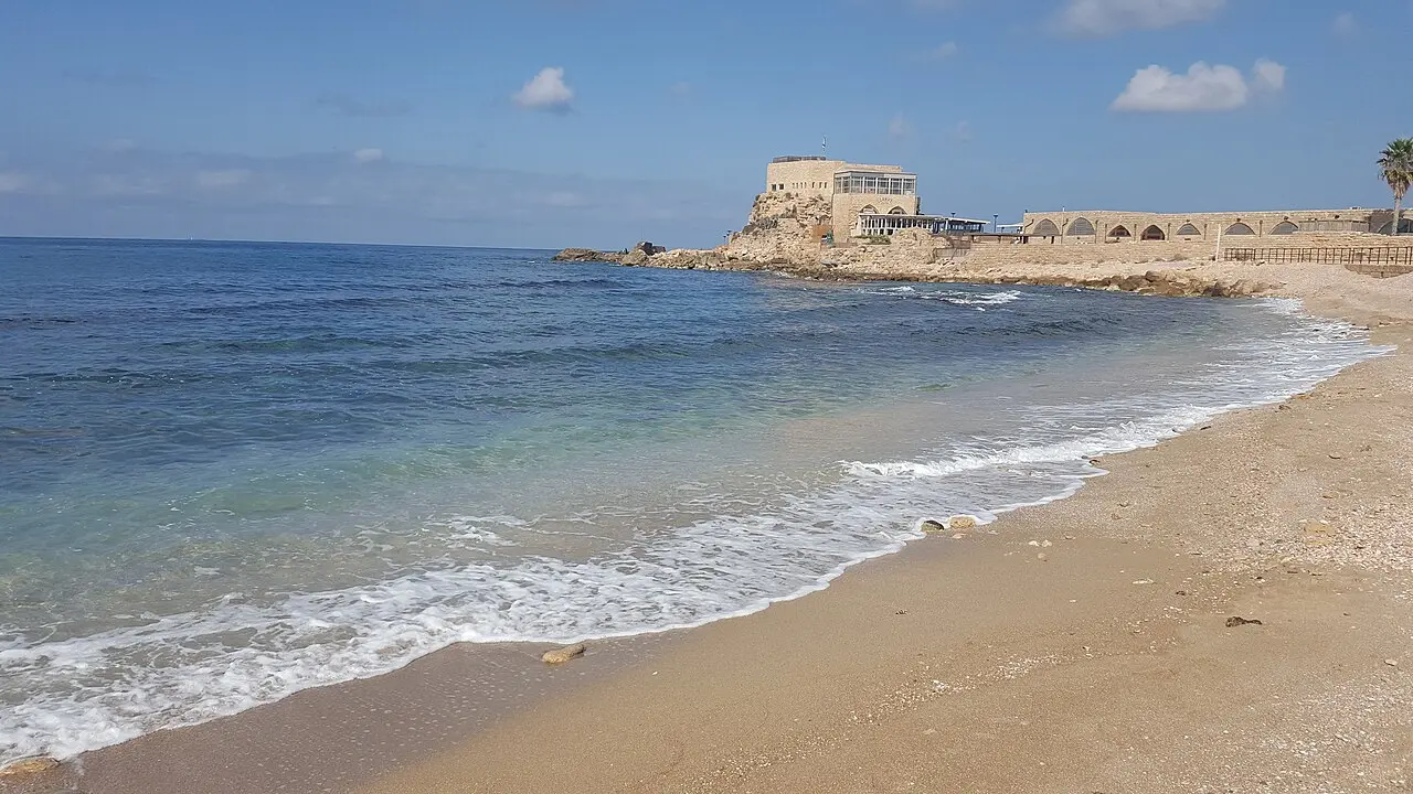
Mohammad Hijjawi / CC BY-SA 4.0 · Wikimedia Commons
Engineering
What five drilled cores said about Herod's concrete
Roman hydraulic concrete was lime, water and pozzolana, a volcanic ash rich in aluminosilicates, with rubble added as aggregate. It sets under water, which is what made a harbour on this shore thinkable. Getting it into place took wooden formwork, and Caesarea is the site where at least three systems have been identified in one harbour. ROMACONS calls the reason unclear, and the variety itself one of the project's most striking features.
In October 2005 the study took five cores from submerged blocks here, three from the southern breakwater and one from the block at the terminus of the northern one. It was its first campaign in which every sample came from well below sea level, recovered with scuba. The results were unflattering: all five tested substantially weaker than the Italian cores in the project's database, and two showed less than half the compressive strength of its benchmark sample from Santa Liberata.
The field notes are more interesting than the verdict. Large lumps of lime in all five cores carried thin alternating black and white stripes the team had not seen at any other site, apparently worked into the mix several times and then left unreduced. Small unmixed lime lumps were commoner here than in Italy, and so were numerous uniform small voids. The explanations are offered as possibilities rather than findings: hurried mixing on an exposed site, mixing done on board ship, a workforce unused to the material, or warm water setting the mortar before it could compact.
Divers meet the consequence directly. At the northern end of the main breakwater there are voids inside the blocks that divers call caves, which the diving club attributes to weathering of a second pour of poorer quality than the first. The aggregate was local kurkar, and the mortar appears not to grip it as well as it grips Italian tuff. The ROMACONS summary is worth keeping: an inferior concrete, and still a remarkably durable one.
- Planks driven into the seabed and braced into a box, then filled: the method Vitruvius describes
- A double-walled hollow box built on shore, towed out, and sunk by filling the cavity with mortar
- Barges planked with mortise-and-tenon carpentry, part-filled in the shallows and towed into position
Anatomy
A breaker in front of the breakwater, and a harbour that flushed itself
The outer basin was made by two breakwaters. The main one starts in the south-east and swings in a broad arc to the north-west, carrying a sea wall with towers on its seaward face and, on its inner face, a loading quay with warehouses and a promenade. At its southern end, where the citadel and the Time Tower now stand, was the largest tower of all, the Drusion, which the diving club suggests may have been the lighthouse. Estimates of the entrance channel's width run from 30 to 80 metres, and two towers stood outside the mouth to mark the approach.
The northern breakwater is shorter and straighter, and probably carried the harbour administration building. Niches cut into its stones may have held pulleys, and the pulleys an iron chain that could be drawn across the entrance. The diving club offers that as a suggestion, not a settled fact.
Two pieces of engineering deserve more attention than they get. The first is the Procumatia, a low forward breakwater about 6 metres wide that reached only to the water surface, set roughly 10 metres south of the main mole and parallel to it. It broke the spray that would otherwise have interrupted loading, and it could be repaired each season without touching the main structure. Josephus names it.
The second is the answer to silting, the problem that kills harbours on a sand coast. Cut into the rock at the south-eastern edge of the middle basin is a channel whose sill stands clear of the seabed and whose head reaches 20 to 30 centimetres above sea level, with vertical slots for wooden doors to regulate the flow. Channels like it let clean water in and set up a constant outward current that carried sediment away through the mouth. The evidence that it worked is a deposit a metre thick at the harbour entrance, full of silt, pottery, metal and pieces of ships swept out of the basins while the port was still running.
Decline
It began sinking almost at once, and the reasons are still argued
The harbour started going down immediately after it was built, and the diving club lists the candidate causes without picking one: a geological fault about 150 metres off the present shore, a series of earthquakes, possibly tsunami waves, an unstable sandy seabed, and the sheer weight of the structures. Add the weakness the cores show. Researchers still differ over how much to give each, and the site's operators do not pretend otherwise.
The timing is better established than the cause. By the end of the first century CE the breakwaters were already submerged, which is known from the cargoes of ships wrecked on them: near the mouth, a lead-sheathed vessel carrying ingots stamped with the emperor Domitian's name. Other wrecks left blocks of raw marble and a heap of third-century amphora sherds. The moles had become shoals, and ships were hitting them on the way in.
There was at least one attempt to fight back: at the start of the sixth century an embankment of rough undressed stone was tipped into the harbour mouth to salvage the sunken port. It did not take, and by that century the harbour was unusable. Roman Ports cites a 2006 paper in Geology whose title assigns the destruction of Herod's harbour to the tsunami of 13 December 115, while the text of both that article and Wikipedia's says only that seabed deposits record a tsunami in the first or second century. Afterwards the sea front was scavenged, and Caesarea's Muslim rulers and then the Crusaders robbed columns from the Roman ruins to raise a sea wall, a square tower and a jetty in the middle basin.
There is a modern coda, and it is the best argument the site makes for Herod's engineers. The present anchorage was built after 1948 for the fishermen of neighbouring Kibbutz Sdot Yam, using its own artificial island for foundations and the concrete-filled hull of an old immigrant ship sunk at the north end of the new breakwater. The diving club records that this one was falling apart fifty years after it went in.
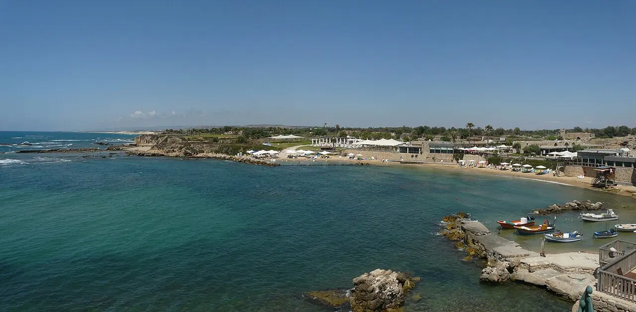
random exposure / CC BY 2.0 · Wikimedia Commons
Now
The vaults, the port ticket and the swim
The most substantial Herodian fabric a visitor can stand inside is behind the quay rather than on it. Fourteen storage vaults, each 7.40 metres high and 21 metres deep, carried the platform of the temple Herod dedicated to Augustus: two wings of four large vaults with six smaller ones between them supporting the monumental staircase up from the pier. Four were restored and fitted out as the harbour visitor centre, which opened in June 2019 after about five years of work, and the parks authority puts a visit at roughly 25 minutes.
The restoration turned up its own story. Only one vault had survived intact, and it was close to collapse. The work then showed that the system had already collapsed once in antiquity and been rebuilt in the Byzantine period, by restorers who kept the Herodian arrangement rather than replacing it. The 2015 to 2019 programme that paid for this cost the Edmond de Rothschild Foundation more than one hundred and fifty million shekels.
Tickets have a quirk specific to this site. The full national park ticket covers everything, but the corporation also sells a cheaper one that admits to the port alone and not to the visitor centre, the theatre or the hippodrome, and a cheaper one again for people coming to eat at the restaurants.
The harbour also keeps producing finds. In February 2015 divers from the local club and marine archaeologists from the Israel Antiquities Authority reported about 2,000 gold coins on the seabed here, a Fatimid hoard more than a thousand years old. Anyone who wants to see the harbour itself rather than its edges needs a mask: the underwater park laid over the drowned structures runs four marked routes and 28 numbered points, taking in the breakwaters, the basins and six anchors from a Bronze Age pierced stone to a modern iron one.
Moran Pirani / CC BY-SA 4.0 · Wikimedia Commons
What to look for
Things not to walk past at Herod's Harbour (Sebastos)
The details that repay knowing about before you are standing in front of them.
The paving under the modern quay
Beneath the concrete of the working harbour front lies the original Herodian paving of the great breakwater. It is the piece of Sebastos most visitors walk over without noticing.
The mooring stone and its water line
At the foot of the temple platform, on the landward edge of the inner basin, a quay survives with a tie stone for ships and a horizontal notch worn underneath it by standing water. The notch marks where the sea used to be.
The round tower at the inner harbour mouth
About 13 metres across, its ashlars laid as headers in an outer ring, standing probably on an earlier fortification of Straton's Tower. A lead pipe still runs fresh water out of its eastern face.
The four restored vaults
Herodian storage vaults 7.40 m high and 21 m deep that once carried the temple platform. Four of the fourteen hold the visitor centre, opened in June 2019, and the film is projected up the full height of one of them.
The empty water west of the promenade
The outer basin enclosed by two breakwaters was the largest artificial harbour built in open sea up to its date. There is nothing to see, which is the point: it is five to seven metres down.
The modern breakwater beside it
The anchorage built after 1948 for the Sdot Yam fishermen used the same artificial-island trick, with a concrete-filled immigrant ship's hull at its north end. It was falling apart within fifty years.
The long view
Herod's Harbour (Sebastos), in order
c. 22 BCE
Herod's builders begin the harbour on an open sand coast with no bay, no cape and a strong northward current.
c. 15–10 BCE
The harbour is finished and named Sebastos, the Greek for Augustus. Accounts of the completion date differ by about five years.
Late 1st century CE
The breakwaters are already under water. Ships begin wrecking on them, among them a lead-sheathed vessel carrying ingots stamped for the emperor Domitian.
1st or 2nd century CE
Seabed deposits record a tsunami. One published study dates it to 13 December 115 and attributes the harbour's destruction to it.
Early 6th century CE
Byzantine engineers tip an embankment of undressed stone into the harbour mouth in an attempt to salvage the sunken port. It fails.
6th century CE
The harbour is unusable. Later, Muslim and then Crusader builders rob columns from the Roman city to raise a sea wall, a square tower and a jetty in the middle basin.
From 1960
Underwater excavation of the submerged harbour runs almost continuously, later under the Caesarea Ancient Harbour Excavation Project.
October 2005
ROMACONS takes five concrete cores from the submerged blocks, its first campaign with every sample recovered by scuba below sea level.
February 2015
About 2,000 Fatimid gold coins are reported on the harbour seabed by local divers and the Israel Antiquities Authority.
2015–2019
The Edmond de Rothschild Foundation funds a programme of over ₪150 million with the antiquities and parks authorities. Four harbour vaults are restored and open as a visitor centre in June 2019.
Practical
Visiting Herod's Harbour (Sebastos)
Where
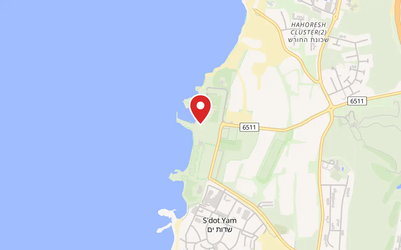
Caesarea Harbour, Caesarea National Park, northern (Crusader gate) entrance, Caesarea
What ticket you need
The harbour sits inside Caesarea National Park, at the opposite end from the theatre gate. A full park ticket covers it along with the theatre, the hippodrome and the harbour visitor centre. The Caesarea Development Corporation also sells a port-only ticket at ₪18 that admits to the harbour front but not to the visitor centre, the theatre or the hippodrome, and the parks authority says the difference can be made up at the visitor centre desk.
Opening hours
- Park, April to October, Sunday to Thursday and Saturday
- 08:00 to 17:00source
- Park, April to October, Friday and holiday eves
- 08:00 to 16:00source
- Park, November to March, Sunday to Thursday and Saturday
- 08:00 to 16:00source
- Park, November to March, Friday and holiday eves
- 08:00 to 15:00source
- Last entry to the park
- one hour before the closing time listedsource
- Harbour front
- open every day until late, with payment taken during national park hourssource
- Harbour visitor centre, April to October
- 08:30 to 17:00 daily, last entry 30 minutes before closingsource
- Harbour visitor centre, November to March
- 08:30 to 16:00, Friday and holiday eves to 15:00, last entry 30 minutes before closingsource
Admission
- Port only, no visitor centre, theatre or hippodrome
- ₪18source
- Port only, for diners at the harbour restaurants
- ₪14source
- Port only, residents of Caesarea and Or Akiva
- no chargesource
- Full national park ticket, adult
- ₪46source
- Full national park ticket, child
- ₪27source
- Full ticket, student or adult in a group
- ₪39source
- Full ticket, Israeli senior citizen or child in a group
- ₪23source
- Car park at the harbour
- ₪20 for the first hour or part of it, ₪5 for the second, free with a disabled permit, and 15 minutes free for setting downsource
Access
Better than most of the park, because the harbour front is a level modern quay. The parks authority lists the beach promenade leading to the port and the visitors' centre among its accessible areas, and the corporation says the centre is accessible to visitors with mobility, hearing and vision impairments, with a phone number for details. Two honest warnings. The restored vaults are an ancient building and have no toilets in them, so the public toilets are back at the park entrance. And the harbour itself cannot be reached on any terms without entering the water: the breakwaters are five to seven metres down and there is no viewing platform over them.
On site
- Ticket office at the northern gate
- Paid car park beside the harbour
- Harbour visitor centre in four Herodian vaults
- Restaurants and cafés on the quay
- Galleries and the artists' court
- Public toilets at the park entrance
- Bathing beach and dive club
- Service centre reachable on *6550, listed as staffed around the clock
Booking
The visitor centre takes bookings and the corporation recommends them for groups of more than ten; without one, entry is first come, first served. Visits are self-guided and there are no audio guides. The parks authority separately runs an online reservation system for the national park as a whole.
Hours and prices are given as the operator publishes them and change without much notice, particularly around Shabbat and the festivals. Check the operator's own page before you travel for this.
Official page at caesarea.com →What people wish they had known
- Nothing of the ancient harbour is visible from the promenade. Visitors spend a while looking for a jetty or a ruin offshore; the breakwaters are five to seven metres down and the only Herodian work at eye level is the vaults behind the quay.
- The ₪18 port ticket is not a discount on the park ticket. It admits to the harbour front and excludes the visitor centre, the theatre and the hippodrome, and the parks authority says the difference can be paid at the visitor centre's reception desk if the choice turns out to be wrong.
- Come in through the northern gate if the harbour is the point of the trip. The other entrance is at the theatre, at the far end of the park, and the walk between them along the shore is not short.
- Park entry closes an hour before the printed closing time, so a late afternoon arrival can mean no entry at all. The harbour front itself stays open into the evening, but payment is taken during park hours.
- The Caesarea Development Corporation's own pages disagree with each other on admission. Its price list matches the parks authority at ₪46 for an adult; its visitor centre FAQ still quotes ₪39. Budget for the higher figure.
- There are no toilets inside the restored vaults, because they are a preserved ancient building. The public ones are at the park entrance.
The figures
Herod's Harbour (Sebastos) by the numbers
Each figure carries the year it belongs to and links the source it came from.
| Measure | Figure | As of | Source |
|---|---|---|---|
| Concrete used in Sebastos | about 35,000 m³, on Christopher Brandon's calculation | 2007 | web.uvic.ca |
| Volcanic ash imported from Puteoli | 24,000 m³, roughly 52,000 tons, or 100 to 150 large shiploads | 2007 | web.uvic.ca |
| Local materials quarried or burnt | 12,000 m³ of kurkar and 12,000 m³ of slaked lime | 2007 | web.uvic.ca |
| Breakwaters | southern about 500 m, northern about 275 m | 2026 | en.wikipedia.org |
| Subsidence of the harbour works | 5 to 7 m, with the breakwaters submerged by the end of the 1st century CE | 2026 | caesarea-diving.com |
| Harbour vaults | 7.40 m high and 21 m deep; 4 of 14 restored and opened June 2019 | 2021 | en.parks.org.il |
| Cost of the 2015 to 2019 works | over ₪150 million from the Edmond de Rothschild Foundation | 2026 | caesarea.com |
| Port-only admission | ₪18, or ₪14 for diners at the harbour restaurants | 2026 | caesarea.com |
While you are here
The rest of Caesarea
Everything else in this destination with a page of its own.
זאב שטיין / CC BY 2.5 · Wikimedia Commons
Museum
Caesarea Harbour Visitors' Centre
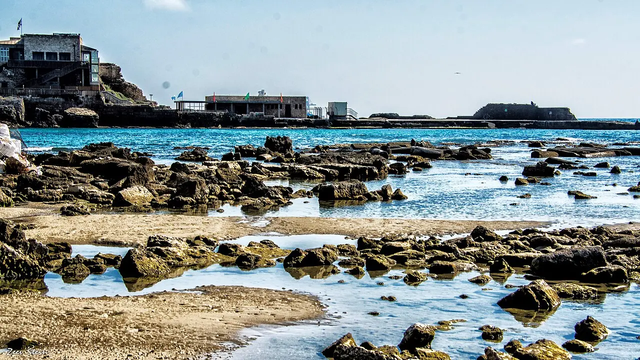
Four of the fourteen Herodian vaults that carried the temple platform above the harbour were dug out, stabilised and opened to the public in June 2019, after about five years of work.
Activity
Caesarea Underwater Archaeological Park
Four marked trails and 28 numbered signs run over the drowned moles of Herod's harbour, the shallowest at four metres and the deepest at nine.
israel zeller ישראל זלר / CC BY 2.5 · Wikimedia Commons
Archaeological site
Crusader City and Ramparts
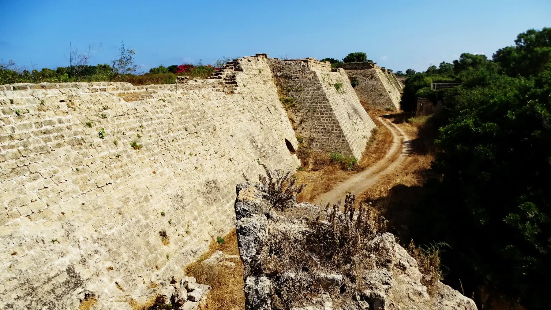
Louis IX of France walled a town of about 120 dunams here in 1251, a fraction of the Roman city, and cut a dry moat round it that the park's operator still measures at 8 to 10 metres deep.
Sources and further reading
Every link below was opened and checked when this page was written. Official statements are marked as such: they are the subject's own account, not an independent one.
- OfficialIsrael Nature and Parks Authorityen.parks.org.ilCaesarea National Park
Summer and winter opening hours, the one-hour entry cutoff, the entrance fee table (₪46 adult, ₪27 child, ₪39 student and adult in a group, ₪23 child in a group and Israeli senior), the accessible areas including the beach promenade leading to the port and the visitors' centre, dogs on a lead, and the bathing and diving beach
- OfficialIsrael Nature and Parks Authorityen.parks.org.ilSpectacular vaults and treasures: Caesarea Harbor Visitors' Center
Vault dimensions of 7.40 m by 21 m, their role as the storage system of the harbour and the base of the temple platform, four of the fourteen restored, the vertical film projected up an 8 m vault, a visit of about 25 minutes, and the statement that a port-only ticket can be topped up at the centre's reception desk
- OfficialCaesarea Development Corporationcaesarea.comPrices (Caesarea National Park and the port)
Port-only admission at ₪18, ₪14 for diners at the harbour restaurants, free for Caesarea and Or Akiva residents, the full ticket table matching the parks authority, and the car park tariff of ₪20 for the first hour, ₪5 for the second and 15 free minutes for setting down
- OfficialCaesarea Development Corporationcaesarea.comOpening Hours (Caesarea Harbor)
April to October and November to March hours, the note that the harbour is open every day until late with payment taken during national park hours, and the visitor centre opening from 08:30 to half an hour before park closing
- OfficialCaesarea Development Corporationcaesarea.comHours of Operation and FAQ, Harbour Visitors' Center
Seasonal centre hours, last entry 30 minutes before closing, a visit of about 30 minutes, and the accessibility statement for mobility, hearing and vision impairments
- OfficialCaesarea Development Corporationcaesarea.comHarbor Renovation
The Edmond de Rothschild Foundation's investment of over ₪150 million between 2015 and 2019, the single surviving intact vault and its near collapse, and the discovery that the vault system had collapsed in antiquity and been rebuilt by Byzantine restorers who kept the Herodian arrangement
- OfficialCaesarea Development Corporationcaesarea.com2015-2019 The Caesarea Project
The vault array as two wings of four vaults about 21 m long and 5 m wide with six smaller vaults between them carrying the monumental staircase from the pier, and the description of the harbour as a ten-year engineering enterprise
- OfficialOld Caesarea Diving Clubcaesarea-diving.comUnderwater archaeological park: the harbour and its components
The protected anchorage of about 200 dunams in three basins, the dug inner basin now almost entirely on land, the round tower 13 m across built as headers with a lead pipe still running fresh water, the mooring quay and erosion notch at the foot of the temple platform, the Herodian paving of the great breakwater visible under the modern concrete quay, the Drusion tower where the citadel now stands, the entrance channel estimated at 30 to 80 m, the marker towers with their statue platform, and the niches that may have carried a chain across the mouth
- OfficialOld Caesarea Diving Clubcaesarea-diving.comUnderwater archaeological park: construction methods and special features
The Procumatia about 6 m wide standing 10 m south of the main mole and reaching only to the surface, the rock-cut flushing channel with its raised sill, its head 20 to 30 cm above the sea and its wooden regulating doors, the metre-thick debris deposit at the harbour mouth, formwork of about 7 by 14 m and 11 by 15 m built on shore from imported timber, the towing and sinking procedure, the hollow double-walled forms filled by wave-driven sand over two to three years, the divers' caves formed by a poor second pour at the north end of the main breakwater, and ashlars up to 7 m and ten tonnes clamped with iron set in lead
- OfficialOld Caesarea Diving Clubcaesarea-diving.comUnderwater archaeological park: the sinking of the harbour and its later phases
Subsidence beginning immediately and the competing explanations (a fault about 150 m offshore, earthquakes, possible tsunamis, an unstable sandy bed and the weight of the structures), total subsidence of 5 to 7 m, breakwaters submerged by the end of the first century, the Domitian lead ingots and the marble, amphora and basalt-ballast wrecks, the early sixth-century rubble embankment at the harbour mouth, the medieval sea wall and tower of reused columns, and the post-1948 Sdot Yam breakwater that was disintegrating within fifty years
- ReferenceRoman Maritime Concrete Study, University of Victoria (Hohlfelder, Brandon and Oleson)web.uvic.caConstructing the harbour of Caesarea on the sea: new evidence from the ROMACONS field campaign of October 2005
The largest artificial harbour built in open sea to its date, the c. 23 to 15 BCE construction window, the sand beach with the longest fetch in the Mediterranean and a strong longshore current, the three formwork systems, the five cores and their locations, the striped lime lumps and small voids, the sub-Santa Liberata compressive strengths, and Brandon's volumes of 35,000 m³ of concrete, 24,000 m³ of pozzolana at 100 to 150 shiploads, 12,000 m³ of kurkar and 12,000 m³ of slaked lime
- ReferenceUniversity of Victoriaweb.uvic.caThe Roman Maritime Concrete Study (ROMACONS)
The project's scope, the Bay of Naples origin of the pozzolana, and the bulk shipment of the material east to Herod's harbour
- ReferenceRomanPorts (Roman Ports and Maritime Archaeology)romanports.orgA Jewish port for the emperor
Construction begun in 22 BCE and named on completion in 15 BCE, the harbour of about 100,000 m², the disputed commercial or military function and the possible boathouses, the artificial islands used to build the southern mole, the lighthouse and the marker towers, Josephus's full description in Whiston's translation, and the citation of Reinhardt and colleagues in Geology 34 (2006) for the tsunami of 13 December 115
- ReferenceWikipediaen.wikipedia.orgCaesarea Maritima
Breakwater lengths of about 500 m and 275 m after Hohlfelder, the harbour of around 100,000 m², the double-planking and barge methods, the weakness of the concrete against Italian comparanda, the fault line and seismic settling, the tsunami in the first or second century, the harbour unusable by the sixth century with the jetties more than five metres down, and the February 2015 report of about 2,000 gold coins found on the seabed with hundreds more recovered in 2021
Herod's Harbour (Sebastos): common questions
Can you actually see Herod's harbour?+
Not from dry land, and not in the way the theatre or the Crusader walls can be seen. The breakwaters and quays that made up Sebastos lie five to seven metres under water offshore of the modern promenade. What is visible on foot is the Herodian paving beneath the modern quay, a mooring quay and its worn water line at the foot of the temple platform, the round tower at the inner harbour mouth and the storage vaults behind the waterfront.
What was Sebastos?+
Sebastos was the name of the harbour, from the Greek for Augustus, as Caesarea was named for Caesar. It was an artificial harbour laid into open sea on a coast with no natural shelter, and the ROMACONS project describes it as the largest artificial harbour built in the open sea up to its date. It enclosed three basins behind two concrete breakwaters.
Do you have to dive to see the harbour properly?+
Yes, if the ancient structures are the point. The underwater archaeological park laid out over the drowned harbour has four marked routes and 28 numbered points covering the breakwaters, the basins, the round tower and a display of six anchors from the Bronze Age to the modern period. Snorkelling reaches some of it in calm water; the deeper blocks need scuba and the local club runs the trail.
How much does it cost to get into Caesarea harbour?+
The Caesarea Development Corporation prices the port on its own at ₪18, and at ₪14 for people going to eat at the harbour restaurants, with free entry for residents of Caesarea and Or Akiva. Neither of those admits to the harbour visitor centre, the Roman theatre or the hippodrome. The full national park ticket, which covers all of it, is ₪46 for an adult and ₪27 for a child, as published by the Israel Nature and Parks Authority.
How long does the harbour take?+
About an hour covers the harbour front, the vaults and the visitor centre at a normal pace. The parks authority puts the visitor centre alone at roughly 25 minutes, and the corporation says about 30. The whole national park, theatre and hippodrome included, is a half day.
Why did the harbour sink?+
Nobody has settled it, and the site's own operators list several causes together: a geological fault line running about 150 metres offshore, repeated earthquakes, possibly tsunami waves, an unstable sandy seabed and the weight of the structures themselves. The concrete did not help. All five cores ROMACONS drilled here in 2005 tested substantially weaker than comparable Italian samples, and the mortar appears not to bond well to the local kurkar aggregate.
Is the harbour wheelchair accessible?+
The harbour front is the most accessible part of Caesarea National Park, because it is a level modern quay rather than excavated terrain. The parks authority lists the beach promenade leading to the port and the visitors' centre among its accessible areas, and the corporation states that the centre is accessible to visitors with mobility, hearing and vision impairments. The vaults have no toilets, so plan around the ones at the park entrance.
Is there anything to see if you are not interested in archaeology?+
The harbour front is the part of Caesarea that works as an evening rather than a monument: restaurants along the water, galleries, an artists' court and a bathing beach, open after the ruins close. It is also the point where the site is most legible without a guide, since one film in the vaults runs the full height of a Herodian arch. Whether that justifies the ticket depends on how much of the day is already going on the park.
Can you swim at the harbour?+
Yes. There is a bathing and diving beach at the harbour, listed by the parks authority among what else is at the site, and the dive club operates from the same shore. Swimming above the ancient breakwaters is the ordinary way visitors get any sense of their scale, and the shallowest blocks sit only a few metres down.
Is the harbour the same thing as the visitor centre?+
No, though they are a few steps apart and often confused. The harbour is Herod's drowned port; the visitor centre is an exhibition installed in 2019 inside four of the fourteen Herodian storage vaults that stood behind the quay and carried the temple platform. The port-only ticket admits to the first and not to the second.