Nature reserve · The Galilee
Rosh Hanikra Grottoes
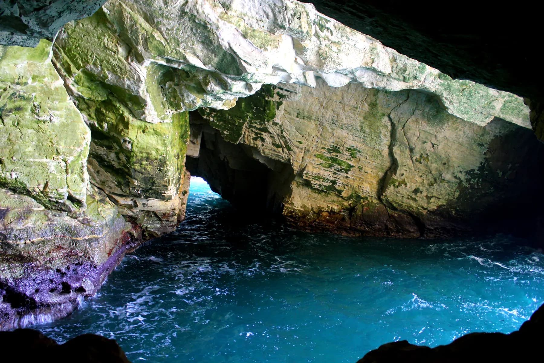
The sea cut these caves out of soft chalk at the top of Israel's coast, and until a 400 metre tunnel was driven through the ridge in 1968 the only way into them was to swim.
Natalinasser / CC BY-SA 4.0 · Wikimedia Commons
The grottoes
about 200 metres
combined length of the linked sea caves, on the Hebrew and English encyclopaedia accounts
Cable car gradient
60 degrees
on a line of 102 metres, from a station 70 metres above the water
Tunnel to the caves
400 metres
cut in 1968; before it, the grottoes were reached only from the sea
Marine reserve
about 100,062 dunams
Rosh Hanikra to Achziv, declared 6 November 2019
In short
- How long to give it
- About 60 to 90 minutes for the descent, the grottoes, the railway tunnel and the film. The walk itself is short; the queue for the cable car, not the caves, is what sets the pace on a busy day.
- Published opening times
- Not quoted here. Confirm the current opening times by telephone or through a ticket seller before travelling.
- Akko and Rosh Hanikra combined ticket
- ₪90 per person, sold by the Old Akko and Nazareth Development Company alongside its ₪55 Akko-only ticket
ראש הנקרה · رأس الناقورة
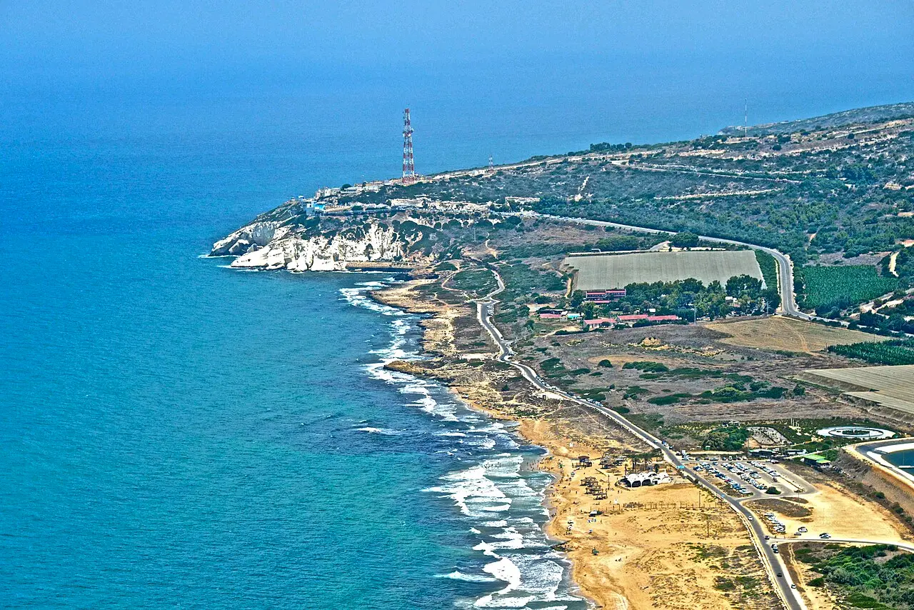
Rosh Hanikra is the headland where Israel's Mediterranean coast stops at the Lebanese border, and the grottoes are the sea caves the waves have cut into the foot of its white chalk cliff. The Hebrew name means head of the cavern; the Arabic name, Ras an-Naqura, belongs to the village just north of it, inside Lebanon. The caves run to roughly 200 metres in two main branches that connect, and they are entered from inside the ridge rather than from the water.
That last point is the whole modern history of the site. For most of its existence the grottoes could be reached only by swimming in from open sea, which left them to divers and strong swimmers. A 400 metre tunnel cut through the rock in 1968, just above sea level, turned a serious swim into a walk, and a cable car dropping down the cliff at 60 degrees turned the walk into an afternoon.
The other thing at the top of the cliff is a border. The railway Britain drove through this ridge in 1942 to link Haifa to Beirut ran through two tunnels joined by a bridge over one of the caves; the bridge was blown up in 1948 and the northern tunnel, which the boundary runs through, was sealed and has stayed sealed. The armistice that ended the fighting between Israel and Lebanon was signed here on 23 March 1949, and the crossing beside the ticket office is still the only working one on that frontier.
Geology
Why the caves are here and not somewhere else
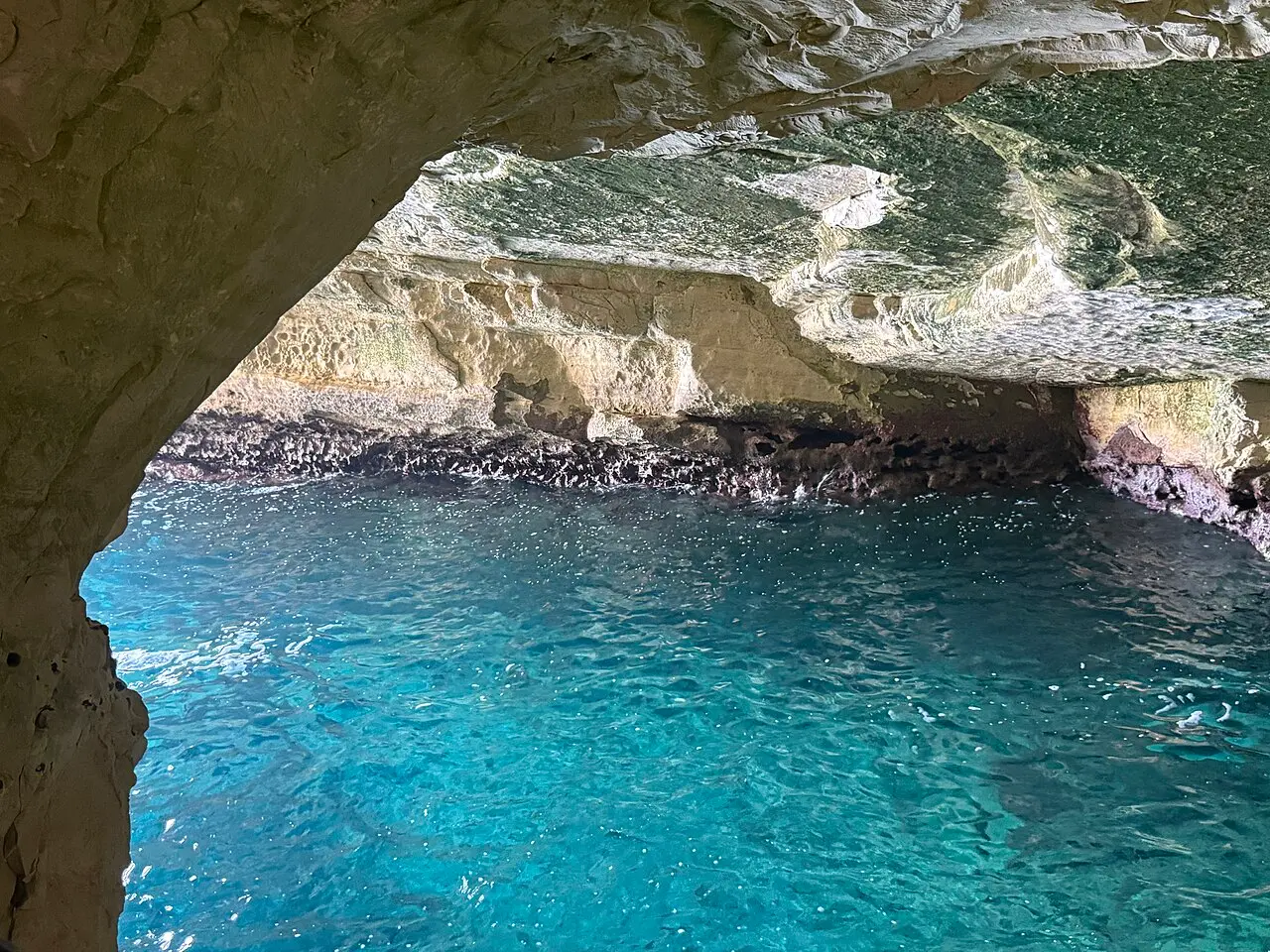
The cliff is the western end of a ridge the Hebrew sources call Rechess HaSulam, the Ladder ridge: an anticline whose axis runs from the south west up into Lebanon, rising to about 300 metres. Where it meets the sea it presents a face of roughly 70 metres, built from the Rosh Hanikra member of the Deir Hanna formation, bands of chert and of chalk with a little travertine. The chalk is soft. The sea has spent a very long time taking it out band by band, and the caves are the hollows left behind.
Below that band lies a harder limestone layer, most of it now under water, and the sea has cut into that too: the northern grotto is the only one formed entirely in hard rock. There are further caves below the waterline, and that is the detail worth carrying away. Caves cut at several heights mean the sea did not always stand where it stands now, and each set was carved at the level of its own era.
There is matching evidence on land. Between the deeper caves, remains have been found that were laid down in a dry-land environment, and the strip from here south to Achziv holds traces of ancient farming, winepresses among them, on ground that carries no soil today. The reading that follows is that the shoreline once ran hundreds of metres further west, beyond the islands offshore.
Those islands, Tchelet, Shahaf, Nahliely and Achziv, are the surviving heads of an old kurkar ridge, about 20 dunams of rock in all. All four are nature reserves and nobody lands on them, but they are the thing to look at from the clifftop while waiting for a cabin.
שלמה רודד / CC BY 2.5 · Wikimedia Commons
Access
The tunnel that turned a swim into a walk
Before 1968 there was no land entrance. The geographer Yosef Braslavi described swimming in from open water with a party of walkers to work out what was producing the booming heard around the headland; his answer was that the waves roll into the caves and throw back doubled and trebled echoes. That noise is still the strongest impression the place makes, and it is why one cave carries the Arabic name Maghharat an-Nuh, the cave of sighs.
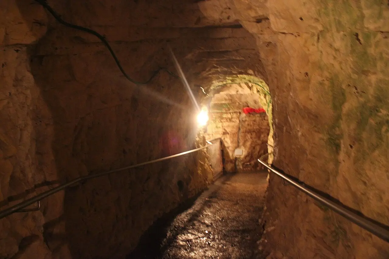
Development as a place a family could visit began in 1962, under the Sulam Tzor regional council: a restaurant at the top of the cliff, the widening of the grottoes and footpaths cut through them. A cable car was announced in 1963, to be supplied by a Swiss firm. The 400 metre tunnel followed in 1968, linking the caves to each other and to the old railway alignment.
It is worth being clear about what that leaves. The caves are natural and the sea made them. The route through them is not: it is a widened, floored and lit walkway, and some of the passage between one grotto and the next was cut in the 1960s.
Natalinasser / CC BY-SA 4.0 · Wikimedia Commons
The ride
A 102 metre line at sixty degrees, and two dates for it
The upper station stands beside the car park on Route 4, a few metres short of the border, on the lip of the chalk about 70 metres above the water. The lower station faces the sea behind a white rock-like wall put there to take the spray. The line between them is 102 metres long and hangs at 60 degrees, with the drive and control gear at the top and the deflection sheave and tension weights at the bottom.
The installation is Austrian, by Doppelmayr, working with the Technion in Haifa; the cabins, fifteen people each, came from Swoboda, a firm Doppelmayr later bought. It is an aerial tramway on a single cable, each cabin fixed to it by four grips, where most ropeways use one cable to carry the cabins and a second to haul them.
The dates do not agree and no source resolves them. The Hebrew and English encyclopaedia articles on the site both say the cable car was completed in 1968, soon after the tunnel, and a newsreel item from that year is titled for a new cable car on these cliffs. The Hebrew article on the cable car itself gives 1987 for the Doppelmayr line now running. The likeliest reading is that the second replaced the first, but no source says so.
The claim the site is best known for is that this is the steepest cable car in the world. Wikipedia has carried that sentence with a request for a source since 2017, and no manufacturer's statement confirming it could be found for this page. The gradient of 60 degrees is not in dispute; the superlative attached to it has never been sourced. The weather is documented: very rough conditions shut the line down, for wind speed and to keep the cabins out of the spray, and the operating company's own figure is two or three days a year.
- Line 102 metres, gradient 60 degrees, upper station about 70 metres above the sea
- Doppelmayr with the Technion; Swoboda cabins of fifteen
- Single carrying cable, four grips per cabin, no separate haul rope
- Closed by storms two or three days a year, on the company's own figure
1942
The tunnels South African sappers cut, and the bridge that went in 1948
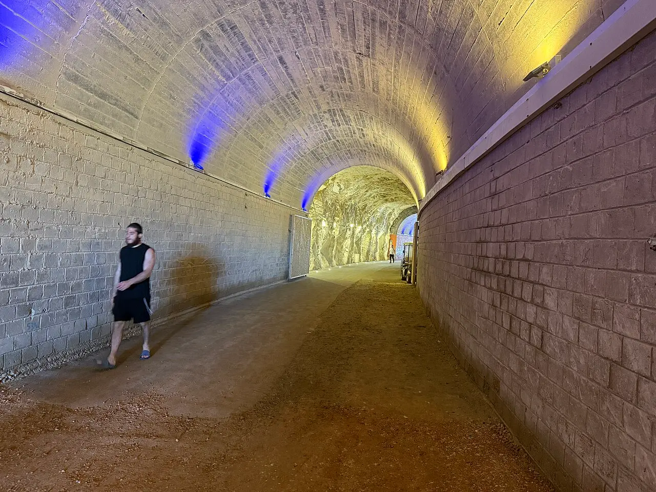
In 1941, after Allied forces took Lebanon from Vichy control, Britain decided to join the coastal railway in Palestine to the Lebanese network, and through it to Aleppo and Turkey, so that troops and equipment could move by rail. The obstacle was this ridge. Two tunnels were driven under it and joined by a bridge thrown over one of the larger grottoes. The digging was done by the 40th Company of the South African engineers, with New Zealand and Australian units on the wider job, and an inscription over the southern portal records the completion.
The Hebrew record is precise: the tunnel was inaugurated on 14 August 1942, the Haifa to Beirut alignment was finished on 24 August, and the line reached Tripoli station on 18 December. The Haifa to Beirut to Tripoli railway was the first rail link between the networks of Europe and of North Africa. It never carried a civilian service: the British kept it under military control, and a decision taken in 1947 to open it to the public was never acted on.
It lasted five and a half years. The bridge was spared during the Night of the Bridges in 1946, then destroyed in the 1948 war to stop Lebanese arms and troops moving south. Here the sources part company. The Hebrew accounts, citing the site's own history page, date the charge to 14 March 1948 and credit the 21st Battalion of the Carmeli Brigade. The English account puts the same 21st Battalion under the Palmach and dates the demolition to late February. The unit number is what both agree on.
Repairing it was judged too expensive. The border runs through the northern tunnel, so that tunnel was sealed and remains sealed. The southern one is now part of the visit: it is the passage that leads to the grotto route. An audio-visual presentation runs in its northern neighbour's southern end, as close to Lebanon as a ticket goes.
שלמה רודד / CC BY 2.5 · Wikimedia Commons
The frontier
Where the armistice was signed, and what the gate is for
On 23 March 1949 the Lebanese and Israeli delegations signed the General Armistice Agreement that closed the Lebanese front of the 1948 war. The text ends 'DONE at Ras En Naqoura on the twenty-third of March nineteen forty-nine, in the presence of the Personal Deputy of the United Nations Acting Mediator on Palestine and the United Nations Chief of Staff of the Truce Supervision Organization'. Ras en Naqoura is this headland. Lebanese forces withdrew under the agreement, and Israeli prisoners were released across the line here the same day.
Kibbutz Rosh HaNikra had gone up on the ridge two months earlier, on 6 January 1949, founded by demobilised fighters of the Palmach's Yiftach Brigade, and moved to its permanent site on 1 October 1950. The kibbutz runs the attraction: the cable car, the film, the shop, the kiosk and the tunnels are its business, alongside dairy, bananas, avocados and citrus.
The crossing is the only functioning one between Israel and Lebanon. It is worked by the Israel Defence Forces and by UNIFIL, and ordinary visitors cannot pass through it. What it gets used for is the closing act of negotiations: on 16 July 2008 Samir Kuntar was returned to Lebanon through this gate and the bodies of Eldad Regev and Ehud Goldwasser were handed back through it. A poem about waiting for peace is mounted on the Israeli side, an apology from the management of the Cairo to Jaffa to Haifa to Beirut railway that lists everything broken and ends on the detail that peace is running late.
Protection
Five separate declarations, and the sea in front of them
The protected ground here was assembled piece by piece over almost forty years, which is why nobody can give a single figure for it. The islands became a reserve of 311 dunams in 1965. The main reserve followed in 1969 at 500 dunams, with a further 765 added in 1996. The beach was declared in 2003, at 230 dunams, and a national park covers another 220. Whether those areas overlap is not set out in any source consulted here.
The sea took much longer. Two marine reserves were planned at first, one off Rosh Hanikra and one off Achziv, then merged into one, and the merged proposal was cut back from Israel's territorial water limit at about 22 kilometres out to 15, losing roughly a third of the area. What was declared on 6 November 2019 covers about 100,062 dunams: some 7 kilometres of indented coast from the Lebanese border to the northern edge of Nahariya. It is the largest and northernmost marine reserve in the country, and it opened to visitors on 6 June 2023.
The wildlife is local rather than decorative. The shore from Rosh Hanikra to Achziv is the only place in the world where Galilee sea-lavender grows: it was treated for years as the Greek species before being separated out. Fruit bats roost in the roofs of the grottoes, rock doves and swifts nest in the cliff fissures, and the loggerhead turtle breeds off this coast, with hatchlings crossing the sand on a few full-moon nights each year. The Mediterranean monk seal was seen in the caves until the 1950s.
The reserve is also where more cartilaginous fish are recorded on dives than anywhere else in Israeli water, close to two fifths of all such sightings, with two shark species logged inside it. That is a statement about the sea rather than the grottoes, which are lit, floored and full of people: the wild part of Rosh Hanikra starts where the walkway ends.
יגאל דקל / CC BY-SA 4.0 · Wikimedia Commons
What to look for
Things not to walk past at Rosh Hanikra Grottoes
The details that repay knowing about before you are standing in front of them.
The sound inside the caves
Swell rolling into a closed chamber of chalk and coming back doubled. It is what brought the first walkers in by sea, and it is the part no photograph carries.
The cable car
A 102 metre line at 60 degrees down the cliff face, in cabins of fifteen. The descent is under a minute and is the only way down to the caves.
The southern railway tunnel
Cut by the 40th Company of the South African engineers in 1941 and 1942 and inaugurated on 14 August 1942. Walking to the grottoes means walking the old Haifa to Beirut alignment.
The sealed northern tunnel
The international boundary runs inside it, which is why it was closed after 1948 and never reopened. The audio-visual show about the site runs in its southern end.
The border gate
The only working crossing between Israel and Lebanon, staffed by the IDF and UNIFIL and shut to visitors. The armistice of 23 March 1949 was signed on this ground.
The islands offshore
Tchelet, Shahaf, Nahliely and Achziv, about 20 dunams of kurkar left standing when the rest of an old ridge went under. All four are nature reserves and none can be landed on.
The long view
Rosh Hanikra Grottoes, in order
144 BCE
The First Book of Maccabees names the Ladder of Tyre as the northern limit of the territory under Simon Maccabaeus. Whether the phrase means this cliff or one of two capes near it is not settled.
1915
The British army builds a road for vehicles over the ridge.
1941
After the Allied capture of Lebanon, the 40th Company of the South African engineers begins driving two railway tunnels under the ridge, with New Zealand and Australian units on the wider works.
14 August 1942
The tunnel is inaugurated. The Haifa to Beirut alignment is completed on 24 August and the line reaches Tripoli on 18 December, the first rail link between the networks of Europe and North Africa.
1946
The Haganah spares the Rosh Hanikra bridge during the Night of the Bridges.
1948
The bridge between the tunnels is blown up to stop Lebanese arms moving south. Hebrew sources say 14 March, by the 21st Battalion of the Carmeli Brigade; the English account says late February, by the 21st Battalion under the Palmach.
6 January 1949
Kibbutz Rosh HaNikra is established on the ridge by demobilised fighters of the Palmach's Yiftach Brigade. It moves to its permanent site on 1 October 1950.
23 March 1949
The Lebanese and Israeli delegations sign the General Armistice Agreement at Ras en Naqoura. Lebanese forces withdraw from Rosh Hanikra.
1962
The Sulam Tzor regional council starts developing the headland for visitors: a clifftop restaurant, widening of the grottoes and footpaths through them.
1965
The Rosh Hanikra islands are declared a nature reserve of 311 dunams.
1968
A 400 metre tunnel is cut to the grottoes slightly above sea level, and a cable car is completed down the cliff.
1969
The main Rosh Hanikra reserve is declared at 500 dunams, with a further 765 dunams added in 1996.
1987
The Hebrew account of the cable car dates the Doppelmayr line now in service to this year, which the encyclopaedia articles on the site do not mention.
16 July 2008
A prisoner and remains exchange with Hezbollah is carried out at the crossing.
2003
The Rosh Hanikra beach is declared a reserve of 230 dunams.
6 November 2019
The Rosh Hanikra to Achziv marine reserve is declared, about 100,062 dunams, the largest and northernmost in Israel.
6 June 2023
The marine reserve is launched to visitors as the first tourism marine reserve on Israel's Mediterranean coast.
Practical
Visiting Rosh Hanikra Grottoes
Where
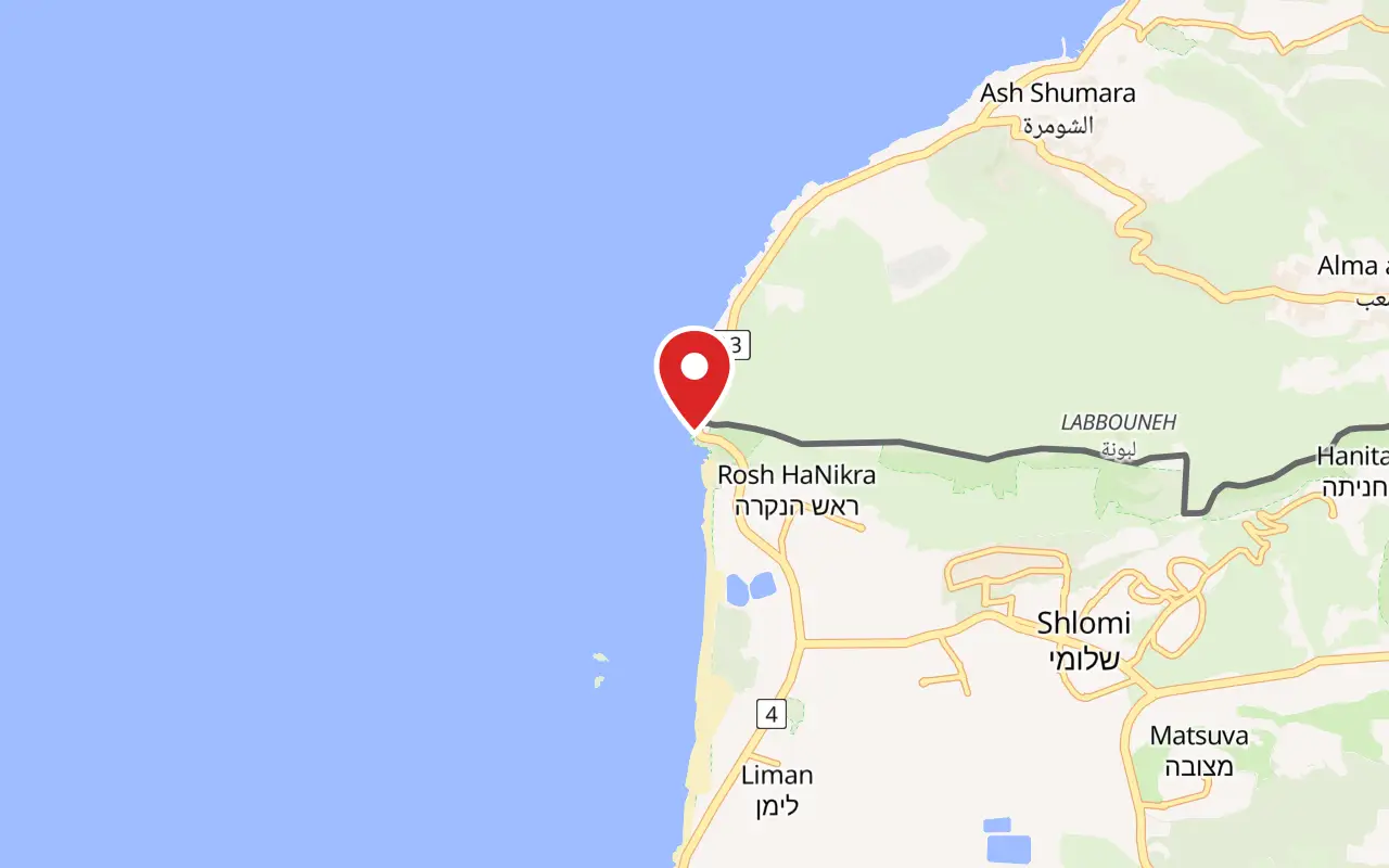
Rosh Hanikra, at the northern end of Route 4, Mateh Asher Regional Council, Western Galilee. Nahariya, the nearest town and the end of the coastal railway, is about 10 kilometres south.
What ticket you need
The cliff and the water in front of it are protected ground several times over: an islands reserve from 1965, the main reserve from 1969, a beach reserve from 2003, a national park of 220 dunams, and since 2019 the Rosh Hanikra to Achziv marine reserve. The Israel Nature and Parks Authority is the governing body for that. None of it is what the ticket buys. The attraction itself, meaning the cable car, the walkway, the railway tunnel and the film, is run as a business by Kibbutz Rosh HaNikra, whose other trade is dairy, poultry, bananas, avocados and citrus.
Opening hours
- Published opening times
- Not quoted here. Confirm the current opening times by telephone or through a ticket seller before travelling.
- Weather closures
- Very rough weather stops the cable car, both for wind speed and to keep the cabins out of the spray. The operating company's own figure, as reported in the Hebrew account of the line, is two or three days a yearsource
- The border crossing
- Closed to visitors at all times. It is operated by the Israel Defence Forces and UNIFIL, and the passage of ordinary tourists is forbiddensource
Admission
- Akko and Rosh Hanikra combined ticket
- ₪90 per person, sold by the Old Akko and Nazareth Development Company alongside its ₪55 Akko-only ticketsource
- Grottoes and cable car on their own
- No figure is published here. The single-site price is set by the operator at Rosh Hanikra, and quoting a shekel figure from an aggregator that does not say when it was checked would be worse than quoting none
Access
There is no climb: the cable car is the way down and the way back up, so the drop of about 70 metres is not walked. Inside, the route is a made walkway laid through natural caves and a railway tunnel, cut and floored in the 1960s, with the passage between chambers narrowing in places. No accessibility statement from the operator is quoted here, and none of the secondary sources used here describes step-free access inside the grottoes. Anyone who needs a firm answer on wheelchairs, pushchairs or boarding a cabin should telephone the site before setting out rather than rely on this page. The cliff is wet and the spray reaches the lower station, so the surfaces underfoot are not always dry.
On site
- Cable car to the grottoes
- Walkway through the sea caves
- The southern British railway tunnel
- Audio-visual show in the northern tunnel
- Souvenir shop
- Kiosk
- Car park at the head of Route 4
- Viewpoint south over the Nahariya and Akko coast
Booking
No hours or single-site price appear above, so confirm both with the site before travelling. The Old Akko and Nazareth Development Company's ₪90 combined Akko and Rosh Hanikra ticket is published on that company's own English page and is the practical way to buy for anyone doing both in a day.
Hours and prices are given as the operator publishes them and change without much notice, particularly around Shabbat and the festivals. Check the operator's own page before you travel for this.
What people wish they had known
- Check that the cable car is running before driving north. It is the only way down, and storms stop it: the operating company's own figure is two or three days a year, and those days fall in winter when the caves are otherwise at their most dramatic.
- The best conditions are not the sunniest. The Hebrew account of the site says the grottoes show at their best towards sunset and during a storm, which is the opposite of the midday coach schedule most visitors arrive on.
- Do not plan on crossing into Lebanon or walking up to the fence for a photograph. The crossing beside the site is worked by the army and UNIFIL and ordinary visitors are not permitted through it.
- The tunnel that takes you to the caves is not a visitor tunnel. It is the southern bore of the 1942 Haifa to Beirut railway, with an inscription over the portal, and it is easy to walk through it looking at your feet.
- The audio-visual show sits in the southern end of the sealed northern tunnel, past the point most people turn around. It is the only part of the site that is inside the tunnel the border runs through.
- If Akko is also on the list for the same day, the Old Akko and Nazareth Development Company sells a combined Akko and Rosh Hanikra ticket at ₪90 against ₪55 for Akko alone.
The figures
Rosh Hanikra Grottoes by the numbers
Each figure carries the year it belongs to and links the source it came from.
| Measure | Figure | As of | Source |
|---|---|---|---|
| Total length of the grottoes | about 200 metres | 2026 | en.wikipedia.org |
| Tunnel cut to reach them | 400 metres, cut in 1968 | 2026 | jewishvirtuallibrary.org |
| Cable car line length | 102 metres | 2026 | he.wikipedia.org |
| Cable car gradient | 60 degrees | 2026 | en.wikipedia.org |
| Height of the upper station above the sea | 70 metres | 2026 | he.wikipedia.org |
| Cabin capacity | 15 people | 2026 | he.wikipedia.org |
| Rosh Hanikra to Achziv marine reserve | about 100,062 dunams, declared 6 November 2019 | 2019 | he.wikipedia.org |
| Combined Akko and Rosh Hanikra ticket | ₪90 per person | 2026 | akko.org.il |
While you are here
The rest of The Galilee
Everything else in this destination with a page of its own.
ארז אשכנזי / CC BY-SA 4.0 · Wikimedia Commons
Neighbourhood
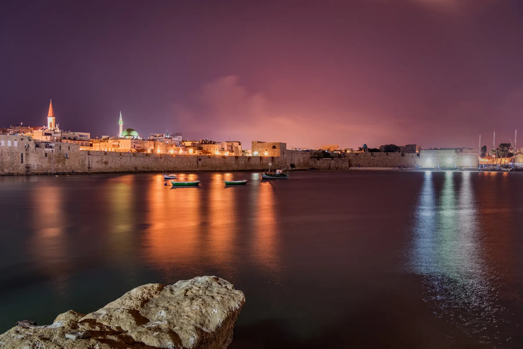
Akko Old City
The Ottoman port town inside the walls stands roughly eight metres above the Crusader city it was built on, and one ticket of ₪55 opens six of the sites inside, including the Hospitaller Fortress and the Templars Tunnel.
Ofery / CC BY-SA 4.0 · Wikimedia Commons
Archaeological site
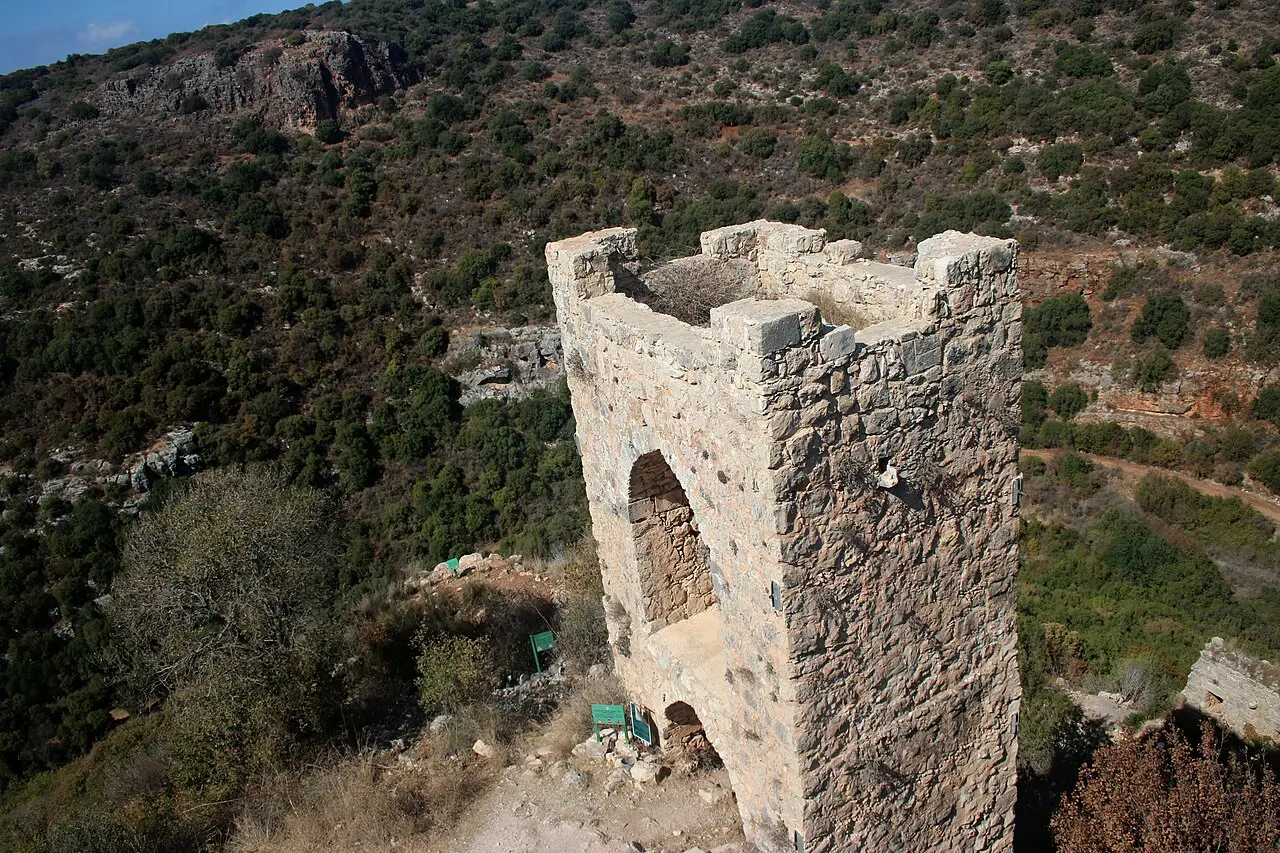
Montfort Castle
The Teutonic Order bought this spur above Nahal Kziv from the de Milly family in 1220 and moved its archive and treasury here in 1229, out of reach of the Templars and Hospitallers in Acre.
שלמה רודד / CC BY 2.5 · Wikimedia Commons
Nature reserve
Tel Dan Nature Reserve
The largest of the Jordan River's three headwaters rises inside this 48 hectare reserve, and the trail that follows it ends at a mudbrick city gate of about 1750 BCE that still stands seven metres high.
Sources and further reading
Every link below was opened and checked when this page was written. Official statements are marked as such: they are the subject's own account, not an independent one.
- OfficialOld Akko and Nazareth Development Companyakko.org.ilOld Akko: attractions and ticket prices
The combined Akko and Rosh Hanikra ticket at ₪90 per person, published alongside the ₪55 Akko-only ticket. The only currently loading page carrying a shekel price that covers this site
- ReferenceWikipediaen.wikipedia.orgRosh HaNikra grottoes
The 200 metre length of the grottoes, the 400 metre tunnel of 1968, the 60 degree gradient and the unsourced 'steepest in the world' claim, the 1942 railway works, and the areas and dates of the four protected declarations
- ReferenceHebrew Wikipediahe.wikipedia.orgראש הנקרה
The geology of the Rosh Hanikra member of the Deir Hanna formation, the 70 metre cliff and 300 metre ridge, the drowned caves and the evidence for a former shoreline, Braslavi's swim, the 1962 development by the Sulam Tzor regional council, and the flora and fauna of the reserve
- ReferenceHebrew Wikipediahe.wikipedia.orgרכבל ראש הנקרה
The 102 metre line, the 70 metre upper station, the Doppelmayr build with the Technion, Swoboda cabins of fifteen, the single cable and four grips, and the company's figure of two or three storm closures a year
- ReferenceHebrew Wikipediahe.wikipedia.orgמנהרות הרכבת בראש הנקרה
The 40th Company of the South African engineers, the inauguration on 14 August 1942 and the completion dates of 24 August and 18 December 1942, the sealing of the northern tunnel, and the 14 March 1948 demolition by the Carmeli Brigade's 21st Battalion
- ReferenceHebrew Wikipediahe.wikipedia.orgמעבר ראש הנקרה
The crossing as the only functioning one on the Lebanese frontier, its use by UN personnel, the pre-civil-war family visits, and the July 2008 exchange
- ReferenceWikipediaen.wikipedia.orgRosh HaNikra Crossing
That the terminal is operated solely by UNIFIL and the IDF and that the passage of ordinary visitors is forbidden, and the 2008 and 2010 crossings
- ReferenceHebrew Wikipediahe.wikipedia.orgשמורת ים ראש הנקרה-אכזיב
The declaration of 6 November 2019, the area of about 100,062 dunams, the 7 kilometres of coast and 15 kilometres seaward, the cut from the original territorial-water proposal, the launch to visitors on 6 June 2023 and the cartilaginous fish records
- ReferenceHebrew Wikipediahe.wikipedia.orgראש הנקרה (קיבוץ)
The founding on 6 January 1949 by Palmach Yiftach veterans, the move to the permanent site on 1 October 1950, and the list of what the kibbutz operates at the tourist site: the cable car, the audio-visual show, the shop, the kiosk and the railway tunnels
- ReferenceThe Avalon Project, Yale Law Schoolavalon.law.yale.eduLebanese-Israeli General Armistice Agreement, March 23, 1949
The full text, and the closing line placing the signature at Ras En Naqoura on 23 March 1949
- ReferenceJewish Virtual Libraryjewishvirtuallibrary.orgRosh Hanikra
An independent account of the 400 metre tunnel, that it took two years to cut, the British railway tunnel and the Palmach demolition, and the wildlife of the reserve
- ReferenceWikivoyageen.wikivoyage.orgRosh Haniqra
Consulted for practical detail and deliberately not used for prices or hours, because its figures carry no date
Rosh Hanikra Grottoes: common questions
What are the Rosh Hanikra grottoes?+
They are sea caves cut by the waves into the foot of a white chalk cliff at the northern end of Israel's Mediterranean coast, on the Lebanese border. Their combined length is about 200 metres, in two main branches that link up. The chalk they are cut into is a soft band in the Deir Hanna formation, which is why the sea has been able to hollow it out.
How do you get down to the caves?+
By cable car, and only by cable car. The line drops 102 metres at a gradient of 60 degrees from a station about 70 metres above the water, in cabins holding fifteen people. From the lower station a tunnel cut in 1968 leads into the grottoes; before that tunnel existed the only way in was to swim from open sea.
Is it really the steepest cable car in the world?+
The site advertises it that way, and the claim has never been sourced. Wikipedia has carried a request for a citation on that sentence since 2017, and no statement from Doppelmayr, which built the line, could be found to confirm it for this page. The gradient of 60 degrees is documented and is genuinely severe. The superlative is the site's own.
How much does it cost?+
The one figure quoted here is the Old Akko and Nazareth Development Company's combined Akko and Rosh Hanikra ticket at ₪90 per person. The single-site price is set at Rosh Hanikra itself, and no shekel figure for the grottoes alone is quoted here. Ring the site or buy through the Akko operator.
How long does it take?+
Reckon on 60 to 90 minutes for the ride down, the grotto walk, the railway tunnel and the film. The walking is short and largely level. What stretches the visit is the queue for the cabins, which run in one direction at a time.
Can you cross into Lebanon here?+
No. The Rosh Hanikra crossing is the only working border crossing between Israel and Lebanon, but it is operated by the Israel Defence Forces and UNIFIL and ordinary visitors are forbidden to use it. It has been opened for specific exchanges, including the return of Samir Kuntar and the bodies of Eldad Regev and Ehud Goldwasser on 16 July 2008.
Is there anything left of the old railway?+
Yes, and you walk through part of it. Two tunnels were cut under the ridge in 1941 and 1942 by the 40th Company of the South African engineers and joined by a bridge over one of the grottoes. The bridge was blown up in 1948 and the northern tunnel was sealed because the international boundary runs inside it. The southern tunnel is the passage visitors use, and an inscription over its portal records the completion in 1942.
Can it be done without a car?+
It is possible but it takes planning. The coastal railway ends at Nahariya, about 10 kilometres south, and the last leg has to be done by bus or taxi from there. Buses on that stretch run a handful of times a day and thin out from Friday afternoon until Saturday night, so a car or an organised trip is the realistic answer for most visitors.
Does it close in bad weather?+
The cable car does, which closes the caves with it. High wind stops the line and heavy spray is a second reason to halt it, since the lower station sits directly on the water behind a wall built to take the impact. The operating company's own figure, as reported in the Hebrew account of the line, is two or three days a year.
Is it worth going, or is it just a cave and a ride?+
It is worth going, with one caveat about expectations. The caves are natural but the experience of them is engineered: a widened, floored and lit walkway, laid out from 1962 onwards, through chambers the sea cut and people then made passable. What survives that treatment is the noise, the colour of the water and the fact that the walk ends at a sealed tunnel with an international boundary inside it. Anyone hoping for wilderness should look at the marine reserve offshore instead.