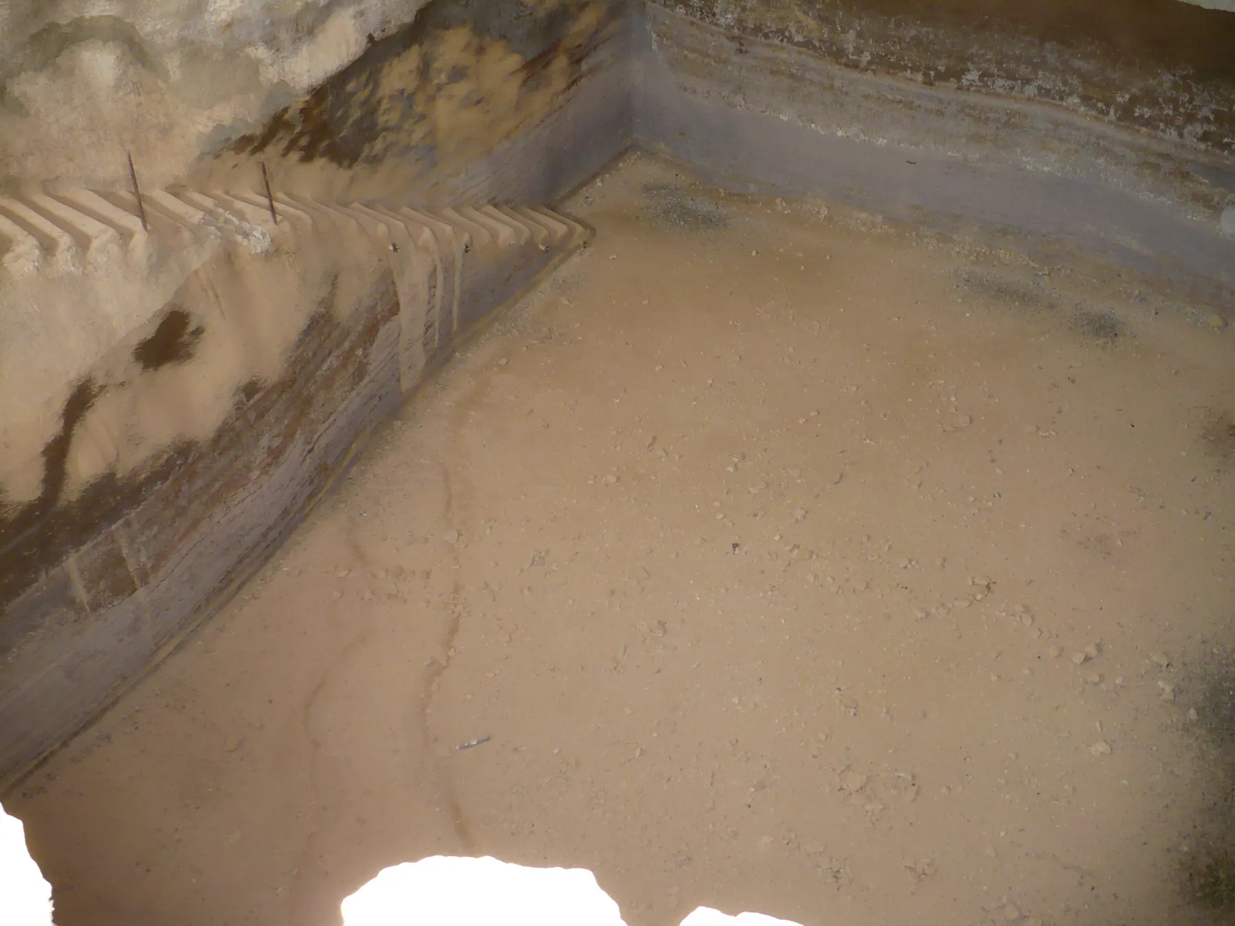
Archaeological site · Masada
The Water Cisterns and Water System
Dams built in the wadi beds diverted flash floods into plastered channels that filled twelve cisterns cut in two rows into the slope, and the parks authority puts their combined capacity at 40,000 cubic metres.
Tribun militum / CC BY-SA 4.0 · Wikimedia Commons
Cisterns on the slope
12
cut in two levels, one row above the other
Combined capacity
40,000 cu m
the parks authority's figure, matched by Encyclopaedia Judaica
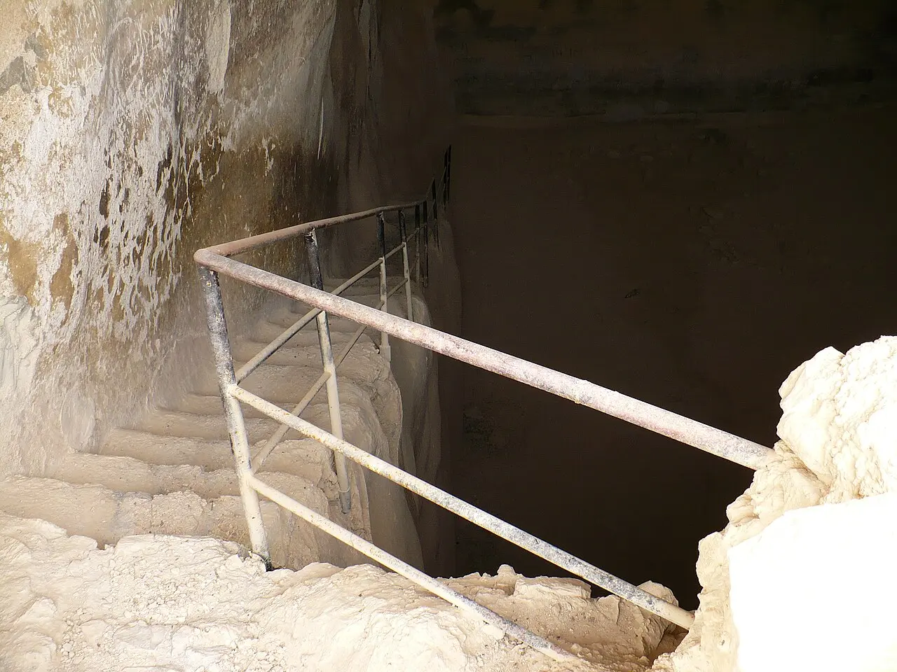
Steps into the southern cistern
64
on the plateau, with a 1941 inscription beside them
The cisterns trail
about 200 m
roughly 30 minutes there and back, published 2024
In short
- How long to give it
- about 30 minutes for the cisterns trail there and back, per the parks authority, plus the plateau visit if you also want the southern cistern
- Cisterns trail
- open in all seasons, but closed on rainy days and after them because of flood risk, and on days of extreme heat
- Adult, park entry, cable car excluded
- ₪37
בורות המים ומערכת המים
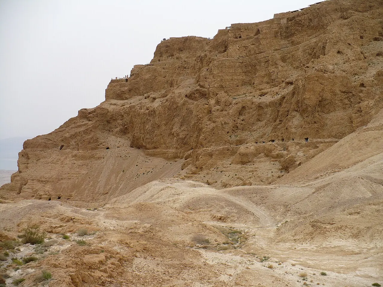
The water system is the thing that made Masada habitable. There is no spring on the rock and no perennial stream near it, so Herod's engineers built a catchment instead: dams in the beds of the wadis below diverted flash floods into plastered channels cut along the hillside, and the channels emptied into twelve very large cisterns quarried into the slope in two levels, one row above the other. The Israel Nature and Parks Authority gives their combined capacity as 40,000 cubic metres.
Nothing about that arrangement is automatic. The cisterns are below the summit, not on it, so the water still had to be lifted the last stretch: pack animals carried it up from the cisterns, through a gate the parks authority calls the water gate, into further storage cisterns on the plateau. The largest of those on top is the southern cistern, a chamber entered down a flight of 64 steps with an inscription scratched beside them by a youth movement in 1941.
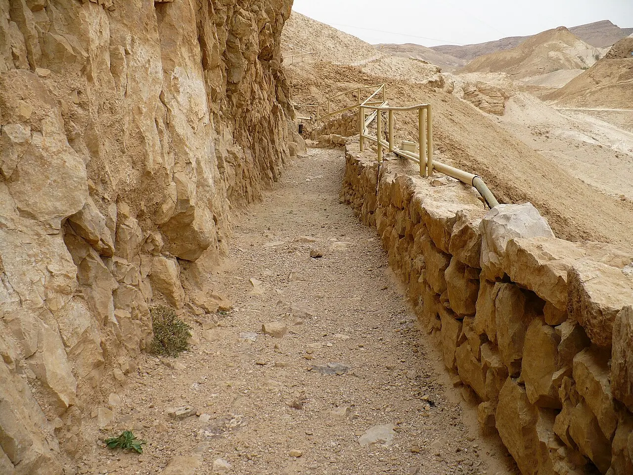
For most of the twentieth century this was something visitors read about rather than walked into. In February 2024 the parks authority published a short marked route from the foot of the Roman ramp on the western side: about 200 metres, about half an hour there and back, reaching two of the cisterns and passing a small bridge of the Roman period that carried the aqueduct across a gully.
The system
Dams in the wadis, channels along the cliff, twelve tanks in the rock
Masada is flanked by two wadis, Wadi Ben Yair on the west and Wadi Masada on the south and east, and neither carries water except after rain. That is the whole problem the system was built to solve, and the solution was to treat a few hours of flood a year as the annual supply. Encyclopaedia Judaica describes dams that diverted the floodwater of the two wadis west of the mountain into two plastered channels, which fed the cistern array; the parks authority's own page for the western side describes dams built in the channels of Nahal Masada doing the same work.
The cisterns themselves are the engineering. Encyclopaedia Judaica counts a dozen of them, cut on two parallel levels into the rocky slope, mostly square in plan, each holding up to 4,000 cubic metres and the set together roughly 40,000. Each was given two openings: a lower one where the aqueduct discharged, and a higher one connected to an internal staircase so that water could be drawn out as the level fell. The staircase is the detail that explains what the interiors look like now, since a flight of cut steps running down one wall is the first thing visible from the mouth.
Getting the water the rest of the way up was done by animal. The parks authority says the water was carried on pack animals from the cisterns through the water gate to storage cisterns on the plateau. Encyclopaedia Judaica adds the routes: one passage climbed from the upper row of cisterns and ended at a gate just south of the Northern Palace, and another led from the lower row to the Snake Path.
The capacity figure is worth pausing on, because the published numbers do not agree. The parks authority and Encyclopaedia Judaica both give about 40,000 cubic metres for the slope cisterns. Britannica describes aqueducts bringing water to cisterns holding nearly 200,000 gallons, which it renders as 750,000 litres, and that is 750 cubic metres: less than a fiftieth of the other figure. The two statements cannot both be describing the same set of chambers, and which subset Britannica is counting is not stated on its page.
- 12 cisterns, cut into the slope on two levels
- Up to 4,000 cubic metres each, per Encyclopaedia Judaica
- Filled by plastered channels fed by dams in the wadi beds
- Two openings apiece: one for the channel, one over an internal staircase
- Water carried up by pack animal through the water gate to cisterns on the plateau
Tribun militum / CC BY-SA 4.0 · Wikimedia Commons
Herod
A reservoir built for a siege that arrived a century late
Josephus is the only ancient writer who describes the works, and he describes them without numbers. In the Whiston translation of The Wars of the Jews he writes that Herod "had cut many and great pits, as reservoirs for water, out of the rocks, at every one of the places that were inhabited, both above, and round about the palace, and before the wall: and by this contrivance he endeavoured to have water for several uses, as if there had been fountains there". The count of twelve, the two levels and the capacity all come from later survey and excavation, not from him.
What Josephus does supply is the reversal that makes the system worth the trouble. When the Roman governor Lucius Flavius Silva besieged the rock, it was the besiegers who had the supply problem: Josephus notes that food had to be fetched from a distance and that "water was also to be brought to the camp: because the place afforded no fountain that was near it". The people on top of the mountain were drinking rain caught by an engineer who had died a century earlier.
The same passage claims that Herod's stores of corn, wine, oil, pulse and dates were still edible when the Romans took the place, nearly a hundred years after they were laid in, and puts it down to the dryness of the air. That is Josephus asserting something, not an excavated fact, and it should be read as the flourish it is. The defensible point underneath it is narrower and better supported: thirst is not what ended the siege.
Tribun militum / CC BY-SA 4.0 · Wikimedia Commons
On the ground
Two hundred metres of path, and two cisterns you can look into
The route the parks authority published on 10 February 2024 starts and ends at the foot of the Roman ramp at Masada West, reached from Arad rather than from the Dead Sea road. It is graded as a linear there-and-back walk suitable for families, about 200 metres long and about 30 minutes for the round trip, and its listed points of interest are the cisterns, an ancient bridge and a lookout.
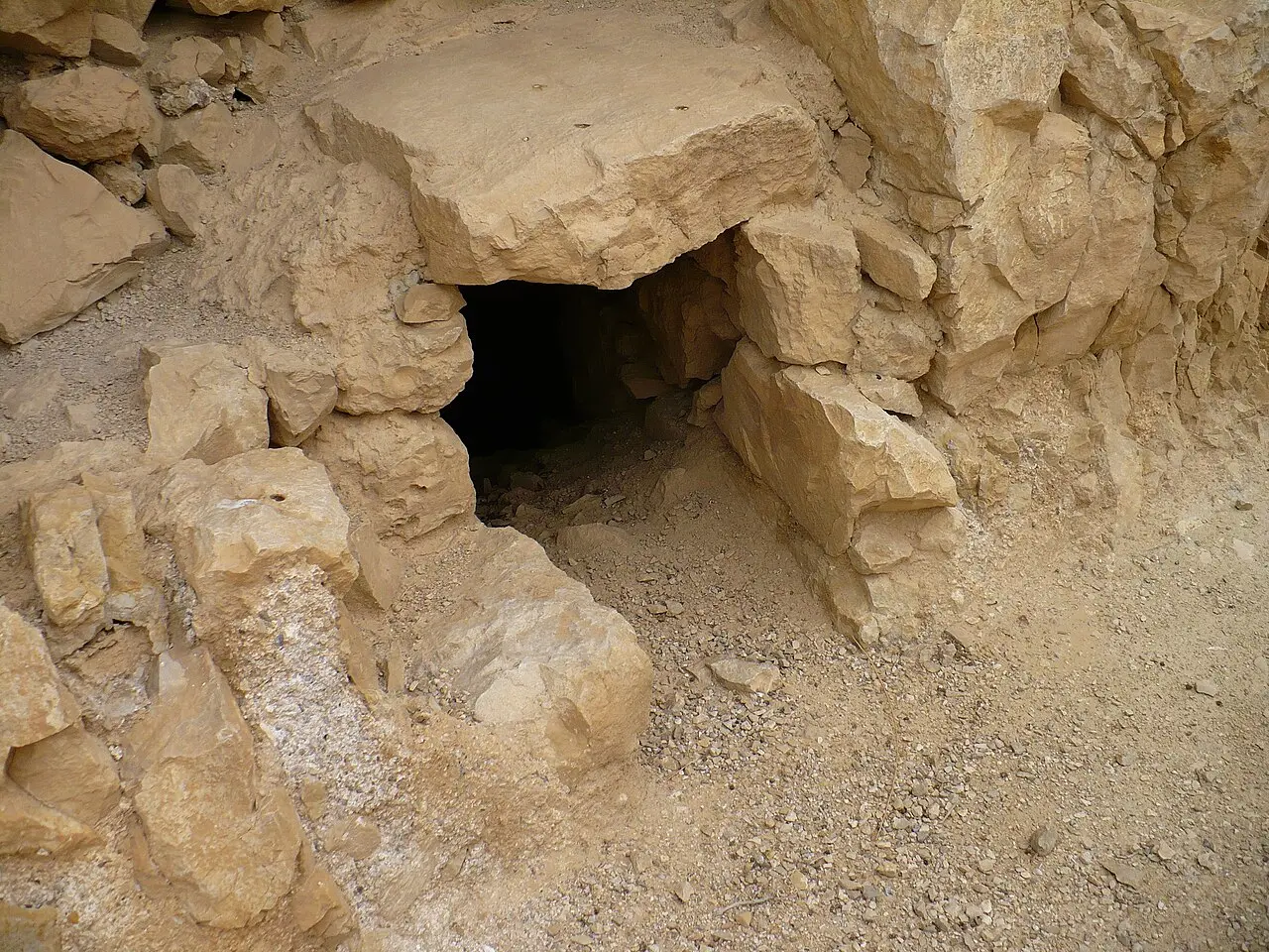
What is on it is unusually concrete for a site of this age. The path gives access to two of the cisterns and a view down into them. On the way it crosses a small bridge of the Roman period which carried the aqueduct over a gully and took people and pack animals as well. Sections of the channels survive alongside, and so does original plaster, which is the part most visitors do not expect: the waterproofing is the working surface of the system, and it is still on the rock.
It is worth being clear about what is ancient and what is not. The cisterns, the channel fragments, the bridge and the plaster are the remains. The walking surface, the signage and the safety furniture are the parks authority's, added to make the place reachable; its description of the route names no reconstruction of the cisterns themselves. This is access rather than restoration.
The trail is open in every season, but it closes on rainy days and in the days after them because of the flood risk, and on days of extreme heat load. The closure has a certain symmetry to it: the floods that shut the path are the floods the whole system was cut to catch.
- About 200 m, about 30 minutes there and back
- Starts at the foot of the ramp, Masada West, from the Arad side
- Two cisterns, a Roman-period bridge, channel remains and original plaster
- Closed on rainy days, after rain, and in extreme heat
Tribun militum / CC BY-SA 4.0 · Wikimedia Commons
On top
Sixty-four steps down, and an inscription from 1941
The southern water cistern is the one most visitors actually enter, and it is a different thing from the twelve on the slope. It sits on the plateau, at the far end from the cable car, and it is a large storage chamber with a flight of 64 steps running to its floor. The wall beside the steps carries an inscription that the parks authority describes as a remnant of a youth movement's visit to Masada in 1941.
That inscription is a small piece of the mountain's modern history left inside a piece of its ancient one. The youth movement ascents of the 1940s, led by Shmarya Guttman, are what turned Masada into a national symbol and what eventually produced the first Israeli excavation. Somebody on one of those climbs went down 64 steps into the dark with something sharp.
The plateau cisterns were the delivery end of the system rather than the bulk of it. The parks authority is explicit that further impressive cisterns exist on the summit and on its eastern flank, but that most of the water was stored in the slope array. The chambers on top held what had been carried up, which is to say what could be moved by animal in a day.
Tribun militum / CC BY-SA 4.0 · Wikimedia Commons
Research
Naval officers, a surveyor and a youth leader
The cisterns were among the first things anyone recognised on the mountain. American scholars identified Masada itself through a telescope from Ein Gedi in 1838; ten years later, in 1848, American naval officers reached the site and identified the cisterns. Encyclopaedia Judaica credits Sandel with discovering the water system in 1905, and records that S. Guttman and A. Alon studied Herod's water system in 1953.
That 1953 season is the one the parks authority treats as the turning point. The first Israeli excavation at Masada, which Guttman drove, identified the water supply system, established the full route of the Snake Path and correctly identified the Northern Palace as Herod's palace. The water system was not an afterthought of that dig; it was one of its three results.
One inconsistency is worth flagging, because a reader comparing pages will hit it. The parks authority's page for the western approach calls these the northern cisterns and places them on the northern slope of Masada. Its page for the cisterns trail places the same system of twelve cisterns on the western slope. Encyclopaedia Judaica describes the upper row's passage ending at a gate just south of the Northern Palace and the lower row's leading to the Snake Path, which puts the array around the north-western corner of the rock. The descriptions are of one system; the labels have simply not been reconciled.
What to look for
Things not to walk past at The Water Cisterns and Water System
The details that repay knowing about before you are standing in front of them.
The two open cisterns
The short trail from the foot of the ramp reaches two of the twelve and lets you look down into them. The cut steps running along one wall are the drawing staircase, not a modern addition.
The Roman-period bridge
A small bridge on the line of the path carried the aqueduct across a gully and took foot and pack-animal traffic as well. It is listed by the parks authority as one of the route's three points of interest.
Original plaster
Stretches of the waterproof lining survive on the channels beside the path. Plaster is what turned a rock-cut hole into a reservoir, and it is the least replaceable thing on the site.
The southern cistern on the plateau
Sixty-four steps lead down into it from the summit, and the wall beside them carries an inscription left by a youth movement in 1941.
The view from the path
The route looks out over Masada West, the Runner's Path, the trail down towards Nahal Tze'elim and the pale marl badlands east of the mountain.
The long view
The Water Cisterns and Water System, in order
37-4 BCE
Herod fortifies Masada and has reservoirs cut from the rock, in Josephus's words at every one of the inhabited places, above the palace, around it and before the wall.
73 or 74 CE
The Roman siege. Josephus records that water had to be hauled to the Roman camp because there was no spring near it, while the defenders drew on Herod's catchment.
1848
American naval officers reach Masada and identify the cisterns, a decade after the mountain itself was identified from Ein Gedi through a telescope.
1905
Sandel discovers the water system, on Encyclopaedia Judaica's account of the research history.
1941
Members of a youth movement visiting Masada cut an inscription into the wall beside the 64 steps of the southern cistern.
1953
The first Israeli excavation, driven by Shmarya Guttman, identifies the water supply system. Encyclopaedia Judaica records S. Guttman and A. Alon as having studied Herod's water system that year.
February 2024
The parks authority publishes a marked 200 metre trail from the foot of the Roman ramp to two of the slope cisterns, with the Roman-period bridge on the way.
Practical
Visiting The Water Cisterns and Water System
Where
Foot of the Roman ramp, Masada West, reached from Arad on road 3199; the cistern with 64 steps is on the plateau, at its southern end
What ticket you need
Both halves of this site are inside Masada National Park and are covered by the park entrance fee. The trail to the slope cisterns is charged and entered on the western side, from Arad on road 3199; the 64-step southern cistern is on the plateau, so reaching it means the Snake Path, the ramp path or the cable car first. The cable car is charged on top of the entrance fee, and the Yigael Yadin museum is charged and reserved separately again.
Opening hours
- Cisterns trail
- open in all seasons, but closed on rainy days and after them because of flood risk, and on days of extreme heatsource
- Roman ramp trail, from the same car park
- opens about 30 minutes before sunrise; ascent about half an hour, difficulty intermediatesource
- Ramp trail in extreme summer heat
- last ascent 11:00, last descent 12:00source
- Park, summer, Sunday to Thursday and Saturday
- 08:00 to 17:00source
- Park, summer, Friday and holiday eves
- 08:00 to 16:00source
- Park, winter, Sunday to Thursday and Saturday
- 08:00 to 16:00source
- Park, winter, Friday and holiday eves
- 08:00 to 15:00source
- Last entry
- one hour before the closing time listedsource
Admission
- Adult, park entry, cable car excluded
- ₪37source
- Child
- ₪21source
- Student
- ₪31source
- Adult in a group of over 30
- ₪31source
- Child in a group of over 30
- ₪18source
- Israeli senior citizen
- ₪19source
- Pupil, Hebrew price list only
- ₪10source
- Cisterns trail itself
- no separate charge is published; it is covered by the national park entrance feesource
Access
Not wheelchair accessible. The southern cistern on the plateau is entered down a flight of 64 steps and there is no alternative route into it, though the plateau itself has concrete paths, railings on steps, benches and shaded gathering places, and the cable car and its bridge are wheelchair accessible. The cisterns trail on the western side is a short unsurfaced desert path graded for families rather than for wheelchairs; what the parks authority lists as accessible at the western entrance is the car park, the toilets, the visitor service centre, the picnic awning, railings at steps and the signage, not the trail. The parks authority runs a coordination form for accessible visits.
On site
- Car park at Masada West
- Toilets
- Visitor service centre
- Picnic awning
- Railings at steps
- Directional and identification signage
- Models of Roman siege weapons
- Cold and hot drinks, snacks, hats and sun cream
Booking
The parks authority runs an online reservation system for Masada National Park and asks visitors to book a time slot; if the slot is full on arrival you will be asked to show the confirmation. No separate booking is published for the cisterns trail. The route description and the downloadable trail sheet are on the Hebrew site only.
Hours and prices are given as the operator publishes them and change without much notice, particularly around Shabbat and the festivals. Check the operator's own page before you travel for this.
Official page at en.parks.org.il →What people wish they had known
- The twelve big cisterns are on the western flank and the trail to them starts at the foot of the Roman ramp, reached from Arad on road 3199. Visitors who arrive at the eastern complex for the cable car are on the wrong side of the mountain for them and will not see them at all.
- Do not plan the cisterns trail as an outing of its own. It is 200 metres and about half an hour there and back, so it works as an addition to the ramp climb or to a night at the Masada West campground, not as a reason to drive from the Dead Sea road.
- The cistern with 64 steps is not one of the twelve. It is on the plateau, at the southern end, so it costs you the walk to the far end of the summit after whichever ascent you have chosen.
- Check the forecast before setting out. The trail closes on rainy days and in the days after them because the wadis flood, and it closes again on days of extreme heat, which between them cover a good many days of the year.
- Read the route description before you leave home if you do not read Hebrew. The parks authority publishes the cisterns trail, its measurements and its downloadable sheet on the Hebrew site, and there is no equivalent English page.
- Look at the plaster, not just the holes. The waterproof lining on the channels beside the path is what made the whole catchment work, and it is the part of the system that survives least often elsewhere.
The figures
The Water Cisterns and Water System by the numbers
Each figure carries the year it belongs to and links the source it came from.
| Measure | Figure | As of | Source |
|---|---|---|---|
| Cisterns cut into the slope | 12, in two levels | 2026 | parks.org.il |
| Combined capacity of the slope cisterns | 40,000 cubic metres | 2026 | parks.org.il |
| Capacity of a single cistern | up to 4,000 cubic metres | Encyclopaedia Judaica, entry by Guy Stiebel | encyclopedia.com |
| Britannica's figure for the cisterns | nearly 200,000 gallons, given as 750,000 litres | 2026 | britannica.com |
| Steps down into the southern cistern | 64 | 2026 | en.parks.org.il |
| Length of the cisterns trail | about 200 m, about 30 minutes there and back | 2026 | parks.org.il |
| Park entry, cable car excluded | ₪37 adult, ₪21 child | 2026 | en.parks.org.il |
While you are here
The rest of Masada
Everything else in this destination with a page of its own.
Jan Helebrant / CC0 · Wikimedia Commons
Archaeological site
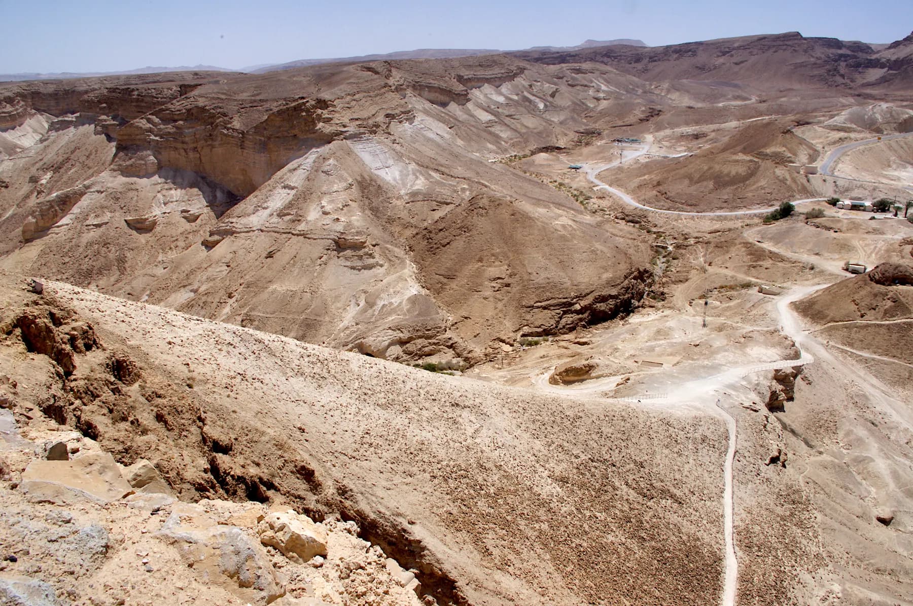
The Roman Assault Ramp
The bank the Tenth Legion raised against Masada's western cliff in the siege of 73 or 74 CE, whose foot the parks authority puts only about 60 metres below the summit, and which now carries the shortest footpath to the top.
Godot13 / CC BY-SA 4.0 · Wikimedia Commons
Archaeological site
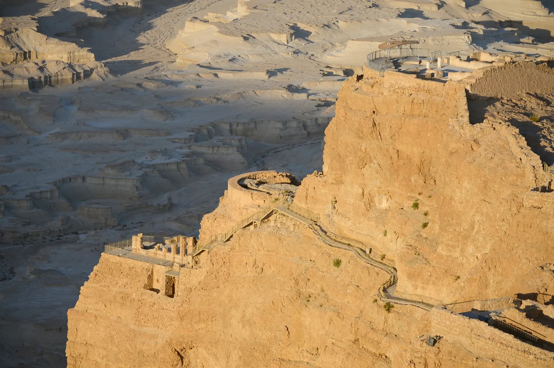
Herod's Northern Palace
Herod's architects hung a private house on three rock terraces at the northern tip of Masada, with about 30 metres of height between the top terrace and the bottom one and retaining walls holding the lower two onto the cliff.
Carole Raddato from FRANKFURT, Germany / CC BY-SA 2.0 · Wikimedia Commons
Archaeological site
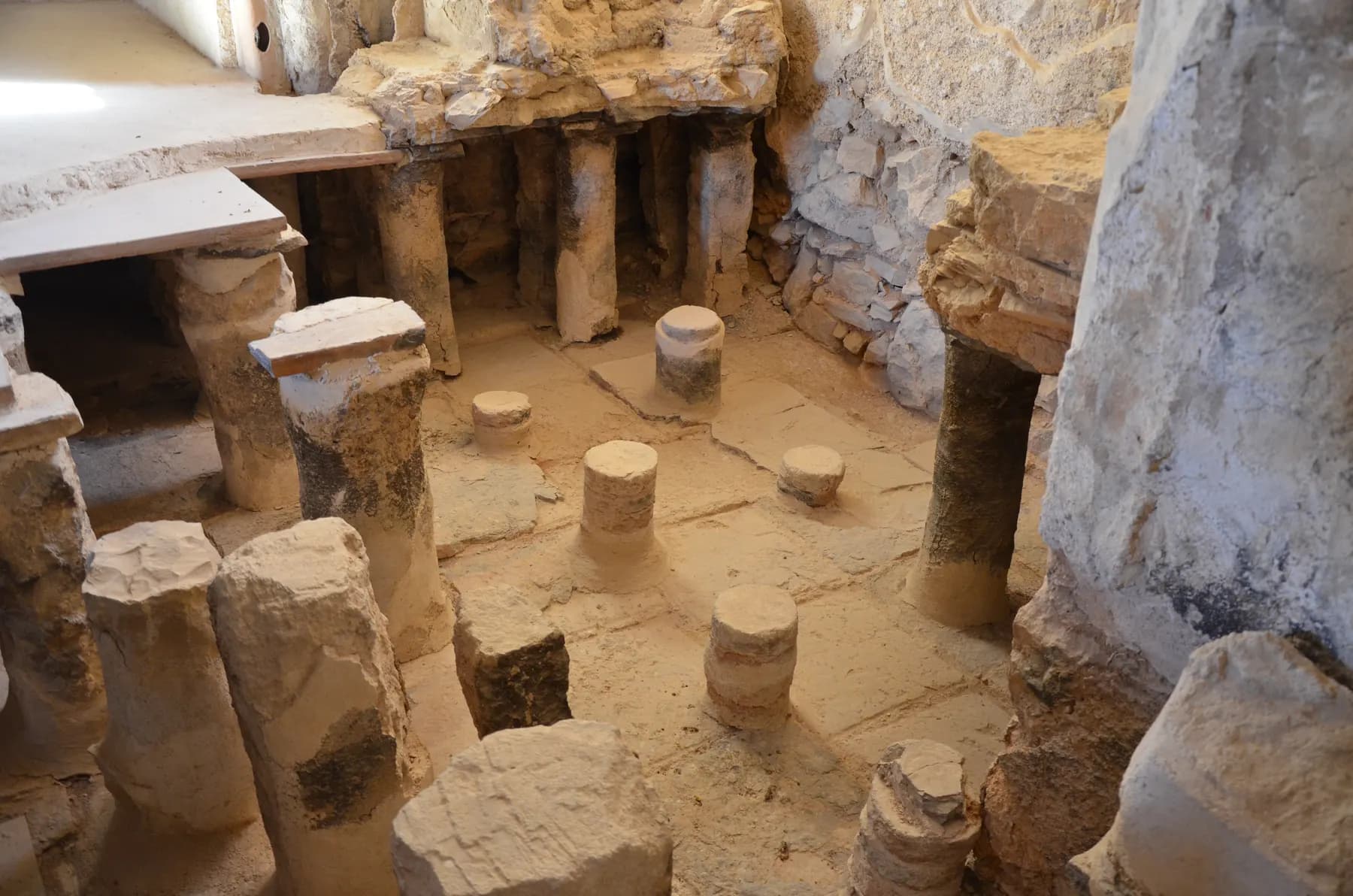
Herod's Large Bathhouse
The floor of the hot room still stands on roughly 200 small columns, most of them brick, with the furnace stokehole, the wall flues and the stepped cold pool all in place around it.
Sources and further reading
Every link below was opened and checked when this page was written. Official statements are marked as such: they are the subject's own account, not an independent one.
- OfficialIsrael Nature and Parks Authorityen.parks.org.ilMasada National Park: The Plateau
The Southern Water Cistern accessed by a flight of 64 steps, with an inscription on the wall near the steps left by a youth movement's visit in 1941; American naval officers identifying the cisterns in 1848; and the 1953 Israeli excavation which identified the water supply system, discovered the full route of the Snake Path and identified the Northern Palace as Herod's palace
- OfficialIsrael Nature and Parks Authorityen.parks.org.ilMasada National Park
Summer and winter opening hours with entry closing one hour before the listed time; entrance fees of ₪37 adult, ₪21 child, ₪31 student and group adult, ₪18 group child, ₪19 Israeli senior and ₪20 museum; the Roman ramp trail opening about 30 minutes before sunrise from Arad on road 3199 with the last ascent at 11:00 and descent at 12:00 in extreme heat; Wadi Ben Yair and Wadi Masada; accessibility at the western entrance and on the plateau; and the flood warning
- OfficialIsrael Nature and Parks Authority (Hebrew)parks.org.ilגן לאומי מצדה, price tables
The fee rows the English page omits, including the ₪10 pupil rate, ₪21 for a soldier and ₪28 for reserve duty, alongside the one-way cable car at ₪32 adult and ₪16 child and the return at ₪54 and ₪32, all excluding park entry
- OfficialIsrael Nature and Parks Authority (Hebrew)parks.org.ilשביל הסוללה בגן לאומי מצדה
The paragraph headed the northern cisterns: Herod built a water collection array of impressive size, dams he built in the channels of Nahal Masada diverted floodwater into channels, and the channels filled 12 enormous cisterns hewn into the slope on two levels with a capacity of 40,000 cubic metres, from which the water was carried on pack animals through the water gate to storage cisterns on the plateau; also that the cisterns are clearly visible from the western entrance, and that the foot of the ramp is only about 60 m below the summit
- OfficialIsrael Nature and Parks Authority (Hebrew)parks.org.ilפלא הנדסי קדום: שביל בורות המים במצדה
Published 10 February 2024. Places the system of 12 cisterns on two levels on the western flank; gives the trail as about 200 m and about 30 minutes there and back, linear, suitable for families, starting and finishing at the foot of the ramp at Masada West from the Arad direction; access to two cisterns and a view into them; a small bridge of the Roman period carrying the aqueduct as well as people and pack animals; remains of the channels and original plaster; views of Masada West, the Runner's Path, the trail to Nahal Tze'elim and the Masada marl; and closure on rainy days, after rain and in extreme heat
- OfficialIsrael Nature and Parks Authority (Hebrew)parks.org.ilבמת ההר בגן לאומי מצדה
The Hebrew description of the southern water cistern as a large storage cistern on the plateau with a flight of 64 steps down to its floor and an inscription cut into the wall beside the steps, a remnant of a youth movement's visit to Masada in 1941
- ReferenceEncyclopaedia Judaica, entry by Guy Stiebel (via Encyclopedia.com)encyclopedia.comMasada
A dozen large cisterns cut on two parallel levels into the rocky slope, mostly square, each holding up to 4,000 cubic metres and together about 40,000; two openings apiece, one from the aqueduct and a higher one connected with an inner staircase for drawing water; dams diverting the floodwater of the two wadis west of Masada into two plastered channels; pack animals bearing the water up to the cisterns on the mountaintop; a passage from the upper level ending at a gate just south of the Northern Palace and another from the lower level to the snake pass; Sandel discovering the water system in 1905 and S. Guttman and A. Alon studying Herod's water system in 1953
- ReferencePenelope, University of Chicagopenelope.uchicago.eduThe Wars of the Jews, Book VII (Whiston translation)
Herod having cut many and great pits as reservoirs for water out of the rocks at every one of the inhabited places, above and around the palace and before the wall, so as to have water as if there had been fountains there; water having to be brought to the Roman camp because the place afforded no fountain near it; and the stores of corn, wine, oil, pulse and dates said to be still sound after nearly a hundred years
- ReferenceEncyclopaedia Britannicabritannica.comMasada
Herod's aqueducts described as bringing water to cisterns holding nearly 200,000 gallons, rendered as 750,000 litres, which is the figure that conflicts with the 40,000 cubic metres given by the parks authority and Encyclopaedia Judaica
The Water Cisterns and Water System: common questions
What is the Masada water system?+
It is a rainwater catchment built to supply a mountain with no spring. Dams in the wadi beds below diverted flash floodwater into plastered channels along the hillside, and those channels filled twelve very large cisterns cut into the slope in two levels. Water was then carried up to further cisterns on the plateau by pack animal.
How much water did the cisterns hold?+
The Israel Nature and Parks Authority gives 40,000 cubic metres for the twelve slope cisterns, and Encyclopaedia Judaica agrees, putting each cistern at up to 4,000 cubic metres. Britannica states a much smaller figure, cisterns holding nearly 200,000 gallons or 750,000 litres, which works out at 750 cubic metres. The published sources do not agree and it is not clear what Britannica is counting.
Can you go inside the cisterns?+
You can go into the southern cistern on the plateau, down its flight of 64 steps. On the western slope the parks authority's short trail gives access to two of the twelve cisterns and a view into them rather than free run of the interiors.
Where does the cisterns trail start?+
At the foot of the Roman ramp at Masada West, on the western side of the mountain, reached from Arad on road 3199 rather than from the Dead Sea road. The parks authority gives the Waze destination as Masada West national park.
How long does the cisterns trail take?+
About 30 minutes there and back, over roughly 200 metres. The parks authority grades it as a linear out-and-back route suitable for families, with the cisterns, an ancient bridge and a lookout as its points of interest.
Do I need a separate ticket for the water cisterns?+
No. The trail and the plateau cistern are both inside Masada National Park and no separate charge for them is published. Park entry is ₪37 for an adult and ₪21 for a child, with student, group and senior rates, and the cable car is charged on top of that.
Is the site wheelchair accessible?+
No. The southern cistern is reached down 64 steps with no alternative way in, and the trail on the western slope is a short desert path over natural ground. The parks authority lists the western entrance car park, toilets, visitor service centre and picnic awning as accessible, but not the trail, and it runs a coordination form for accessible visits.
Is the water system worth seeing if I have limited time on Masada?+
It depends on which side you are on. If you are climbing the Roman ramp from Arad the trail is half an hour and starts at the car park, which makes it easy to justify. If you are coming up the cable car from the Dead Sea side, the twelve cisterns are on the far flank and the honest answer is that the southern cistern on the plateau is the piece of the system you will actually see.
Why did the defenders not run out of water during the Roman siege?+
Because Herod's catchment had already solved the problem a century earlier, and because the siege was short. Josephus records the opposite difficulty on the Roman side, noting that water had to be brought to the camp since there was no spring near it. Modern scholarship reads the siege as a matter of weeks or months rather than years, so thirst never became the deciding factor.
Is there any shade on the trail?+
Effectively none. It is a short unshaded desert path on a west-facing slope, which is why the parks authority closes it on days of extreme heat load. There is a picnic awning back at the western entrance, and the service centre there sells cold drinks, hats and sun cream.