
Judaean Desert
Masada
A desert plateau some 450 metres above the Dead Sea, carrying Herod's palace, the most complete Roman siege works to survive anywhere, and an unfinished argument about what happened here.
Clifftop height
about 450 m
above the Dead Sea shore, per the parks authority
Summit
about 650 × 300 m
a flat-topped horst broken away from the escarpment
Roman camps
8
linked by roughly 4.3 km of siege wall
World Heritage
inscribed 2001
Israel's first site on the UNESCO list, with Akko
Snake Path
about 1 hour up
graded high difficulty by the parks authority
Things to do
11 sites, each with its own page
in Masada
Restaurants
10 picks
in Masada
Hotels
8 picks
in Masada
Getting there
7 routes
in Masada
When to go
Month by month
in Masada
מְצָדָה · Judaean Desert, above the western shore of the Dead Sea
Masada is a flat-topped rock in the Judaean Desert, standing roughly 450 metres above the Dead Sea shore with a summit about 650 metres long and 300 metres wide. Geologically it is a horst: a block that rose and detached from the Ha-'Etekim escarpment behind it, leaving sheer faces on every side and two wadis cutting the ground below. The Israel Nature and Parks Authority, which has run the site as a national park since 1966, describes that detachment as still visible in the southern part of the mountain.
Herod, who ruled Judaea from 37 to 4 BCE, turned the rock into a palace-fortress in the manner of the early Roman East: a three-tiered palace hanging off the northern cliff, a bathhouse with a hypocaust floor, storerooms, and cisterns cut to catch flash-flood water in a place that gets almost none. A century later, rebels of the First Jewish Revolt held it, and the Roman governor Lucius Flavius Silva came with an army, ringed the mountain with a wall and eight camps, and built a ramp up the western flank. What happened on the last night is known from a single ancient writer, Josephus, and is argued over to this day.
For a visitor the practical questions are simpler: which way up, and how early. There is a cable car from the eastern side, a steep zigzag called the Snake Path, and a shorter path up the Roman ramp from the Arad side. All three are governed by the heat.
The setting
A block of rock that broke away from the desert cliff
Masada sits on the eastern edge of the Judaean Desert between Sodom and Ein Gedi, with Wadi Ben Yair on the west and Wadi Masada to the south and east. The parks authority gives the summit as roughly 650 metres long by 300 metres wide, and the mountain as about 450 metres above the Dead Sea; Britannica puts the height above the lake at 434 metres and the summit area at about seven hectares. The two sets of figures sit together better than they look: 650 and 300 are the greatest length and width of an irregular lozenge, not the sides of a rectangle, so the area enclosed comes out well below the product. The gap between 450 and 434 metres is most likely the shoreline rather than the rock: the Dead Sea surface had fallen to about 430 metres below sea level by the mid-2010s, from about 400 metres below in the mid-twentieth century, and was still dropping roughly a metre a year.
East of the mountain a pale marl plain runs to the water, scored with rills and gullies left by sediment from the ancient Lisan Sea. It is this plain that holds the Roman camps, and the reason they survive is the same reason nothing grows here: the air is dry, the ground is stony, and nobody had a use for the stones afterwards. Two ancient roads passed close by, linking Edom, Moab and the Arava with Ein Gedi and Jerusalem: remote enough to be safe, close enough to matter.
- A horst: a block uplifted and detached from the Ha-'Etekim cliff
- Sheer on all sides, with two wadis cutting the ground below
- Declared a national park in 1966
- Inscribed by UNESCO as a World Heritage Site in 2001
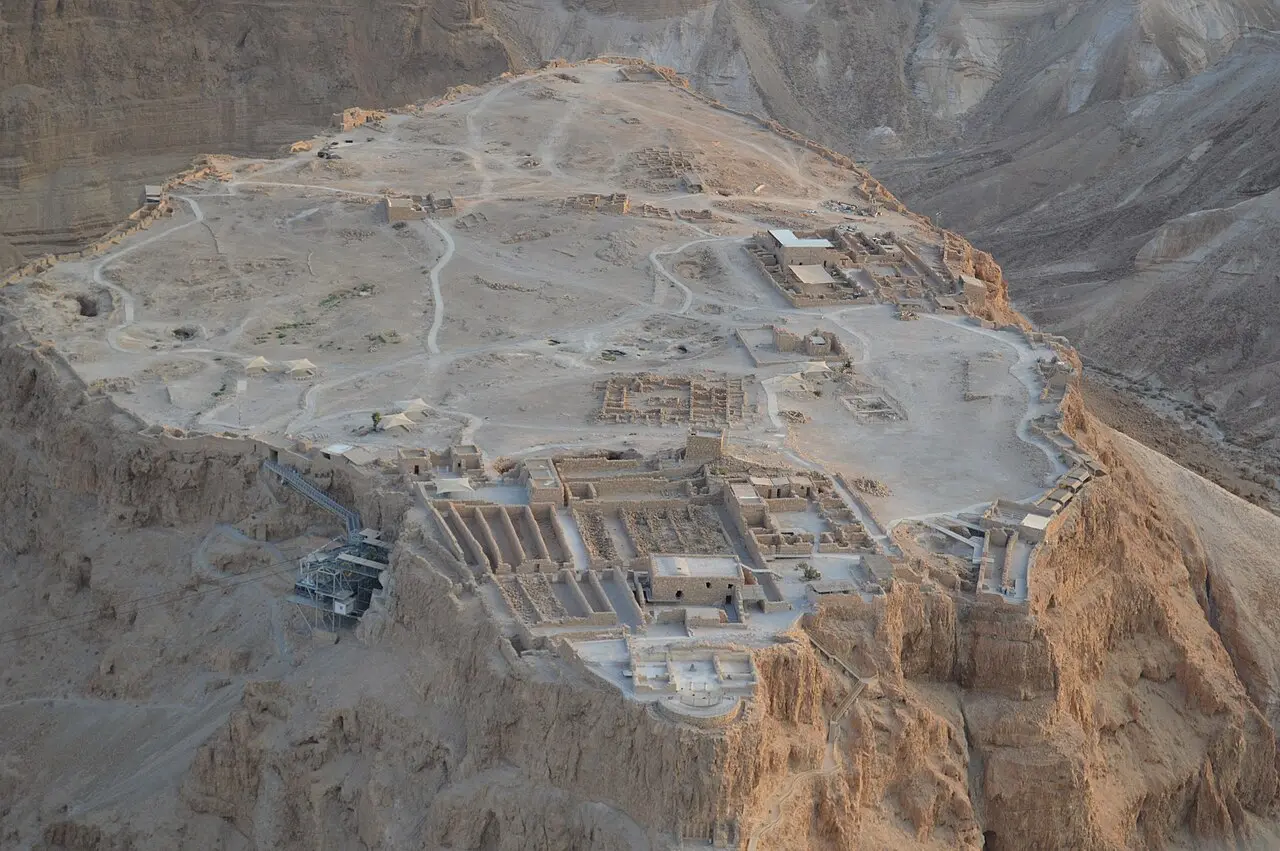
BACbKA / CC BY-SA 4.0 · Wikimedia Commons
Herod
The palace on the edge of the cliff
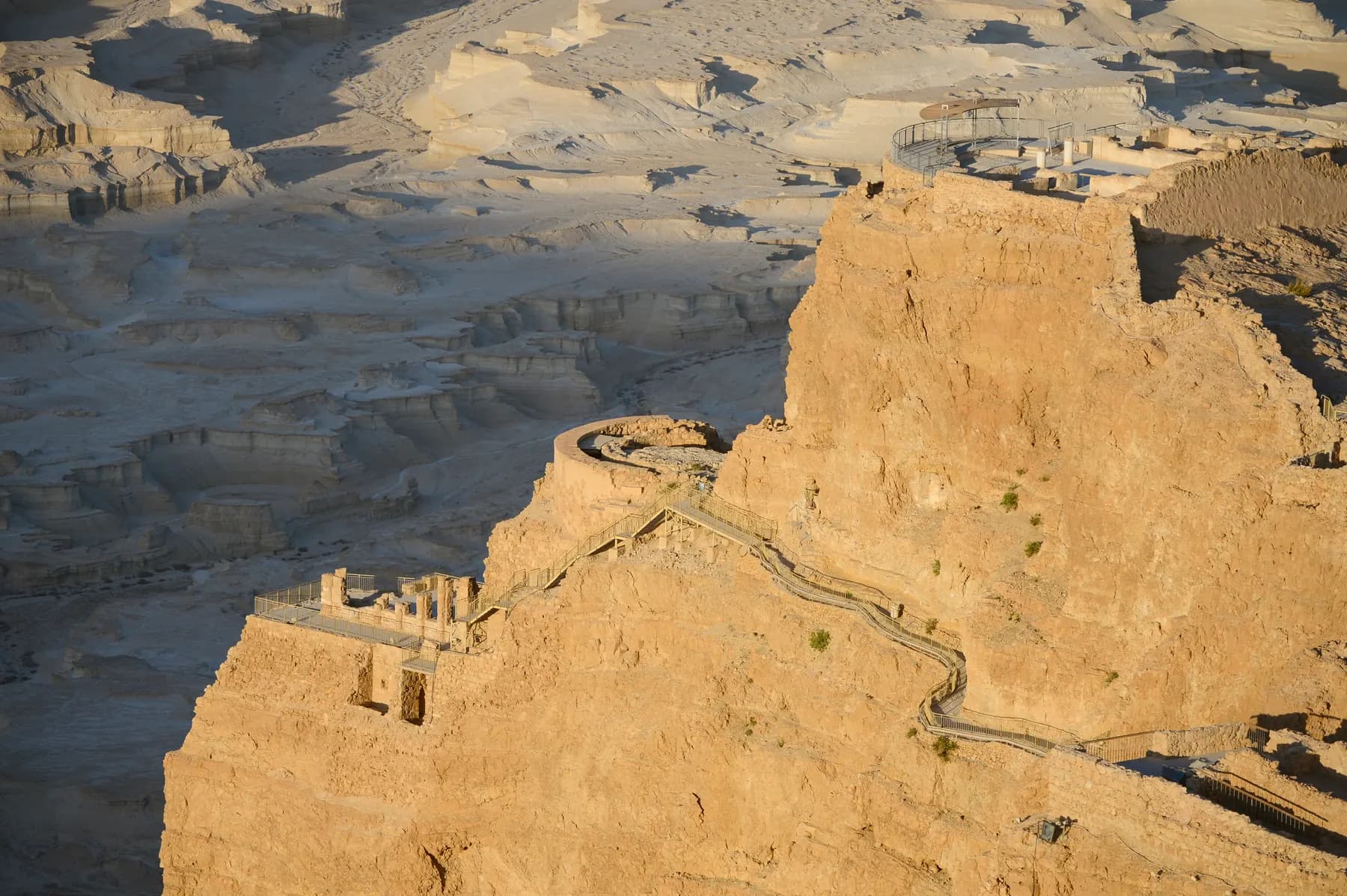
The Northern Palace is the piece that photographs badly and stuns in person. Herod's architects hung a private residence on three rock terraces at the northern tip of the plateau, with about 30 metres of height between top and bottom and retaining walls doing work that looks impossible from below. The top terrace held four rooms and a central hall, paved with geometric mosaics and painted; a semicircular colonnaded balcony looked out over the escarpment, the Dead Sea and, later, the Roman siege works. The middle terrace carried a circular chamber for entertaining, the lower one walls frescoed in imitation of coloured marble.
The Western Palace is the largest building on the mountain at 3,700 square metres, with a room whose floor carries four depressions that may have held the legs of a throne. The bathhouse is Roman in every detail: a colonnaded exercise courtyard, a frescoed changing room, a stepped cold pool, and a hot room whose floor rests on small columns with hot air drawn through clay pipes in the walls. During the revolt the changing room was turned into a ritual immersion pool, which tells you something about who was living there.
None of it works without water. Cisterns were cut into the rock and fed by channels catching the flash floods; Britannica reckons the system held on the order of 750,000 litres. One southern cistern is reached by 64 steps, its wall still carrying an inscription left by a youth movement in 1941.
- Northern Palace: three terraces, about 30 m of height difference
- Western Palace: 3,700 sq m, the largest structure on the plateau
- Roman-style bathhouse with an intact hypocaust floor
- A synagogue converted by the rebels from a Herodian stable
- A Byzantine church with a mosaic floor, from the monastic period
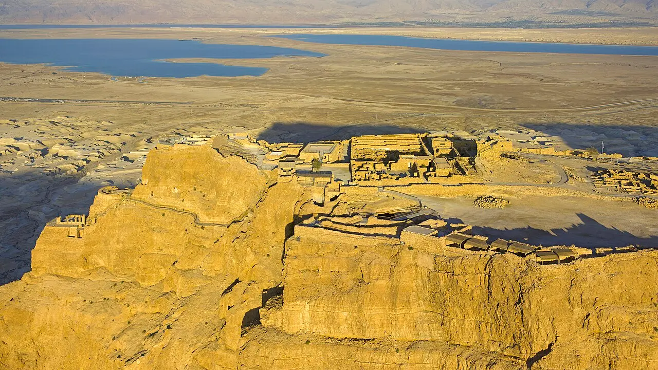
Godot13 / CC BY-SA 4.0 · Wikimedia Commons
The siege
Eight camps, a wall and a ramp
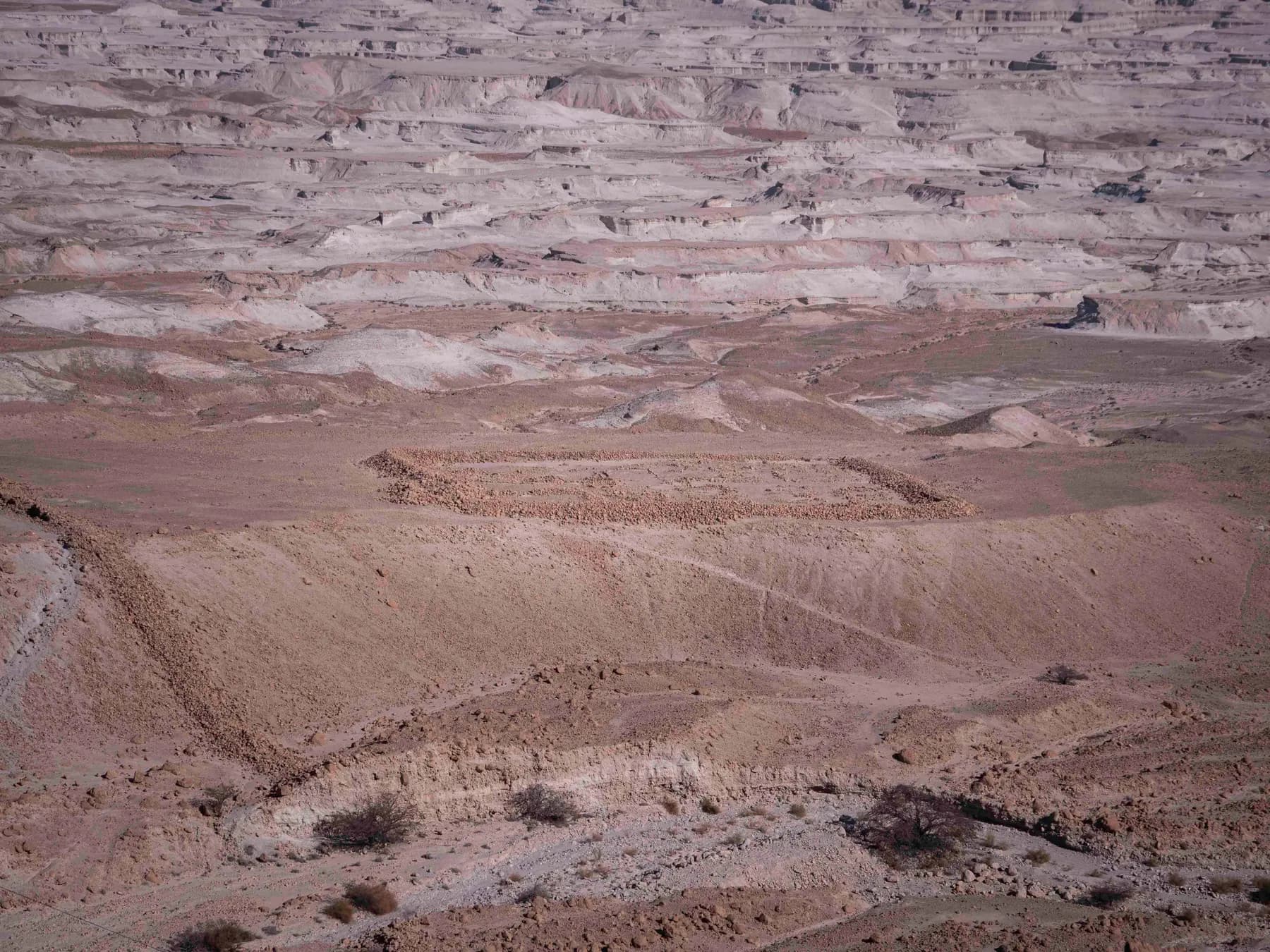
After Jerusalem fell in 70 CE, Masada was among the last places still held against Rome. The governor Lucius Flavius Silva, successor to Lucilius Bassus, brought roughly 8,000 men built around Legio X Fretensis (a legion already blooded at Gamla, Jerusalem and Machaerus, on Jodi Magness's account) and did what Roman armies did: sealed the mountain off. Eight camps, lettered A to H by archaeologists, ring the base; B and F are conspicuously larger, having housed the legionary troops, and a stone circumvallation wall runs between them all.
A 2024 study in the Journal of Roman Archaeology by Hai Ashkenazi, Omer Ze'evi-Berger, Boaz Gross and Guy D. Stiebel put a photogrammetric 3D model over the conflict landscape and produced numbers rather than impressions: about 4,290 metres of circumvallation wall plus roughly 1,980 metres of camp fortification, 15 towers along the eastern and northern stretches, some 26,700 cubic metres of stone. The wall stood 2 to 2.5 metres high, and the authors read parts of it as much a psychological instrument as a barrier: you were meant to look down at it every morning.
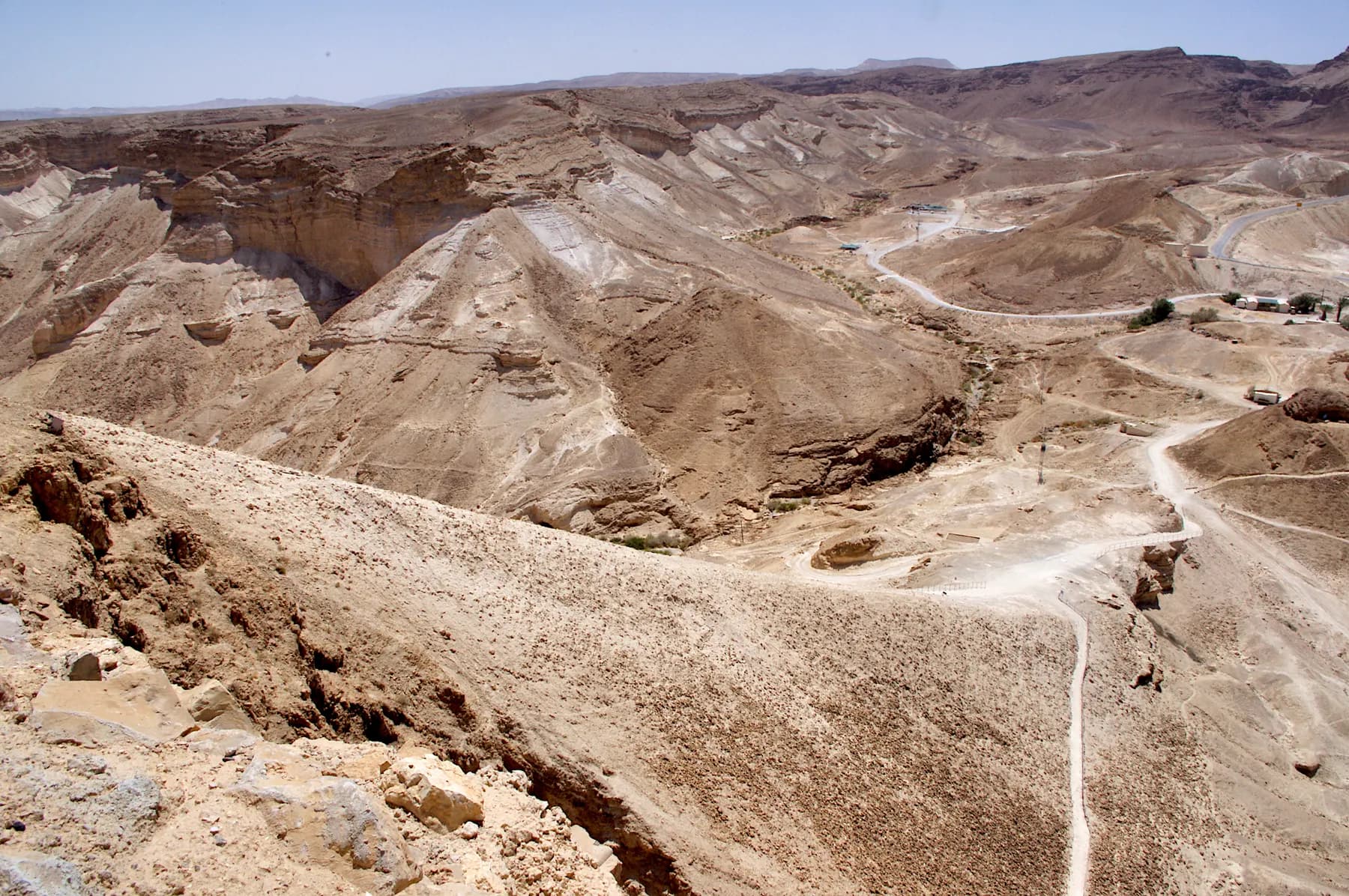
The famous ramp climbs the western flank. Josephus describes Silva raising it at a place he calls the white promontory until the bank stood 200 cubits high, then setting an iron-plated tower and a battering ram on top; Britannica gives the finished work as about 600 metres long and around 61 metres high. Geological analysis indicates it was raised over a natural spur rather than heaped from nothing, though Magness, who has excavated here, records that her team never reached the spur itself.
The arithmetic is the point of the recent work. The 2024 team calculated that 5,000 soldiers could have thrown up the wall and the camps in 11 to 16 days. The old picture of a fortress holding out for three years has largely gone: Magness writes that the siege 'lasted no longer than six months and almost certainly was much shorter, perhaps as little as seven weeks from beginning to end.'
- 8 camps, A to H; 15 towers on the eastern and northern stretches
- About 4,290 m of circumvallation wall (JRA, 2024)
- Roughly 26,700 cubic metres of stone moved
- The ramp appears to be built over a natural spur
- Modern estimates: weeks, not years
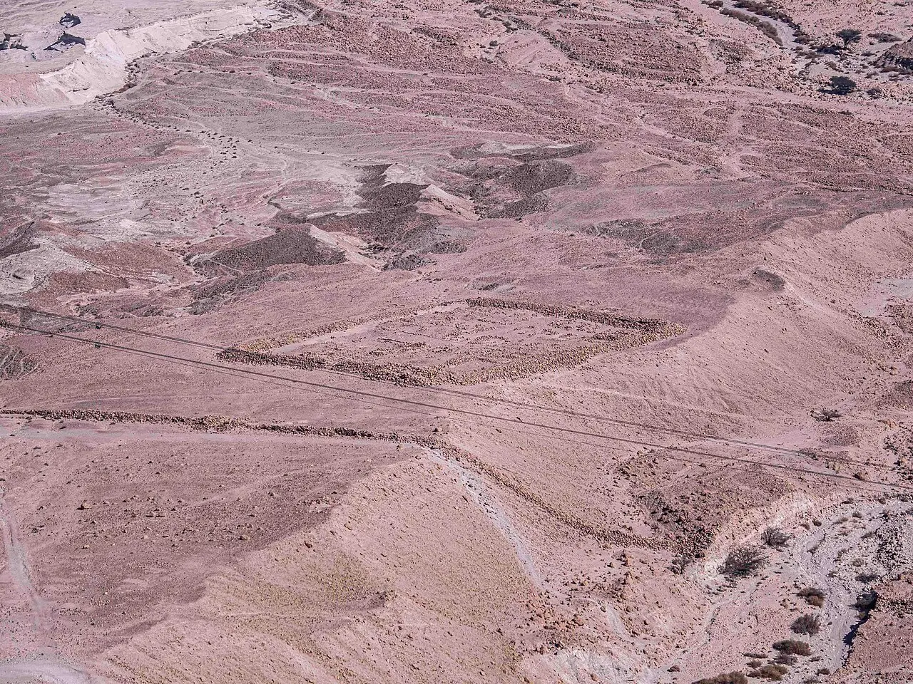
יוסי רון / CC BY 2.5 · Wikimedia Commons

The argument
What Josephus says, and what scholars will not sign
Everything anyone knows about the last night comes from one source: Flavius Josephus, writing decades later for a Roman readership, who was not there. In his account the rebel commander Eleazar ben Yair persuades the defenders that death is preferable to enslavement; the men kill their families, ten are chosen by lot to kill the rest, and 960 people die, 'the women and children being withal included in that computation'. Two women and five children survive by hiding in caverns underground and tell the Romans what happened.
The date is not settled either. Josephus's narrative has long been read as putting the fall in the spring of 73 CE (Whiston's translation carries an editorial '[A.D. 73]' beside the slaughter) but the year turns on when Silva took the governorship from Bassus, which the ancient evidence does not fix. Britannica gives 73 or 74 CE; Jodi Magness's book opens on exactly that hesitation, heading its first chapter 'The Siege of Masada (72–73 or 73–74 CE)'.
The suicide itself is disputed on archaeological grounds. Yigael Yadin picked twelve inscribed potsherds out of some 250 found on the mountain (one bearing the name 'Ben Yair', the hand apparently the same throughout) and read them as the lots of Josephus's story, though he names ten men and there are twelve sherds. The epigrapher Joseph Naveh found them too like the sherds used as tags for distributing food to be identified as the lots, and the parks authority's description of the Room of the Lots offers both readings without choosing. Skeletons were not found massed as the account implies, and lay alongside pig bones. Hillel Geva reads a large debris mound near the Northern Palace as a Roman assault ramp, and concludes from it that there was no mass suicide. Magness holds that archaeology cannot settle it: 'it is not a question that archaeology is equipped to answer.'
What the archaeology does support is the shape of the thing: a Roman army, a systematic siege, a breach in the casemate wall that is still visible at the top of the ramp, and, in Britannica's summary of the evidence, combat at the site in this period. The choreography of the last hours is literature until someone finds evidence that is not.

Excavation
From a telescope at Ein Gedi to Yadin's volunteers
Masada was identified in 1838 by the American scholars Edward Robinson and Eli Smith, who picked out the shape of the northern cliff through a telescope from Ein Gedi and guessed, correctly, that it was Herod's palace. Four years later the American missionary Samuel Wolcott and the British artist William Tipping climbed to the summit and drew it; American naval officers found the cisterns in 1848, and Félix de Saulcy dug the Byzantine church and surveyed the siege system soon after.
Charles Warren and Claude Conder of the Palestine Exploration Fund surveyed the mountain and the Roman camps in 1865 and located the Snake Path. The German archaeologist Adolf Schulten spent about a month here in 1932 and laid the groundwork for everything after, though he misread the Northern Palace as a fortification at the head of the path.
In the 1940s Shmarya Guttman brought youth movements up the rock and made it a symbol; he drove the first Israeli excavation in 1953, which traced the water system, recovered the full route of the Snake Path, correctly identified the Northern Palace and dug Roman camps A and C. Yigael Yadin's expedition began in 1963 and, over two field seasons with thousands of volunteers from around the world, excavated nearly the whole site. Later work has continued under Ehud Netzer and Guy Stiebel.
The finds are not only architectural. Fragments of biblical parchment came out of two pits in the floor of the rebels' synagogue (apparently its genizah) with more scrolls and papyri from the adjoining 'casemate of the scrolls'. Dried fruit survived, and so did a woman's braided hair, found in the bathhouse of the Northern Palace beside three skeletons.
Afterlife
The rock as an argument about Israel
The slogan 'Masada shall not fall again' became symbolic of the modern state after 1948, and it did a great deal of national work; the Israel Defense Forces held induction ceremonies on the summit for many years. Jodi Magness puts the appeal plainly: the example of Jews 'putting up a heroic resistance to the death instead of going meekly to their slaughter had great appeal in the wake of the Holocaust and at a time when Israel's population felt embattled'. She adds that in today's post-Zionist era the story has become a less compelling model for Israelis, and that scholarly views have moved too.
There are counter-arguments. One is that a mass suicide sits awkwardly against Judaism's prohibition on taking one's own life, a tension Magness notes even admirers must reconcile, though on Josephus's account only the last man died by his own hand. The other concerns who was on the rock: the dominant faction was the Sicarii, whom Britannica calls an extremist sect and whom Josephus portrays turning on Jews willing to submit to Rome.
UNESCO inscribed Masada in 2001, in the same year as the Old City of Akko and two years after Israel signed the World Heritage Convention. The listing rests on two distinct claims: that Herod's Northern Palace is an outstanding example of a luxurious villa of the early Roman period, and that the works below it are, in UNESCO's words as quoted by the parks authority, 'the finest and most complete Roman siege works to have survived to the present day'.
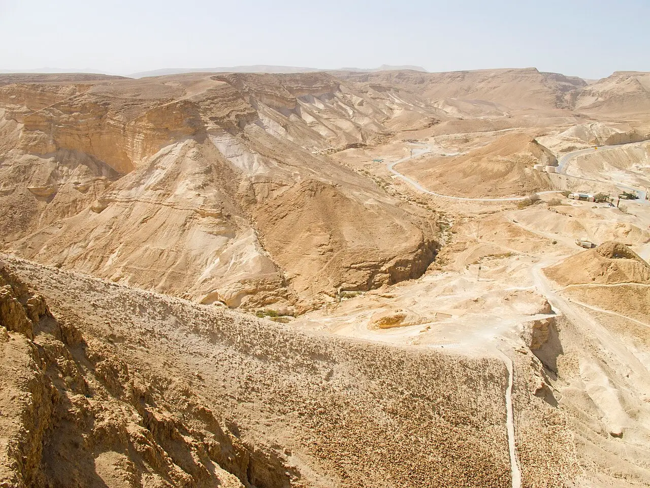
Dan Lundberg / CC BY-SA 2.0 · Wikimedia Commons
Getting up
Snake Path, cable car or the Roman ramp
Three ways up, and they are not equivalent. The Snake Path leaves from the eastern, Dead Sea side and zigzags up the face: a steep earthen path, much of it built steps with railings, timed by the parks authority at about an hour and graded high difficulty. It opens for ascent about an hour before sunrise, and closing times are dictated by heat rather than the clock. On the schedule the parks authority published in 2026, ordinary hot weather puts the last ascent at 10:00 and the last descent at 11:00; very hot weather 08:00 and 09:00; extreme summer heat 07:00 and 08:00.
The cable car runs from the visitor centre on the same eastern side to a suspension bridge at the top, so there are no steps at the upper station. The first line dates from 1971 and was replaced in 1998 to handle larger numbers, with the electronics upgraded in 2020. A car takes up to 80 passengers, though the authority caps each trip at 65, and the ride is about three minutes. It is wheelchair accessible and costs extra on top of the entrance fee.
The third route is the western one, up the Roman ramp itself, reached from Arad on road 3199: intermediate, about half an hour, opening roughly 30 minutes before sunrise. It is the quiet option, and offers the odd experience of walking up the thing the Tenth Legion built. On extreme-heat days the last ascent here is 11:00 and the last descent noon.
- Snake Path: east side, about 1 hour, high difficulty
- Cable car: east side, about 3 minutes, extra fee, step-free at the top
- Roman ramp path: west side from Arad, about 30 minutes, intermediate
- Heat, not opening hours, decides when the paths close
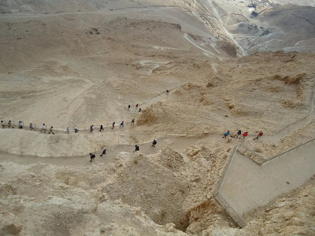
Meg Stewart from Poughkeepsie, NY, U.S.A. / CC BY-SA 2.0 · Wikimedia Commons

Timing
Why everybody comes before dawn
The sunrise is not a marketing conceit; it is a consequence of the climate. At Sedom, down the same shore, 49.9°C was measured on 17 July 2019, the highest temperature recorded anywhere in Israel since June 1942, when Tirat Tzvi reached 54°C, which remains the national record. Long before heat like that becomes a record it becomes a hazard on an unshaded path, which is why the parks authority sets the last ascent by the Israel Meteorological Service forecast and closes the Snake Path to climbers by mid-morning.
So the day starts in the dark. The Snake Path opens about an hour before sunrise and the ramp path about half an hour before; sunrise times shift through the year and the authority expects you to look them up yourself. The reward is the light arriving over the mountains of Moab across the water and moving down the Judaean escarpment behind you, with the outlines of the Roman camps surfacing on the plain below as the shadows shorten.
If you cannot face the climb, the parks authority runs sunrise cable car ascents at various times of year, bookable in advance. Camping at Masada West the night before, on the Arad side, puts you at the foot of the ramp path with nothing to organise at four in the morning.
On the ground
What to see at Masada
The things worth building a visit around, in the order most people reach them.
The Northern Palace
Herod's private three-terrace residence hung off the cliff edge, with mosaic floors, restored wall paintings and a semicircular colonnaded balcony over the Dead Sea. The descent is by many steps; models and lookouts on the plateau serve as an alternative.
The bathhouse
A complete Roman bath sequence: courtyard, frescoed changing room, cold pool, warm room, and a hot room whose floor still stands on its small columns above the hypocaust.
The synagogue
One of the very few synagogues surviving from the Second Temple period, converted by the rebels from a Herodian stable. Two pits in the floor, apparently the genizah, held fragments of biblical parchment.
The Room of the Lots
Inscribed potsherds bearing personal names, including 'Benyair'. Yigael Yadin read them as the lots of Josephus's story; others read them as tags for distributing food. The parks authority presents both.
The Roman camps from the balcony
From the Northern Palace terraces and the eastern lookouts you can see the outlines of the siege camps and the circumvallation wall laid out on the marl plain, and from up there they read far more clearly than they ever do from the road below.
The southern cistern
Reached by 64 steps cut into the rock, part of the system that made a fortress viable where it almost never rains. A 1941 youth-movement inscription survives on the wall by the steps.
Go deeper
Every site in Masada, in full
11 places here have a page of their own: what survives, what it costs, when it opens and how long to give it.
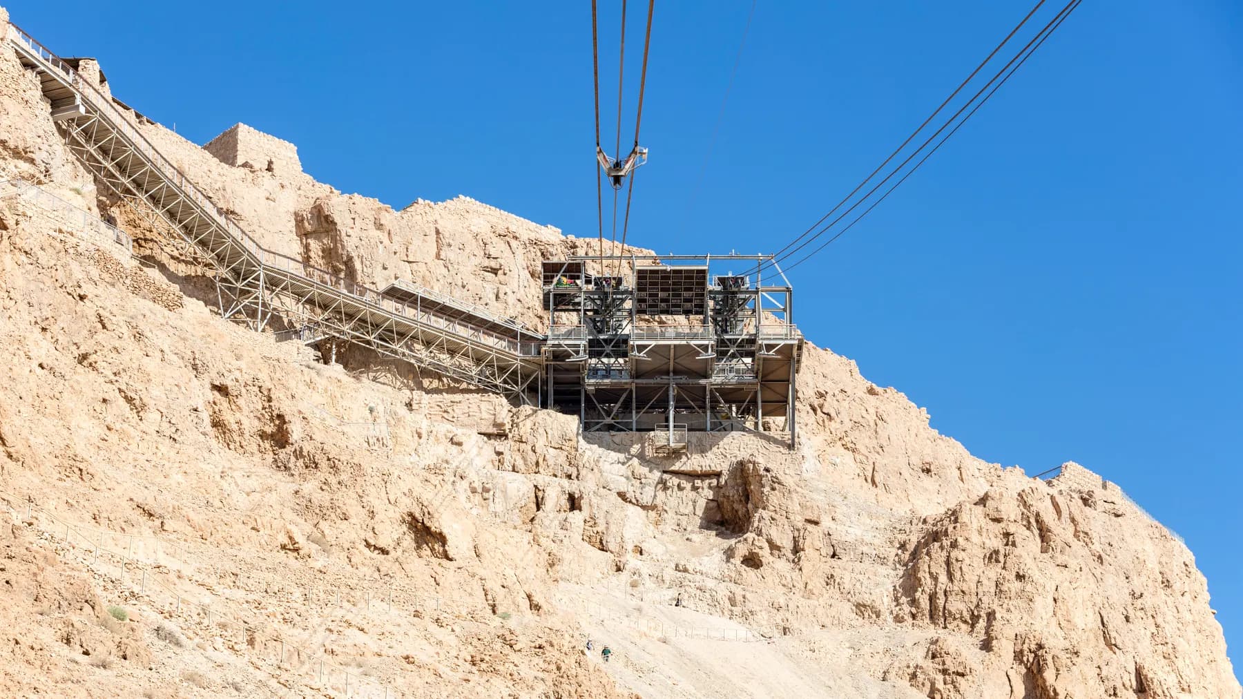
Godot13 / CC BY-SA 4.0 · Wikimedia Commons
Activity
The Masada Cable Car
Its lower station stands 257 metres below sea level and its upper station 33 metres above, which is why ropeway databases file it as the lowest aerial tramway in the world.
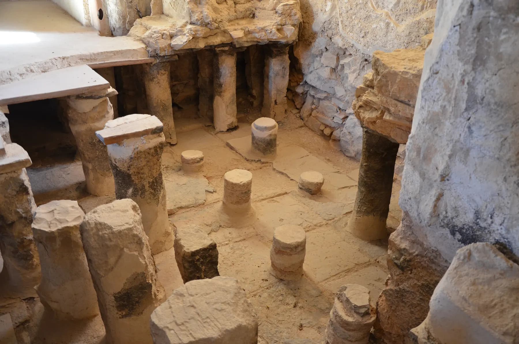
Carole Raddato from FRANKFURT, Germany / CC BY-SA 2.0 · Wikimedia Commons
Archaeological site
Herod's Large Bathhouse
The floor of the hot room still stands on roughly 200 small columns, most of them brick, with the furnace stokehole, the wall flues and the stepped cold pool all in place around it.
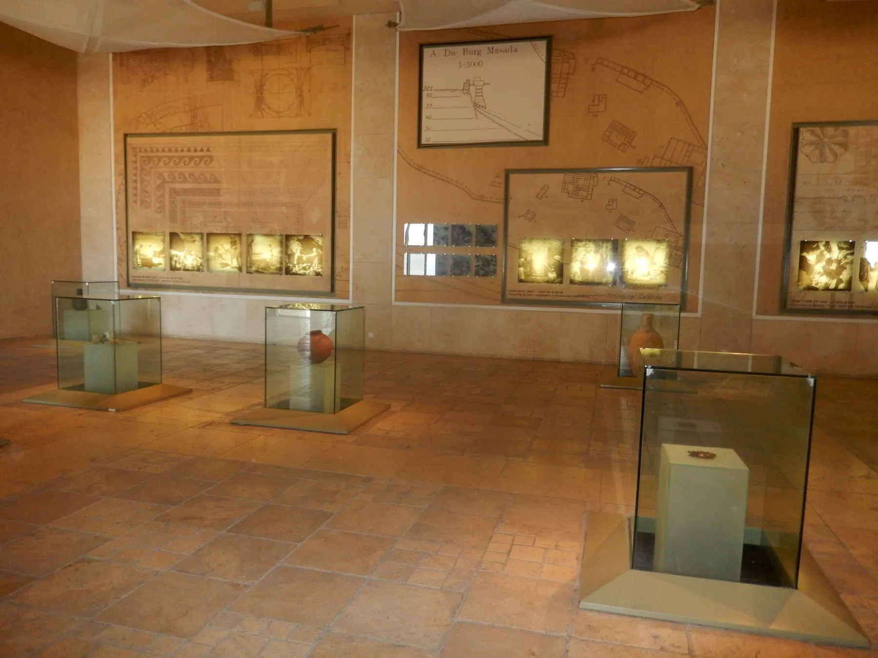
Armineaghayan / CC BY-SA 4.0 · Wikimedia Commons
Museum
The Masada Museum in Memory of Yigael Yadin
Nine rooms at the foot of the mountain, painted from dark grey to black so that the objects Yigael Yadin's expedition dug out of Masada between 1963 and 1965 are the only lit things in them.
Godot13 / CC BY-SA 4.0 · Wikimedia Commons
Archaeological site
Herod's Northern Palace
Herod's architects hung a private house on three rock terraces at the northern tip of Masada, with about 30 metres of height between the top terrace and the bottom one and retaining walls holding the lower two onto the cliff.
Jan Helebrant / CC0 · Wikimedia Commons
Archaeological site
The Roman Assault Ramp
The bank the Tenth Legion raised against Masada's western cliff in the siege of 73 or 74 CE, whose foot the parks authority puts only about 60 metres below the summit, and which now carries the shortest footpath to the top.
יוסי רון / CC BY 2.5 · Wikimedia Commons
Archaeological site
The Roman Siege Camps and Circumvallation Wall
Eight Roman camps and a stone wall that a 2024 survey measured at 4,290 metres still ring the foot of Masada, and almost none of it has ever been excavated.
Jan Helebrant / CC0 · Wikimedia Commons
Activity
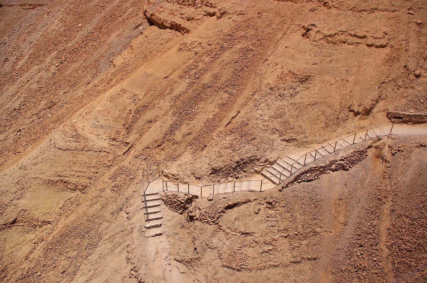
The Snake Path
The parks authority measures the climb at 350 metres over about two kilometres and roughly 900 steps, on a line up the east face that Josephus already knew as the serpent.
Activity
Masada from Dusk to Dawn
A 45-minute video-mapping show projected straight onto the western cliff of Masada, between the Roman siege ramp and the Northern Palace, watched from an open-air theatre that can only be reached through Arad.
Jan Helebrant / CC0 · Wikimedia Commons
Religious site
The Masada Synagogue
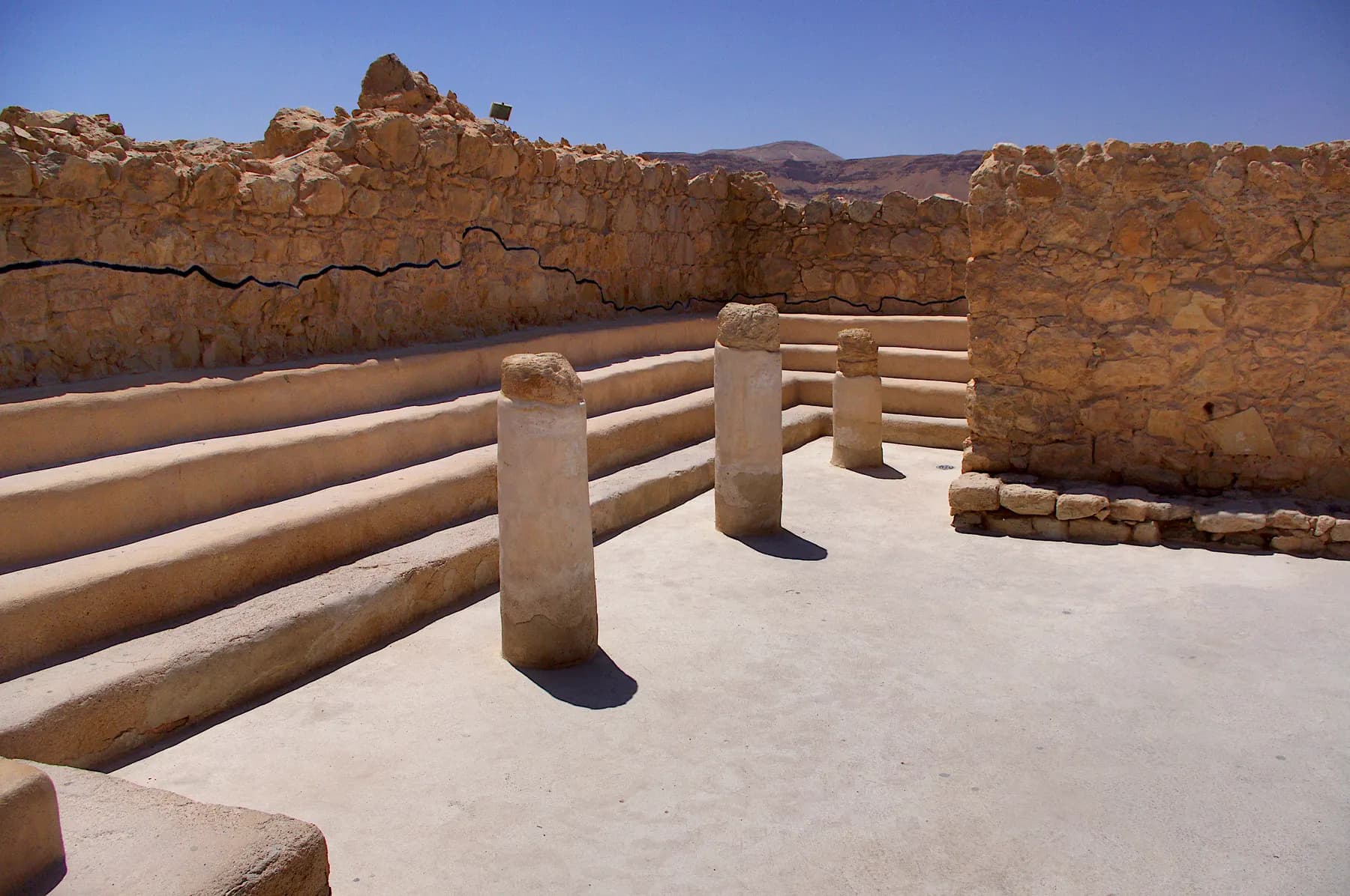
A rectangular room set into the northwestern casemate wall, used as a stable in Herod's day on the parks authority's account and rebuilt during the revolt with four tiers of plastered benches and two pits in the back room floor that held parts of Deuteronomy and Ezekiel.
Tribun militum / CC BY-SA 4.0 · Wikimedia Commons
Archaeological site
The Water Cisterns and Water System
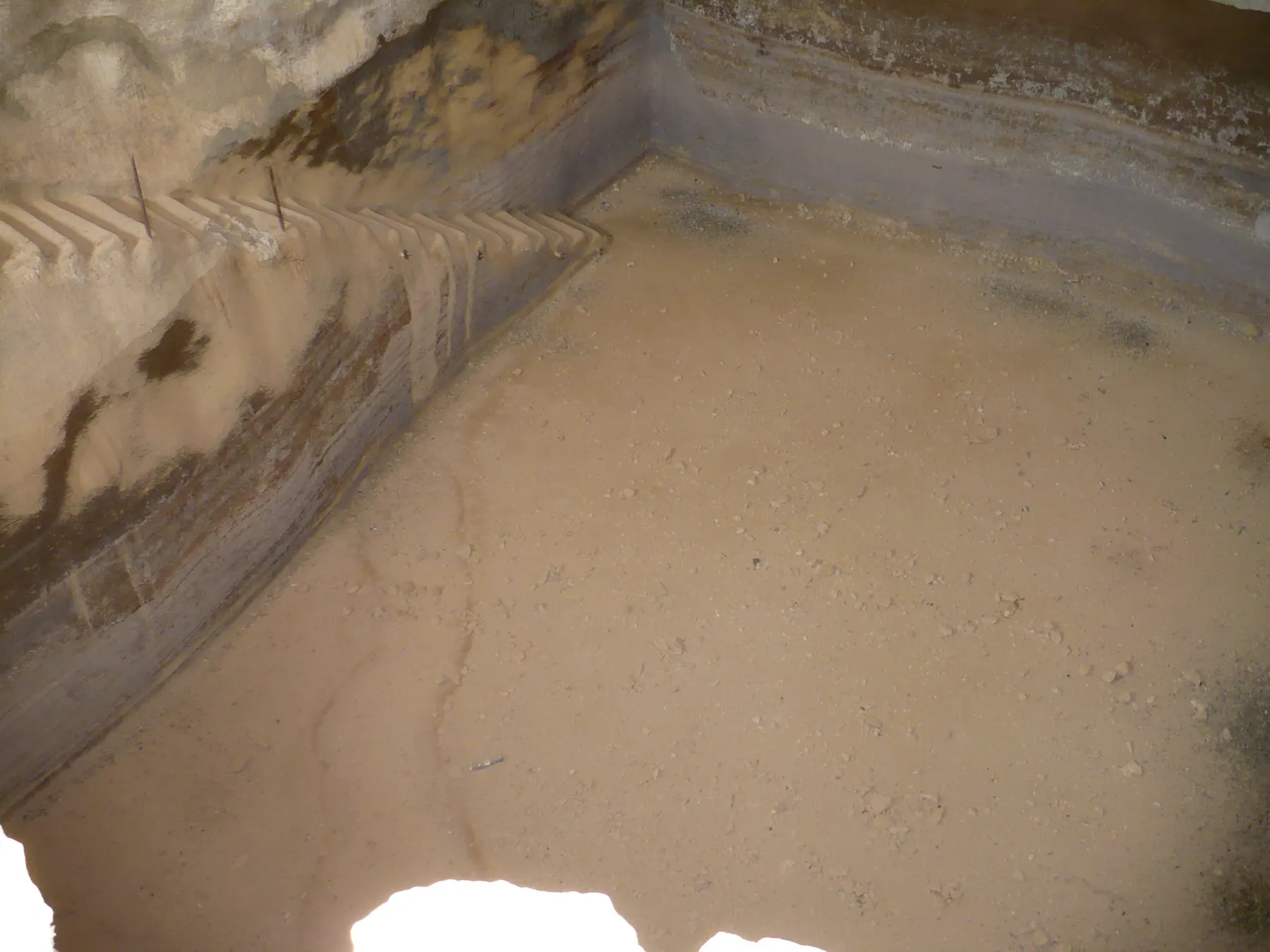
Dams built in the wadi beds diverted flash floods into plastered channels that filled twelve cisterns cut in two rows into the slope, and the parks authority puts their combined capacity at 40,000 cubic metres.
Tiia Monto / CC BY-SA 3.0 · Wikimedia Commons
Archaeological site
The Western Palace
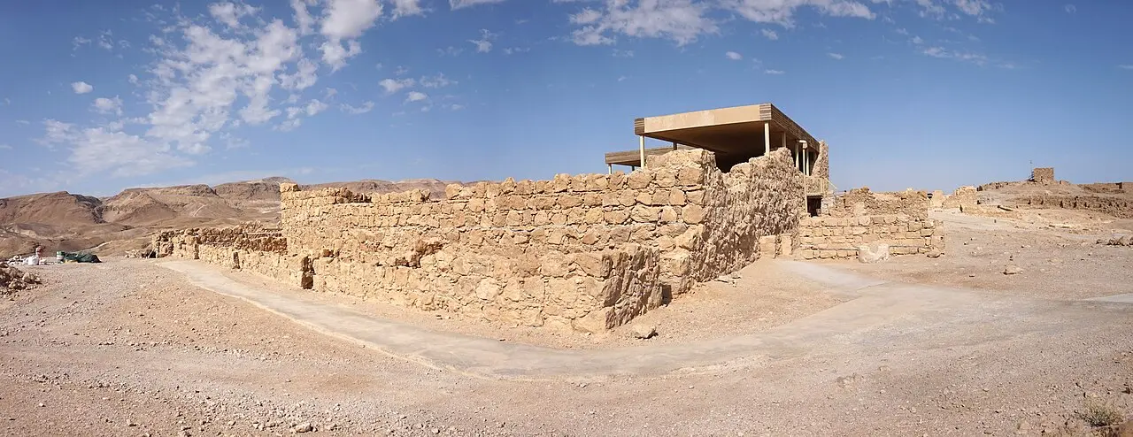
The Israel Nature and Parks Authority puts this building at 3,700 square metres, which makes it the largest on the Masada plateau, and its four wings held Herod's reception rooms, his storerooms, his workshops and his administration.
The long view
Masada, in order
37–4 BCE
Herod rules Judaea. He builds Masada into a palace-fortress in the style of the early Roman East: the Northern Palace on its three terraces, the Western Palace, the bathhouse, storerooms and rock-cut cisterns.
70 CE
Jerusalem falls to the Romans. Masada is among the last places in Judaea still held by rebels, alongside Herodium and Machaerus.
73 or 74 CE
Lucius Flavius Silva besieges the rock with a force built around Legio X Fretensis, ringing it with eight camps and a circumvallation wall and raising a ramp on the western flank. Josephus records 960 dead and seven survivors.
5th–6th c. CE
A Byzantine church is built on the plateau and serves as the gathering place for monastic hermits; its apse, mosaics and roof tiles survive.
1838
Edward Robinson and Eli Smith identify Masada through a telescope from Ein Gedi and recognise the northern cliff as Herod's palace.
1865
Charles Warren and Claude Conder of the Palestine Exploration Fund survey the site and the Roman camps and locate the Snake Path.
1953
The first Israeli excavation, driven by Shmarya Guttman, traces the water system, recovers the full route of the Snake Path and digs Roman camps A and C.
1963–65
Yigael Yadin's expedition, with thousands of volunteers, excavates almost the entire site over two seasons.
1966
Masada is declared a national park.
1971 / 1998 / 2020
The first cable car is built, replaced in 1998 with the present system and its summit suspension bridge, and given upgraded electronics in 2020.
2001
UNESCO inscribes Masada as a World Heritage Site, alongside the Old City of Akko.
2024
A 3D survey of the siege landscape published in the Journal of Roman Archaeology calculates that 5,000 soldiers could have built the camps and circumvallation wall in 11–16 days.
Getting there
- The main entrance and the cable car are on the eastern, Dead Sea side, off Route 90. The parks authority gives the distances as about 18 km south of Ein Gedi, or about 12 km from Ein Bokek.
- The western entrance, at the foot of the Roman ramp, is reached from Arad on road 3199. It is a separate car park and a separate approach; you cannot drive between the two sides without going a long way round.
- Public buses run along the Dead Sea road and stop at Masada, but services are limited and the timetable changes with the season and the day of the week; check the operator's own timetable before you plan a day around one.
- The Masada West campground sits on the Arad side, which is the simplest way to be at the ramp path before dawn.
Access
Better than the mountain suggests. At the eastern entrance the covered parking, museum, shops, public areas, film halls and lifts are accessible, and the cable car and the summit suspension bridge are wheelchair accessible. On the plateau there are concrete paths, accessible toilets, railings on steps, benches and shaded gathering points, with access to most of the key sites and lookouts; models and relief maps are made accessible to visually impaired visitors. The descent through the Northern Palace involves many steps, with railings on both sides; the models and lookouts are offered as the alternative. On the western side the parking, toilets, visitor service centre, picnic awning, railings and signage are accessible, but the path up from there is steep, unpaved and stepped. The sound-and-light show has accessible parking, paved paths, dedicated seating for wheelchair users and hearing assistance systems. The parks authority runs a coordination form for accessible visits.
When to go
October to April for anything involving walking. In the deep summer the Judaean Desert is punishing (Sedom, on the same shore, reached 49.9°C in July 2019, the highest temperature measured anywhere in Israel since 1942) and the parks authority shuts the Snake Path to climbers as early as 07:00 on extreme days. Whatever the month, dawn is the hour: cooler, quieter, and the only time the light does anything interesting on the Roman camps below.
Hours and cost
When the Israel Nature and Parks Authority's Masada page was checked in 2026 it listed summer hours of 08:00–17:00 Sunday to Thursday and Saturday, and 08:00–16:00 on Fridays and holiday eves; winter hours were an hour earlier at 08:00–16:00 and 08:00–15:00. Entrance to the park closes an hour before the stated time and the last cable car goes up an hour before closing. The Snake Path opens for ascent about an hour before sunrise and the Roman ramp path about half an hour before; both close on a heat schedule set by the Israel Meteorological Service forecast. Booking a time slot online is recommended, and the museum is by reservation only. Check the park's own page before travelling: hours drift, and sections do close for maintenance and safety.
Entrance without the cable car was listed at ₪37 for an adult and ₪21 for a child when the parks authority's Masada page was checked in 2026, with ₪31 for students and adults in groups and ₪19 for Israeli senior citizens. The Yigael Yadin museum is a further ₪20. The cable car is charged separately on top of entry, and the evening sound-and-light show is ticketed separately again, listed at ₪45 for an adult on the same page. The Israel Pass covers entry to parks authority sites; prices drift, so read the operator's list rather than this page.
Opening times and prices change. Both are given as published by the operator and should be checked against its own page before you travel.

Practical
What people wish they had known about Masada
- Decide your route before you arrive: the eastern side has the cable car and the Snake Path, the western side has the ramp path from Arad, and swapping between them means a long drive.
- Carry more water than feels reasonable and start earlier than feels reasonable. There is no shade on either path.
- If you walk up, consider the cable car down: the parks authority closes the Snake Path to descent earlier than you might expect on hot days.
- In winter, spring and autumn, flash floods are a genuine risk in the wadis. Check the Israel Meteorological Service forecast and do not enter or cross a wadi bed when flooding looks likely.
- Book a slot online; if the site is at capacity you will be asked to show your confirmation to get in.
- Allow two to three hours on the plateau if you want the Northern Palace, the bathhouse, the synagogue and the western complexes rather than a quick lap.
- Dogs are not permitted, and fires are prohibited anywhere in the national park; barbecues are allowed only at the campground.
The figures
Masada by the numbers
Each figure carries the year it belongs to and links the source it came from.
| Measure | Figure | As of | Source |
|---|---|---|---|
| Height above the Dead Sea shore | about 450 m | 2026 | en.parks.org.il |
| Summit dimensions | about 650 m × 300 m, enclosing roughly 7 hectares | 2026 | en.parks.org.il |
| Circumvallation wall | about 4,290 m, plus about 1,980 m of camp fortification | 2024 | cambridge.org |
| Stone moved for the siege works | about 26,700 cubic metres, buildable by 5,000 soldiers in 11–16 days | 2024 | cambridge.org |
| Dead reported by Josephus | 960, women and children included, with two women and five children surviving | 1st c. CE account | penelope.uchicago.edu |
| Adult entrance fee, cable car excluded | ₪37 (child ₪21; museum ₪20) | 2026 | en.parks.org.il |
| Cable car | up to 80 passengers, capped at 65; about 3 minutes each way | 2026 | en.parks.org.il |
| Highest temperature at Sedom, on the same shore | 49.9°C on 17 July 2019, the highest in Israel since June 1942, when Tirat Tzvi reached 54°C | 2019 | wmo.int |
Where this is
Masada in the length of the country
Israel runs about 420 km from its northern tip to Eilat. Here is where this one sits on that line.
Nearby
Where to go next

The Jordan Rift Valley
The Dead Sea
The lowest ground on Earth, water nearly ten times saltier than the ocean, and a shoreline retreating by more than a metre a year.

Southern Israel
The Negev
More than half of Israel is desert, and almost none of it is sand: erosion craters, canyons with water in them, Nabataean ruins and the darkest sky in the country.

Mediterranean coast
Caesarea
Herod poured a harbour into open water here, using volcanic ash shipped from the Bay of Naples. Most of it now lies more than five metres down.
Sources and further reading
Every link below was opened and checked when this page was written. Official statements are marked as such: they are the subject's own account, not an independent one.
- OfficialIsrael Nature and Parks Authorityen.parks.org.ilMasada National Park
Summit dimensions and height above the Dead Sea, the horst geology and the two wadis, the ancient roads, opening hours and heat rules for the Snake Path and ramp path, entrance and show fees, accessibility, road distances from Ein Gedi and Ein Bokek, the Tuesday and Thursday sound-and-light show, dogs and fires, national park declaration in 1966 and UNESCO inscription in 2001
- OfficialIsrael Nature and Parks Authorityen.parks.org.ilMasada National Park – The Plateau
Descriptions of the Northern and Western Palaces, bathhouse, synagogue and genizah, Room of the Lots and both readings of the potsherds, Byzantine church, southern cistern and its 64 steps, and the history of research from Robinson in 1838 through Warren and Conder, Schulten, Guttman and Yadin to Netzer and Stiebel
- OfficialIsrael Nature and Parks Authorityen.parks.org.ilThe Masada Cable Car
Cable car built 1971, replaced 1998, electronics upgraded 2020; capacity of 80 capped at 65; about three minutes each way; wheelchair accessible via the summit suspension bridge
- OfficialIsrael Nature and Parks Authorityen.parks.org.ilWorld Heritage Sites
Masada inscribed in 2001 alongside the Old City of Akko; Israel signed the World Heritage Convention in 1999; UNESCO's wording on the Northern Palace as a luxurious early Roman villa, on 'the finest and most complete Roman siege works to have survived to the present day', and on Masada as a symbol of Jewish cultural identity and of the struggle between oppression and liberty
- ReportingBiblical Archaeology Societybiblicalarchaeology.orgBesieging Masada
Plain-language account of the 2024 Journal of Roman Archaeology findings, including the wall's thickness and height and the finding that some stretches were built for psychological effect rather than defence
- ReportingThe Times of Israeltimesofisrael.comMaybe there was no mass suicide at Masada? Top archaeologist questions a legend
The twelve inscribed ostraca picked out of roughly 250, Yadin's reading against Joseph Naveh's food-tag reading, the mismatch with Josephus's ten men, Hillel Geva's debris-mound argument, the mismatched skeletons and pig bones, and Magness's 'not a question that archaeology is equipped to answer'
- ReportingThe Times of Israeltimesofisrael.comNew nature chief aims for tourists to see more of Israel's national parks, reserves
Masada named the most popular parks authority site among tourists in 2022, out of about 10.71 million paying visitors across all INPA sites that year
- DataWorld Meteorological Organizationwmo.intRecord-breaking temperatures in Israel, July 2019
49.9°C recorded at Sedom on 17 July 2019, the highest temperature in Israel since June 1942, when 54°C was measured at Tirat Tzvi, still the highest ever recorded in Israel
- ReferenceJournal of Roman Archaeology (Cambridge University Press)cambridge.orgThe Roman siege system of Masada: a 3D computerized analysis of a conflict landscape
Ashkenazi, Ze'evi-Berger, Gross and Stiebel, 2024: circumvallation wall of about 4,290 m standing 2–2.5 m high, about 1,980 m of camp fortification, 15 towers on the eastern and northern stretches, about 26,700 cubic metres of stone, an 11–16 day build by 5,000 soldiers, and the wall's function as psychological warfare as well as obstacle
- ReferencePopular Archaeologypopular-archaeology.comThe Siege of Masada
Camps B and F conspicuously larger than the rest because they housed the legionary troops, Legio X Fretensis under Silva, the timber-braced ramp built on existing topography, and the estimate that the siege lasted no more than six months and perhaps only seven weeks
- ReferencePrinceton University Press (essay by Jodi Magness)press.princeton.eduThe fall of Masada
Josephus as the only ancient account; the view among many scholars that the mass suicide is fabricated; 'Masada shall not fall again' as a symbol after 1948; IDF induction ceremonies on the summit; the appeal in the wake of the Holocaust; the tension with Judaism's prohibition on suicide; and the story's decline in the post-Zionist era
- ReferencePrinceton University Pressassets.press.princeton.eduMasada: From Jewish Revolt to Modern Myth, chapter 1 (PDF)
The chapter title 'The Siege of Masada (72–73 or 73–74 CE)' and the campaign placed in the winter-spring of 72–73 or 73–74; Silva succeeding Lucilius Bassus; about 8,000 Roman troops, the Tenth Legion previously at Gamla, Jerusalem and Machaerus; camps lettered A–H running counterclockwise from the Snake Path to Mount Eleazar; the ramp built on a natural spur that the excavators did not reach; the breach in the casemate wall; and the siege lasting no longer than six months and perhaps as little as seven weeks
- ReferenceEncyclopaedia Britannicabritannica.comMasada
Height above the Dead Sea of 434 m, summit area of about 18 acres (7 hectares), Herod's reign of 37–4 BCE, cistern capacity of nearly 750,000 litres, the Byzantine church of the 5th–6th century, and Yadin's 1963–65 excavations with thousands of volunteers from around the world
- ReferenceEncyclopaedia Britannicabritannica.comSiege of Masada
The siege placed in 73 or 74 CE, Lucius Flavius Silva in command, Eleazar ben Yair and the Sicarii described as an extremist sect, 960 dead, the ramp given as 600 m long and 61 m high, the doubts many historians hold about Josephus, and the archaeological evidence that combat took place at the site in this period
- ReferencePenelope, University of Chicagopenelope.uchicago.eduThe Wars of the Jews, Book VII (Whiston translation)
Josephus on the rock's inaccessibility and the serpentine path, Silva succeeding Bassus and throwing a wall round the fortress, the bank raised 200 cubits at the white promontory with a fifty-cubit stone platform and a sixty-cubit iron-plated tower and battering ram, Eleazar ben Yair's speech, the 960 dead with women and children included in the count, and the two women and five children hidden in caverns underground
- ReferenceEncyclopaedia Britannicabritannica.comDead Sea
Surface level of about 430 m below sea level by the mid-2010s, down from about 400 m below in the mid-twentieth century, and falling about a metre a year
Masada: common questions
Do I have to walk up Masada?+
No. A cable car runs from the eastern visitor centre to a suspension bridge at the summit, taking about three minutes each way, and it is wheelchair accessible. It costs extra on top of the entrance fee. The Snake Path from the same side takes about an hour and is graded high difficulty; the Roman ramp path from Arad on the west takes about half an hour and is graded intermediate.
Is the sunrise worth getting up for?+
Yes, and it is also the sensible choice. The Snake Path opens for ascent about an hour before sunrise and the ramp path about half an hour before, and both close to climbers as the day heats up, as early as 07:00 in extreme summer heat. Arriving at dawn is how you get the cool air, the empty plateau and the low light that picks out the Roman camps on the plain.
Did the mass suicide actually happen?+
It is disputed. Josephus is the only ancient source, and he was not there. His account has 960 people dying and two women and five children surviving. Yigael Yadin identified twelve inscribed potsherds as the lots; the epigrapher Joseph Naveh argued they were too like the sherds used as tags for food distribution to be identified that way, and the parks authority's own signage offers both readings. Hillel Geva reads a debris mound near the Northern Palace as a Roman assault ramp and concludes there was no mass suicide. Jodi Magness, who has excavated at Masada, holds that archaeology simply cannot settle the question, and notes that many scholars now think the account was fabricated.
When exactly did Masada fall?+
Either 73 or 74 CE, and the sources do not settle it. Josephus's narrative has traditionally been read as putting the fall in the spring of 73, but the year depends on when Flavius Silva succeeded Lucilius Bassus as governor of Judaea, which is not fixed. Britannica gives the siege as 73 or 74 CE, and Jodi Magness titles her chapter on it 'The Siege of Masada (72–73 or 73–74 CE)'.
How long did the Roman siege last?+
Far less time than the old accounts suggest. Geological work indicates the assault ramp was raised over a natural spur rather than built from the desert floor, and a 2024 study in the Journal of Roman Archaeology calculated that 5,000 soldiers could have built the camps and circumvallation in 11 to 16 days. Jodi Magness writes that the siege 'lasted no longer than six months and almost certainly was much shorter, perhaps as little as seven weeks from beginning to end', against a common impression that the fortress held out for three years.
Why is Masada a UNESCO World Heritage Site?+
It was inscribed in 2001 on two grounds. Herod's Northern Palace is treated as an outstanding example of a luxurious villa of the early Roman period, and the works below it are, in UNESCO's words as quoted by the Israel Nature and Parks Authority, 'the finest and most complete Roman siege works to have survived to the present day'. The listing also recognises the site's symbolic weight, calling it a symbol both of Jewish cultural identity and of the human struggle between oppression and liberty.
How much time should I allow?+
Two to three hours on the plateau covers the Northern Palace, the bathhouse, the Western Palace, the synagogue and the main lookouts at a reasonable pace. Add an hour each way if you are walking the Snake Path, and add time for the Yigael Yadin museum at the foot, which is entered by reservation only.
Can I visit Masada with limited mobility?+
To a considerable extent. The cable car and the summit bridge are wheelchair accessible, the plateau has concrete paths, accessible toilets, railings and shaded gathering places, and most of the key complexes and lookouts can be reached. The Northern Palace descent is many steps, and the parks authority offers the models and lookouts as an alternative. There is a coordination form for accessible visits.
Is there anything to do after dark?+
The parks authority runs a sound-and-light show telling the history of the site. When its Masada page was checked in 2026 the show was listed as playing every Tuesday and Thursday, with headphones for simultaneous translation into English, German, French, Russian and Spanish for an extra ₪15. There is also a campground on the western side, which is the easiest way to be at the ramp path before dawn. Check the operator's page before making the trip.
Can I combine Masada with the Dead Sea?+
Easily, and most people do. The eastern entrance is about 18 km south of Ein Gedi and about 12 km from the Ein Bokek hotel strip on the southern basin, so a dawn climb and an afternoon float are a standard pairing. Ein Gedi's springs and Qumran are on the same road north.
Hotels & Stays
See all hotels & stays →Ecce Homo Pilgrim House
Jerusalem
A guesthouse on the Via Dolorosa, over Roman pavement
Jerusalem Hotel
Jerusalem
A stone-vaulted hotel in East Jerusalem, by the Old City
Jungle Jaffa Hostel
Tel Aviv
A social hostel in old Jaffa, ten minutes' walk from the beach
Matmon Barava
Ein Yahav
Desert cabins and a visitor centre in Ein Yahav, deep in the Arava