Viewpoint · The Sea of Galilee
Mount Arbel
A limestone and dolomite cliff standing 181 metres above sea level and about 390 metres above the Sea of Galilee, with several hundred caves cut into its face and a seventeenth-century fortress built across them.
Yinonk / CC BY 4.0 · Wikimedia Commons
Summit
181 metres above sea level
and about 390 metres above the lake, both figures as the Israel Nature and Parks Authority publishes them
Cave fortress circuit
about 2 km, about 3 hours
the Parks Authority grades it a circular route for fit walkers, with a descent on iron rungs and cables
Lookouts circuit
about 1 km, about 1 hour
three viewpoints, one of them on a path built for wheelchairs and pushchairs
Adult admission
₪31
Parks Authority list price, 2026; the ancient synagogue outside the gate is free
In short
- How long to give it
- about 90 minutes for the lookouts circuit and the synagogue, or about four hours if the cliff descent to the cave fortress is added to them
- Summer, Sunday to Thursday and Saturday
- 08:00 to 17:00
- Adult
- ₪31
הר ארבל
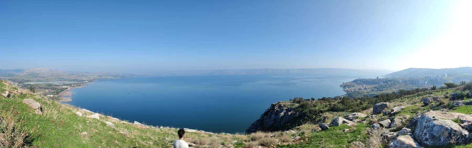
Mount Arbel is the cliff at the north-western corner of the Sea of Galilee, and the place the whole lake is looked at from. The Israel Nature and Parks Authority puts the summit at 181 metres above sea level and roughly 390 metres above the water, which is the number that counts: the lake surface sits more than 200 metres below sea level, so a hill of no great height produces a drop of nearly 400 metres straight off the edge. The Parks Authority notes that cliffs of this kind are uncommon in the country, and credits the hard limestone and dolomite for the vertical face.
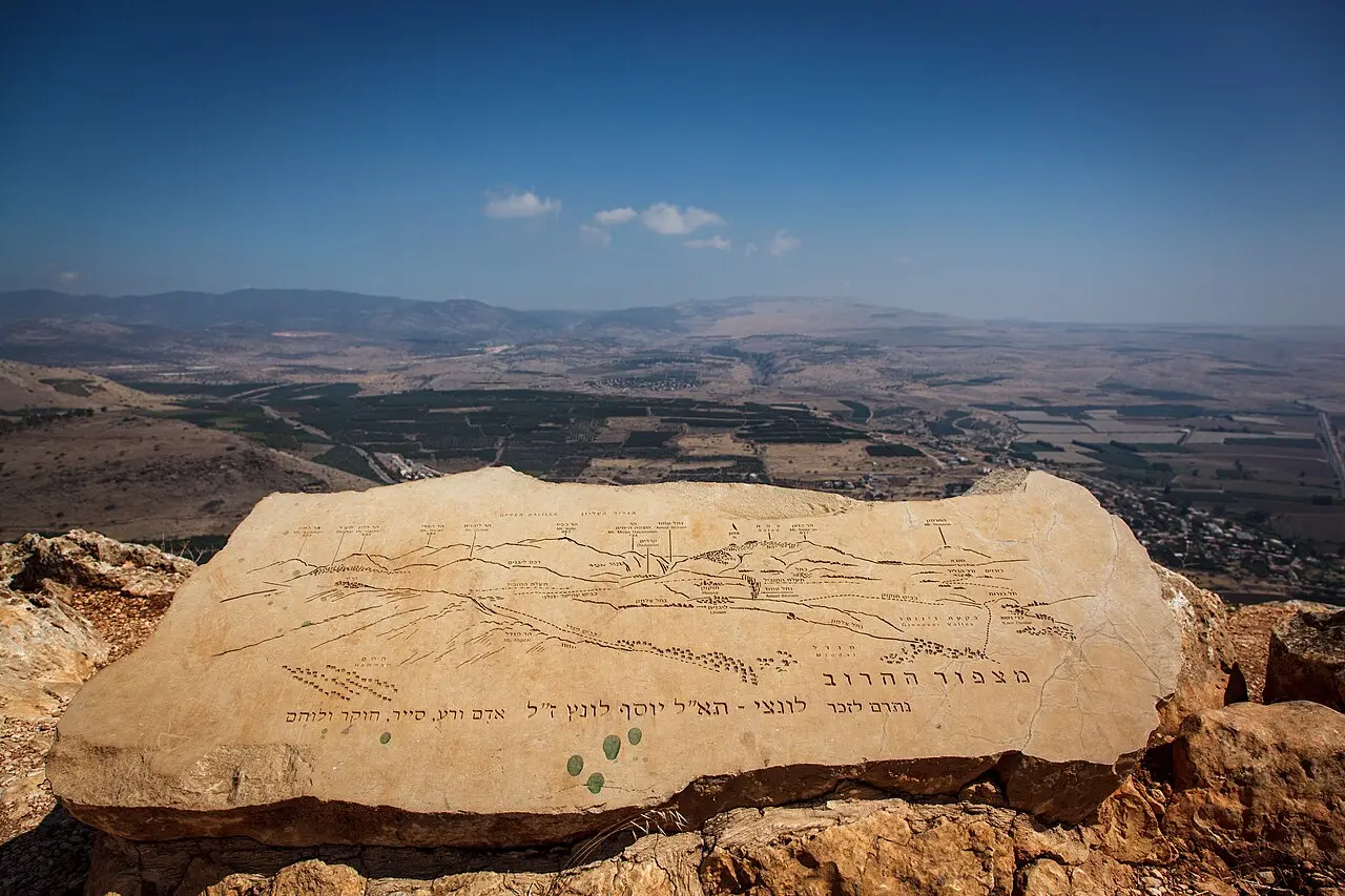
The view is the reason most people drive up, and it is unusually complete. From the top the Jordan Valley, the Sea of Galilee, the Golan Heights, Mount Hermon and both the Upper and Lower Galilee are visible at once. What surprises visitors is that the site is not only a lookout. Several hundred caves are hollowed into the cliff below the rim, a fortress was built across their mouths, and the remains of a Jewish village with a substantial synagogue lie a couple of kilometres back down the approach road, outside the ticketed gate and free to walk into.
The park and the reserve are one site with two quite different visits inside it. An hour on level ground buys three lookouts and the synagogue. Three hours and a head for heights buys the descent of the cliff on iron rungs and cables to the cave fortress and back up again. The Parks Authority publishes both circuits, closes the cliff route in the rain, and shuts the gate an hour before the closing time on its board.
The cliff
Why a 181-metre hill drops 390 metres
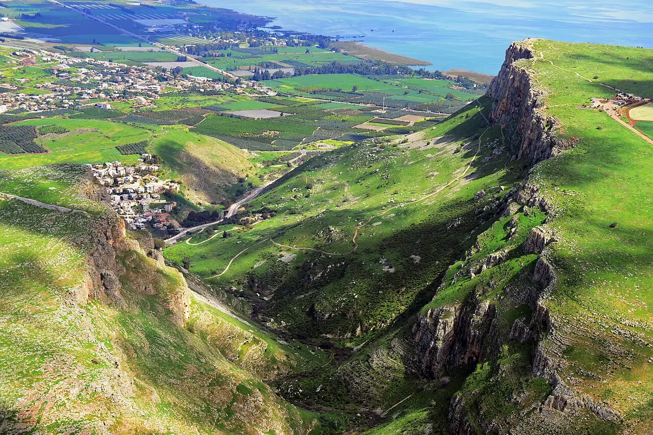
Almost everything odd about Arbel follows from the fact that the ground on one side of it is far below sea level. The Parks Authority describes the cliff as the product of the great Syrian-African rift and of geological faults running across the Lower Galilee, and attributes its sheer face to the hard limestone and dolomite it is cut from. The summit is a modest 181 metres above sea level. The lake below is more than 200 metres beneath that datum, and the difference is the 390 metres the Parks Authority prints.
The cliff is the heart of the Arbel Nature Reserve, declared in 1967, and of the national park wrapped around it, which also takes in Mount Nitai across the valley, Mount Savyon, the Horns of Hittim and the Arbel plateau. Mount Nitai is the ridge directly opposite, and the gorge between the two, Nahal Arbel, is the natural route from the Galilee hills down to the lake at Migdal.
The park keeps most of the rim unfenced on purpose. The Parks Authority states plainly that a large part of the cliff has no railing, because it wants the landscape left as it is, and asks visitors to hold on to children and follow the rangers. That is not boilerplate. The lookouts are the busiest part of the site and the drop begins at the grass.
AVRAHAM GRAICER / CC BY-SA 4.0 · Wikimedia Commons
Refuge
The caves Herod's army could not walk into
Arbel appears in the record as a hiding place before it appears as anything else. Josephus writes that in about 161 BCE the Seleucid general Bacchides camped at Arbela, a city of Galilee, besieged and took those who were sheltering in caves there, and moved on to Jerusalem. The Encyclopaedia Judaica entry connects the episode to the account in 1 Maccabees of the capture of the mesalot at Arbel, and reads the word as a reference to the caves and the stairways linking them.
The famous siege is Herod's. Josephus tells it twice. The caves, he writes, were in mountains so abrupt that there was no way up from below and no way of climbing down from above, so Herod had chests built, hung them from an engine at the top of the mountain on iron chains, filled them with armed men carrying long hooks, and lowered them level with the cave mouths. The account in the Jewish War adds that fire was sent into the caves, and describes an old man at a cave mouth killing his seven children and his wife in turn rather than accept Herod's offer of safe conduct, with Herod close enough to watch and to plead with him.
Which year that happened in is not settled, and the disagreement is easy to see. The Parks Authority's own trail notes date the stand of the Galilean zealots to 37 BCE. The Wikipedia article says 38 BCE. The Encyclopaedia Judaica entry says 39 BCE. Josephus supplies the sequence, from the taking of Sepphoris in a snowstorm to the forty days before Herod arrived in person, but not a calendar date, and the modern figures are all reconstructions from the surrounding campaign.
The caves were used again a century later. Writing about himself in the third person as commander in Galilee at the start of the revolt against Rome in 66 CE, Josephus lists the places he fortified and includes walls built about the caves near the lake of Gennesar, in the Lower Galilee. The Parks Authority's Hebrew description of the park mentions a wall from the days of the Great Revolt among its remains.
יגאל דקל / CC BY-SA 4.0 · Wikimedia Commons
The fortress
Qal'at Ibn Ma'an, a castle with a cliff for a roof
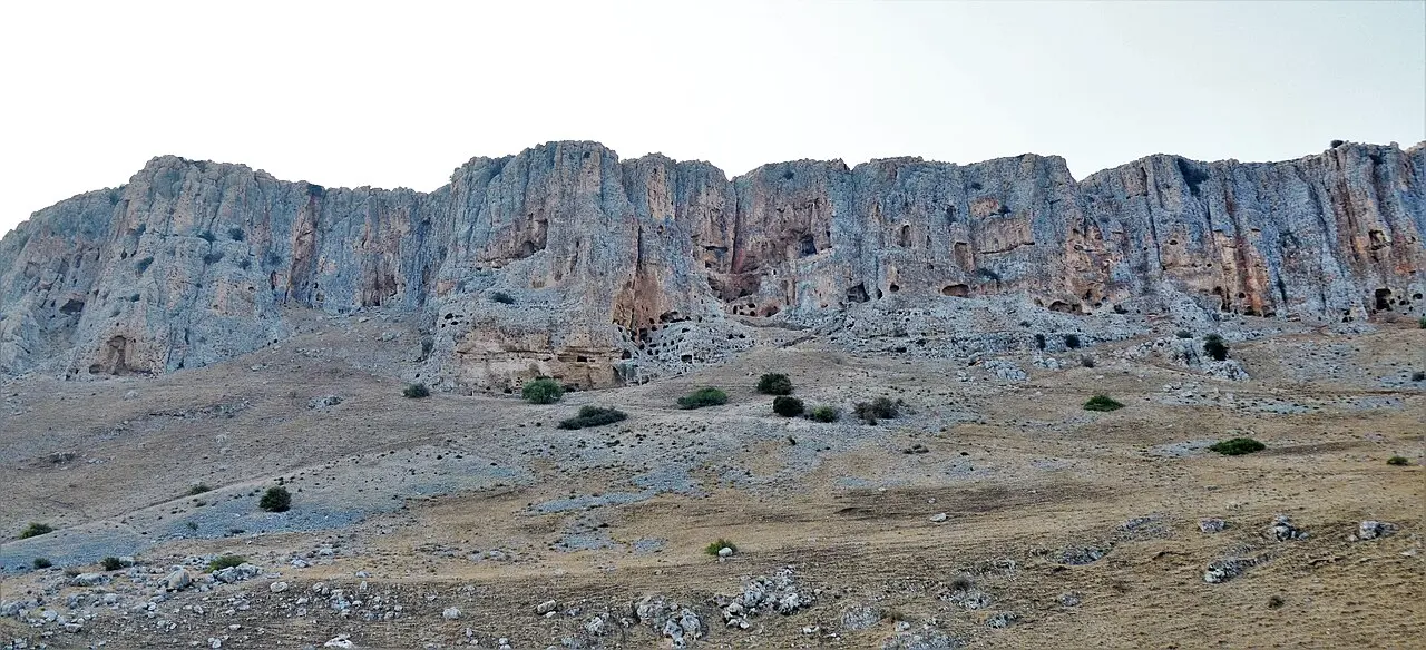
The structure hikers descend to is not the caves of Josephus but a fortress built across them roughly sixteen centuries later. The Parks Authority describes a large system of chambers fronted by enormous walls of alternating black basalt and white limestone, and attributes it to the seventeenth century and probably to Ali Beg, son of the Druze emir Fakhr al-Din of the Ma'an family, which is where the local name Qal'at Ibn Ma'an, the fortress of the son of Ma'an, comes from. Wikipedia's article gives the same attribution, following Jerome Murphy-O'Connor's Oxford archaeological guide.
The building method is the interesting part. Nothing here was raised from open ground. The caves themselves began as natural karst cavities and were then quarried and enlarged by hand into dwelling halls, water cisterns, storage pits, flights of steps and a few ritual baths, and the fortress simply walled up the front of that honeycomb and connected it with concealed passages and stairways. What survives is therefore a facade and an interior, with the mountain doing the work of a roof and a back wall.
Finds inside push the occupation back a long way before the fortress. The Parks Authority reports Hellenistic material in the caves within the walls, including coins and ritual baths, which is the archaeological end of the story Josephus tells from the literary end. It is worth being clear about what a visitor sees: the walls and the cave complexes are old, and the way down to them is not. The steps, the iron pegs and the metal cables on the cliff face were installed by the Parks Authority so that the descent could be made at all.
Below the cliff
The synagogue Robinson found in 1852, and the gate that was put back up
About two kilometres before the park entrance, at the northern edge of Moshav Arbel, the road passes the ruins of the ancient village of Arbel and its synagogue. The Parks Authority credits the scholar Edward Robinson with identifying the remains in 1852; the Encyclopaedia Judaica entry records Charles Wilson exploring them later in the nineteenth century and the first excavation by Heinrich Kohl and Carl Watzinger in 1905. The building was deliberately made to stand out: dry-laid from large blocks of white limestone in a district where houses were built of black basalt.
The Parks Authority sets out two main phases. The first, founded on the evidence of its style and finds in the fourth century CE, was a hall with three rows of columns arranged in a squared horseshoe, carrying galleries above, with benches along the walls and a collection box cut into the rock of the northern wall behind a small door. That building was destroyed at a date nobody can fix, and a second synagogue went up on the spot, probably in the sixth century, reusing a great deal of the first one's stonework. It added a rounded niche in the southern wall for the Torah ark, repaved the floor and extended the courtyard northwards over two long vaulted halls. The visible ruin is the later building.
The dating has been argued over for a century and the argument is not closed. The Encyclopaedia Judaica entry states flatly that the third-century date originally proposed on architectural grounds is no longer accepted, without putting a firm alternative in its place. A fresh excavation in 2008 under Benny Arubas found material the Parks Authority describes as belonging to a synagogue building of the Second Temple period, which would make the site considerably older than either of the two phases above it.
The synagogue seems to have burned. The Parks Authority suggests the great earthquake of 749, remembered in Jewish sources as the shevi'it earthquake because it fell in a sabbatical year and which wrecked settlements up and down the rift. The gateway that now stands complete on the site was rebuilt by the Parks Authority from its own original pieces, which were lying scattered in the field: ancient stone, modern re-erection, and the distinction is worth carrying around the ruin. Entry into the synagogue building itself is currently barred because of the excavation, and the compound is free.
The trails
One hour on the flat, or three hours down a ladder of pegs
The Parks Authority publishes two circuits from the same car park and they are not variations on each other. The lookouts route is about a kilometre and takes about an hour, taking in a viewpoint facing the lake and the southern Golan, Mitzpe HaHaruv, the Carob lookout, named for a single carob tree growing on the cliff edge and commemorating Brigadier General Lunz, and the Mount Nitai lookout, which has a path surfaced for wheelchairs and pushchairs.
The cave fortress route is about two kilometres, takes about three hours and is graded for fit walkers. It leaves the entrance on the black-marked trail to the Carob lookout, turns east and goes over the edge, with pegs fixed by the Parks Authority to help on the way down. At the foot of the cliff it turns west; after roughly 800 metres it meets a red-marked trail, and turning left up the red trail brings you to the fortress. The red trail then climbs the cliff again, on cables and pegs set into the rock, back to the top.
Three published rules shape the day more than anything else. The gate closes an hour before the site closes. Last entry to the trails that descend the cliff is three hours before closing, and to the lookouts one hour before closing. And on rainy days the cliff route is shut.
- Lookouts circuit: about 1 km, about 1 hour, easy, three viewpoints
- Cave fortress circuit: about 2 km, about 3 hours, for fit walkers
- Descent and re-ascent on steps, iron pegs and fixed metal cables
- Trail marking map number 3
- Closed in rain; last entry to the cliff trails is three hours before closing
- Dogs allowed on the lookout trails only, leashed and muzzled, and never on the cliff trails
Ruby1619 / CC BY-SA 3.0 · Wikimedia Commons
The reserve
A snail that lives on this cliff and nowhere else
The reserve was declared in 1967, and the Parks Authority is explicit that the reason was biological before it was archaeological: the variety of habitats packed into the cliff, the species peculiar to them, and the fact that the ground forms part of a continuous corridor of open country that lets wildlife move between areas. The heritage sites were a second reason, not the first.
The species the authority names first is a small snail, Cristataria genezerethana, which it says exists only at the Arbel. Alongside it are rare plants including the bladder senna, Colutea istria, and the rock scrophularia, Scrophularia xylorrhiza, and birds of prey that nest in the face. The bird worth carrying binoculars for is the wallcreeper, Tichodroma muraria, which winters here and which the Parks Authority describes as looking like a red butterfly in flight.
The larger animals are there and are mostly not seen. The authority lists gazelle, foxes, jackals, badgers, wild boar and wolves among the mammals of the reserve, and notes that they lie up during the day while the trails are busy and forage in the evening, at night and in the early morning.
What to look for
Things not to walk past at Mount Arbel
The details that repay knowing about before you are standing in front of them.
Mitzpe HaHaruv, the Carob lookout
Named for the single carob tree growing on the lip of the cliff, and the point where the black trail turns east and starts down. The Parks Authority also records it as a memorial to Brigadier General Lunz.
The cave fortress, Qal'at Ibn Ma'an
Walls of alternating black basalt and white limestone built across the mouths of natural karst caves, attributed by the Parks Authority to the seventeenth century and probably to Ali Beg, son of the Druze emir Fakhr al-Din.
The descent on pegs and cables
The stretch of cliff where the trail becomes a fixed ladder of iron pegs and metal cables. It is the only way from the summit to the fortress, and the Parks Authority closes it in rain.
The Arbel synagogue
A limestone hall built to stand out against a village of black basalt, identified by Edward Robinson in 1852 and first excavated by Kohl and Watzinger in 1905. Free, outside the ticket gate, and shut to entry while the excavation continues.
The rebuilt gateway
The synagogue's gate now stands whole because the Parks Authority re-erected it from its own original blocks, which had been lying scattered around the field. Ancient stone, recent assembly.
The Mount Nitai lookout
The one viewpoint reached on a surfaced path built for wheelchairs and pushchairs, looking across Nahal Arbel to the ridge on the far side of the gorge.
The long view
Mount Arbel, in order
about 161 BCE
Josephus records the Seleucid general Bacchides camping at Arbela, besieging and taking the people sheltering in its caves, and marching on to Jerusalem.
1st century BCE
Herod's siege of the cave-dwellers, with armed men lowered from the clifftop in chests hung on iron chains. Josephus tells it in both the Antiquities and the Jewish War; modern sources date it to 39, 38 or 37 BCE.
66 CE
Josephus, commanding in Galilee at the start of the revolt against Rome, lists among his defences walls built about the caves near the lake of Gennesar.
4th century CE
The first synagogue at Arbel is built, on the Parks Authority's reading of its style and finds: a columned hall with galleries, benches and a collection box cut into the rock.
6th century CE
A second synagogue replaces it on the same spot, reusing much of the earlier stonework and adding a rounded niche in the south wall for the Torah ark. This is the ruin visible today.
749 CE
The great rift earthquake, remembered as the shevi'it earthquake, wrecks settlements along the Jordan Valley. The Parks Authority suggests it as the cause of the fire that ended the synagogue.
17th century
A fortress is built across the cave mouths in the cliff face, attributed to Ali Beg, son of the Druze emir Fakhr al-Din of the Ma'an family, and known locally as Qal'at Ibn Ma'an.
1852
Edward Robinson identifies the remains of the synagogue at Arbel.
1905
Heinrich Kohl and Carl Watzinger carry out the first excavation of the synagogue.
1967
The Arbel Nature Reserve is declared, primarily to protect the cliff's habitats and the species found in them.
2008
A new excavation at the synagogue under Benny Arubas produces material the Parks Authority attributes to a synagogue building of the Second Temple period.
Practical
Visiting Mount Arbel
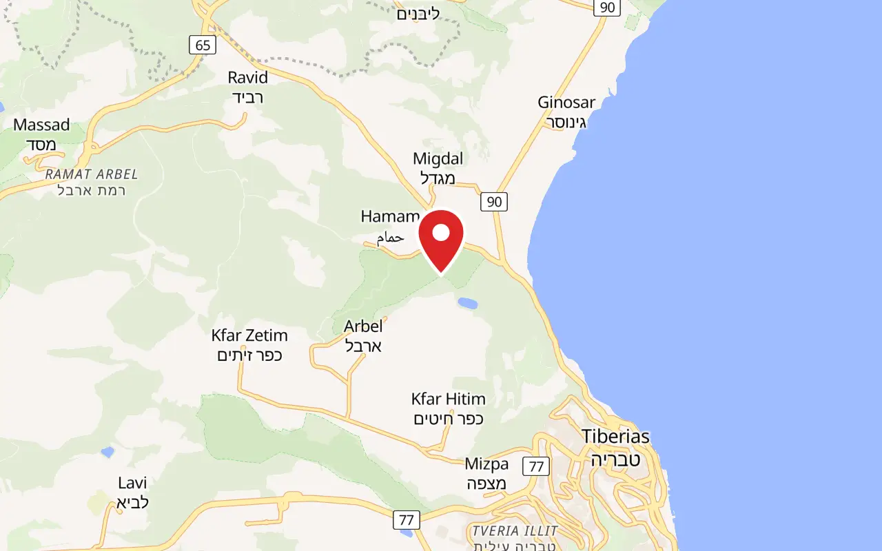
Where
Arbel National Park and Nature Reserve, above Moshav Arbel, Lower Galilee. From road 77 turn at the Kfar Hittim junction onto road 7717, then towards Moshav Arbel; turn left before the moshav entrance and continue about 3.5 km to the site. Telephone 04-6732904
What ticket you need
The lookouts, the cliff descent and the cave fortress all sit inside Arbel National Park and Nature Reserve and need the Parks Authority ticket. The ancient synagogue does not: it stands about two kilometres back down the approach road, outside the gate, and is free. Drivers coming from the Kfar Hittim junction pass it before they reach the pay booth, which is the sensible order to see the site in and the one most visitors miss.
Opening hours
- Summer, Sunday to Thursday and Saturday
- 08:00 to 17:00source
- Summer, Friday and holiday eves
- 08:00 to 16:00source
- Winter, Sunday to Thursday and Saturday
- 08:00 to 16:00source
- Winter, Friday and holiday eves
- 08:00 to 15:00source
- Eve of Rosh Hashanah, eve of Passover and eve of Yom Kippur
- 08:00 to 13:00source
- Last entry
- The gate shuts one hour before the closing time above. Last entry to the trails that descend the cliff is three hours before closing; last entry to the lookouts is one hour before closingsource
- Outside opening hours
- The Parks Authority states that visitors must not enter the Arbel Nature Reserve when the site is closed, and that a visit outside regular hours has to be arranged with the site office. This is the rule that catches people planning to be on the cliff for sunrisesource
- Rain
- The cliff route is closed on rainy dayssource
Admission
- Adult
- ₪31source
- Child
- ₪16source
- Student
- ₪26source
- Pupil
- ₪10source
- Israeli senior citizen
- ₪16source
- Adult in a group
- ₪26, for groups of more than 30 people on the Parks Authority's Hebrew price tablesource
- Child in a group
- ₪14, for groups of more than 30 peoplesource
- The ancient synagogue
- Free. It lies outside the ticketed gate on the approach road, and the Parks Authority states that the compound is open to the public at no charge, although entry into the synagogue building is barred while the excavation is under waysource
Access
Split, and the split is sharp. One lookout is genuinely accessible: the Parks Authority has surfaced a concrete path to the Mount Nitai viewpoint and to the ancient synagogue, fitted handrails on the steps, and set aside six accessible parking bays, two by the path to the entrance plaza, two by the accessible path to the Mount Nitai lookout and two beside the synagogue. The entrance plaza itself is accessible, including the visitor service centre, a toilet, picnic tables, drinking fountains, the sarcophagus display and the permanent exhibition of Arbel landscape photographs, and there is directional and identification signage. The cliff is the opposite. The route to the cave fortress goes over the edge on steps, iron pegs and fixed cables, and a wheelchair cannot do any part of it; nor is it suitable for anyone unsure on steep ground or carrying a small child. A large part of the cliff rim is left unfenced and without railings by deliberate policy, which matters for anyone with limited mobility or poor balance even on the easy circuit.
On site
- Car park
- Visitor service centre and shop
- Toilets
- Picnic tables and drinking fountains
- Sarcophagus display and landscape photography exhibition
- Marked trails, map number 3
- Accessible path to the Mount Nitai lookout and the synagogue
- Guiding bookable through the Lower Galilee education centre
- No barbecues or open fires
- Dogs on the lookout trails only, leashed and muzzled
Booking
The Parks Authority runs an online visit-coordination system for this site and says booking secures a place at the date and time requested. Its Hebrew page adds the practical consequence: if you have booked, arrive and find the site full, you will be asked to show the booking confirmation at the gate in order to get in. Guided visits go through the Lower Galilee education centre on 04-8276637.
Hours and prices are given as the operator publishes them and change without much notice, particularly around Shabbat and the festivals. Check the operator's own page before you travel for this.
Official page at parks.org.il →What people wish they had known
- Stop at the synagogue on the way up, not on the way back. It sits about two kilometres before the park gate, it is free, and drivers concentrating on the road to the summit go straight past it. Coming back down, most people are tired and the light has gone.
- Sunrise on the cliff is not a thing you can just turn up and do. The gate opens at 08:00 all year and the Parks Authority states that entering the reserve when the site is closed is forbidden and that an out-of-hours visit must be arranged with the site office in advance.
- Work backwards from the closing time, not forwards from your arrival. The gate shuts an hour before the posted closing time and the cliff trails stop admitting three hours before it, so a 16:00 winter close means no descent after 13:00 and no entry at all after 15:00.
- The descent is not a walk with a nice view at the end. It goes over the cliff edge on steps, iron pegs and fixed metal cables, and it climbs back up the same way. Anyone unsure on steep exposed ground should do the lookouts circuit instead and lose nothing of the view.
- Check the forecast for rain rather than for temperature. The Parks Authority closes the cliff route on rainy days, and the limestone underfoot is slick when wet even after the rain has stopped.
- Bring binoculars. The Parks Authority recommends them for this site specifically, and they are what turns the panorama into a list of identifiable places and the cliff face into nesting raptors and, in winter, the wallcreeper.
The figures
Mount Arbel by the numbers
Each figure carries the year it belongs to and links the source it came from.
| Measure | Figure | As of | Source |
|---|---|---|---|
| Summit elevation | 181 m above sea level | 2026 | parks.org.il |
| Height above the Sea of Galilee | about 390 m | 2026 | parks.org.il |
| Cave fortress circuit | about 2 km, about 3 hours, graded for fit walkers | 2026 | parks.org.il |
| Lookouts circuit | about 1 km, about 1 hour, three viewpoints | 2026 | parks.org.il |
| Adult admission | ₪31 | 2026 | parks.org.il |
| Nature reserve declared | 1967 | 1967 | parks.org.il |
| Synagogue identified by Edward Robinson | 1852 | 1852 | parks.org.il |
| First excavation of the synagogue, by Kohl and Watzinger | 1905 | 1905 | jewishvirtuallibrary.org |
While you are here
The rest of The Sea of Galilee
Everything else in this destination with a page of its own.
Ovedc / CC BY-SA 4.0 · Wikimedia Commons
Archaeological site
Magdala
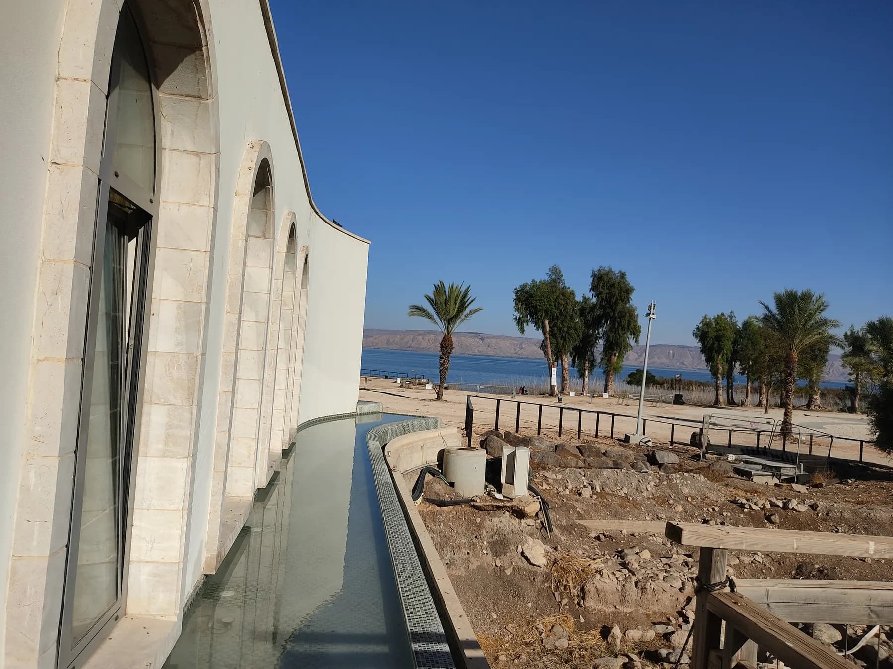
A guest house for pilgrims was going up here until the required salvage dig hit a synagogue from the time of the Second Temple in September 2009, and the buildings were redrawn around it.
Gerd Eichmann / CC BY-SA 4.0 · Wikimedia Commons
Museum
The Jesus Boat at Ginosar
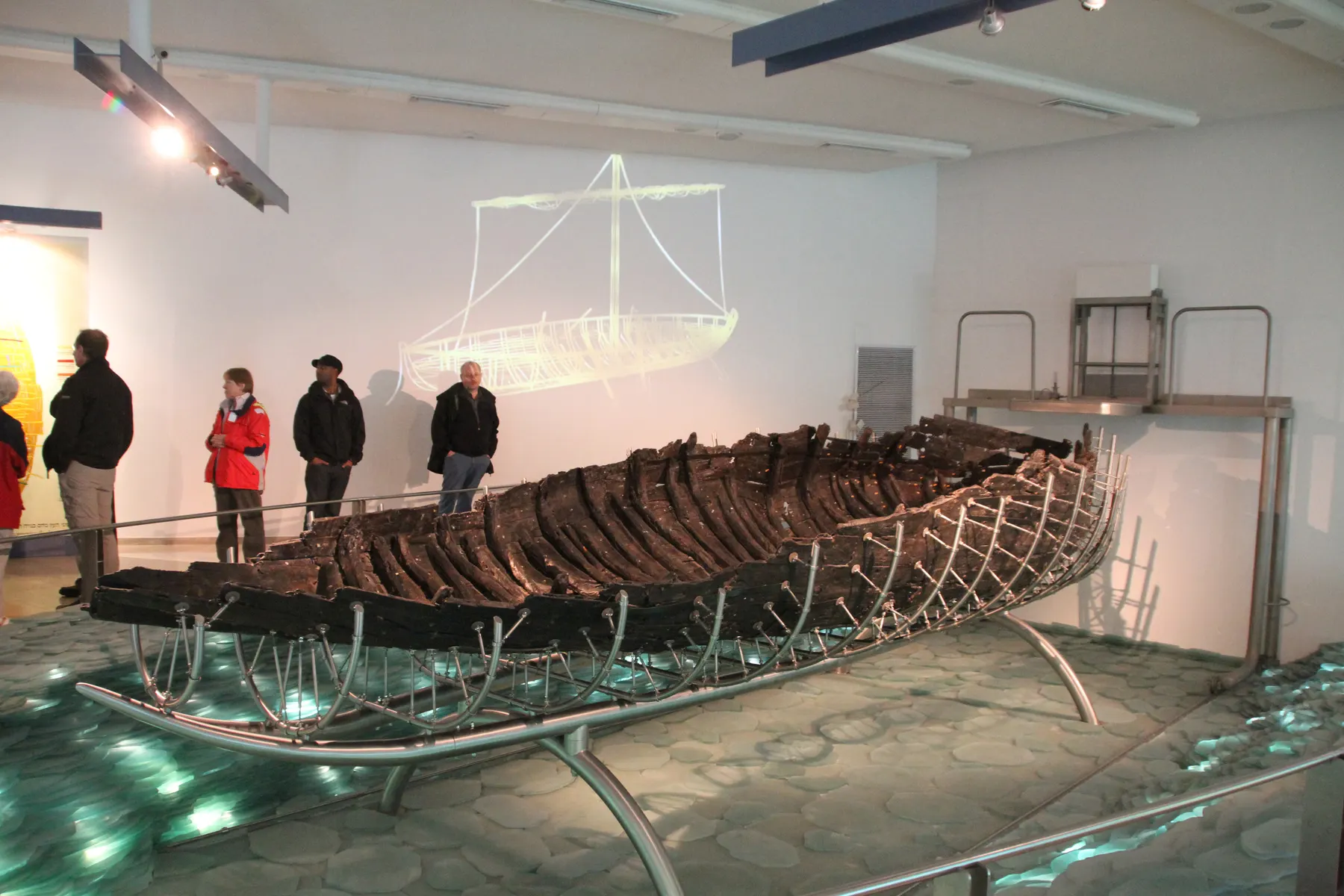
An eight-metre fishing hull that lay in the lakebed clay for two thousand years, was dug out in eleven days and nights in February 1986, and then sat in a pool of synthetic wax until 2000 before it could be shown.
יוסי רון / CC BY 2.5 · Wikimedia Commons
Religious site
Tabgha
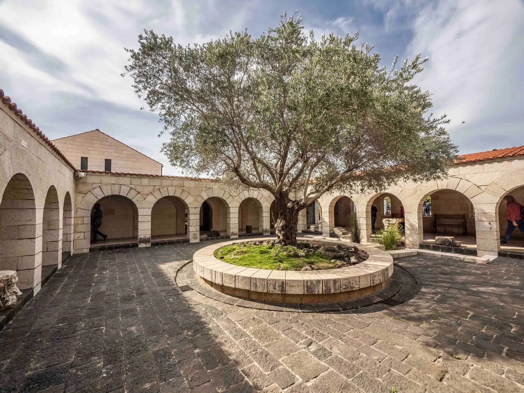
The mosaic in front of the altar shows a basket of four loaves, not the five of the Gospel account, and the usual reading is that the fifth is the one consecrated on the altar above it.
Sources and further reading
Every link below was opened and checked when this page was written. Official statements are marked as such: they are the subject's own account, not an independent one.
- OfficialIsrael Nature and Parks Authorityparks.org.ilArbel National Park and Nature Reserve
Summer and winter opening hours, the one-hour gate rule and the three-hour cut-off for the cliff trails; entrance fees in shekels for adult, child, student, pupil, Israeli senior citizen and groups; 181 m above sea level and about 390 m above the lake; the hard limestone and dolomite; the 1967 declaration and the reason for it; Mount Nitai, Mount Savyon, the Horns of Hittim and the Arbel plateau; Cristataria genezerethana, the wallcreeper, bladder senna and rock scrophularia; parking, washrooms, cafeteria and trails; the ban on entering when the site is closed
- OfficialIsrael Nature and Parks Authorityparks.org.ilגן לאומי ושמורת טבע ארבל
The Hebrew page, which carries more than the English one: the accessibility statement with six parking bays, the concrete path to the Mount Nitai lookout and the synagogue and the accessible entrance plaza; the eve of Rosh Hashanah, Passover and Yom Kippur closing at 13:00; the full price table including groups of more than thirty; dogs on lookout trails only; no open fires; the service centre stock; the synagogue's phases and the 2008 excavation under Benny Arubas; the wall from the Great Revolt; the booking-confirmation rule
- OfficialIsrael Nature and Parks Authorityparks.org.ilמבצר המערות על מצוק הארבל: המלצה למסלול טיול
The authority's own route notes: cave fortress circuit about 2 km and about 3 hours for fit walkers, lookouts circuit about 1 km and about 1 hour, trail map 3; the black trail to Mitzpe HaHaruv and the 800 m to the red trail; the fortress dated to the seventeenth century and attributed to Ali Beg son of Fakhr al-Din, its basalt and limestone courses and the Hellenistic coins and ritual baths inside; the 37 BCE date for the stand against Herod; Robinson in 1852; the two synagogue phases, the 749 earthquake and the re-erected gateway; the unfenced rim; closure in rain; free entry to the synagogue
- OfficialJesus Trailjesustrail.comWhat is the Jesus Trail?
The 65-kilometre route from Nazareth to Capernaum and its published stage list, which runs through the Horns of Hattin, Nebi Shu'eib and Arbel National Park before dropping to Magdala and Ginosar
- ReferenceFlavius Josephus, Whiston translation (University of Chicago)penelope.uchicago.eduAntiquities of the Jews, Book XIV
The primary account of Herod's attack on the cave-dwellers near the village of Arbela: the abrupt mountains with no approach from above or below, the chests hung on iron chains from an engine at the summit, the soldiers with long hooks, and the forty days before Herod arrived with his whole army
- ReferenceFlavius Josephus, Whiston translation (University of Chicago)penelope.uchicago.eduThe Wars of the Jews, Book I
The second telling of the same campaign, with the three cohorts and troop of horse sent ahead to the village Arbela, the fire sent into the caves, Herod's offer of safe conduct, and the old man who killed his seven children and his wife at the cave mouth rather than surrender
- ReferenceFlavius Josephus, Whiston translation (University of Chicago)penelope.uchicago.eduAntiquities of the Jews, Book XII
Bacchides pitching camp at Arbela, a city of Galilee, and besieging and taking those who had fled into the caves there, in the campaign Whiston's marginal note dates to 161-160 BCE
- ReferenceFlavius Josephus, Whiston translation (University of Chicago)penelope.uchicago.eduThe Wars of the Jews, Book II
Josephus's list of the places he fortified as commander in Galilee in 66 CE, which includes walls built about the caves near the lake of Gennesar in the Lower Galilee
- ReferenceEncyclopaedia Judaica, via the Jewish Virtual Libraryjewishvirtuallibrary.orgArchaeology in Israel: Arbel
Charles Wilson's nineteenth-century exploration and the first excavation by Kohl and Watzinger in 1905; the reading of the mesalot at Arbel in 1 Maccabees as the caves and their stairways; the 39 BCE date for the stand against Herod and the detail of fires lit at the cave mouths; Nittai of Arbela and the priests of the House of Jeshua; the statement that the third-century date once proposed for the synagogue is no longer accepted
- ReferenceWikipediaen.wikipedia.orgMount Arbel
The 38 BCE date for the Herodian episode, one of the three competing years; the cave castle attribution to Ali Beg following Jerome Murphy-O'Connor's Oxford Archaeological Guide; the reserve at 1,400 dunams and the national park at 8,509; the Israel National Trail from the south and the Jesus Trail from the west converging at the peak
- ReferenceWikipediaen.wikipedia.orgKhirbet Wadi Hamam
Background on the excavated village at the foot of Mount Nitai opposite Arbel, dug between 2007 and 2012 by Uzi Leibner for the Hebrew University of Jerusalem, and the naming of the wadi for its cliff-nesting pigeons
- ReferenceSefariasefaria.orgPirkei Avot 1:6
The text naming Nittai the Arbelite among the pairs who received the oral tradition, the earliest use of the place name as a person's epithet
Mount Arbel: common questions
How long does Mount Arbel take?+
About an hour for the lookouts circuit, which the Parks Authority publishes as roughly a kilometre with three viewpoints, and about three hours for the circular route down the cliff to the cave fortress and back, which is about two kilometres. Add half an hour for the synagogue on the approach road. Most visitors who are not doing the descent are done in ninety minutes.
How much does it cost to get in?+
The Parks Authority lists ₪31 for an adult and ₪16 for a child, with ₪26 for a student, ₪16 for an Israeli senior citizen and ₪10 for a pupil. Groups of more than thirty pay ₪26 an adult and ₪14 a child. The ancient synagogue outside the gate is free.
Is the cliff descent dangerous?+
It is exposed and it is steep, and the Parks Authority grades it for fit walkers rather than for families. The route goes over the rim on steps, iron pegs and metal cables fixed into the rock, and returns by the same kind of ground. The authority also warns about falling and rolling stones, closes the route in rain, and asks people not to approach the cliff edge elsewhere, since much of the rim is deliberately left unfenced.
Can you visit Mount Arbel in a wheelchair?+
The lookout at Mount Nitai and the ancient synagogue, yes; the cliff, no. The Parks Authority has laid a concrete path to that lookout and to the synagogue, fitted handrails to the steps, and made the entrance plaza, service centre, toilet, picnic tables and exhibitions accessible, with six designated parking bays. The descent to the cave fortress is a fixed ladder of pegs and cables and is not passable in a wheelchair.
What can you actually see from the top?+
The Parks Authority lists the Jordan Valley, the Sea of Galilee, the Golan Heights, Mount Hermon and the Galilee, and on a clear day that is all visible from one spot. The lookouts face different ways: one towards the lake and the southern Golan, the Carob lookout down the cliff itself, and the third across Nahal Arbel to Mount Nitai.
Can you go up for sunrise?+
Not without arranging it first. The site opens at 08:00 throughout the year, the Parks Authority states that entering the reserve when it is closed is forbidden, and it directs anyone wanting to visit outside regular hours to book with the site office. The clifftop is a well-known dawn spot, which is exactly why the rule is printed.
Do you need to book?+
Booking is not universally compulsory but it is strongly pushed and it is worth doing. The Parks Authority runs a visit-coordination system for Arbel and says a reservation secures a place at the requested date and time; its Hebrew page notes that if you have booked and the site turns out to be full, showing the confirmation at the gate is what gets you in.
Is the cave fortress the same as the caves Herod attacked?+
Partly. The caves are the same caves, natural karst cavities later cut and enlarged by hand, and Josephus describes Herod's men being lowered into their mouths in chests hung on chains. The fortified walls across them are far later: the Parks Authority dates the fortress to the seventeenth century and attributes it to Ali Beg, son of the Druze emir Fakhr al-Din. Hellenistic coins and ritual baths have been found in caves inside the fortress.
Can you bring a dog?+
On the lookout trails only, leashed and muzzled. The Parks Authority does not permit dogs on the cliff trails at all, which rules out the whole cave fortress circuit.
Is Mount Arbel worth it if you are short of time?+
Yes, and it is one of the few sites around the lake that repays a very short visit. The lookouts circuit is about a kilometre on easy ground and delivers the view that the rest of the destination is described in relation to. If the choice is between an hour at Arbel and an hour at anything else on this shore, the hour at Arbel is the one that makes the geography of the lake make sense.