
Lower Galilee and the Jordan Rift…
The Sea of Galilee
A harp-shaped lake more than 200 metres below sea level, ringed by basalt hills, gospel ruins and a water gauge the whole country reads.
Length, north to south
about 21 km
and roughly 11 km across at its widest, per Britannica
Surface area
about 166 sq km
per Britannica
Maximum depth
about 48 m
Britannica's figure, measured in the north-east; other accounts give about 43 m
Surface elevation
roughly 209–214 m below sea level
described by NASA's Jet Propulsion Laboratory as the lowest freshwater lake on Earth
Shoreline circuit
roughly 60–65 km
the length of the Kinneret Trail, Shvil Sovev Kinneret
Things to do
10 sites, each with its own page
in The Sea of Galilee
Restaurants
13 picks
in The Sea of Galilee
Hotels
10 picks
in The Sea of Galilee
Getting there
7 routes
in The Sea of Galilee
When to go
Month by month
in The Sea of Galilee
יָם כִּנֶּרֶת · Lower Galilee and the Jordan Rift Valley, northern Israel
Israelis do not call it the Sea of Galilee. They call it the Kinneret, and they talk about it the way other countries talk about the weather: not as scenery but as a number. Every winter the news carries the lake's level in centimetres, measured against a set of administrative lines drawn on the water. It is the country's only large freshwater lake, it sits in the Jordan Rift Valley more than two hundred metres below sea level, and for decades it was the tap that fed the state.
It is also small. About 21 kilometres from the Jordan's inflow in the north to the Degania sluices in the south, roughly 166 square kilometres of water with a maximum depth near 48 metres, according to Britannica. You can drive round it in an afternoon and see the far shore from almost anywhere on it. That compactness makes the place legible: Tiberias on the western slope, Capernaum and Tabgha on the northern shore, the Golan escarpment rising brown and abrupt on the east, banana plantations and date palms in the flat south.
What a visitor actually finds is two lakes overlaid. One is a working reservoir with a limnological laboratory, pumping stations and a dam. The other is the shoreline of the Gospels, where a first-century fishing hull sits in a climate-controlled hall at Kibbutz Ginosar and pilgrims wade into the Jordan a few kilometres downstream. Both are real, and they share the same beaches.
The lake
Why the Kinneret sits where it does
The Sea of Galilee lies in the Jordan Rift Valley, which NASA's Earth Observatory describes as a narrow depression that began forming tens of millions of years ago as the Arabian plate tore away from Africa. The Jet Propulsion Laboratory goes further and calls the lake the lowest freshwater lake on Earth. Only the Dead Sea, further south down the same rift and far saltier, sits lower.
The Jordan River enters at the north end, having gathered snowmelt and spring water off Mount Hermon and the Hula Valley, and leaves at the south past Kibbutz Degania, where sluice gates control the outflow. The lake's shape follows the rift: a straight, steep eastern shore under the Golan escarpment, a gentler western shore where Tiberias climbs the slope, and the fertile Ginosar plain in the north-west.
The name is old and much reused. Britannica records it as the Sea of Chinnereth in the Hebrew Bible, the Lake of Gennesaret later, Yam Kinneret in modern Hebrew, Buḥayrat Ṭabarīyā in Arabic and Lake Tiberias in older English writing: all the same water.
- Inflow: the Jordan River, from the north
- Outflow: the Jordan again, through the Degania sluices in the south
- East shore: the Golan escarpment, rising sharply
- West shore: Tiberias, the Arbel cliffs and the Ginosar plain
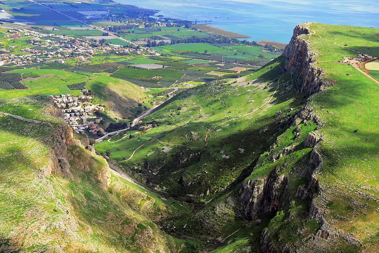
AVRAHAM GRAICER / CC BY-SA 4.0 · Wikimedia Commons
Water
The red lines, and what they actually mean
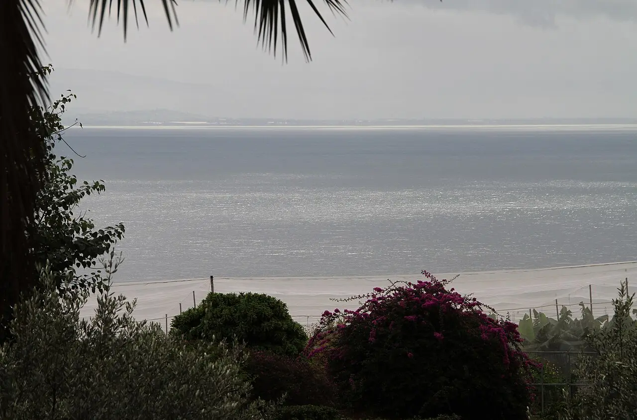
Israel manages the Kinneret against three thresholds, and once you know them the winter news reports make sense. The upper red line sits at 208.80 metres below sea level: above that the lake risks flooding the Tiberias promenade and the Degania gates are opened. The lower red line is at 213 metres below sea level, the point below which pumping is supposed to stop because water quality and the lake's ecology begin to suffer. Below that lies the black line, where the damage is treated as irreversible; the Times of Israel put it at about 215 metres below sea level in 2022, the Jerusalem Post at 214.87 metres in October 2025. The Water Authority's preferred 'green' level is around 211.40 metres.
The lake spends a lot of its life below the lower red line. In October 2025 it stood at 213.19 metres below sea level, 19 centimetres under that line, after what the Water Authority's Kinneret division director Fares Talhami called the driest winter in the lake's drainage basin since measurements began about a century ago. In early February 2026 it was still 23 centimetres below the line and only 1.65 metres above the black line. By 31 March 2026, after a wetter spell, the Kinneret Authority put it 20.5 centimetres above the lower red line: a recovery, but a thin one.
The numbers are not guesswork. The Kinneret Limnological Laboratory, at the Sapir site on the lake's shore, runs continuous monitoring of the lake's water quality, with research vessels and a research raft moored at the lake's centre that samples round the clock. The figures on this page carry the dates they were measured, because they will have moved.
- Upper red line: 208.80 m below sea level (Times of Israel, 2022)
- Lower red line: 213 m below sea level; pumping stops
- Black line: about 215 m (Times of Israel, 2022) or 214.87 m (Jerusalem Post, 2025) below sea level
- 31 March 2026: 20.5 cm above the lower red line (Kinneret Authority, via Globes)
Gerd Eichmann / CC BY-SA 4.0 · Wikimedia Commons

Engineering
The National Water Carrier, running backwards
The National Water Carrier, built in the 1960s, is the canal, tunnel, pipeline and pumping-station system that lifts Kinneret water out of the rift; Britannica describes it as conveying water from the Jordan to Israel's densely populated coastal region and south to the Negev, pumped uphill some 800 feet on the way. It was the physical spine of the young state's water economy. The desalination plants built along the Mediterranean since the 2000s have taken over most of that job.
Then the direction changed. Mekorot and the Water Authority built a link that lets desalinated seawater from the Mediterranean plants travel north instead (construction began in 2018, according to the Jerusalem Post) at a cost of NIS 900 million, about $264 million, ending in a 13-kilometre underground pipe that discharges into the Tzalmon stream, which drains into the lake near Kibbutz Ginosar. Sluice gates were opened at the launch ceremony on 28 December 2022. The Times of Israel reported it as the first time anywhere that desalinated water had been used to replenish a lake.
For its first years it ran far below capacity, because the lake was high. The drought changed that. The Water Authority moved to full operation in the autumn of 2025, and in February 2026 raised the flow from 1,000 cubic metres an hour to between 4,000 and 6,000, the lake having gained only about 30 centimetres that season against 1.6 metres in an average one. The water arrives through a once-dry streambed that the flow has revived, and the limnological laboratory's monitoring is the instrument by which its effect on a living freshwater lake will be judged.
The city
Tiberias: hot springs, Talmud and a lakefront
Tiberias was founded in 18 CE by Herod Antipas, tetrarch of Galilee, and named to flatter the reigning emperor Tiberius. It is the only town of any size on the lake and the base most visitors use: hotels and restaurants along the Yigal Alon promenade, boats leaving from the marina, buses radiating to the northern shore. Britannica calls the combination of warm winter climate, thermal baths and lake views enough to make it Israel's most popular resort city. CityPopulation.de, drawing on Central Bureau of Statistics figures, puts its population at 46,698 at the end of 2021.
Its weight in Jewish history is out of all proportion to its size. After the destruction of the Second Temple the Sanhedrin moved here, along with the yeshivot; Britannica's account has much of the compilation of the Mishnah done in Tiberias in the third century, and the Jerusalem version of the Gemara edited here about two hundred years later. In the eighth and ninth centuries Tiberian scholars developed the system of vocalisation and cantillation behind the Masoretic text of the Hebrew Bible, the version still printed today. Tiberias is counted among Judaism's four holy cities, with Jerusalem, Hebron and Safed.
Just south of the modern centre are the hot springs that gave the suburb of Hammat its name, known, Britannica notes, for over 2,000 years for their supposed medicinal qualities. The national park there takes in the springs and the excavated remains of an ancient synagogue with a figurative mosaic floor, one of the best known in the country. Check the Israel Nature and Parks Authority's own page for current hours and fees before you go.
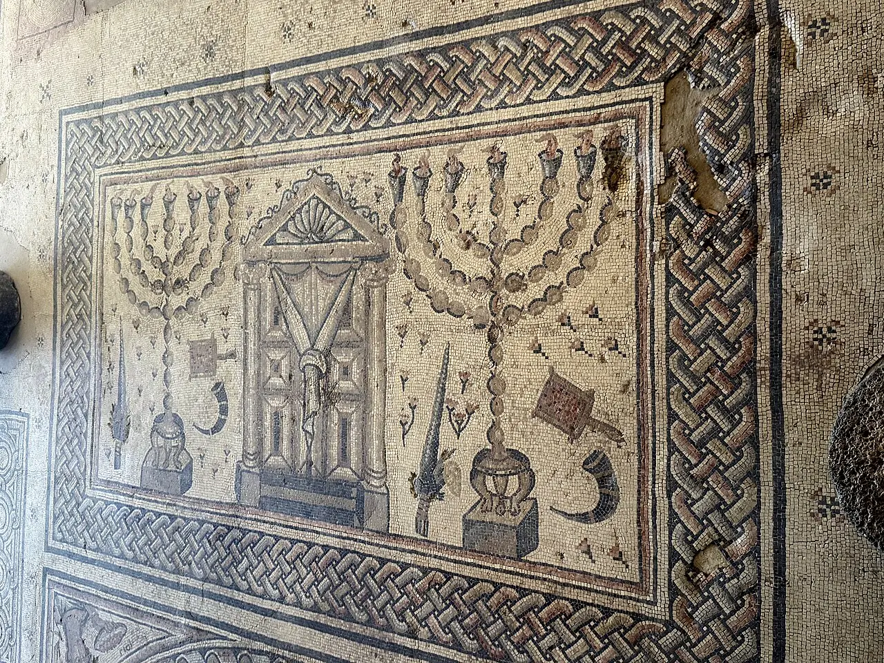
שלמה רודד / CC BY 2.5 · Wikimedia Commons

The north shore
Capernaum, Tabgha and the Mount of Beatitudes
The Gospels put most of Jesus's Galilean ministry on the north-western arc of this lake, and the sites sit within a few kilometres of each other. Capernaum is the anchor. The Custody of the Holy Land bought the land after eight years of negotiation with the Samakieh Bedouin, completing the purchase in September 1894, and Franciscan archaeologists have worked it ever since: nineteen campaigns under Virgilio Corbo between 1968 and 1986, four more seasons under Stanislao Loffreda from 2000 to 2003.
What you see is two layers. The handsome white limestone synagogue, standing incongruously bright against the village's black basalt, is dated by the Custody's own archaeologists to the fifth century, with coins under the floor pointing to completion in its last quarter; beneath it are traces of an earlier synagogue from the time of Jesus, its walls of squared basalt blocks. A short way south, under an octagonal Byzantine church, is a house singled out from the mid-first century, found in 1968 with fragments of painted plaster scratched with Christian inscriptions. The Franciscans identify it as Simon Peter's house and built a memorial church over it, consecrated on 29 June 1990. The identification rests on that continuity of veneration rather than on an inscription naming Peter.
A short walk west, Tabgha (from the Greek Heptapegon, 'seven springs') holds the Church of the Multiplication, with its fifth-century mosaic of two fish flanking a basket of loaves. On 18 June 2015 a fire that police treated as arson raged mainly on the roof and damaged a book store, offices and an event hall; the church itself and its Byzantine mosaics came through without significant damage. Above Tabgha the Mount of Beatitudes looks down the whole northern basin. Further round at Migdal, salvage excavations in 2009 uncovered a first-century synagogue and the carved Magdala Stone, bearing one of the earliest known depictions of a menorah, thought by some scholars to represent the one that stood in the Temple. A second first-century synagogue was announced there in 2021.

The boat
The hull that came out of the mud in 1986
A severe drought gripped Israel in 1985 and 1986; the winter rains barely came, and the lake fell away from its shore. In January 1986 two brothers from Kibbutz Ginosar (Moshe and Yuval Lufan, fishermen and avid amateur archaeologists who often walked the newly exposed lakebed) noticed the outline of a wooden hull in the mud. The excavation that followed, led by the nautical archaeologist Shelley Wachsmann and reported in Biblical Archaeology Review in 1988, ran round the clock, day and night, before the water could return.
The surviving hull is a small open fishing boat of the kind that worked this lake, not a ship. The Yigal Allon Centre, which displays it, dates it by radiocarbon to somewhere between 100 BCE and 100 CE, a span that takes in both the era of the Gospels and the Jewish revolt against Rome, which is why it is universally nicknamed the Jesus Boat. Nothing links it to Jesus or his disciples beyond that overlap, and the museum does not claim otherwise.
Waterlogged ancient wood collapses as it dries, so the boat was treated with polyethylene glycol, a synthetic water-soluble wax that replaces the water in the decaying cells and lets the timber dry without deforming. The process took seven years. The boat was moved into its exhibition hall at Ginosar in 2000, where humidity, temperature and air pressure are held constant. The centre's website listed hours in 2026 of Sunday to Thursday, 8am to 5pm, with Friday and Saturday only for groups of twenty or more by arrangement; confirm directly before travelling, since museum hours in Israel move with the season and the holiday calendar.

The shore
Swimming, beaches and the Kinneret Trail
The Kinneret is a swimming lake, and unusually for Israel it is warm enough for most of the year. Ynet counts 31 guarded beaches with rescue services around the shore: eleven in Tiberias, fifteen belonging to the Kinneret municipal union and designated 'quiet beaches', four to the Emek HaYarden Regional Council and one to the Migdal Beach Local Council. Pedestrian access to the beaches run by the local authorities is free, Ynet reports; at most of them you will be charged for parking, which is where the money actually goes. A free shuttle links the beaches through the summer holidays, and runs at weekends through the year.
Swim at a guarded beach and inside the flags. The lake shelves unevenly, the bed is basalt cobble in places, and the wind can get up fast in the afternoon. Water temperatures are comfortable from late spring to late autumn and cool markedly in midwinter.
The Kinneret Trail, Shvil Sovev Kinneret, is the walking and cycling circuit of the shoreline, roughly 60 to 65 kilometres round. It is flat and broken into short segments; parts are paved and others left rough. Around 85 per cent of the route was open to the public free of charge as of 2026, when Israel's planning council reversed a proposal that would have let kibbutzim restrict access and adopted a framework of continuous public passage instead, so check which sections are through before planning a full circuit. The trail also links to the 65-kilometre Jesus Trail, which runs from Nazareth via Zippori, Cana, the Horns of Hattin and Arbel to Migdal, Ginosar, Tabgha and Capernaum.

On the water
Squalls, boats and St Peter's fish
The lake's sudden storms are not a literary device. Cold air spilling off the Golan and the Hula Valley drops onto warm air sitting on a small, shallow, deeply sunken body of water, and the result can be violent within the hour. On 15 May 2022 easterly gusts of 140 km/h drove waves over the Yigal Alon promenade in Tiberias, shattering shop windows, flooding the promenade, sinking boats and bringing down trees, damage the municipality put in the millions of shekels.
Fishing is the other constant. The signature catch is Sarotherodon galilaeus, the Galilee tilapia sold everywhere as St Peter's fish, and it came close to collapse: by January 2010 the agriculture ministry was describing stocks as having fallen by tens of percentage points a year, to a critical level, and a two-year ban on fishing in the Kinneret took effect on 1 March 2010. It was later softened into an annual closed season from 15 April to 15 August, covering the spawning months, alongside a requirement to restock the lake with young St Peter's fish each year. Order it in a lakeside restaurant and it may well be farmed rather than netted from the lake.
Boats still work the water for other reasons. Wooden-hulled tourist launches cross between Tiberias, Ginosar and the northern shore, and the crossing is worth doing for the geometry of the place: the Arbel cliff, the Golan wall, the whole basin visible at once from the middle of it.
On the ground
What to see at The Sea of Galilee
The things worth building a visit around, in the order most people reach them.
The Ancient Boat, Kibbutz Ginosar
A fishing hull radiocarbon-dated to between 100 BCE and 100 CE, found in the drought of 1986 and conserved in synthetic wax over seven years, now displayed in a climate-controlled hall at the Yigal Allon Centre.
Capernaum
Black basalt village streets, a fifth-century white limestone synagogue over traces of an earlier one from the time of Jesus, and the house the Franciscans identify as Simon Peter's, under a memorial church consecrated in 1990.
Tabgha and the Mount of Beatitudes
The Church of the Multiplication's fifth-century mosaic of loaves and fishes, which came through the 2015 arson fire undamaged, with the Beatitudes hillside looking down over the whole northern basin.
Hammat Tiberias
Thermal springs credited with medicinal properties for more than two millennia, and a national park preserving the excavated remains of an ancient synagogue with a figurative mosaic floor.
Magdala
A first-century synagogue found in a 2009 salvage dig, and the carved Magdala Stone with one of the earliest known images of a menorah, thought by some scholars to show the one that stood in the Temple.
The Kinneret Trail
Roughly 60 to 65 kilometres of flat shoreline walking and cycling, about 85 per cent of it open free of charge, kept as a continuous public right of passage around the lake.
Go deeper
Every site in The Sea of Galilee, in full
10 places here have a page of their own: what survives, what it costs, when it opens and how long to give it.
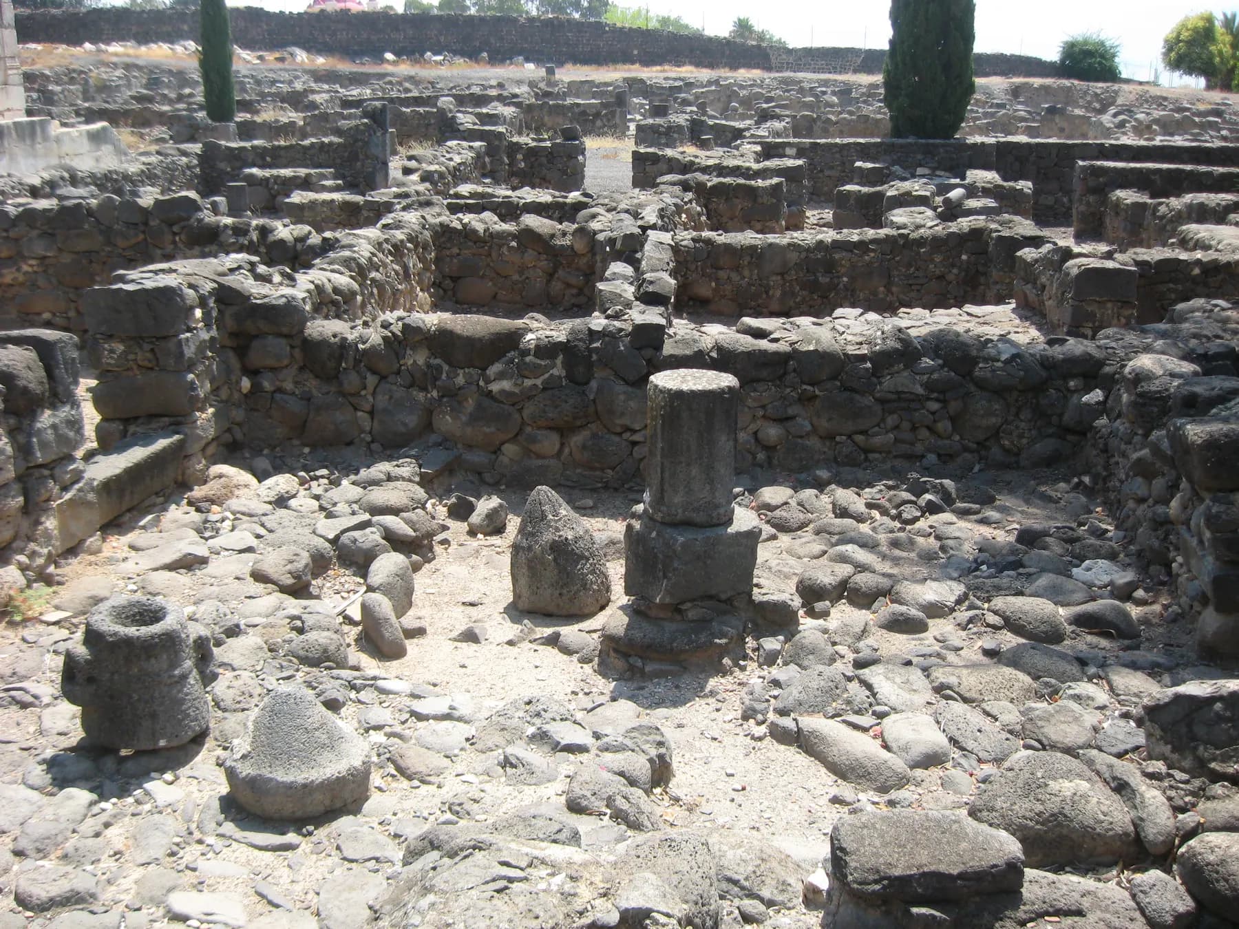
Tracy Hunter from Spokane, USA / CC BY 2.0 · Wikimedia Commons
Archaeological site
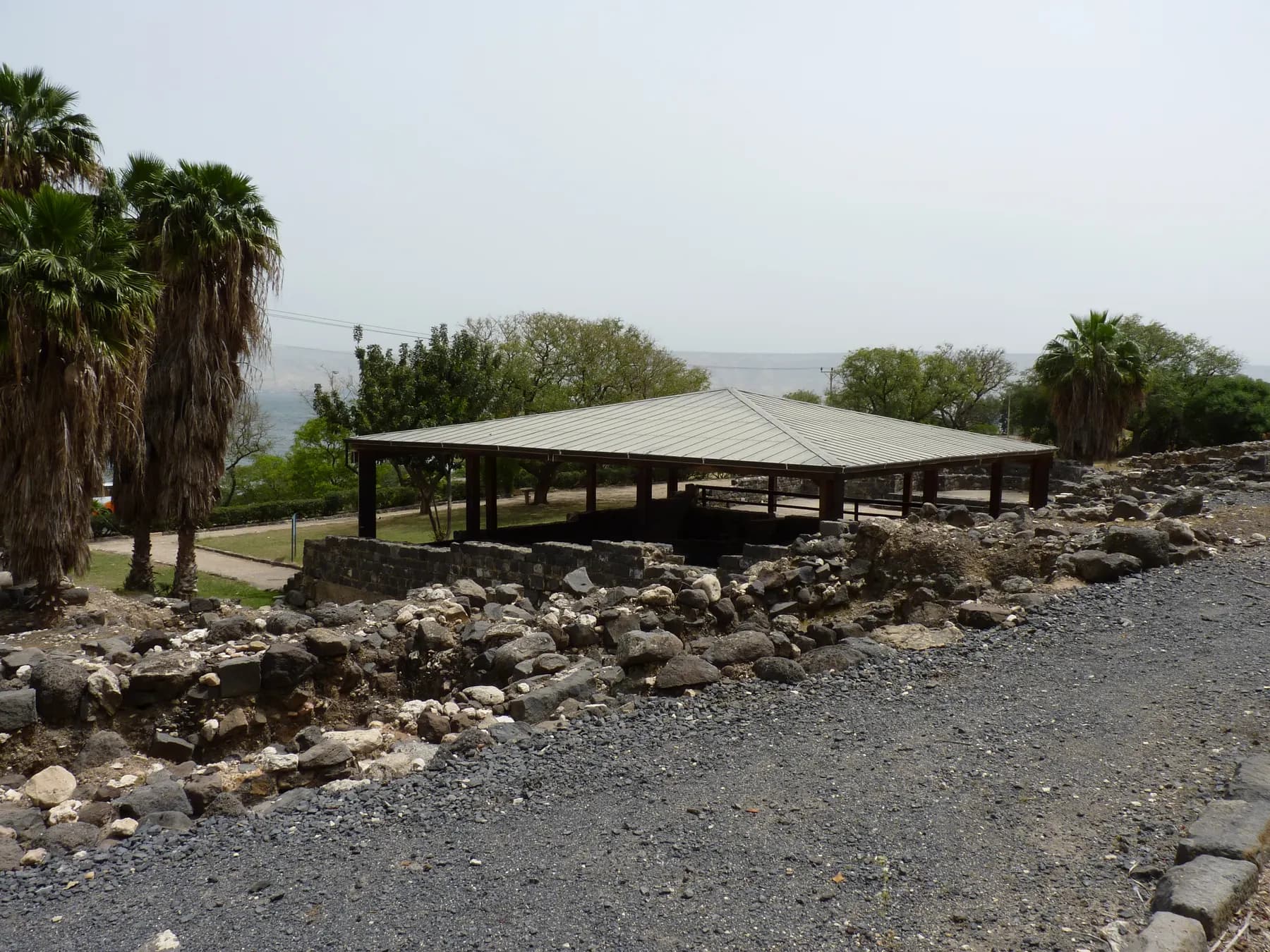
Capernaum
Two thirds of the ruined village belongs to the Franciscans, who finally got the title deeds on 19 September 1894 after eight years of Ottoman paperwork and have dug it in twenty-three seasons since 1968.
geagea / CC BY 3.0 · Wikimedia Commons
Activity
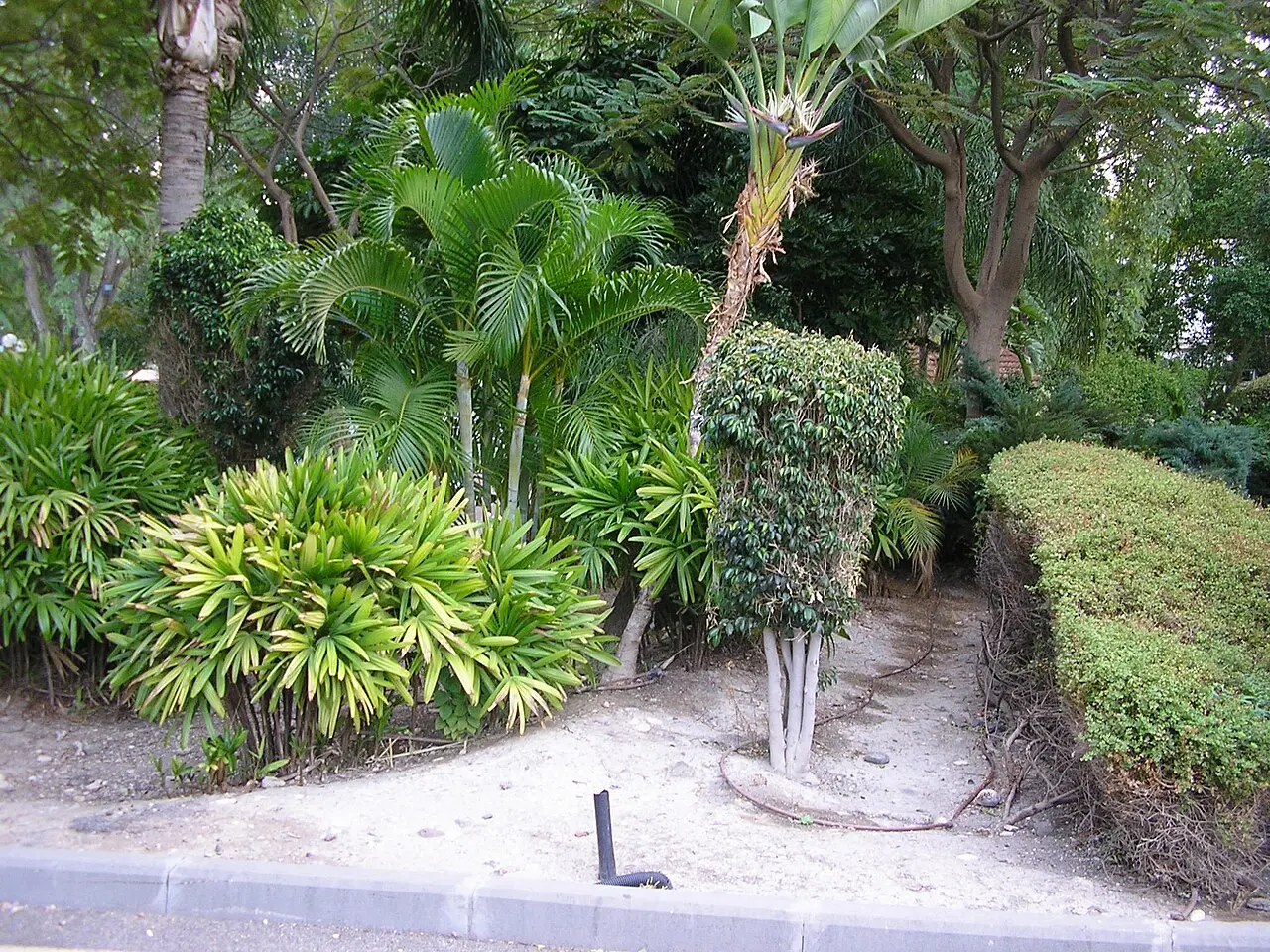
Hamat Gader
The water reaches the surface here at 42 degrees all year, and the Roman bath complex excavated beside the modern pools was begun in the second century by the Tenth Legion, garrisoned at Gadara on the ridge that is now in Jordan.
Archaeological site
Hamat Tiberias
Seventeen springs come out of the ground here at about 60 degrees Celsius, and the synagogue beside them has a mosaic floor that puts a zodiac wheel around the sun god Helios.
Gerd Eichmann / CC BY-SA 4.0 · Wikimedia Commons
Museum
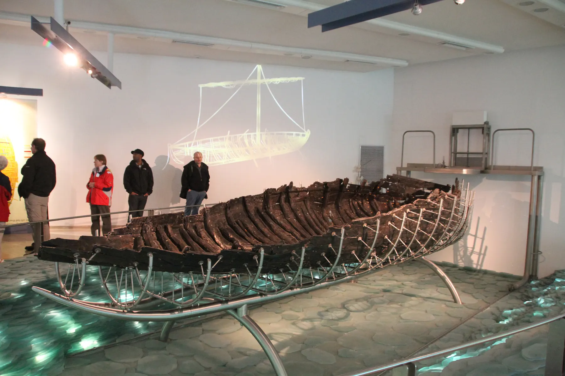
The Jesus Boat at Ginosar
An eight-metre fishing hull that lay in the lakebed clay for two thousand years, was dug out in eleven days and nights in February 1986, and then sat in a pool of synthetic wax until 2000 before it could be shown.
זאב שטיין / CC BY 2.5 · Wikimedia Commons
Archaeological site
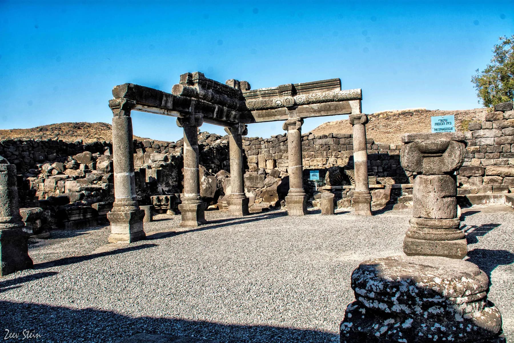
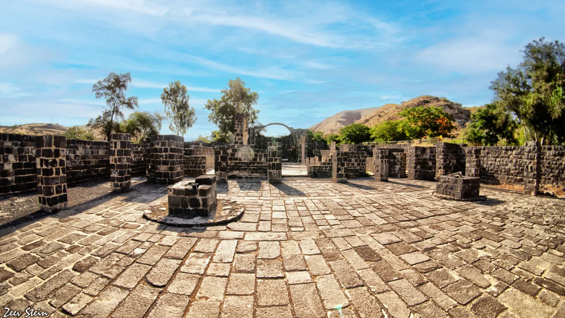
Korazim
A Talmudic-era town built entirely out of the black basalt it stands on, remembered in the Babylonian Talmud for its wheat and in the Gospels for refusing to listen.
זאב שטיין / CC BY 2.5 · Wikimedia Commons
Archaeological site
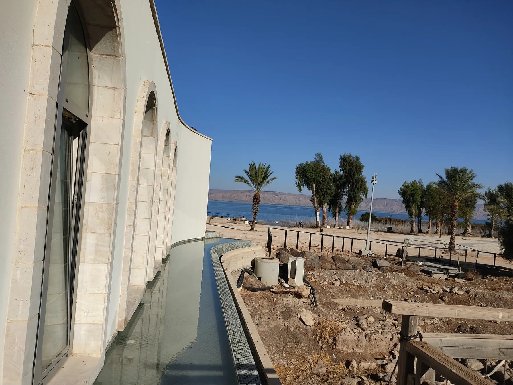
Kursi
A bulldozer cutting a new road to the Golan hit its wall in 1970, and what came out was a walled Byzantine monastery of 145 by 123 metres that the parks authority calls the largest known in the Holy Land.
Ovedc / CC BY-SA 4.0 · Wikimedia Commons
Archaeological site
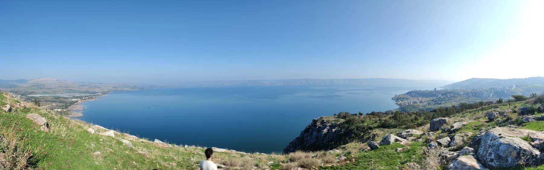
Magdala
A guest house for pilgrims was going up here until the required salvage dig hit a synagogue from the time of the Second Temple in September 2009, and the buildings were redrawn around it.
Yinonk / CC BY 4.0 · Wikimedia Commons
Viewpoint
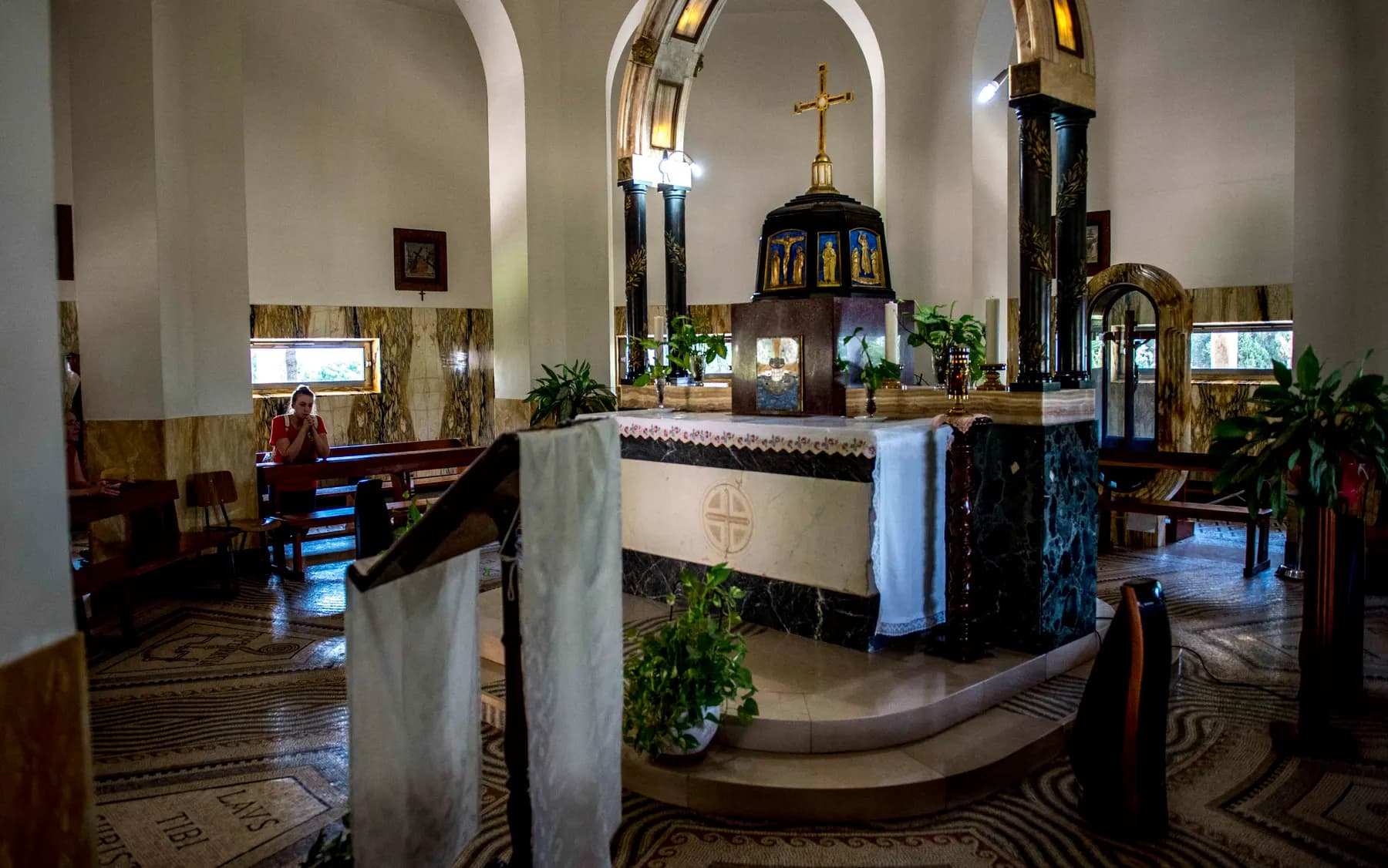
Mount Arbel
A limestone and dolomite cliff standing 181 metres above sea level and about 390 metres above the Sea of Galilee, with several hundred caves cut into its face and a seventeenth-century fortress built across them.
Commander, U.S. Naval Forces Europe-Africa/U.S. 6th Fleet / Public domain · Wikimedia Commons
Religious site
Mount of Beatitudes
Antonio Barluzzi gave the church eight sides for the eight beatitudes and set it on a hill about 25 metres below sea level, which makes the summit one of the lowest in the world.
יוסי רון / CC BY 2.5 · Wikimedia Commons
Religious site
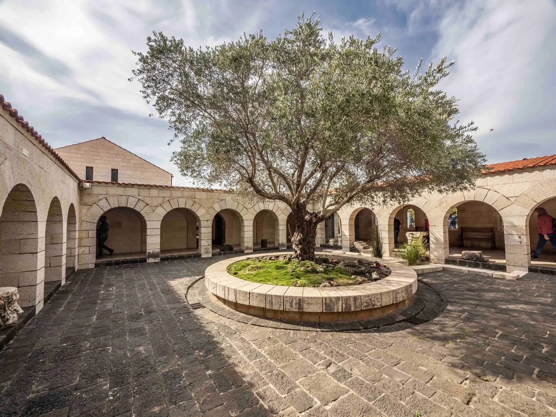
Tabgha
The mosaic in front of the altar shows a basket of four loaves, not the five of the Gospel account, and the usual reading is that the fifth is the one consecrated on the altar above it.
The long view
The Sea of Galilee, in order
18 CE
Herod Antipas founds Tiberias on the western shore and names it for the emperor Tiberius.
1st century CE
Capernaum, Magdala and the northern shore villages form the setting of Jesus's Galilean ministry; a synagogue and the Magdala Stone at Migdal date from this period, as does the Ginosar boat, whose radiocarbon span takes in the Jewish revolt against Rome.
3rd century
The Sanhedrin and the yeshivot move to Tiberias; Britannica has much of the compilation of the Mishnah done there, and the Jerusalem Gemara edited there some two centuries later.
5th century
The white limestone synagogue is built at Capernaum, an octagonal church rises over the venerated house, and the Tabgha loaves-and-fishes mosaic is set.
8th–9th centuries
Tiberian scholars develop the vocalisation and cantillation system behind the Masoretic text of the Hebrew Bible.
1894
The Custody of the Holy Land completes its purchase of Capernaum after eight years of negotiation; Franciscan excavation continues there to this day.
1909
Deganya, the first kibbutz, is founded at the lake's southern outlet.
1960s
The National Water Carrier is built, taking Kinneret water to the coastal plain and the Negev.
1986
Moshe and Yuval Lufan find the ancient boat in lakebed exposed by the drought of 1985–86; Shelley Wachsmann leads the round-the-clock excavation.
2009
A first-century synagogue and the Magdala Stone are uncovered in a salvage dig at Migdal; a second first-century synagogue follows in 2021.
2010
A two-year ban on fishing in the Kinneret takes effect on 1 March, later softened into an annual closed season from 15 April to 15 August.
2015
A fire treated by police as arson damages the roof, offices and book store at Tabgha on 18 June; the Byzantine mosaics survive.
December 2022
The reversed National Water Carrier is inaugurated on 28 December, reported as the first scheme anywhere to replenish a lake with desalinated seawater.
2025–2026
After the driest winter on record in the lake's basin, the reverse carrier is used in earnest for the first time and the flow is raised to 4,000–6,000 cubic metres an hour.
Getting there
- Tiberias is the transport hub for the lake. There is no railway station on the Kinneret; the nearest line is the Haifa–Beit She'an Jezreel Valley railway, which opened on 16 October 2016, with stations at Afula and Beit She'an, from which you continue by bus or car.
- By road, Tiberias is roughly two hours from Tel Aviv and around two and a half from Jerusalem, longer in Sunday-morning or Thursday-evening traffic. Route 90 runs the western shore, Route 92 the eastern.
- Intercity buses serve Tiberias from Haifa, Nazareth, Afula, Jerusalem and Tel Aviv. Local buses run the shoreline to Ginosar, Tabgha, Capernaum and the eastern beaches, and a free shuttle links the lakeside beaches through the summer holidays.
- Ferries and tourist launches cross between Tiberias, Ginosar and the northern shore, a pleasant way to reach the Gospel sites without a car.
Access
The promenade in Tiberias, several of the guarded beaches and the paved stretches of the Kinneret Trail are level and manageable with a wheelchair or a pushchair, and some beaches list accessible facilities. The archaeological sites are harder: Capernaum has uneven basalt paving and Hammat Tiberias has raised walkways over mosaics. The Arbel clifftop viewpoint is reachable by car but the descent route is a scramble and is not accessible.
When to go
March to May and October to November. Spring brings green hills and wildflowers and the lake is already warm enough to swim; autumn has the heat broken and the light long. July and August are punishing (the average maximum at Tiberias in both months is 38°C) though the water itself is at its most inviting, and the shoreline fills with Israeli families. Winter is mild and green, with most of the area's average 435 mm of annual rain falling between November and February.
Hours and cost
The lake and its public beaches are open all year; the sites around it are not uniform. National parks such as Hammat Tiberias and Arbel run to Israel Nature and Parks Authority hours, with earlier closing in winter and on Fridays and holiday eves; check the authority's own page rather than trusting a published time. Capernaum and Tabgha are run by religious communities and keep their own hours and dress codes, with shoulders and knees covered. The Yigal Allon Centre at Ginosar listed Sunday to Thursday, 8am to 5pm in 2026, with Friday and Saturday for groups of twenty or more by arrangement. Yardenit, the baptismal site at the lake's southern outlet, says entry is free, but its own website was showing the site as temporarily closed in 2026; write to them before you plan around it.
Access to the lake itself is cheap. Pedestrian entry to the guarded beaches run by the local authorities is free, according to Ynet's survey of the shoreline, but at most beaches you pay for parking, and privately run beaches with water parks or events charge admission on top. National parks charge an entrance fee set by the Israel Nature and Parks Authority, and a multi-park pass is worth it if you are visiting three or more; the authority publishes the current tariff. Church-run sites at Capernaum and Tabgha take a small fee or a donation. Boat crossings and the Ginosar museum are ticketed separately.
Opening times and prices change. Both are given as published by the operator and should be checked against its own page before you travel.

Practical
What people wish they had known about The Sea of Galilee
- Read the water level before you go. It tells you what the beaches will look like: a low lake means wide gravel margins and long walks to the water.
- Swim only at guarded beaches, inside the flags. The lake is small but the afternoon wind is real and the bottom shelves unevenly.
- Do the north-shore sites in one loop: Ginosar for the boat, then Magdala, Tabgha, the Mount of Beatitudes and Capernaum, all within a few kilometres of each other.
- Go up to the Arbel cliff early or late. It gives you the entire lake in one frame and explains the geography better than any map.
- Bring cash for beach parking and small site fees, and more water than you think you need in summer.
- If you cycle the trail, start at dawn in summer; there is very little shade on the eastern shore.
The figures
The Sea of Galilee by the numbers
Each figure carries the year it belongs to and links the source it came from.
| Measure | Figure | As of | Source |
|---|---|---|---|
| Surface area and maximum depth | about 166 sq km; about 48 m deep | 2026 | britannica.com |
| Lower red line | 213 m below sea level | 2022 | timesofisrael.com |
| Black line | about 214.87 m below sea level | 2025 | jpost.com |
| Lake level, 31 March 2026 | 20.5 cm above the lower red line | 2026 | en.globes.co.il |
| Reverse-carrier flow, dry winter | 4,000–6,000 cubic metres an hour | 2026 | timesofisrael.com |
| Cost of the reverse-carrier scheme | NIS 900 million (about $264m) | 2022 | timesofisrael.com |
| Guarded beaches around the lake | 31 | 2026 | ynetnews.com |
| Population of Tiberias | 46,698 | 2021 | citypopulation.de |
Where this is
The Sea of Galilee in the length of the country
Israel runs about 420 km from its northern tip to Eilat. Here is where this one sits on that line.
Nearby
Where to go next

The Jordan Rift Valley
The Dead Sea
The lowest ground on Earth, water nearly ten times saltier than the ocean, and a shoreline retreating by more than a metre a year.

Judaean Desert
Masada
A desert plateau some 450 metres above the Dead Sea, carrying Herod's palace, the most complete Roman siege works to survive anywhere, and an unfinished argument about what happened here.

Mediterranean coast
Caesarea
Herod poured a harbour into open water here, using volcanic ash shipped from the Bay of Naples. Most of it now lies more than five metres down.
Sources and further reading
Every link below was opened and checked when this page was written. Official statements are marked as such: they are the subject's own account, not an independent one.
- OfficialNASA Jet Propulsion Laboratoryjpl.nasa.govSea of Galilee, Israel (PIA24130)
Describes the lake as the lowest freshwater lake on Earth; gives its coordinates.
- OfficialNASA Earth Observatoryscience.nasa.govSea of Galilee
The Jordan Rift Valley setting, the near-record low of 2018 and the rebound to −209.9 m on 16 December 2020.
- OfficialMekorotmekorot-int.comNational Carrier Flow Reversal Project
The operator's own description of reversing the carrier's flow from south to north for the first time in Israel's history.
- OfficialIsrael Oceanographic and Limnological Researchocean.org.ilThe Kinneret Limnological Institute
Continuous water-quality monitoring from the Sapir site, research vessels and a research raft at the centre of the lake.
- OfficialCustodia Terrae Sanctaecustodia.orgCapernaum
The 1894 purchase after eight years of negotiation, Corbo's nineteen seasons (1968–86) and Loffreda's four (2000–03), fifth-century dating of the white synagogue, the earlier synagogue beneath it, the house of Peter found in 1968 and the memorial consecrated on 29 June 1990.
- OfficialYigal Allon Centre, Kibbutz Ginosaren.yigal-allon-centre.org.ilThe Ancient Boat
Radiocarbon range of 100 BCE–100 CE, the 2000 move to the exhibition hall, and the opening hours listed on the centre's site in 2026.
- OfficialJesus Trailjesustrail.comAbout the Jesus Trail
65 km route from Nazareth via Zippori, Cana, the Horns of Hattin and Arbel to Migdal, Ginosar, Tabgha, the Mount of Beatitudes and Capernaum.
- OfficialYardenit Baptismal Siteyardenit.comAbout Yardenit
Free entry and published hours, with the site listed as temporarily closed at the time of checking in 2026.
- ReportingThe Times of Israeltimesofisrael.comIsrael to be 1st in world to pipe desalinated water into a natural lake, the Galilee
Upper red line at −208.80 m, lower red line at −213 m, black line at about −215 m and the 'green' target level of about −211.40 m (28 June 2022).
- ReportingThe Times of Israeltimesofisrael.comPioneering plan inaugurated to top up Sea of Galilee with desalinated water
The 28 December 2022 inauguration, NIS 900m ($264m) cost, 13 km pipe, the Tzalmon stream inlet near Ginosar and the world-first claim.
- ReportingThe Times of Israeltimesofisrael.comIsrael to greatly increase flow of desalinated water into Sea of Galilee
February 2026 decision to raise flow from 1,000 to 4,000–6,000 cubic metres an hour; 30 cm gained this season against 1.6 m in an average one.
- ReportingThe Jerusalem Postjpost.comLake Kinneret reaches dangerously low water levels as Israeli authorities decide to pump in water
October 2025 level of −213.19 m, 19 cm below the lower red line, the black line at −214.87 m, and Fares Talhami of the Water Authority on the driest winter since measurements began.
- ReportingThe Jerusalem Postjpost.comKinneret remains below red line despite above average rainfall this winter
2 February 2026: 23 cm below the lower red line and 1.65 m above the black line.
- ReportingGlobesen.globes.co.ilKinneret ends March above bottom red line
Kinneret Authority figure of 20.5 cm above the lower red line on 31 March 2026.
- ReportingThe Jerusalem Postjpost.comKinneret Lake replenished with desalinated water in world-first project
The Zalmon stream inlet and its revived streambed, winter flow rates, and construction of the reverse carrier beginning in 2018 (21 September 2025).
- ReportingJNSjns.orgRefilling the Kinneret: Israel's bold experiment in water security
The Water Authority on the lake dropping below the lower red line, and the logic of pushing surplus desalinated water north in winter (6 October 2025).
- ReportingThe Times of Israeltimesofisrael.comSea of Galilee church where 'Jesus fed 5,000' torched in suspected hate attack
The 18 June 2015 fire at Tabgha: damage to roof, book store, offices and event hall, no significant damage to the church, and the survival of the fifth-century mosaics.
- ReportingHaaretzhaaretz.comStrong winds leave a trail of destruction at Tiberias lakeside promenade
Easterly gusts of 140 km/h on 15 May 2022, shattered shopfronts and flooding on the Yigal Alon promenade, boats sunk and trees down.
- ReportingYnetnewsynetnews.comSun, sand and serenity: the spectacular beaches of the Sea of Galilee
31 guarded beaches and how they divide between Tiberias, the Kinneret municipal union, Emek HaYarden and Migdal; free pedestrian entry to local-authority beaches, parking charges and the free summer shuttle.
- ReportingGlobesen.globes.co.ilIsrael Railways completes Haifa–Beit Shean line
The 60 km Jezreel Valley line, its five stations including Afula and Beit She'an, and the 16 October 2016 start of service.
- ReportingUnited with Israelunitedwithisrael.orgIsrael Reverses Plan to Restrict Public Access Along Sea of Galilee Trail
The circular trail at roughly 60–65 km, about 85 per cent open to the public free of charge, and the 2026 planning-council decision keeping passage continuous (6 May 2026).
- ReportingIsrael National Newsisraelnationalnews.comKinneret a No-Fishing Zone
The two-year fishing ban running 1 March 2010 to 28 February 2012, and the ministry's description of stocks falling by tens of percentage points a year (24 January 2010).
- ReportingEnvironment and Climate in the Middle East, York Universitymideastenvironment.apps01.yorku.caMinistry proposes prohibiting Kinneret fishing for 4 months (Jerusalem Post)
The annual closed season of 15 April to 15 August covering the spawning months, and the requirement to restock with young St Peter's fish (17 February 2011).
- DataCityPopulation.de, citing Israel's Central Bureau of Statisticscitypopulation.deTeverya (Tiberias) population
Population of 46,698 at the estimate of 31 December 2021.
- ReferenceEncyclopaedia Britannicabritannica.comSea of Galilee
Dimensions (21 km by 11 km), area of 166 sq km, maximum depth of 48 m, surface elevation and the lake's historical names.
- ReferenceEncyclopaedia Britannicabritannica.comNational Water Carrier
The carrier as a canal conveying water from the Jordan to the coastal region and south to the Negev, pumped uphill some 800 feet.
- ReferenceBiblical Archaeology Review (BAS Library)library.biblicalarchaeology.orgThe Galilee Boat: 2,000-Year-Old Hull Recovered Intact
Shelley Wachsmann's 1988 account: the 1985–86 drought, and the discovery by Moshe and Yuval Lufan in January 1986. Full text is behind a subscription; only the opening is public.
- ReferenceJesusboat.comjesusboat.comThe Jesus Boat conservation and recovery story
Polyethylene glycol conservation over seven years and the climate-controlled display at Ginosar.
- ReferenceBiblical Archaeology Societybiblicalarchaeology.orgArchaeologists Discover New First-Century Synagogue in Magdala
The synagogue found in 2009, the Magdala Stone and its early menorah image, and the second first-century synagogue announced in 2021.
- ReferenceEncyclopaedia Britannicabritannica.comTiberias
Founded 18 CE by Herod Antipas; the Sanhedrin and yeshivot; the Mishnah and Jerusalem Gemara; the eighth- and ninth-century vocalisation system; the four holy cities; the hot springs known for over 2,000 years; Israel's most popular resort city.
- ReferenceEncyclopaedia Britannicabritannica.comDeganya
Deganya, founded in 1909 near the outlet of the Sea of Galilee, as Israel's first and oldest kibbutz.
- ReferenceClimates to Travelclimatestotravel.comIsrael climate: temperature, rain, when to go
Tiberias July and August average maximum of 38°C and about 435 mm of rain a year.
The Sea of Galilee: common questions
Is the Sea of Galilee actually a sea?+
No. It is a freshwater lake (Israel's only large one), about 166 square kilometres in area and up to roughly 48 metres deep, fed and drained by the Jordan River. 'Sea' is a translation convention from the biblical text; in Hebrew it is Yam Kinneret, and Israelis call it the Kinneret.
Can you swim in it?+
Yes, and most Israeli visitors do. Ynet counts 31 guarded beaches with rescue services around the shore. Pedestrian entry to the ones run by local authorities is free, though at most of them you pay for parking. Swim inside the flags: the bed is uneven and the afternoon wind can pick up quickly.
What are the red lines everyone talks about?+
Administrative water-level thresholds. The upper red line is 208.80 metres below sea level, above which the Degania gates are opened to prevent flooding; the lower red line is 213 metres below sea level, below which pumping is meant to stop; and the black line (given as about 215 metres below sea level by the Times of Israel in 2022 and 214.87 metres by the Jerusalem Post in 2025) marks the level at which ecological damage is considered irreversible.
Is Israel really pumping seawater into the lake?+
Desalinated seawater, yes. A scheme costing NIS 900 million reversed part of the National Water Carrier so that water from the Mediterranean desalination plants can travel north and enter the lake via the Tzalmon stream. It was inaugurated on 28 December 2022 and used in earnest for the first time after the drought winter of 2024–25.
Is the Jesus Boat really Jesus's boat?+
No, and the museum does not say so. The hull found at Ginosar in 1986 is dated by radiocarbon to roughly 100 BCE–100 CE, which places it in the right lake in the right period, and that is the whole of the connection.
Is the synagogue at Capernaum the one Jesus taught in?+
Not the building you see. The Custody of the Holy Land's archaeologists date the standing white limestone synagogue to the fifth century. Beneath it, however, they have found traces of an earlier synagogue from the time of Jesus on the same spot.
How long does it take to go round the lake?+
By car, an easy half day with stops. On foot or by bicycle, the Kinneret Trail is roughly 60 to 65 kilometres of flat shoreline broken into short segments; around 85 per cent of it was open free of charge as of 2026, so check which sections are through before committing to a full circuit.
When is the best time to visit?+
Spring and autumn. July and August average 38°C maximum at Tiberias, which is a lot for sightseeing, though the swimming is at its best. Winter is mild and green, with most of the area's average 435 mm of rain falling between November and February.
Do I need a car?+
It helps but is not essential. Tiberias has intercity bus links and local shoreline services, a free beach shuttle in the summer holidays, and boat crossings to the northern shore. The nearest railway is the Haifa–Beit She'an line, with stations at Afula and Beit She'an.
Is the eastern shore in the Golan Heights?+
The lake itself lies within Israel, and the hills rising immediately east of it are the Golan Heights, which Israel captured in 1967 and to which it applied Israeli law in 1981, an application not recognised by most of the international community. Beaches and parks along the eastern shore operate normally for visitors.
Why is the fish called St Peter's fish?+
It is Sarotherodon galilaeus, the Galilee tilapia, named for the Gospel story of Peter finding a coin in a fish's mouth. Stocks fell sharply in the 2000s, prompting a two-year fishing ban from March 2010 that was later softened into an annual closed season from 15 April to 15 August, covering the spawning months.
Hotels & Stays
See all hotels & stays →Ecce Homo Pilgrim House
Jerusalem
A guesthouse on the Via Dolorosa, over Roman pavement
Jerusalem Hotel
Jerusalem
A stone-vaulted hotel in East Jerusalem, by the Old City
Jungle Jaffa Hostel
Tel Aviv
A social hostel in old Jaffa, ten minutes' walk from the beach
Matmon Barava
Ein Yahav
Desert cabins and a visitor centre in Ein Yahav, deep in the Arava