Archaeological site · The Old City of Jerusalem
Jerusalem Archaeological Park, Davidson Center
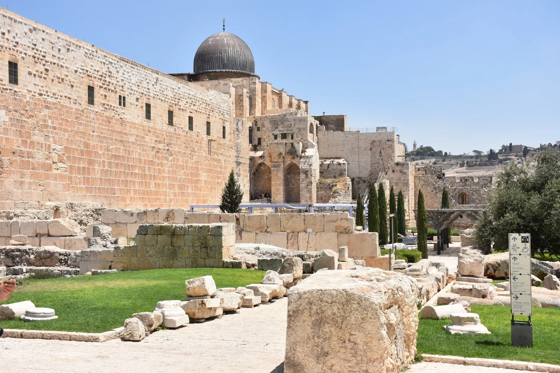
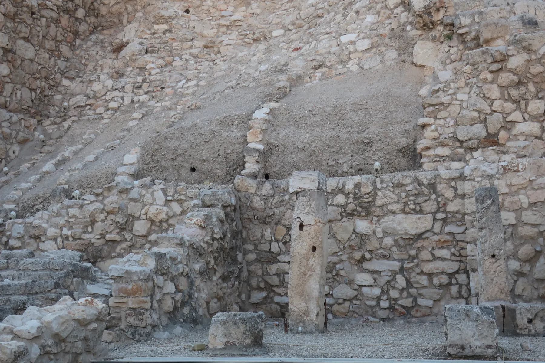
The excavated corner where the Temple Mount's southern and western walls meet, with the paving of the Herodian street still under the heap of masonry the Romans pushed off the top in 70 CE.
Mohammad Shad Siddiqui / CC BY-SA 4.0 · Wikimedia Commons
Excavated
1968–1978
Benjamin Mazar's decade-long dig at the foot of the Temple Mount
Site area
about 20 dunams
roughly two hectares in the northern Ophel, below the Dung Gate
Robinson's Arch
about 15 m span
carrying a staircase some 17 m above the street beneath it
Adult admission
₪40
the operator's Hebrew price list, read in August 2026
In short
- How long to give it
- about 90 minutes, which is what the operator allows for its guided tour; its own English page suggests 30 minutes for a quick look at the garden alone
- Sunday to Thursday
- 09:00 to 17:00
- Adult
- ₪40
הגן הארכיאולוגי, מרכז דוידסון
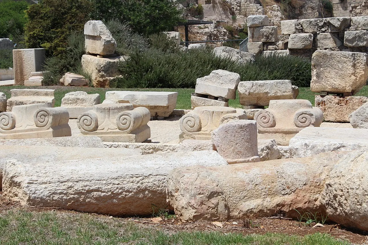
The Jerusalem Archaeological Park is the excavated ground at the south-western corner of the Temple Mount, and the Davidson Center is the museum sunk into an early Islamic palace inside it. It is entered from the road below the Dung Gate, a few metres from the Western Wall plaza and on the other side of the fence from it. What it shows is the outside of the Temple Mount at ground level: the paved street that ran along the base of the retaining wall, the springing stones of Robinson's Arch above it, the stairway pilgrims climbed to the sealed Hulda Gates, and the masonry the Roman army pushed off the platform in 70 CE, left where it landed.
Almost all of it came out of one excavation. Benjamin Mazar of the Hebrew University dug here from 1968 to 1978, on land owned by the Jerusalem Waqf and leased for the purpose, in what became one of the largest archaeological projects in Israeli history. The operator says about 350,000 cubic metres of earth were removed before the remains now on show began to appear.
It is also the quietest ticketed site in this corner of the Old City, and the most argued over. The Israel Antiquities Authority set the park up as a research-led alternative to the prayer plaza next door; the platform used for non-Orthodox prayer at the Western Wall stands inside its boundary; and control of the place has been through the courts twice.
Orientation
One corner, three centuries left standing
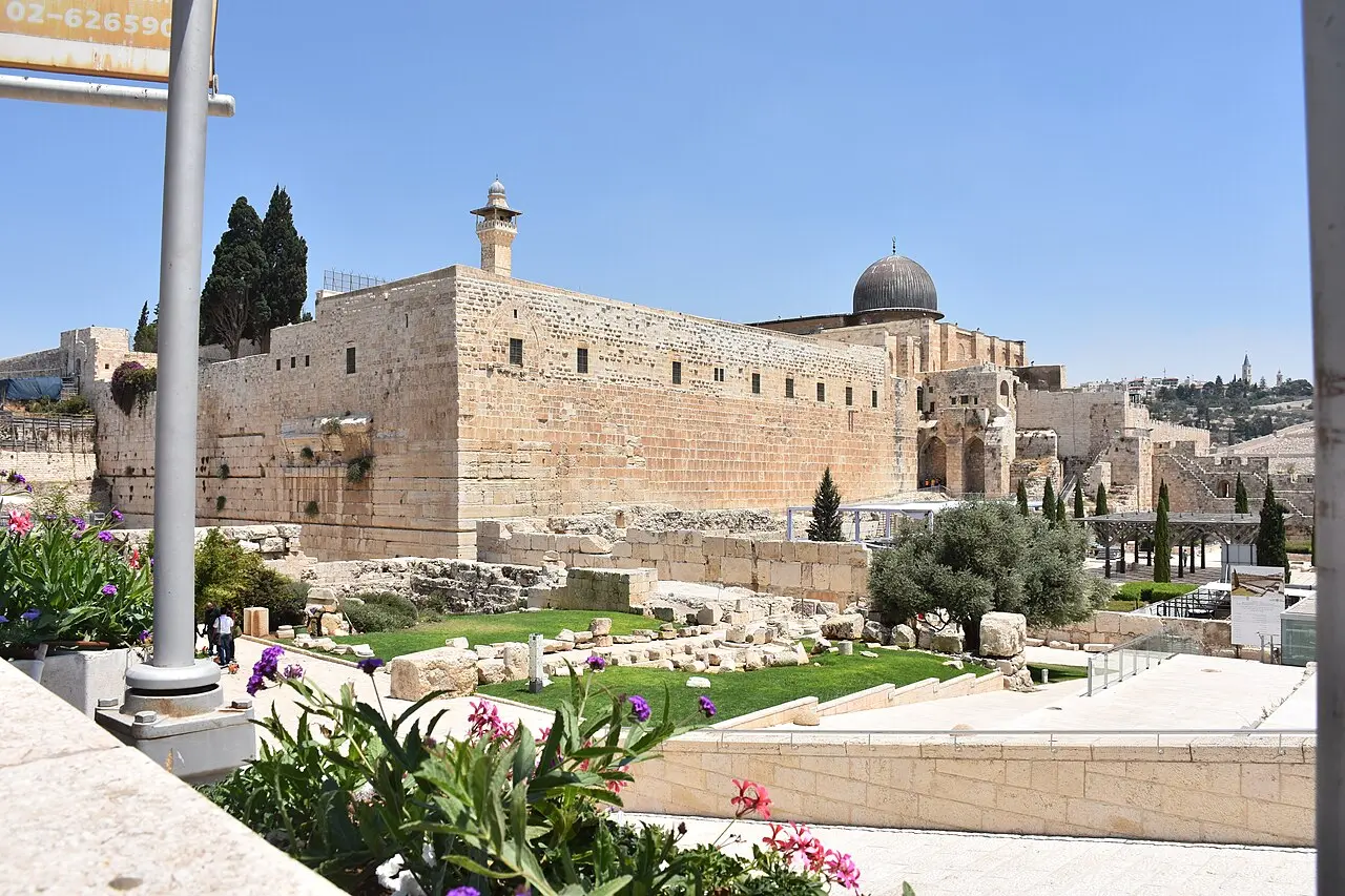
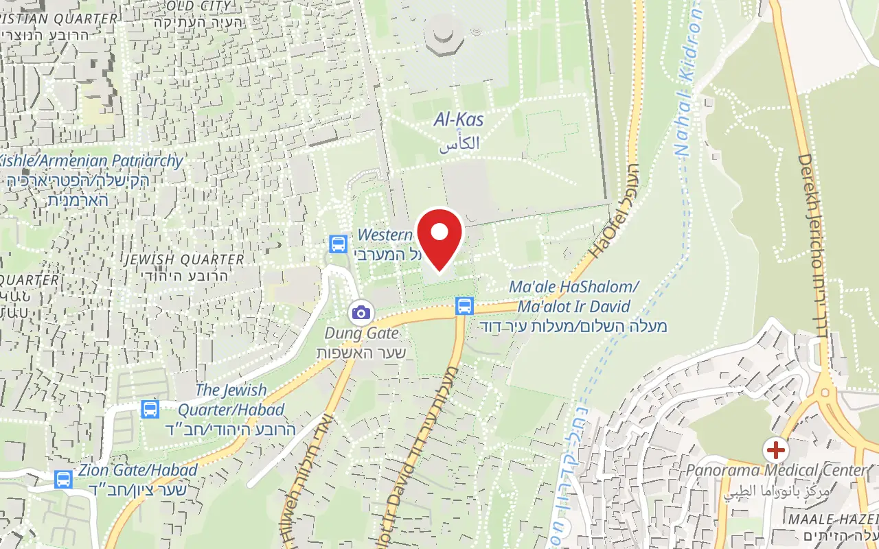
The entrance is on Ma'alot ha-Rav Shlomo Goren Street by the Dung Gate, through an underpass on the access road to the Western Wall. Inside, the ground falls away sharply: the Tyropoeon Valley runs under the park, and the level difference across the western wing of the Umayyad palace alone reaches about 15 metres.
Because the ground holds three thousand years of building, the excavators had to choose which century to leave standing, and the park is laid out in three compounds accordingly. The area beside the Western Wall was taken down to the Second Temple period; the ground along the eastern half of the southern wall was left at its Byzantine level, and the western half at the early Muslim level. Knowing which compound you are standing in is the difference between reading the site and looking at rubble.
One structure crosses all three. Suleiman's sixteenth-century city wall was built partly on the outer wall of the Umayyad palace, which is why it stops at the palace corner and turns north to meet the southern wall halfway along rather than at its end. To keep the garden continuous, the excavators cut a hole through it.
Mohammad Shad Siddiqui / CC BY-SA 4.0 · Wikimedia Commons
The dig
A century and a half of digging at the foot of the wall
Charles Warren was first. Forbidden by the Ottoman authorities to dig on or near the Temple Mount, he worked by shaft and tunnel instead, and between 1867 and 1870 found a large pier standing some 13 metres west of the wall, opposite the stones Robinson had noticed in 1838.
The excavation that made the park ran from 1968 to 1978 under Benjamin Mazar, with Meir Ben-Dov in the field. Israeli archaeologists had decided not to dig on the Temple Mount itself, so they dug all the way around it and published under the title Excavations of the Temple Mount. Mazar died in 1995 before the final report appeared; his granddaughter Eilat Mazar and then a team under his daughter published the rest.
Ronny Reich and Yaacov Billig cleared much of the collapse around Robinson's Arch between 1994 and 1996. The most recent work is the Israel Antiquities Authority's, under Moran Hagbi and Joe Uziel, between March 2016 and August 2017 and again in 2019 and 2020, ahead of the Davidson Center's expansion. Their report makes a point worth carrying round the site: the conservation work done when the park was first opened hampered their reading of the architecture, and no record survives of the remains before it.
Deror_avi / CC BY-SA 3.0 · Wikimedia Commons
The arch
Robinson's Arch was a staircase, not a bridge
Four courses of stone jut from the Western Wall above the park: a row of impost blocks cut into a dentil pattern and three courses of voussoirs, all that is left of the springing of an arch. Edward Robinson identified them in 1838, after Frederick Catherwood had noticed them, and read them, following Josephus, as the remains of a bridge running west across the valley. The name stuck. The reading did not.
Warren's pier and Mazar's excavation together showed what the structure was. South of the pier the diggers found six more vault-supporting piers, stepping down in height over about 35 metres. The arch and those vaults carried a monumental flight of stairs that rose from the street, turned, climbed the descending vaults and crossed back over the street through the arch into a gate of the Royal Stoa above. It was not a road to anywhere. It went up.
The measurements are large by any standard of classical building: a span of about 15 metres, an arch about 15.2 metres wide, the stair carried some 17 metres above the street, and a pier 15.2 by 3.6 metres preserved to about 5 metres. Four small hollows in the pier's base were probably shops opening onto the street. Fragments of the gate at the top give a width of about 5 metres, though whether it was a single, double or triple opening is not known.
The date it stopped working is fixed by an accident. Excavators south of the Temple Mount found a Roman milestone naming Vespasian and Titus, cut from one of the handrails that had stood on top of the arch. Whoever ordered that milestone had a ruined staircase to quarry, which puts the collapse no later than 79 CE.
- Ancient: the four courses of springing stones in the Western Wall, the pier, the six descending vault piers, the street paving and the shop recesses
- Gone: the arch itself, the staircase it carried, and the gate into the Royal Stoa at the top
- Elsewhere: the handrail block, recut as a Roman milestone naming Vespasian and Titus
- Modern: the raised prayer platform beside the arch, completed in August 2013
The street
The paving, the collapse and the argument about who finished it
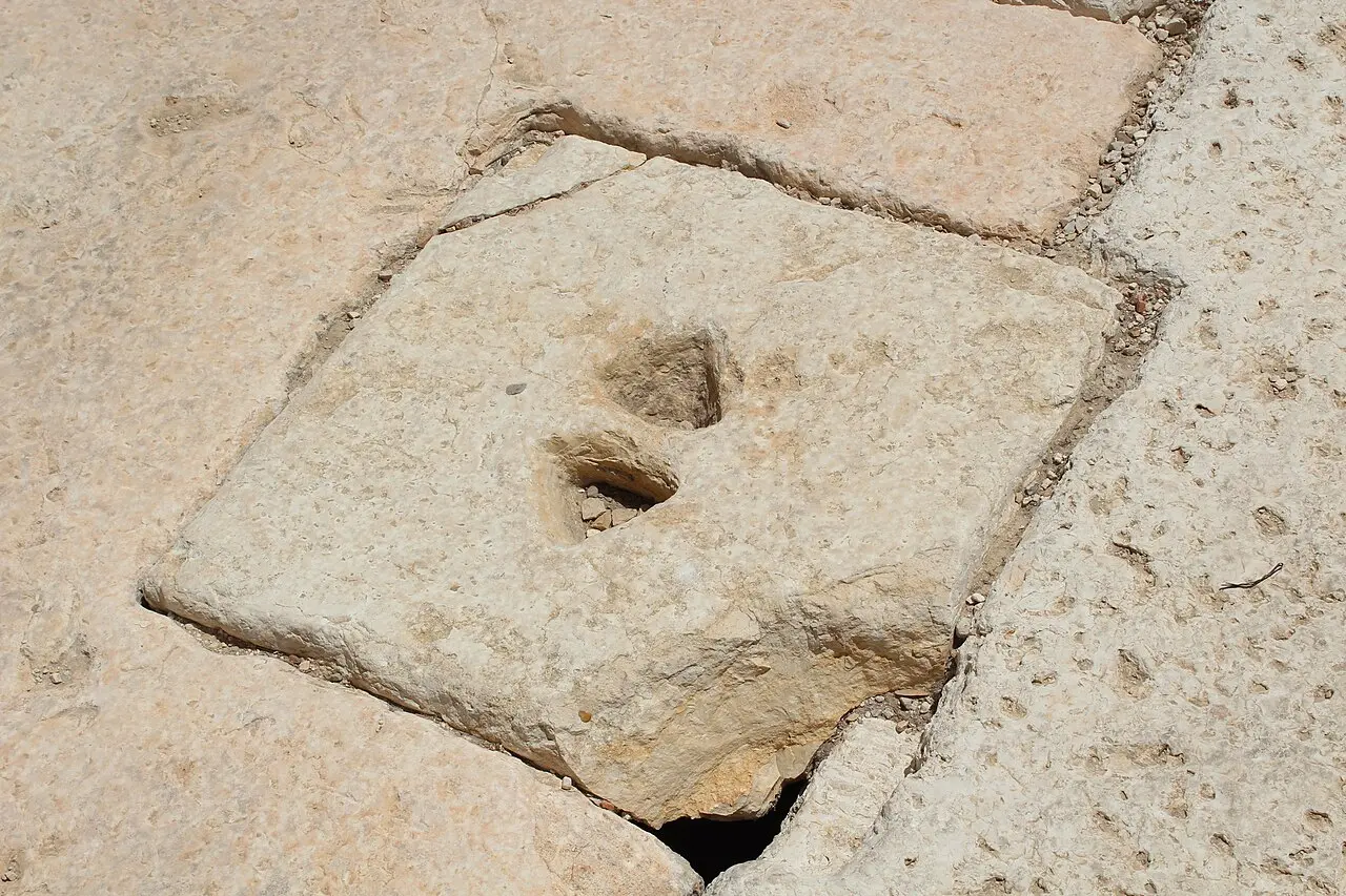
The street along the base of the wall is the reason to come. It is the Tyropoeon Valley road, bounded by high stone kerbs and about eight metres wide; its full run from the Pool of Siloam to this corner is around 750 metres, of which only a stretch is exposed here. When it was uncovered it lay under stones thrown down from the top of the wall during the Roman siege in 70 CE. Most of that pile was cleared, but a section was deliberately left in place, the paving slabs cracked and dished under the impact.
One of the fallen stones carries writing. Mazar found it in 1968 near the south-western corner: a block of 84 by 31 by 26 centimetres, inscribed in square Hebrew letters, reading to the house of the trumpeting and then breaking off. Josephus describes a priest standing on the Temple's parapet to sound a trumpet at the beginning and end of the Sabbath, and the stone is read as the sign marking that place. What the broken third word said is not known. The original is in the Israel Museum.
The street's date is genuinely open, and it is not a footnote: it decides who built the most photographed pavement in Jerusalem. Herod's reconstruction was ordered in 20 or 19 BCE, and the paving was long attributed to him. Excavation beneath it by the arch found three oil lamps of a first-century type and seventeen identifiable coins, several struck by the prefect Valerius Gratus in 17 or 18 CE, which puts this stretch of wall and arch after that year. A separate count of fifteen coins from under the road gave a latest issue minted under Pontius Pilate.
So some scholars now credit the paving to Agrippa II rather than to Herod. Josephus records that under the procurator Albinus, between 62 and 64 CE, the streets were paved with white stone to find work for the men laid off when the Temple was finished. The slabs show almost no wear.
Deror_avi / CC BY-SA 3.0 · Wikimedia Commons
The steps
The southern stairway and the sealed Hulda Gates
Round the corner, the southern wall of the Temple Mount runs 281 metres, which Josephus gives as one stadion. This was the pilgrims' side. Two gate complexes, known together as the Hulda Gates, opened in it: the Double Gate to the west and the Triple Gate to the east, each leading into a vestibule and then up a vaulted ramp onto the esplanade. Both have been blocked since the Middle Ages, so a visitor sees the outline of an entrance rather than an entrance.
The Double Gate is the one to look at. Its lintel and relieving arch are Herodian; the elaborately carved cornice above is Umayyad, added six centuries later. Only about half its width, some 3.09 metres, shows from outside, and the three openings of the Triple Gate are about 4.03 metres each.
The stairway that climbed to the Double Gate is largely intact, while the flight to the Triple Gate is mostly destroyed. The treads are deliberately irregular, running roughly 12 to 35 inches deep with risers of about 7 to 10 inches, so that nobody can take them at a run. Ritual baths were found at the foot of the stairs, where pilgrims immersed, and the Mishnah's tractate Middot describes the crowd entering by one gate and leaving by another.
After 70
A palace, a museum inside it, and a long fight over both
The corner did not stay empty. By the end of the fourth century a dense Byzantine neighbourhood stood over the ruins, and parts of its mosaic floors survive; the excavators think it was destroyed in the Persian invasion of 614 and never rebuilt. Nearby are the remains of a two-storey building identified as a synagogue on the strength of two menorahs painted in red on its walls, a third cut in stone, and recesses at every doorway read as mezuzah niches. It served about sixty years before an Umayyad palace was built over it.
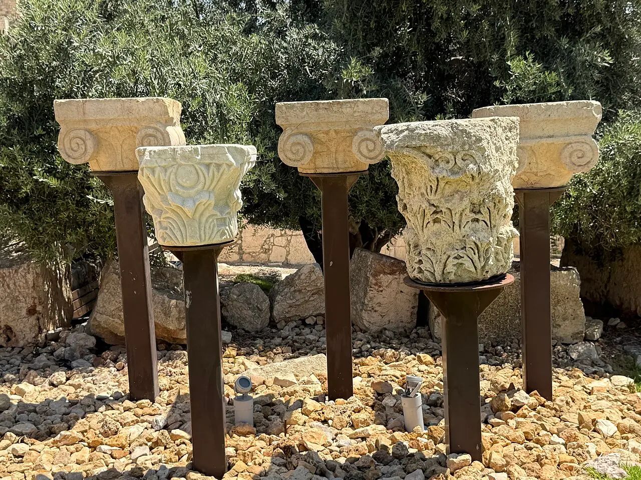
That palace is the most substantial standing structure in the park. Mazar uncovered four large administrative buildings from the reign of al-Walid I covering the whole area of the garden; only one, Building II, is presented to visitors. It measures roughly 80 by 80 metres, a ring of rooms around an open courtyard, built in places from stone robbed out of the Temple Mount's own ruins, standing in places three storeys high, and linked at roof level by a bridge to the al-Aqsa Mosque. It was probably brought down by the mid-eighth-century earthquake.
The Davidson Center sits inside it, mostly underground so that it does not break the skyline. It opened in April 2001 and was built without building permits: the Jerusalem municipality comptroller reported in 2005 that the claim the works fell within the definition of archaeological excavations was baseless. In December 2013 a court ordered the East Jerusalem Development Company, which had built and run it, to hand ownership to the Company for the Reconstruction and Development of the Jewish Quarter. An agreement signed that October would have passed operation to the Elad Foundation, which runs the City of David site in Silwan; the state appealed, and in September 2014 the court struck it down, holding that a site of this significance must stay with a public authority acting as trustee for the public.
The museum closed for three years and reopened in March 2023, rebuilt and expanded by the Israel Antiquities Authority with funding from the William Davidson Foundation, and the Jewish Quarter company now sells the tickets. The galleries lead on the Temple and its menorah. The centrepiece is a coin of Antigonus II Mattathias, the last Hasmonean king, which Yuval Baruch of the Israel Antiquities Authority describes as the oldest known artistic depiction of the Temple menorah, made 107 years before the Second Temple was destroyed.
The other long dispute is over prayer. After a 2003 Supreme Court decision the area beside Robinson's Arch was prepared for services not permitted at the main plaza, and a permanent platform of about 4,480 square feet, named Ezrat Yisrael, was completed on 25 August 2013 with access at all hours. Reform and Conservative movements and Women of the Wall have consistently called the arrangement second-class. Archaeologists object from the other side: Baruch called an earlier expansion plan a threat to the only place from which the Western Wall's courses, the Herodian street and the evidence of the destruction can be seen together.
שלמה רודד / CC BY 2.5 · Wikimedia Commons
What to look for
Things not to walk past at Jerusalem Archaeological Park, Davidson Center
The details that repay knowing about before you are standing in front of them.
The springing of Robinson's Arch
Four courses of stone projecting from the Western Wall: a row of dentilled impost blocks and three courses of voussoirs, the start of a 15 metre span. Everything above them fell in 70 CE.
The Herodian street and the collapse
A stretch of the Tyropoeon street, about eight metres wide between high kerbs, with a section of the fallen masonry left where it landed and the paving slabs cracked beneath it.
The shops in the pier
Four small recesses cut into the base of the arch's western pier, opening onto the street. They are the most ordinary thing on the site and among the most useful for imagining it in use.
The pilgrims' stairway
The monumental flight up to the blocked Double Gate, largely intact, with treads running between roughly 12 and 35 inches so that no one can climb it quickly. Ritual baths were found at its foot.
The Double Gate lintel
Herodian lintel and relieving arch with an ornate Umayyad cornice above it, six centuries apart in the same doorway. Only about 3.09 metres of its width shows from outside.
The menorah coin in the Davidson Center
A coin of Antigonus II Mattathias, the last Hasmonean king, described by the Israel Antiquities Authority as the oldest known artistic depiction of the Temple menorah, cut 107 years before the Temple fell.
The long view
Jerusalem Archaeological Park, Davidson Center, in order
20/19 BCE
Herod orders the reconstruction of the Temple and the enlargement of its platform. The retaining walls, Robinson's Arch and the southern gates belong to this programme.
17/18 CE
Coins struck by the prefect Valerius Gratus are deposited beneath the street by the arch, showing that this stretch of wall and arch was still going up decades after Herod's death.
62–64 CE
Josephus records the streets of Jerusalem being paved with white stone under the procurator Albinus, to employ the men laid off when the Temple was completed.
70 CE
Roman forces throw the upper courses of the Temple Mount walls down onto the street. The Trumpeting Place stone falls with them and lands at the south-western corner.
by 79 CE
A handrail block from the top of the arch is recut as a Roman milestone naming Vespasian and Titus, fixing the collapse to within a decade of the siege.
late 4th century
A dense Byzantine quarter of houses, shops and churches covers the ruins in the eastern Ophel, leaving the mosaic floors now on show.
614
The Byzantine quarter is destroyed, on the excavators' reading, during the Persian invasion, and is not rebuilt.
early 8th century
Four large Umayyad administrative buildings go up under al-Walid I, one of them linked at roof level to the al-Aqsa Mosque and built partly from Temple Mount stone.
mid-8th century
An earthquake brings the palaces down. The site is abandoned, and the ruins are reused centuries later in Fatimid fortifications.
1538–1540
Suleiman's city wall is built partly on the outer wall of the Umayyad palace, which is why it turns north at the palace corner instead of continuing east.
1838
Edward Robinson identifies the projecting stones in the Western Wall and reads them, following Josephus, as the remains of a bridge.
1867–1870
Charles Warren, barred from digging near the Temple Mount, tunnels instead and finds the great pier standing about 13 metres west of the wall.
1968–1978
Benjamin Mazar excavates the whole corner for the Hebrew University, on land leased from the Jerusalem Waqf, and finds the Trumpeting Place stone in the first season.
1994–1996
Ronny Reich and Yaacov Billig clear much of the collapse debris around Robinson's Arch and trace a further stretch of the street.
April 2001
The Davidson Center opens inside the Umayyad palace, built by the East Jerusalem Development Company and the Israel Antiquities Authority, and without building permits.
August 2004
The area beside Robinson's Arch is inaugurated for services not permitted at the main Western Wall plaza.
25 August 2013
The permanent Ezrat Yisrael prayer platform, about 4,480 square feet, is completed inside the park with access at all hours.
December 2013
A court orders the East Jerusalem Development Company to vacate and transfer ownership to the Company for the Reconstruction and Development of the Jewish Quarter.
September 2014
The court strikes down the agreement that would have handed operation of the centre to the Elad Foundation, holding that such a site must stay with a public authority.
2016–2020
The Israel Antiquities Authority excavates inside the Umayyad palace ahead of the Davidson Center's expansion, in seasons in 2016, 2017, 2019 and 2020.
March 2023
The Davidson Center reopens after three years closed, rebuilt and expanded by the Israel Antiquities Authority with funding from the William Davidson Foundation.
Practical
Visiting Jerusalem Archaeological Park, Davidson Center
Where
Ma'alot ha-Rav Shlomo Goren Street, by the Dung Gate, Old City of Jerusalem
What ticket you need
This is a separately ticketed site, not part of the Western Wall plaza next door, which is free and unticketed, and not covered by a City of David ticket. The same operator sells a combined ticket covering the archaeological park together with the drainage channel and the Pilgrimage Road, which run south from here under Silwan to the Pool of Siloam.
Opening hours
- Sunday to Thursday
- 09:00 to 17:00source
- Friday
- 09:00 to 14:00, by prior arrangement with the booking centresource
- Last entry
- about 40 minutes before closingsource
- The operator's English page differs
- it lists winter hours of 10:00 to 17:00 Sunday to Thursday and 09:00 to 14:00 on Fridays and holiday evessource
Admission
- Adult
- ₪40source
- Child aged 5 to 18, soldier or pensioner
- ₪22source
- Student
- ₪32source
- Groups over 25
- special rates, quoted by the booking centresource
- Guided tour, The past beyond the corner
- from ₪40, about an hour and a half, in Englishsource
- The operator's English page differs
- it lists ₪34 for an adult and ₪18 for a child, soldier or pensionersource
Access
Split, and the operator says so. Its accessibility declaration lists, for this site, an entrance area adapted for wheelchair users, accessible service desks with an induction loop, subtitles on the films, designated places for visitors with disabilities in every guiding and screening area, adapted toilets with handrails, and accessible routes between the areas of the centre. It also states plainly that all of this is subject to the limitations that apply at antiquities sites. The museum building is largely step-free; the excavated garden is not. The Herodian street, the pilgrims' stairway and the routes between the compounds are ancient paving and stone steps on a steep valley slope, with a level difference of about 15 metres across the site, and there is no step-free way onto the stairway or down to the street.
On site
- Ticket desk at the entrance
- Indoor museum galleries
- Film and projection room
- Audio guide app, downloaded at the entrance
- Accessible toilets
- Induction loop at the service desks
- Guided tours in English, by booking
- Virtual reality experience, ticketed separately
Booking
Tickets and tours are sold by the Company for the Reconstruction and Development of the Jewish Quarter through its booking centre on *4987 or 02-6265906. Friday visits are by prior arrangement only. The guided tour is cancellable up to three business days ahead; after that the full price is charged. The operator asks visitors to arrive at least ten minutes before a booked slot.
Hours and prices are given as the operator publishes them and change without much notice, particularly around Shabbat and the festivals. Check the operator's own page before you travel for this.
Official page at travelrova.co.il →What people wish they had known
- The entrance is not the Western Wall plaza. It is on the road below the Dung Gate, through an underpass, and people regularly queue at the plaza's security check and then discover the park gate is somewhere else.
- The operator publishes two different sets of prices and hours. Its Hebrew page gives ₪40 for an adult and 09:00 to 17:00 Sunday to Thursday; its English page gives ₪34 and a 10:00 opening. Ring the booking centre before building a morning around either.
- Friday visits are by prior arrangement only, and last entry is about 40 minutes before closing, so a late Friday walk-up is the commonest wasted journey here.
- The Trumpeting Place stone is not on the site. It was found here in 1968 and it is in the Israel Museum; what the park offers is the corner it fell from.
- This is stone steps and two-thousand-year-old paving on a steep valley slope. The museum building is adapted for wheelchair users, the excavated garden is not, and a pushchair is a mistake.
- The prayer platform inside the park is a working synagogue used by non-Orthodox congregations, and bar mitzvah services run there. It is part of the site, not a separate attraction, and it is not the Western Wall plaza.
The figures
Jerusalem Archaeological Park, Davidson Center by the numbers
Each figure carries the year it belongs to and links the source it came from.
| Measure | Figure | As of | Source |
|---|---|---|---|
| Adult admission, the operator's Hebrew price list | ₪40 (student ₪32, child aged 5 to 18, soldier or pensioner ₪22) | 2026 | travelrova.co.il |
| Adult admission, the same operator's English page | ₪34 (child, soldier or pensioner ₪18) | 2026 | travelrova.co.il |
| Earth removed during the excavation, per the operator | about 350,000 cubic metres | 2026 | travelrova.co.il |
| Area of the park | about 20 dunams | 2026 | en.wikipedia.org |
| Robinson's Arch | span about 15 m, width 15.2 m, carrying the stair about 17 m above the street | 2026 | en.wikipedia.org |
| Length of the Temple Mount's southern wall | 281 m, which Josephus gives as one stadion | 2026 | en.wikipedia.org |
| The Trumpeting Place stone | 84 by 31 by 26 cm, found 1968, now Israel Museum IAA 78-1439 | 1968 | en.wikipedia.org |
| Umayyad Building II, the palace the museum sits in | about 80 by 80 m, with a 15 m level difference across its western wing | 2023 | hadashot-esi.org.il |
While you are here
The rest of The Old City of Jerusalem
Everything else in this destination with a page of its own.
patano / CC BY-SA 3.0 · Wikimedia Commons
Religious site
The Western Wall
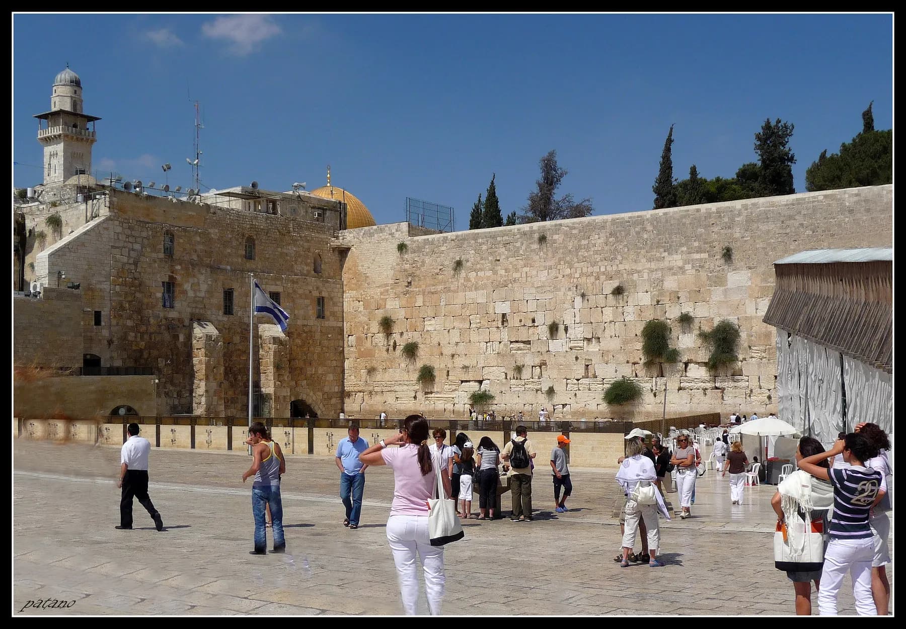
The prayer plaza shows about 50 metres of a retaining wall that runs 488 metres in total, and it is open free of charge at every hour of every day of the year.
arikb / CC BY-SA 3.0 · Wikimedia Commons
Religious site
The Temple Mount and Haram al-Sharif
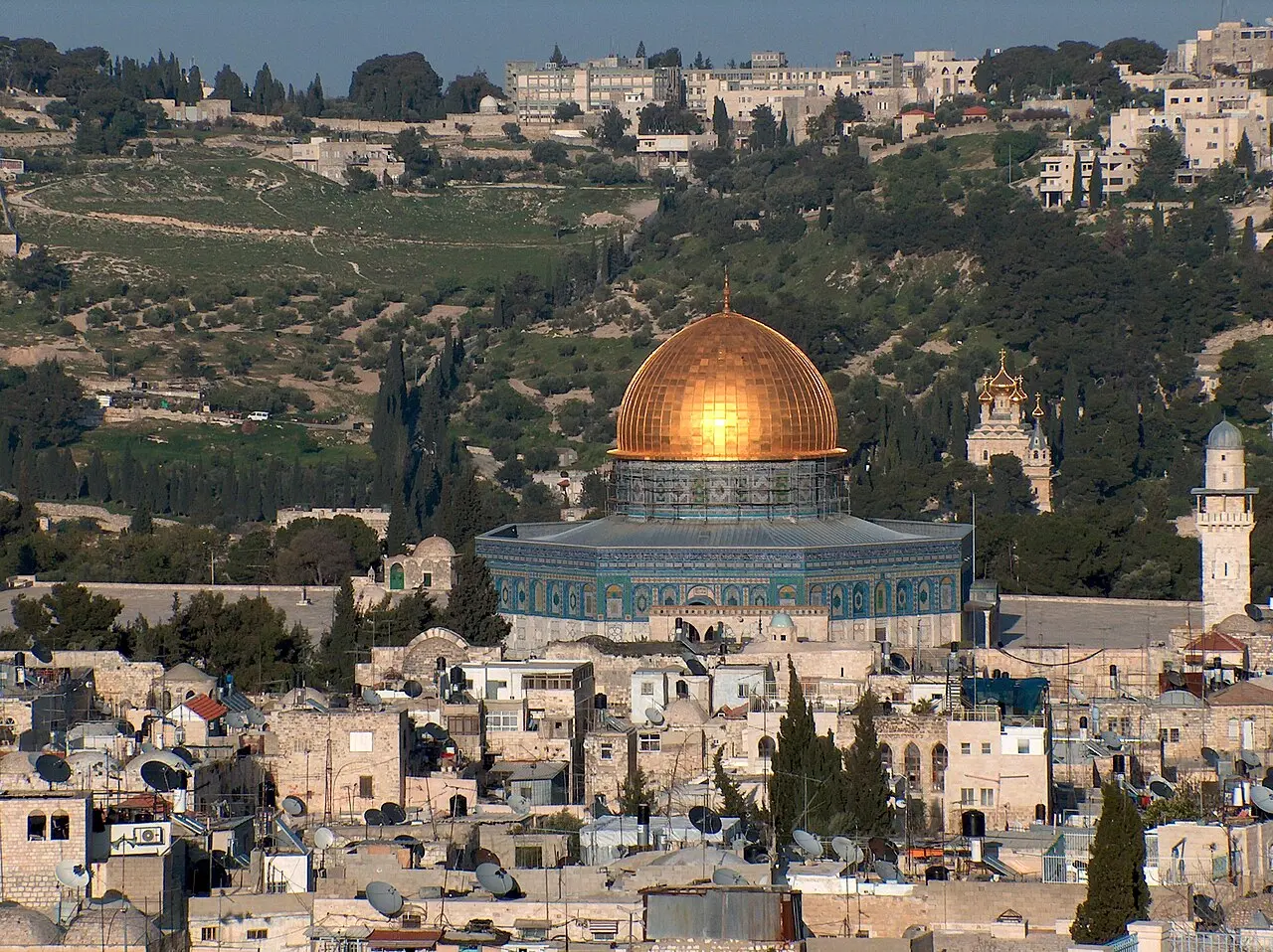
Everything standing on the esplanade is later than the esplanade itself, which Herod's engineers made from about 19 BCE by wrapping a hilltop in four retaining walls and filling in behind them.
Davidbena / CC BY-SA 4.0 · Wikimedia Commons
Archaeological site
City of David
The ridge where Jerusalem began, outside the Ottoman walls and below Dung Gate, with a water tunnel 533 metres long that visitors still wade in water up to 70 centimetres deep.
Sources and further reading
Every link below was opened and checked when this page was written. Official statements are marked as such: they are the subject's own account, not an independent one.
- OfficialCompany for the Reconstruction and Development of the Jewish Quartertravelrova.co.ilמידע חיוני למבקר (Visitor information, Hebrew)
The operator's current price list, giving the Davidson Center at ₪40 adult, ₪22 child aged 5 to 18, soldier or pensioner, and ₪32 student, with special rates for groups over 25; opening hours of 09:00 to 17:00 Sunday to Thursday and 09:00 to 14:00 on Friday by prior arrangement; and last entry about 40 minutes before closing
- OfficialCompany for the Reconstruction and Development of the Jewish Quartertravelrova.co.ilGeneral Information (English)
The English version of the same page, which disagrees with the Hebrew: ₪34 for an adult and ₪18 for a child, soldier or pensioner, and winter hours of 10:00 to 17:00 Sunday to Thursday. Also the directions, parking and bus routes for the Jewish Quarter
- OfficialCompany for the Reconstruction and Development of the Jewish Quartertravelrova.co.ilThe Archeological Garden, Davidson Center
The operator's attraction page for the site, giving an estimated visit of 30 minutes and asking visitors to arrive ten minutes before a booked slot. Its body text currently describes the Broad Wall rather than this site, which is worth knowing before treating it as a guide to what is here
- OfficialCompany for the Reconstruction and Development of the Jewish Quartertravelrova.co.ilDavidson Center Tour: The past beyond the corner
The English guided tour: an hour and a half, from ₪40, meeting at the site entrance, address given as Ma'alot ha-Rav Shlomo Goren Street near the Dung Gate, cancellation up to three business days ahead, and the figure of about 350,000 cubic metres of earth removed during the excavation
- OfficialCompany for the Reconstruction and Development of the Jewish Quartertravelrova.co.ilהצהרת נגישות (Accessibility declaration)
The site-by-site accessibility statement, listing for the Davidson Center an adapted entrance area, accessible service desks, an induction loop, subtitled films, designated places in guiding and screening areas, adapted toilets with handrails and accessible routes within the centre, all qualified as subject to the limitations that apply at antiquities sites
- ReportingThe Jerusalem Post, Zvika Klein, 9 March 2023jpost.comDavidson Center in Jerusalem Archaeological Park reopens with brand-new modernized experience
The reopening after a three-year closure, the renovation and building expansion led by the Israel Antiquities Authority with funding from the William Davidson Foundation, Yuval Baruch on the Antigonus II Mattathias coin as the oldest known artistic depiction of the menorah made 107 years before the destruction, the Jason's Tomb plaster fragment with five menorahs, seventh-century BCE inscriptions bearing the name yršlm, and Herzl Ben Ari of the Jewish Quarter company on the reopening
- ReportingEmek Shaveh, written by Raz Kletter, August 2015emekshaveh.orgTourism and Sacred Sites: The Davidson Center, the Archaeological Park, and the corner of the Western Wall
A report by an advocacy organisation of archaeologists, and the fullest account of the site's governance: the centre opened in 2001 partly inside an Umayyad building, built without permits, with the Jerusalem municipality comptroller's 2005 finding that the excavation defence was baseless; the December 2013 order that the East Jerusalem Development Company vacate in favour of the Jewish Quarter company; the October 2013 Elad operating agreement and the court's September 2014 ruling that such a site must remain with a public authority as trustee of the public; Jon Seligman's 2010 letter on the park's research-based purpose; Yuval Baruch's objection to expanding the prayer area; and William Davidson's donations of $5 million and a further $2.5 million
- ReferenceIsrael Antiquities Authority, Moran Hagbi, Irina Zilberbod and Joe Uzielhadashot-esi.org.ilJerusalem, the Old City, the Archaeological Park (Hadashot Arkheologiyot 135)
The preliminary report on the 2016 to 2017 and 2019 to 2020 excavations inside the Umayyad palace ahead of the Davidson Center's expansion: Building II at about 80 by 80 m as the largest of four, its northern wall founded directly on the first-century street, a level difference of about 15 m across the western wing, and the note that earlier conservation work hampered interpretation with no record surviving of the remains beforehand
- ReferenceWikipediaen.wikipedia.orgJerusalem Archaeological Park
The park's area of about 20 dunams, the division into Second Temple, Byzantine and early Muslim compounds, Warren in the 1860s and Kenyon in the 1960s, Mazar's 1968 to 1978 excavation on land leased from the Jerusalem Waqf, the street at about 750 m long and 8 m wide, the fifteen coins from under the road with the latest minted under Pontius Pilate and the attribution to Agrippa II, the Byzantine quarter and its destruction in 614, the synagogue identified by painted menorahs, the four Umayyad palaces of al-Walid I, the Ottoman wall built on the palace, and the management change from the Ir David Foundation to the Jewish Quarter company in 2021
- ReferenceWikipediaen.wikipedia.orgRobinson's Arch
Robinson's identification in 1838 and Catherwood's earlier notice; Warren's pier 13 m west of the wall in 1867 to 1870; the four surviving courses of impost blocks and voussoirs; the six descending vault piers over about 35 m and the staircase they carried to the Royal Stoa; span about 15 m, width 15.2 m, about 17 m above the street, pier 15.2 by 3.6 m preserved to 5 m; the four shop recesses; the gate width of about 5 m; the seventeen coins including issues of Valerius Gratus of 17/18 CE; the milestone of Vespasian and Titus cut from a handrail; and the Ezrat Yisrael platform of about 4,480 square feet completed on 25 August 2013
- ReferenceWikipediaen.wikipedia.orgSouthern Wall
The southern wall at 281 m, equated by Josephus with one stadion; the monumental stairway with risers of 7 to 10 inches and treads of 12 to 35 inches forcing a deliberate tread; the stair to the Double Gate well preserved and the one to the Triple Gate mostly destroyed; the Triple Gate openings at about 4.03 m and the exposed Double Gate width of 3.09 m; and the ritual baths found at the foot of the steps
- ReferenceWikipediaen.wikipedia.orgHuldah Gates
The Double and Triple Gates as vestibules leading to vaulted ramps onto the esplanade, blocked since the Middle Ages, the Triple Gate in the eleventh century and the Double Gate behind a medieval tower; and the Double Gate's Herodian lintel and relieving arch beneath an Umayyad carved cornice
- ReferenceWikipediaen.wikipedia.orgTrumpeting Place inscription
Found by Mazar in 1968 at the southern wall excavation; a stone of 84 by 31 by 26 cm carrying two complete words in square Hebrew and an incomplete third; read against Josephus's description of a priest sounding a trumpet to open and close the Sabbath; now in the Israel Museum as IAA 78-1439
- ReferenceEncyclopaedia Britannicabritannica.comTemple Mount
Herod's reconstruction ordered in 20/19 BCE and taking more than a generation, the Western Wall as the only remnant of the retaining wall around the Temple, and the destruction of 70 CE
Jerusalem Archaeological Park, Davidson Center: common questions
What is the difference between the Jerusalem Archaeological Park and the Davidson Center?+
They are one site with two halves. The archaeological park is the open excavated ground at the south-western corner of the Temple Mount, and the Davidson Center is the indoor museum sunk into an Umayyad palace inside it. A single ticket covers both, and the museum is the sensible place to start because it explains what the layers outside are.
How much does it cost?+
The operator's Hebrew price list gives ₪40 for an adult, ₪32 for a student and ₪22 for a child aged 5 to 18, a soldier or a pensioner, with special rates for groups over 25 quoted by the booking centre. Its English page has not been updated and still lists ₪34 and ₪18. The guided tour in English is priced separately, from ₪40, and runs about an hour and a half.
How long does it take?+
About 90 minutes covers the museum and a proper walk round the garden. The operator's own English page suggests 30 minutes, which is enough only for a fast loop of the street and the arch without the galleries. Its guided tour is scheduled at an hour and a half, which is the honest figure for seeing the site rather than passing through it.
Is Robinson's Arch really an arch you can walk on?+
No. What survives is the springing: four courses of stone projecting from the Western Wall, a row of impost blocks and three courses of voussoirs. The 15 metre span and the monumental staircase it carried came down in 70 CE, and the pier and the descending vault piers that supported the rest of the stair are what you walk among at ground level.
Did Herod build the street and the arch?+
He began the programme and probably did not finish this part of it. Herod's reconstruction was ordered in 20 or 19 BCE, but excavation beneath the street by the arch produced seventeen identifiable coins including several struck by the prefect Valerius Gratus in 17 or 18 CE, and a separate group of fifteen coins from under the road whose latest issue was minted under Pontius Pilate. Some scholars now credit the paving to Agrippa II, and Josephus describes the streets being paved with white stone in the early 60s CE to employ the men laid off when the Temple was completed. The question is not settled.
Is it wheelchair accessible?+
The museum building largely is and the excavated garden is not. The operator's accessibility declaration lists an adapted entrance, accessible service desks with an induction loop, subtitled films, designated places in every screening area, adapted toilets and accessible routes between the areas of the centre, and states that all of it is subject to the limitations that apply at antiquities sites. Outside, the ground is ancient paving and stone steps on a slope that falls about 15 metres across the site, and there is no step-free route onto the pilgrims' stairway.
Can you get onto the Temple Mount from here?+
No. The Hulda Gates in the southern wall, which were the pilgrims' entrance, have been blocked since the Middle Ages, and the gate at the top of Robinson's Arch is gone. Non-Muslim visitors reach the compound only by the Mughrabi ramp beside the Western Wall plaza, during its own designated hours.
Is this the Western Wall?+
It is the same wall, at a different point and with a different status. The prayer plaza to the north is free, unticketed and run as a synagogue; the park to the south is a ticketed archaeological site showing the wall's foundations, the street at its foot and the corner where it meets the southern wall. The platform used for non-Orthodox and mixed prayer, Ezrat Yisrael, stands inside the park rather than in the plaza, which is precisely what the long argument over it is about.
Is there shade, and when is the best time to go?+
There is very little shade in the excavated garden, which is open stone facing south and west, though the museum is indoors and air-conditioned. In summer the first two hours after the 09:00 opening are the only comfortable ones outside. The site is also quieter than almost anything else in the Old City at any hour, which is part of its appeal.
Is it worth it if I have already seen the Western Wall Tunnels?+
Yes, because they show opposite things. The tunnels run north along the buried courses of the wall in the dark, underneath the Muslim Quarter; the park shows the wall in daylight from the outside, standing on the street that ran beside it, with the stones the Romans threw down still lying where they landed. The tunnels are about the scale of Herod's masonry, and this is about what happened to it.